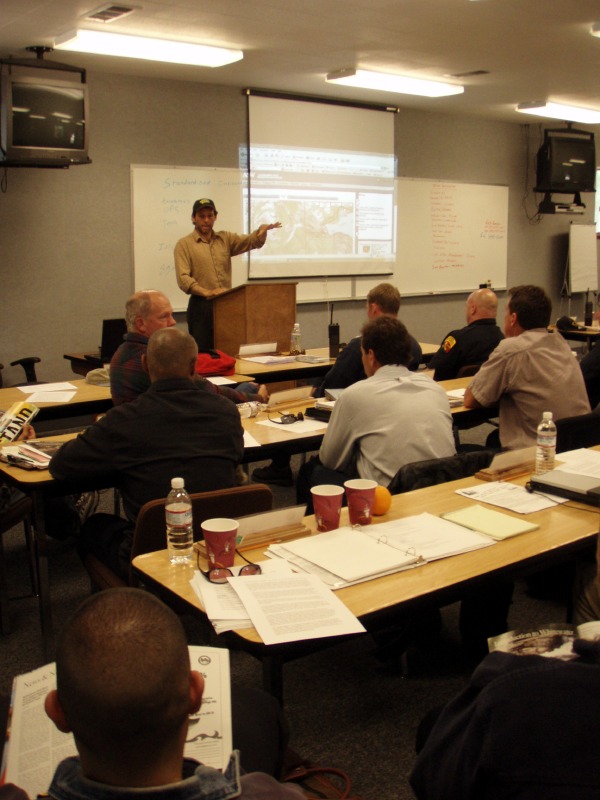
As part of a collaborative project with American Whitewater, Butte County Search and Rescue with a grant from the Butte Fire Council, California Stewardship Director Dave Steindorf and AW volunteer Eric Petlock made a presentation at a Water Rescue Conference in Magalia California. Some of the largest fire departments from all over California attended this three-day conference. The goal of the conference was to work on standardization of training in all water rescue disciplines and create a network of instructors to continue educating firefighters in water rescue. The attendees discussed the future of water rescue training for Cal Fire and the creation of more swift water rescue teams.
American Whitewater’s presentation was an overview of AW’s pilot project
“Taking the search out of search and rescue”. As part of this project American Whitewater hopes to serve as the collecting point for GPS data on Whitewater Rivers, for the purpose of aiding rescue professionals. What is needed is a way to translate what we know about the river– rapid and camp names, road and trail crossings, sidecreeks, etc–into something that emergency and rescue professionals can use. And no doubt about it, what Search and Rescue like best is a nice set of GPS coordinates. Sean Norman of Cal Fire Butte’s swift water rescue team and conference organizer said, “Partnerships like this one are critical to improving our mission”.
The plan is to gather GPS data for river runs listed on AW’s website, starting with the coordinates of the put-in, continuing with info on the major rapids and landmarks, and finishing with the numbers for the take-out. This data would be freely available to anyone visiting AW’s website, and would have any number of potential uses. Foremost, though, it would allow search and rescue folks to translate the kind of info boaters give them (river reach, rapid names, etc) into a known point on the map, within just a few mouse clicks.
This pilot project is starting with the Little Grass Valley reach of the South Fork Feather River, a relatively new run. This reach is somewhat of a clean slate, with few named rapids. This reach was a logical start for this project because it is even a challenge for boaters to communicate to each other about this run. We have all hear d this dialogue, “You know that rapid that has the rock in it?” “No, the one with the rock on the right”. One of the purposes is to get boaters to use a common language in referring to the rapids and other features on this run. In addition, boaters will be able to view and download a map that would show important emergency egress routes, roads, and cell service locations from the canyon.
The Devils Canyon section of the Middle Fork Feather is the second reach that will be included in this project. Unlike the Little Grass Valley Reach, this run has a long history and has become very popular. While most of the rapids on this three day wilderness run have been named, most boaters would have a very difficult time pointing to a map and telling you where they are located on the run. This information is critical in the event that emergency rescue help was needed in the Canyon.
In a perfect world, the GPS project will grow into the comprehensive and definitive go-to database for rescue personal. “This grant from the Butte Fire Council has allowed us to kick start this project,” said Steindorf. American Whitewater is encouraging paddlers to contact local search and rescue entities and educated them on this project. River Safety icon and AW board member, Charlie Walbridge, said, “This is the type of project that keeps American Whitewater at the forefront of river safety”. For more information on this project contact American Whitewater Safety Chair Eric Nies. nies@runbox.com