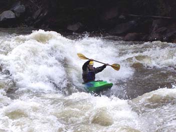
The put-in for the Numbers, one of the most popular in the United States, was closed during the 1990’s after an informal agreement with the landowner was abruptly terminated. River access is often arranged through the permission of local landowners. While these arrangements are important, they don’t assure long-term access and are often not adequate on high-use runs that continue to increase in popularity. American Whitewater and Colorado White Water Association (CWWA) stepped in to find a long-term solution to this important access issue.
Background
As of 1995, AW and CWWA had been working for more than 10 years to work out an agreement that would provide long-term access to the Numbers. The parcel of land in question was a 40 acre mining placer, a long and skinny strip of land that is 200 feet wide on both sides of the river (including the river bottom) and one mile long. Certainly a unique piece of property for river access and conservation. However, not worth much in terms of traditional development, especially considering a county ordinance that prohibited building a house within 100 feet of the river. To top it off the parcel was located just upstream of Rapid #1 providing convenient access to the river at the start of the run. Since the parcel was in private ownership however, long-term access was tenuous at best and depended on an informal year-to-year agreement between CWWA and the landowner.
In early May of 1995, Steve Reese and Dave Taliaferro representing Arkansas Headwaters Recreation Area (a partnership between the BLM and Colorado State Parks Dept.), Colorado White Water Association, and, American Whitewater (Access Director Rich Hoffman) met with the landowners and attempted to purchase this piece of property that used for river access over many years. This effort was unsuccessful when the landowners decided they were not interested in a cash sale of the property. The landowners did however, put forth a proposal for a land swap that would trade Forest Service land for his Arkansas River placer. At the same time, and without warning, the landowners decided to prosecute those found trespassing, posted no trespassing signs, and informed the boating community that they intended to write down license plate numbers and call the sheriff if boaters continued to use the site. The only option for paddlers was to put-in on the Pine Creek run upstream or park along the highway adjacent to railroad property and make a stealth dash across the tracks.
The landowners probably had mixed motives for denying access, including: frustration with boater and commercial use and abuse of their land, liability concerns, and a desire to force the hand of those with the resources to execute the land swap.
Access Secured
It took more time and negotiations along with many dedicated hours by volunteers, but eventually a solution emerged. Following more than a decade of hard work by boating organizations, state and federal agencies, a legal access site to the Numbers section of the Arkansas River (C0.) was established for the 1997 boating season. That spring the Forest Service purchased a parcel of land that allowed continuous road access paralleling the railroad tracks up to a site above the Arkansas Placer, the put-in that had been used for many years but which was off limits.
Getting the new put-in opened up was not as easy as it may seem. The site is owned by the Forest Service, but the river is managed by the State Department of Parks and Recreation (DPR) and the Bureau of Land Management (BLM). There were some sticky Federal/State co-management issues, including the right to enforce regulations and collect fees. As it became apparent that the cooperative agreement was bogging down in red tape, the paddling community made an offer for American Whitewater and CWWA to put up $500 each to help make the site a reality. This helped get the negotiations going again; a short ground breaking ceremony was held on May 23rd 1997, and over the Memorial Day weekend of 1997 a volunteer event was hosted to construct the access. A sign at the new put-in acknowledges the joint efforts to establish this new access site.

Ken Ransford, Rich Hoffman, Pete Skinner and Chuck Estes celebrate the new access
Although the site has successfully served the boating community since its construction, it was intended as a temporary solution. Access to the site requires a one mile plus drive up a dirt road to a narrow parking area squeezed between the railroad, river and private land; with no camping.
CWWA, American Whitewater, DPR, Forest Service, and BLM all made a commitment to continue working on acquiring the Arkansas Placer, and on getting road access reestablished on the east side of the river. One or both of these solutions would allow access and camping at more ideal locations. The materials used in constructing the new site were designed to be pulled up and reused at a more desirable location. Because this may take some time, paddlers should plan on using the current site for the foreseeable future. The Arkansas Headwaters Recreation Area (AHRA) installed a pay station at the site as they determined that any new recreation site in the park will be a fee site, and this was no exception. The fees are used to pay for leasing the portable toilets, keeping the road passable, enforcing regulations (such as the 11 am launch limit for rafts) and keeping the area clean. While fees are not something that any of us wants to pay, a buck to have public access seems reasonable after all the hassles endured by paddlers over the years with no public access. By law the AHRA must raise all its operating revenue from user fees. However, we will encourage the recreation area managers to keep the fee at low level since this is a primitive site (which is what we prefer) that should need relatively little maintenance for our needs.
The Future
Following the efforts to acquire access to the Numbers on the Arkansas and other popular rivers around the country American Whitewater made a decision to establish a formal acquisition program in 1997. Since then, our access program has been instrumental in securing launch points on many favorite whitewater rivers across the country. The program operates at many levels and seeks cost-effective and practical solutions to river access that could involve simply obtaining permission from the landowner, but might include outright purchase of a key site by the whitewater community or a public agency. Lessons learned with our experience on the Arkansas demonstrate that while agreements with local landowners to provide access across private property can be effective temporary solutions, they can be terminated at any time and often without prior notice. Ever increasing concerns over liability and trespass have caused private land owners to close down access to some great whitewater runs. Unfortunately, this trend is going to continue, but in the meantime American Whitewater access program is making a difference. A primary goal of American Whitewater’s program is to be proactive–to secure access before conflicts or restrictions occur–and to work towards long-term solutions that provide public river access.