
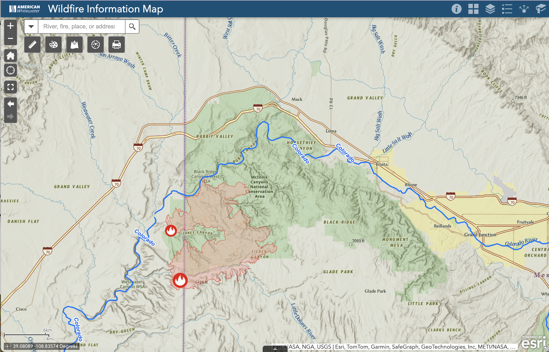
It’s early July, and for much of the country, that means we are all trying to spend more time outside and more time on rivers. For some regions, particularly the Southwest, it’s also the start of what is likely to be an unprecedented fire season. This means that in addition to checking flows and the weather before heading to the river, it’s a good idea to also check for any wildfires, smoke issues, or closures that may impact your plans. We’ve built a map to help you with trip planning and safety.
The American Whitewater Wildfire Information Map shows all the runs in our National Whitewater Inventory alongside the latest wildfire information. The map loads with rivers and fires shown by default, but there is much more information available by selecting additional map layers in the menu in the top right. This includes smoke and air quality info, live AlertWildfire webcams (where available), past fire history, US Forest Service closure areas (WA & OR only), and more. Maps can be easily shared, customized, and printed, and other tools allow measurements, drawing, and more. Click the (i) button in the top-right blue header for complete instructions.
There are currently major fires burning across Utah, Colorado, Arizona, and New Mexico. The Snyder fire on the Utah-Colorado border, which reached over 30,000 acres, caused major evacuations on Ruby-Horsethief in late June. Over 120 people, 6 dogs, and 1 cat were safely evacuated by railcar from the river, and there have been reports of river camps completely burned. The successful rescue mission, led by Mesa County Search and Rescue and coordinated with BLM, CPW, and Union Pacific, was impressive, and we are grateful for the efforts of all involved.
After an extended river closure from James M. Rob State Park to the Utah State Line, the river has been reopened to the public. We are grateful for the expeditious reopening of the river and for the efforts of the firefighters, search and rescue teams, and river managers. To the south, the 60,000-acre Ferris Fire has tragically burned a huge section of the Dolores River between Mcphee and Dove Creek. The river has not been running this season and the extent of the damage to recreation-related resources is not fully known.