Stillaguamish, S. Fork

2 - Mallardy Creek to Verlot (Middle)(Silly Stilly)

Reach banner
DifficultyIII+
Length8.4 mi
Avg Gradientn/a
GaugeSf Stillaguamish River Near Granite Falls, Wa
Flow Rate as of 27 minutes
6.43 ftmedium runnable
Reach Info Last UpdatedJanuary 12, 2026

River Description

Known to locals as the “Silly Stilly,” this section is a solid class III run with fairly continuous action and plenty of spots to practice technique. It’s an excellent choice for those making the jump to class III whitewater. It flows on winter rains and through early summer (October through July). The run responds quickly to rainfall in the range of levels of interest to boaters, particularly during the winter rainy season. Flow can change dramatically over the course of a day, and levels that look reasonable in the morning can be a very different story by afternoon, so pay close attention to gages and the forecast.

Depending on how far upstream you start, the run begins with class II whitewater. The rapids are not difficult, but the possibility of wood hazards demands attentive boat-handling skills throughout.

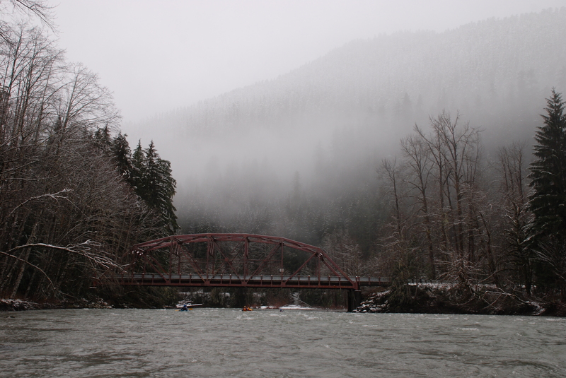
As you approach Wiley Creek (a small stream that enters from river right), the pace picks up with more challenging slalom-style boulder gardens. The real class III action arrives at Wiley Creek Rapid. You can recognize the entrance by the distinct S-bend, which ends in a large pool against the side of the road. This spot is easily recognized from the highway at mile 14.6 and can be scouted on your way to the put-in.

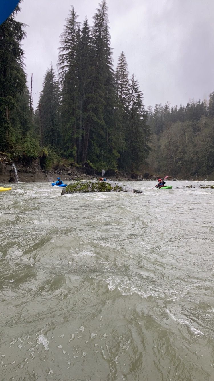
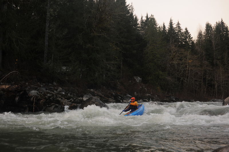
The river accelerates as it plunges through the boulder field and resistant bedrock of Wiley Creek Rapid. Although generally considered a straightforward class III+, those looking for more challenge can create their own slalom course through the rapid to spice things up. Once levels climb above 6 feet on the gauge, this rapid approaches class IV as more significant holes begin to form. A user-friendly playspot sits on river left at the end of the last drop. It’s a particularly welcoming spot for those building confidence and trying their first moves. A short distance downstream, the tea-colored water of Black Creek enters from the left, signaling the start of the next series of boulders and ledges at Black Creek Rapids.

...

River Features

Red Bridge Put In

Distance: 0 mi
Red Bridge Put In

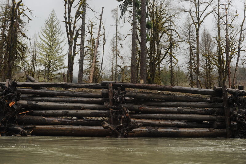
The Red Bridge Campaground is on the upstream side of the Red Bridge (Snohomish County Bridge 537) at Mountain Loop Highway mile 18.1. In the past a logjam was located near the entrance to the campground. You may need to carry boats to a spot downstream of the logs.

Boardman Creek Access

Distance: 1.49 mi
Access Point
Boardman Creek Access

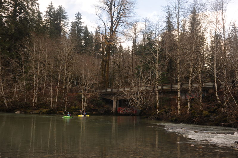
This put-in option at highway mile 16.8 has become more popular in recent years. Parking is available on the upstream river left side of the bridge across Boardman Creek. Put in under the bridge on river left and float out onto a side channel that joins the South Fork Stillaguamish River.

Wiley Creek Rapid

Class: IIIDistance: 3.96 mi
Rapid
Wiley Creek Rapid

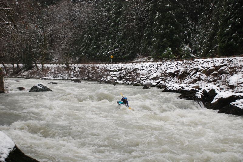
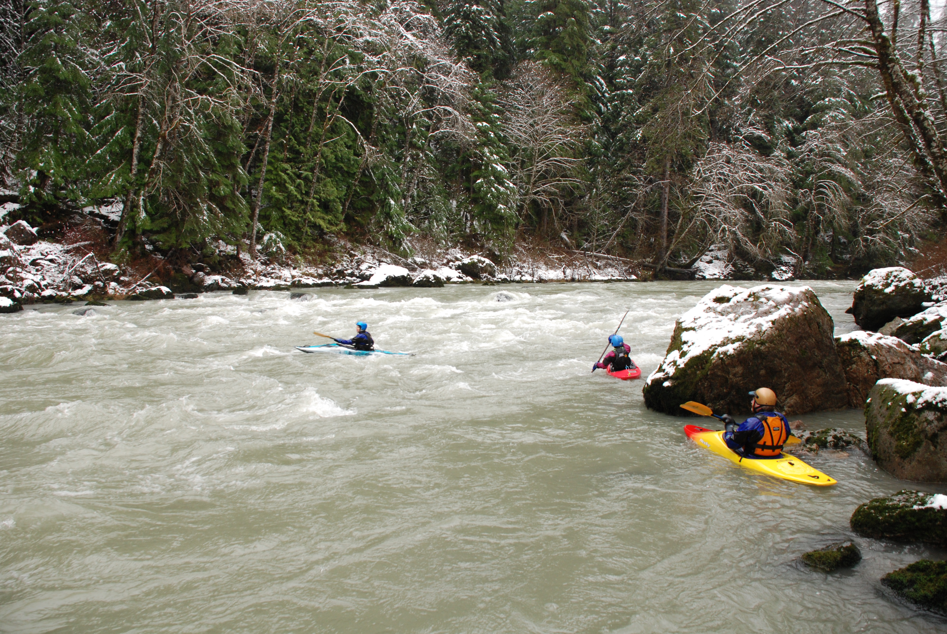
This is the big drop on the run. At moderate flows it is class III but it can push class IV at higher flows. It is traditionally scouted on the shuttle drive up at highway mile 14.6. There are a few different lines and your preferred line may change with the flows so take a look on the way up.

Verlot Campground Take Out

Distance: 8.42 mi
Take Out
Verlot Campground Take Out

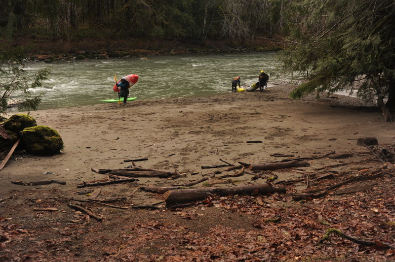
Although the gate to the campground is typically locked during the winter and spring paddling season, you will find good beach access near campsite site 8 (if the water is not too high). During the winter you can park just outside the campground gate at Mountain Loop Highway mile 11.3. If the campground is open you can park across the street from the Verlot Ranger Station. It is a short walk from the campground, across a footbridge, and down a short trail to the parking area.


We kayaked the South Fork of the Stillaguamish River with a group of eight paddlers: seven kayaks and one inflatable kayak. The crew included Tom, Emma, Jennie, Mary, Kanako, Patrick, Bob, and Corey. Bill Petty stopped by while we were getting ready at the put-in and generously helped by shuttling one of the vehicles.

The weather was classic Pacific Northwest winter—overcast skies with a light mist in the air. It had rained overnight and the freezing level had risen, with more rain in the forecast. The steady rain held off through most of the run, only beginning in earnest once we reached the takeout.

We put in at Boardman Creek. Within just a few minutes of paddling, the first class III boulder gardens appeared. At this flow, the river was at an ideal level for this section: high enough to keep things moving, but low enough that boulders were visible and lines were well defined. The boulder gardens were straightforward to boat scout and offered continuous, enjoyable maneuvering with plenty of clean routes between exposed rocks.

Eventually we reached Wiley Creek Rapid, the largest rapid on the run. At this water level it remained solid class III. We had scouted it earlier from the road on the way to the put-in, and on the water the lines were clear and easy to identify by boat scouting. There were alternate routes through the rapid, all offering fun, well-defined moves. Downstream of Wiley Creek we continued through more lively boulder gardens, which made for some of the most enjoyable paddling of the day.

Given the recent flooding in the region last month, many paddlers have been wondering about post-flood river conditions. It was interesting to see the South Fork after those events, but we did not observe any major channel changes or new hazards that significantly affected this run. Aside from one recently fallen tree near the end of the trip that extended about three-quarters of the way across the river—highly visible and easy to avoid on the far left—wood in the channel was minimal. We saw a few isolated pieces, but nothing that posed a serious hazard or required unexpected portages.

We stopped for a quick snack break on a gravel bar on river right before continuing downstream past Gold Basin Campground. Along this section, a large engineered log retaining wall runs for a considerable distance on river right. We observed sediment-laden water emerging from the structure, and signs of recent high water erosion behind the log wall, raising questions about how well the structure is functioning.

Soon after, the river enters a stretch lined with private property, with several cabins on river left. A fun rapid appears as the river bends right along this cabin-lined section. We then approached the Mountain Loop Highway Bridge, where another enjoyable rapid sits just upstream of the crossing. At the bottom of this rapid, wood was protruding from the right bank. It was easy to spot and avoid, as long as paddlers stayed off the right wall and clear of the logs.

After passing under the bridge, there is another short, fun rapid. Shortly downstream we encountered the fallen tree noted earlier, extending most of the way across the river. It was in moving current but not in a rapid, highly visible, and easily avoided by passing far left.

Not long after, we reached the takeout. The campground where we exited was closed, but there was sufficient space near the entrance to park several cars close to the highway. From campsite 8, a small beach provides easy river access, and it’s only a short walk to the parking area. As we changed and packed up our gear, the rain finally arrived in earnest.

Despite the cold and wet conditions, it was a great day on the water. The flow was excellent, the rapids were well formed, and the group enjoyed a fun winter paddle on the South Fork Stillaguamish—an ideal way to embrace the Pacific Northwest rainy season.

Silly Stilly

May 7, 2022


On Saturday (5/7/2022) I was gifted with my first trip down the Silly Stilly. This run is straight up awesome, especially at these flows. When rafting outfitters charge customers $100 to raft the Skagit or the Nooksack, I'm appalled that they don't offer trips on this run.

Anyways, we put in at the access point where the river makes a sharp right hand bend and floated down to the station where the gold cart and the giant log sit. Our group consisted of 4 kayakers and 2 packrafts and the entire run took roughly an hour. We loved how continuous and playful this run is, catch on the fly waves through the entire run. Wiley Creek Rapid came up a bit faster than a few of us expected, but we still had plenty of river to warm up on. At 6.9ft I could probably call Wiley Creek a solid class IV with the picket line of huge holes to work through creating quite the stir if you don't nail your line. After this there is tons of fun class II and III rapids all the way to the first bridge, where a solid wave train on the right wraps up the action. Below this there are a few easy class II rapids until the takeout, most of the group exited at the Sandy beach near the campground but I floated a tad further down and scrambled up the bank by the gold cart.

There was no wood near or below the recently engineered log jams that posed any issues.

We had a fun trip down the South Fork Stillaguamish after the recent high water event. We met up at the Verlot Ranger Station (parked at on the river side of the highway near the big log and mining cart) and set take-out vehicles there. We put-in at Boardman Creek access and had one log we needed to immediately portage. The rest of the run was largely clean with a few pieces of wood in play in some of the drops that was easily avoided. This is a good low runnable flow. The big project to reroute the river at Gold Basin Campground was impressive with engineered wood structures lining the bank for a long distance. Several sections eroded away in the last high water event. We did not find any evidence of logs from the structure as we continued downstream to Verlot but stay alert if you do this run.

KI
Kanako Iwata-Eng

Oct 6, 2021


In the summer of 2021, a construction to change the course of of the river at the Gold Basin Campground took place. On the river right bank, they piled up logs, many of which are not secured. 25 logs had floated down before our first run of the season on 9/19/2021, though none was in a bad place. After the high water, some moved, and more new logs floated out of the bank. Be careful particularly after each high water.

We put in at Boardman Creek, approximately 2 miles upstream of Wiley Creek Rapid. A few pieces of wood in play, use caution as you approach the engineered wood structures on river right at the Mountain Loop Highway Bridge, but mostly all easily visible and nothing requiring a portage.

Nate Halpin
Nate Halpin

May 16, 2019


Ran this May 12th, 2019. There's still wood in the last major rapid above the bridge. If you're a Class III boater, it's worth a quick glance when setting shuttle from the bridge, All the wood is at the bottom right of the rapid with a considerable amount of current impacting wood. A good R. to L. move and you're in the river L. eddy and away from the hazard.

JD
John Dowse

Nov 8, 2016


Landscape view from my phone.

2015 Video
https://youtu.be/sq4aKHJyQiw

JD
John Dowse

Nov 8, 2016


Made this wave while working as a Hydro Tech but winter storms washed it away completely.

JD
John Dowse

Nov 7, 2016


Screen shot from my video https://youtu.be/sq4aKHJyQiw

JD
John Dowse

Nov 7, 2016


Built this up and surfed it while working as a Hydro Tech in 2015. As of 2016 it was completely washed out.