Brunsweiler
B) Beaverdam Lake to Ensinger Road (9.5-10.9-11.8 miles)
| Difficulty | II-III+(IV) |
| Length | 11 mi |
| Avg Gradient | 56 fpm |
| Gauge | Brunsweiler |
| Flow Rate as of 27 minutes | 5 cfsbelow recommended |
| Reach Info Last Updated | January 31, 2021 |
Though difficult to catch 'up', the Brunsweiler is truly one of the gems of Wisconsin's South Shore rivers. Access at the listed put-in may be problematic. The only road into Mineral Lake is private, and may be gated. If you are able to get in (and get permission to launch from there), you will have to paddle across the lake (if it is not iced over) or walk around a bay to get to the dam and the river downstream. For this reason, it is entirely likely most folks will use one of the alternate put-ins. We list the lake/dam as the put-in for this section in order to have 'completeness' in our descriptions of the whitewater on this river, for those who may be interested in trying to deal with the access issues in order to see these seldom-run drops.
From below the dam (the listed put-in) the river takes off at a fast clip downhill. When rock walls begin closing in, get out and scout on the right, there's an intersting small vertical falls (about 6'-8' drop) just downstream. The run-out below this falls is somewhat congested and tends to collect wood. The river deflects off a cliff face below, the heads into another drop cascading about 8'. From here to the Spring Brook Road bridge are several busy boulder bed drops.
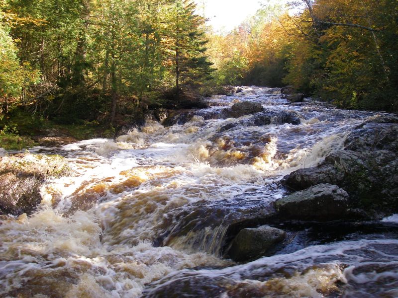
Spring Brook Road (FR189) is where most paddlers will access this run. From here, the river is still pretty much non-stop action with extended stretches of class II-III boulderbed interspersed by three major drops in the class III to IV range (depending on flows). The first of these is a bouldery cascade that sometimes collects wood, the second a fluming drop through a bedrock sluice and the third is a very entertaining, good sized slide sequence. Below the three bigger drops, the river continues to move at at fast clip, though mostly class II. Be careful at a section of braided channel were the left hand channels may have barbed wire strung across them.
Alternate put-in at Spring Brook Road avoids more difficult upper s
...
It appears there is a fair sized island at the outflow of the lake, either side of which has a dam. The more Easterly looks to have a smaller channel (probably more deadfall/snag prone), so the other is our marked start of this run.
It should be noted that much of the early part of this run is heavily obscured on aerial views online, so we are unable to locate and identify many features. As a result, far more of what follows here are just 'waymarkers' to delineate progress downriver.
Often used as alternate put-in to avoid the logistics of the listed put-in, to skip the early action (scouting and portaging or running a class IV-V mini-gorge), and shorten this long run a bit.
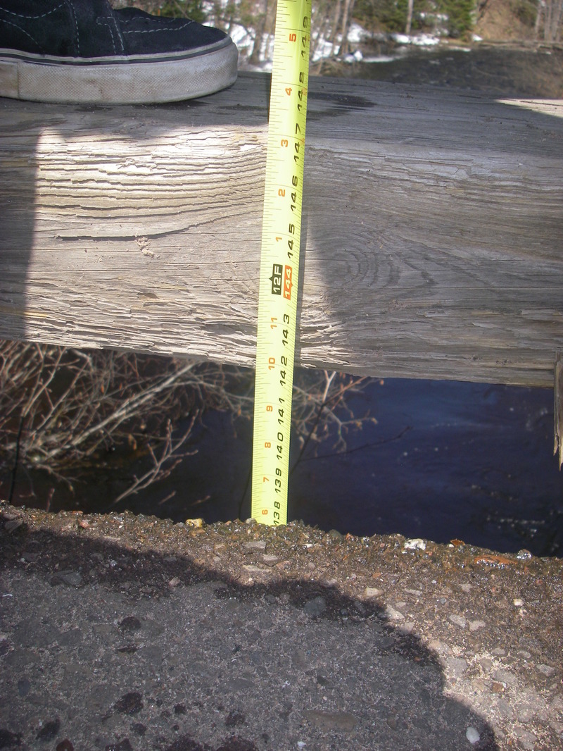
This is the location for usual 'gauging' of the flow. On the river right upstream side of the Spring Brook Rd. bridge, measure down from the top of the bottom 12' x 6' support on the bridge:
10'4' down is a very nice level. Well worth trying to catch. See photos which other users have provided, which show the run at 11' down, which is a rather low-runnable flow. (Keep in mind that, on a 'measure down' gauge, 'more is less'! That is, 11' down is LESS water than 10'4' down.)
For that reason, we recommend doing a calculation of 11' minus your measure-down reading.
Using that calculation, 0' is the 'low boatable' level previously cited, and 8' is the 'very nice level'. (And, one of the comments below mentions running it at a 'measure down' of 11'8', which would be -8' . . . unfortunately, that comment mentions nothing of how boatable it was, but speaks only to how much wood was encountered.)
The river takes a sharp horse-shoe bend (U-Turn) to the right, and there is a clearing in the otherwise heavily forested banks, a swampy area, on the left.
A very swampy area to the right, and a small unnamed (on any online maps I find) trib enters.
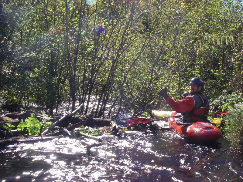
There appears to be a beaver dam at this point of the river, and downstream the flow splits into a number of braided channels. Flow in each will obviously be diminished (compared to the rest of the river) and deadfall and snags will be more a problem. Do your best to find the channel with best flow and least snags.
An island (perhaps the result of the slide?) splits the flow and a steep eroded bank appears on river-right.
An island splits the flow (main flow goes left). Not far past the end of that island, a H-U-G-H island splits the flow (main flow goes right). It is nearly a half-mile before flows rejoin as the island ends.
Possible alternate take-out to shorten the trip, though there are additional decent rips downstream, if time allows.
Aerial view seems to show fence/rail a good ways each side of river, and no obvious/apparent provision for parking. So, while this is listed as the take-out, the other options may actually be better choices!
USGS lists a sampling site here with drainage area of 65.3 square miles.
Fine low-grade rapids continue below Hwy.13. As you cross under a railroad and almost immediately then under Ensinger Road, there appears to be a WONDERFUL landing on river-left.
Apr 12, 2020
Ran Springbrooks down to HWY C @ 200cfs. The entire upstream section is a great creeky run that is mostly free of wood. As AW describes there are 3 main rapids. The sluice or dells rapid (wood RR), the double drop (most fun rapid on section ran both drops RL), and the slide before the eroded bank (ran the middle). Downstream of the slide and eroded bank the river gets wood choked and we made 10+ mandatory portages around dams and sketchy wood in sets. This runout was a bit tedious and consider using a 4WD vehicle to access the alternative TOs instead. Note that we ran shuttle via Springbrook and North York Rd's and both roads were in great condition this early in the season and 2WD was more then adequate.
Sep 27, 2010
Ran with Brendan & Ed O at 11ft down. Did the springbrook to eades road. The owner at the end of eades road said it was ok to park at the bottom of the hill in the turn a round by their driveway so as not to have to carry up the hill.
All 3 rapids were great at this level. We had to pull and push through the alders, portage around 1 tree, limbo under another, dodge about 426 others, and run 8 beaver dams. A typical run. Well worth it if it is up. We did not get up to see the canyon.