San Joaquin
Friant Dam to Mendota Pool Dam
| Difficulty | I |
| Length | 61.6 mi |
| Avg Gradient | 3 fpm |
| Gauge | San Joaquin R Bl Friant Ca |
| Flow Rate as of 30 minutes | 314 cfsrunnable |
| Reach Info Last Updated | January 7, 2023 |
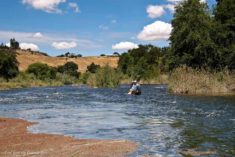
The San Joaquin River below Friant is a flat, valley river with occasional riffles in the upper reaches and even some class 1 rapids near Friant and Lost Lake. At summer low flows it is the safest introduction to river paddling in the Fresno area. At high flows it is the closest whitewater to Fresno, even if there is only a small amount. The main attraction of this reach is its proximity to Fresno, the nice scenery, the birdlife and occasional wildlife sightings, such as deer and beaver. This section is significantly easier than the Kings River at Piedra and is really more similar to the Kings River from Sanger to Reedley, though with more brush hazards because of the usual lack of high flows.
The river from Friant to Skaggs Bridge is typically broken into 3 sections which will take about 4 to 6 hours each at low flows. Allow 2 or 3 hours per section at high flows:
Friant to Highway 41 area - 10 miles.
Highway 41 area to Highway 99 area - 10 miles.
Highway 99 area to Skaggs Bridge - 10 miles.
There are a few access options for each of these sections.
From Skaggs to Mendota is divided into two sections.
Skaggs Bridge to San Mateo avenue is 22 miles. This will take most of the day at high flows and probably more than a day at low flows.
San Mateo to Mendota Dam is 7 miles. Allow 3 hours at 950 cfs. (the last 2.5 miles had no current)
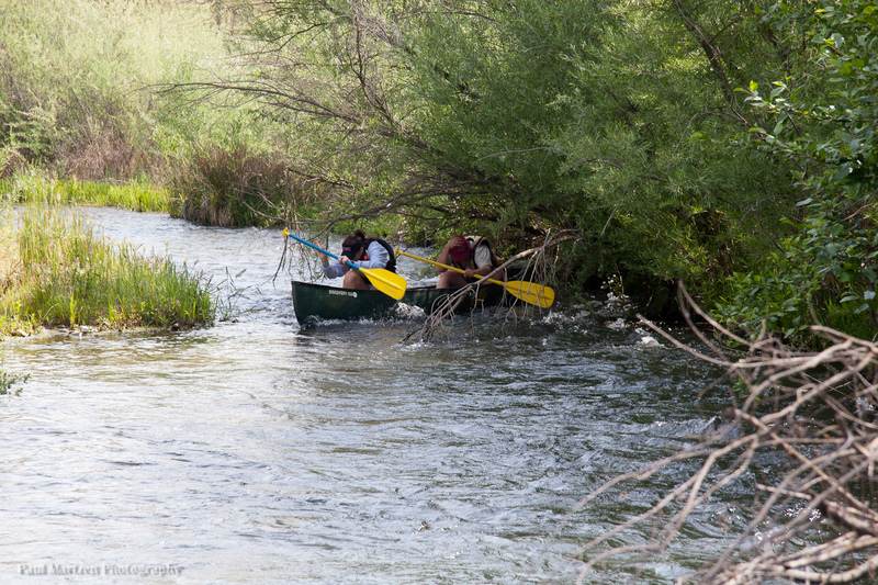
Brush and Tree Hazards: Because Friant seldom releases more than a couple hundred cfs, vegetation tends to crowd into the channel wherever there are shallow riffles. The river is mostly wide, slow pools alternating periodically with narrow, swift riffles where the current often swings close to trees or brush. First time canoers will find many opportunities to tip over where the current pushes them into trees or brush. At high flows such dangers are increased for beginners. At low
...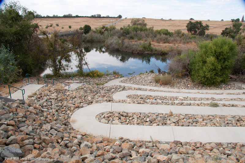
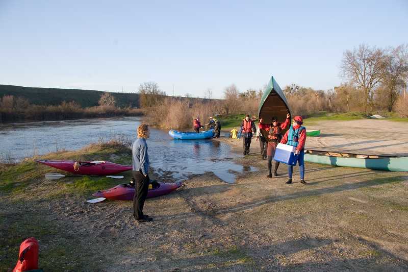
There is a launching area on the upstream, east side of the bridge in Friant. In 2007, the lower parking area was eliminated and replaced with stairs and a winding access ramp. A paved parking area was constructed up above, next to the highway. The parking area is gated at night, but there is an empty lot on the other side of road where you can also leave a car.
Boaters can paddle upstream towards the dam and explore this interesting area. A small rapid/cascade marks the turn around point a safe distance below the dam.
Boaters can also proceed downstream towards Lost Lake, but need to beware of the difficulties immediately downstream. As soon as you round the corner and pass under the bridge, an old Broken Bridge presents several obstacles directly in your way. The water turbulence here can easily flip unskilled boaters.
Immediately past the Broken Bridge, a grove of trees spreads across the entire river, with only two clear, but narrow channels through. At low flows the current feeds debendably into these channels, but careful manuvering is required. At high flows the current flushes straight through the grove and good paddling skills are required to find a safe route.
The remains of an old concrete bridge clutter the river channel, creating obstacles and hydraulics that may be interesting or hazardous, depending on your skill level.
Immediately downstream the river splits into several channels around small islands. Trees in the channel can be a problem, especially at high flows.
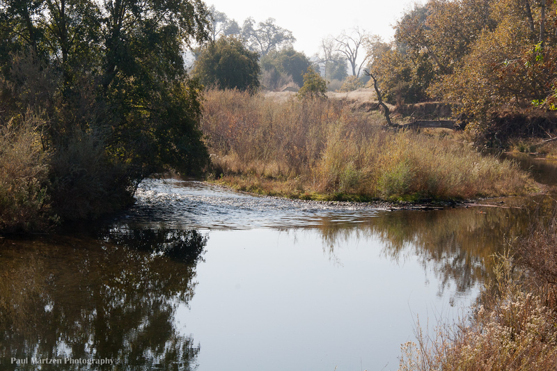
This small riffle is popular with fishermen, but paddlers can have some fun playing in the eddy lines and on the far river right side. At very high flows some interesting play holes can develop at the rounded rocks just downstream.
The riffle itself is probably manmade; the remains of a small weir. There is an old gauging station building on the river left, which has markers showing the height of a past flood.
Also on river left is the Lost Lake campground. Toilets are available here and at several other locations in Lost Lake Park.
Sometime in the past, small boulders were placed across the river to form this low dam. Trees have grown in along the length creating an interesting wild area. Water drains through in various spots, but two chutes, one at each end, carry most of the flow. The chute at the far river right end is straight enough for canoes, but bumpy enough that flips are common. At the far left side, kayaks can scrape over some rocks to run a slalom route. As flows rise, both routes become better. There can be some minor play potential for kayaks at the base of either side.

The river splits around an Island while dropping steadily. At low flows the left channel tends to be a bit deeper, but it has several obstacle rocks in awkward locations. The right channel tends to be wider and cleaner, but more shallow.
Where the channels come back together the flow pushes against granite outcroppings on the river right.
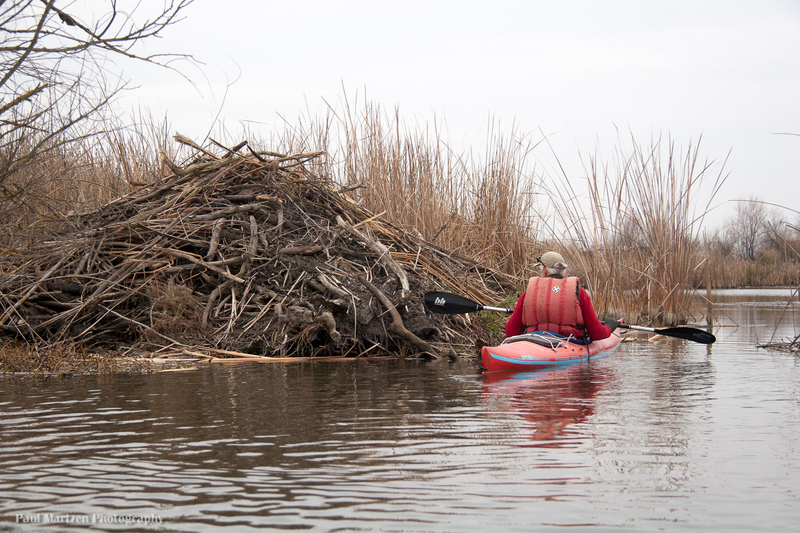
After a long flat straight section, the river comes to the head of Ledger Island and makes a sharp bend to the left. The river drops down a wide, shallow, but long riffle. On the sides at the top of the riffle look for the handiwork of beavers trying to dam the river.
At low flows the deepest water has been on the far river left, but this can change from year to year.. Pass to the left of two very small bushy islands then cut back out to the right of a third very small bushy island.
Indian grinding holes can be seen in the top of the boulder on river right at the bottom.
During high flood releases above 5,000 cfs, part of the river above the rapid, flows to the right into a large expance of gravel pits and flood plains in the center of Ledger Island. This flow rejoins the main channel a few hundred yards below the concrete bridge.
This old bridge serves as a landmark for boaters. There are many swallow nests underneath this bridge. Also, there is a lot of driftwood wedged in the girders underneath the left side of the bridge. The flood of January 1997 was up to this bridge and washed out the roads on either side. This bridge creates a constriction point that raises the level of the river. Somewhere above 7,000 cfs the river level gets very close to the underside of the bridge. If the level gets too close, boaters will have to get far to the side and portage.
This fun riffle starts immediately below the bridge. The channel drops slightly to the left, sharply to the right, and then swings back to the left. At low flows of 250 cfs in 2008, the river split around a low gravel bar. The left channel is safest, as a tree hangs into and blocks most of the right channel.
Note the erosion of the right bank, below the rapid. High flows in 2011 removed perhaps ten feet of bank.
At low flows the right channel is the deepest. For a number of years different trees fell into the channel creating extra hazards. Those trees mostly seem to be gone and Shady Riffle is no longer shady. The riffle still seems to cause plenty of trouble as beginners can run into the banks, get turned sideways and easily tip.
At 1,600 cfs and higher, there are wide easy channels, especially to the left.
As a big fancy house comes into view on the left, the river splits around a long island. The main flow stays to the left. The main channel has a riffle that starts straight then bends sharply left.
The right side channel is quiet and pretty till near the end of the island where this channel splits again, left back to the main channel or right into the Cobb Channel. The Cobb Channel is a small ditch that leads further right for irrigation of lands along its length. It may be passable with sufficiently high flows, but is normally blocked at various points along its way by dams and vegetation.
In 2008, Friant Water Users constructed a new diversion dam on this channel to divert more water into the Cobb channel. The dam is just a pile of cobble stones and is easy to portage. It is also easy to run, or rather scrape down, a shallow chute on the left. The channel is narrow and makes a sharp bend to the left. Beginners who don't make the turn at the bottom of the chute will crash into the berry bushes on the right bank and probably tip over. The chanel following is fast and narrow, with several overhanging bushes that cause beginners to tip over. Some years the bushes and berry bushes become extra hazardous.
Friant is legally obligated to deliver some amount of flow (5 cfs maybe?) into the Cobb channel, but over the years the channels change and less water has flowed into this side channel. To compensate, Friant had to release larger amounts of water into the river. River runners benefitted because flows often were in the 300 to 400 cfs range instead of 100 to 200 cfs.
The new diversion dam raises the level of the river at the side channel and forces more water into the side channel. This allows Friant to lower flows down below 200 cfs most of the time. River runners had to paddle with these much lower flows, till higher restoration program flows started in 2009. Confusing?
A large mansion on River left is a distinct landmark. The property on the right side of the river is Rank Island, now owned by the San Joaquin Conservancy. This 'Island' extends for several miles to below the 'Culvert'. Cobb Channel forms the west boundary of this island.
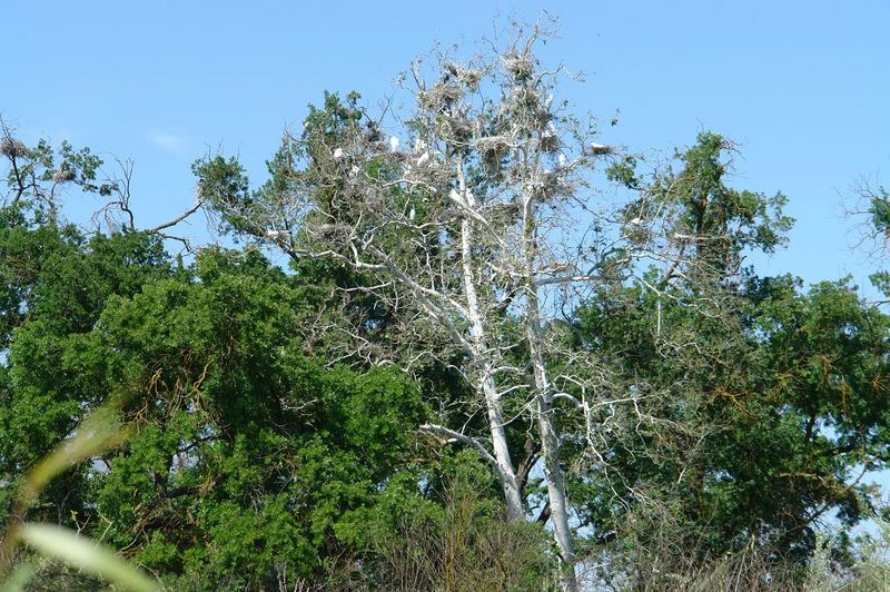
Herons and Egrets nest together in colonies in one or two sycamore trees on river right, but set back 100 yards. The white egrets are easiest to see, but also look for the large clumps of sticks which are the nests.
This rookery is on Rank Island, now protected by the San Joaquin Conservancy. Just before the river picks up speed and flows around a concrete pipe, look at the tall sycamore trees off river to the right. You will see the most activity in spring and early summer.
Past the rookery and the concrete pipe the river flows against the right shore then abruptly turns left, drops down a riffle and dashes into the left shore where a number of trees and bushes hang over the water. It is a common place for upsets and swims, but in 2012 a whole tree has fallen in and blocks most of the channel. It is now safest to avoid this channel completely. Instead of following the main channel, stay far right up above and go down a very small right side channel.
The river runs against the right bank then turns sharply left down a narrow riffle through the trees. A high flow channel continues around to the right, but a tree has fallen across it. The riffle itself is straight, deep in the middle but shallow at the entrance and at the end. Bushes overhang the left side and an old log borders the right side half way down the riffle.
The San Joaquin River Parkway uses this put in for many half day canoe trip adventures. Contact the parkway to sign up for canoe and hiking trips in this area. The property is surrounded by the Vulcan gravel mining operations and so is not presently open to the public other than for Parkway sponsored trips.
The main channel runs against the left bank. The riffle gradually turns to the right as it drops and the safest tactic is to stay on the rights side of the riffle or to cut from left to right across the riffle. Beginners tend to crash into the left bank. Since 2011 this is a more serious area, because a huge oak tree fell of the left bank and fills the left and middle of the channel at the bottom of the riffle. At low flows of 350 or less I have not seen anyone have problems here even though many drift down to this tree. At higher flows it should be easier to stay to the right side of the channel and avoid the tree.
A variety of right side channels open up at high flows. Even at 350 cfs there is a narrow & exciting right side channel that reenters the main channel just below the fallen tree. Paddlers must duck under and crash past a number of drooping branches in this narrow channel. These right side channels must be entered from far upstream in the middle of the Owl Hollow pool.
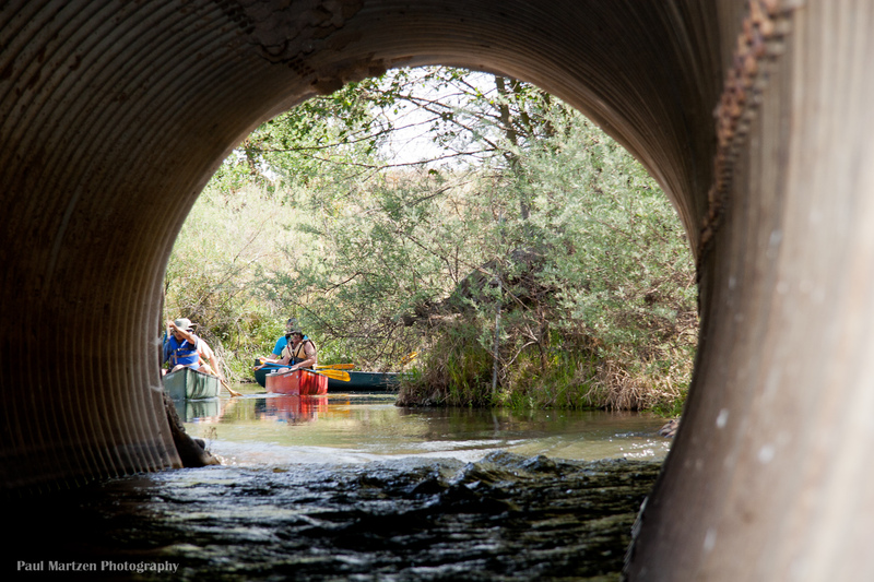
The gravel mining company had a road across the river at this location. A series of small concrete pipes passed much of the flow under the road, but at the furthest downstream point, they placed a very large corrugated pipe culvert which is large enough for canoes to float through. The road is no longer used, so has not been replaced since washing out. The main channel goes to the right just below Lower Owl Hollow Riffle, then down a long straight away towards a gravel bar island. Boaters can go either way around this island, but in 2012 it is easier for beginners on the left side. Both sides have overhanging bushes, but how much the current pushes into the bushes changes from year to year. Beginners often run into these bushes, but if they duck and stay centered, they can stay upright.
If boaters stay left they come to the end of a pool and can peer down through the culvert. There is plenty of room to watch others paddle through and it is easy to line up and float into the culvert yourself. It is an exciting fast ride through the culvert and there is usually a small drop off at the end. The drop off tends to splash water into canoes.
Following the culvert is a short pool, then a tight passage back out to the main channel right above the gravel bar island.
A fun riffle at low flows in a narrow, river right chute. Washes out at high flows. The initial drop is formed by a low, diagonal bedrock ledge on far river right. After the first drop, the current pushes boats further right towards another bedrock outcropping which can tip the unwary paddler.
The rest of the river channel is semi dammed by chunks of concrete and the remains of concrete pipes. There is a diversion channel on the left leading a short ways to the gravel mining operation. It appears that the gravel company has dammed the river a little bit to help divert water to their operation.
The parkway folks have another name for this, but it escapes me at the moment. There is a nice gravel bar for stopping at the bottom left. Swimmers can walk to the top of the riffle and float through.
Ft Washington was a privately owned camping, fishing and river access park. After the death of the owner, the property was mismanaged and eventually closed. Since 2021, there is no longer public access available here.
The river splits around a large island with a series of riffles in each channel. In 2012 Fish and Game has strung a fence with fish sensor most of the way across the entrance to the left channel. There is a gap for boats on the far left side.
Both channels are interesting. The right channel is very narrow towards the end and has a number of tight turns. It can also get blocked by logs and strainers. The left channel is fairly wide and open but has some tight turns and tight spots at low flows.
The Wildwood Access area is where the channels rejoin on the upstream side of the highway 41 bridges. The main flow passes next to a bridge support.
Wildwood Park is on the north side of the river, on the east side of Freeway 41. The parking/loading area is a ways from the river, so boaters must carry their boats to and from the river.
Upstream of the Freeway 41 bridges, the river splits. Both channels get tight and technical as they near the bridge. Tree and brush hazards here are especially bad at high flows and a boater lost her life here during high flows one year when she was pinned by the boat against an obstacle.
After the river passes under Highway 41, it loops back to the north bank (river right). The channel remains against this bank for a ways till it is constricted at this riffle.
At typical low flows the river narrows down against the right bank. A tree fell across the river and was cut off, leaving several feet of tree trunk protruding across the current, hence the name. The high flows of 2011 removed the stump completely. Now this is an easy and clean riffle that curves to the left.
Below this, the river widens a bit, passes two smaller riffles then flattens out into a series of large lakes. The lakes are old gravel mining pits.
A former gravel mining operation was sold to the San Joaquin River Conservancy. It is open for camping and day use, Friday through Sunday. A private contractor collects fees for day use and camping in exchange for supervising the area and doing maintanence. There are bathrooms here and a small store.
The map marker shows the location of a good canoe put in or take out on Muddy Pond. A break in the levee connects this pond with the river channel. Two concrete boat ramps are also found along the considerable Sycamore Island waterfront.
Street access is from the Madera side of the river. Take Avenue 9, to Road 40 south, then turn right on Ave 7 1/2 to the Sycamore Island entrance. Dnive in to a small building which is the store and pay the fees.
Going left at the intersection of of N. Palm and W. Nees, there is a gated access road down to the river. Boaters can drop off or pick up boats at the gate, but will have to park vehicles at nearby Spano Park. Security gaurds at the shopping center next to the access road, do not allow boaters to park in their parking lots.
Boaters who launch here can paddle upstream to explore a large area of interconnected lakes. A series of small riffles run downstream into another area of very large ponds.
The Sycamore Island access area is directly across the river on the Madera side.
Once this area was owned by the Boy Scouts and was used for overnight camping and camporees. It was undeveloped and primitive at that time. Now the area is owned by the Fresno Unified School District and is used for outdoor education activities. It is also home to the Parkway River Camps each summer. The area is now well developed with large lawns, a small amphitheater, bathrooms and challange course structures on both sides of the river.
There is no public access here.
There are some sections of fast narrow channels leading towards scout Island and even faster channels following.
Camp Pashayan is usually open weekends during the spring, summer and fall. Contact the San Joaquin Parkway Trust for specific hours and operations.
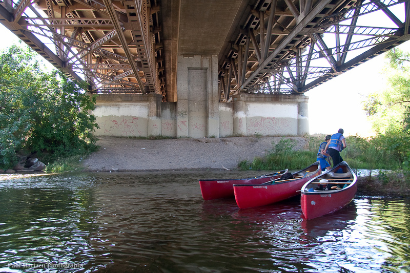
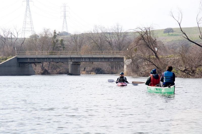
A railroad trestle and freeway 99 both cross the river at the downstream end of Camp Pashayan.
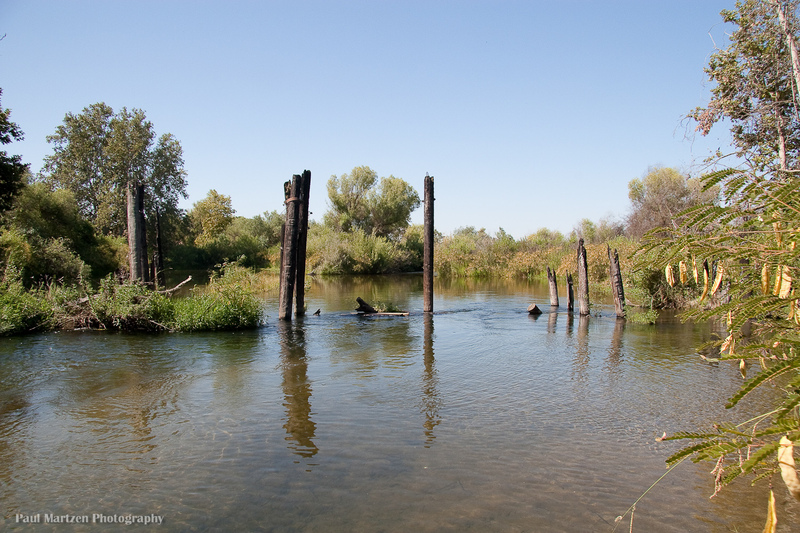
At the downstream end of the freeway overpass, are old bridge pillings (posts) that collect driftwood. There is usually an opening, but in some years it can get completely clogged until someone cleans out some of the driftwood.. Be more careful during or after periods of high water that could deposit more driftwood here.
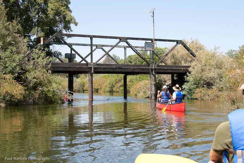
The river passes through a narrow opening under a metal bridge. At high flows, there may be limited clearance. A solar panel powers the gauge instruments.
This Fresno County park is on the west side of highway 145 which runs between between Madera and Kerman. The entrance to the park is a quarter mile south of the bridge. The park is heavily used on summer weekends, so parking can be a problem. The county will close the park when flows are very high.
Since the construction of Friant dam the river has generally been dry after this point. A sudden lack of trees along the river is testament to the lack of water. Since the start of restoration flows in the fall of 2009, riparian vegetation is likely to make a steady comeback.
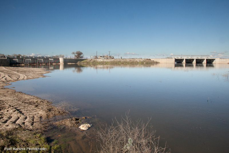
The river is blocked by two small dams. The left dam releases water into the river channel and on to Mendota Pool. The right dam releases water into the Chowchilla Bypass during flood events. The bypass is a big barren ditch.
The portage around the left side of the left dam looks fairly easy.
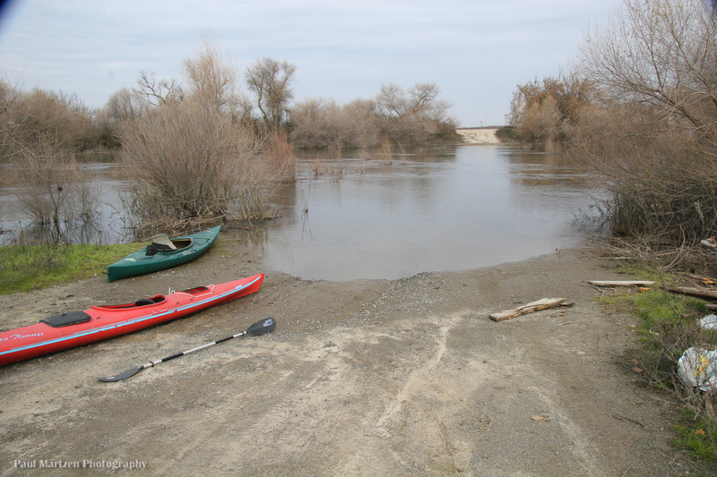
San Mateo Avenue fords the river just upstream of the tailwaters of Mendota Pool. Now that the river is no longer dry, it is not possible to ford, but it is a good launching or take out spot. The road at the very end is not county maintained (has lots of potholes) and may be private. It is regularly used by the public, but there is a gate which could potentially be closed at times.
There is a fair bit of trees and brush in the channel in this area, so careful manuvering is required in several areas. There is one area in particular (in 2010), about a half mile downstream that was very tight and awkward, requiring a sharp right turn next to an overhanging branch.
With 860 cfs, two of us paddled a canoe 4 miles upstream to the bifurcation in 2.5 hours. We came back in 1 hour.
With 950 cfs it took two of us less than 3 hours to leisurely paddle the 7 miles to Mendota dam from here.
This public park on Bass road just south of Mendota dam has water access. It is the same distance as going to the dam but requires turning left up a side channel under a bridge. You could be fighting a current sometimes.
Take out on the left just above the dam. It will be muddy but fairly easy. There is plenty of parking next to the dam. The dam is often heavily used by fishermen. The pool is very shallow in many areas. If the water level is down there will be large areas of exposed mud flats.
An alternate take out or access point is to paddle up a side channel to Mendota Pool Park.
May 19, 2012
Paddled from Skagg's Bridge to Mendota Pool Park on May 17, 2012 with 1090 cfs release from Friant, in 11 hours, with a number of short stops, lunch, and fighting a head wind for the last few hours. There were two boats; a touring kayak that could have easily done it faster, and a 17' canoe with two paddlers who were pretty maxed out on speed. Flow was 850 at Gravelly Ford and 730 below the bifurcation.
Apr 26, 2012
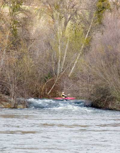
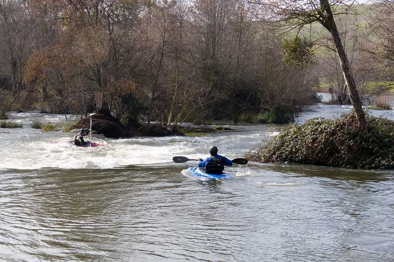
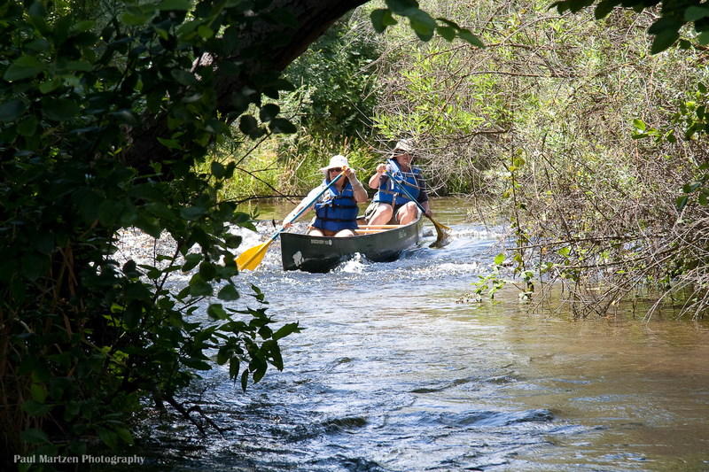
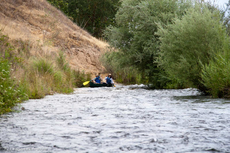
Canoeists have just entered the riffle.
Apr 26, 2012
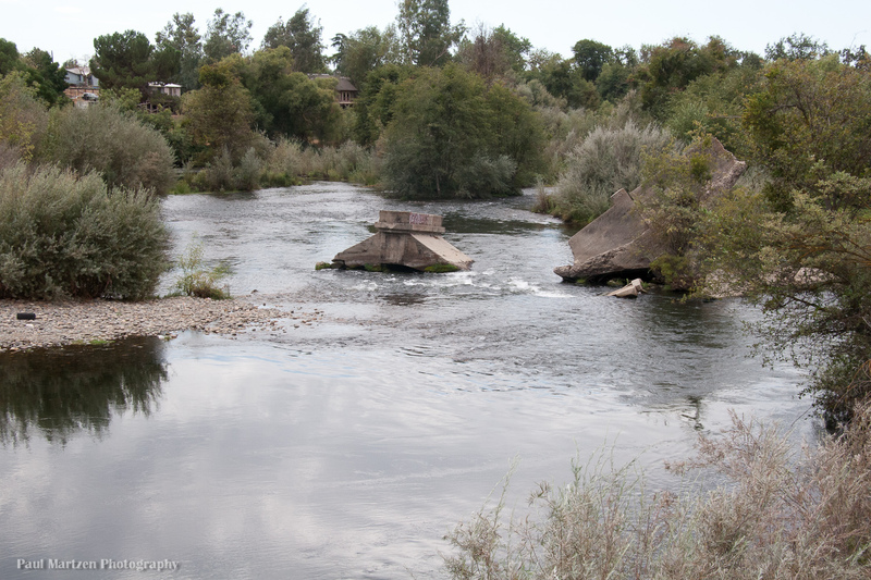
The remains of an old bridge clutter the river, creating challenges. The chute between the two bridge parts is generally the easiest route, but it is easy to portage on the left or run other routes. If you crash into the obstructions you could wrap a boat. Once past the bridge, continue a bit to the left, then down the main channel to the right.
Apr 26, 2012
A nice parking area with toilets, sits above this elaborate but awkward river access area.
Apr 26, 2012
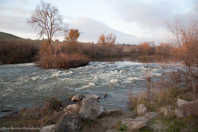
Looking upstream at the wide Beaver Riffle.
Apr 26, 2012
As you exit from underneath the highway 99 bridge, you must negotiate through these posts. They tend to collect logs and branches so be careful.
Apr 26, 2012
There is a take out under the bridge that allows boaters to scout the way through the old bridge posts just downstream.
Apr 26, 2012
We came across this interesting structure somewhere in the middle of Mendota Pool.
Apr 26, 2012
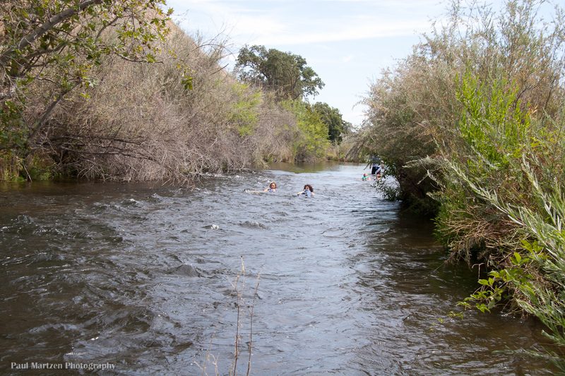
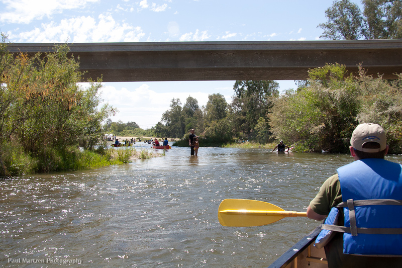
The highway 145 bridge signals the approach to the very popular Skagg's Bridge park. There will usually be lots of people swimming, wading and playing in the river.
Apr 26, 2012
This is the riffle near the end of the right side channel. The riffle is on a sharp turn just past the diversion to Cobb Channel.