Middle
Lackson Road to Sleepy Valley Loop (9 miles)
| Difficulty | I-II |
| Length | 8.6 mi |
| Avg Gradient | 30 fpm |
| Gauge | Bois Brule River at Brule, Wi |
| Flow Rate as of 1 hour | 144 cfsbelow recommended |
| Reach Info Last Updated | January 22, 2022 |
River Description
According to at least one reviewer: ' Hands down ... a MUCH better run than the Bois Brule!'
Click the following link for an eight-minute video showing some of the fine action on this run: Low-water run of the Middle River
Situated midway between the Bois Brule (with its generally mild whitewater -- one section 3.9 Miles, Avg. Gradient 15 fpm, Max Gradient 28 fpm, the other section 9 miles, Avg. Gradient 23 fpm, Max Gradient 45 fpm) and the Amnicon (with its wild sequence in the state park -- listed reach of 5.7 Miles, Avg. Gradient 54 fpm, Max Gradient 129 fpm), one might expect the Middle River to at least have SOME sort of gradient and potential for whitewater. Indeed, this listed section averages 30 FPM, never falls below 14 FPM, and nears 45-50 FPM for a mile-and-a-half. So, one should expect at least Bois Brule-esque action.
Further, analysis of rivers in this area shows that Wisconsin's tallest falls at 165', Big Manitou Falls on the Black River in Pattison State Park, drops from ~960' down into the gorge through the 800' contour. The falls on the Amnicon appear as that river passes through elevations from about 830' down to 730'. Bois Brule's Lenroot and May Ledges appear as that stream passes though 830' and 800'. (Seeing a pattern here, everyone?) The Middle River passes through these elevations in the vicinity of East Moonshine Road, where (indeed) its steepest gradient appears. With this analysis, we listed this reach and petitioned for anyone with first-hand knowledge to 'report'. Sure enough, we got a response.
MnktoDave reports:
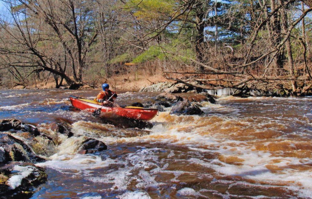
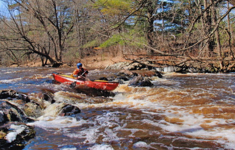
With the Bois Brule running at about 225cfs and dropping fast, we decided to try something new. We had often thought to run the Middle river over the last several years. After looking at the map we decided to do the short section from Lackson Road to Hwy.2. We drove along the river and checked out as much as we could see. The riv
...River Features
Put In at Lackson Rd
Bayfield Road Ledge
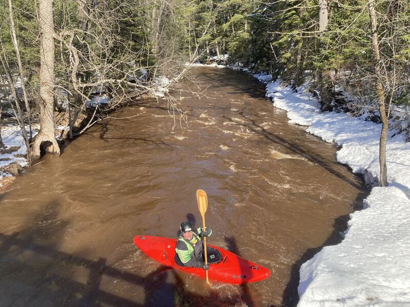
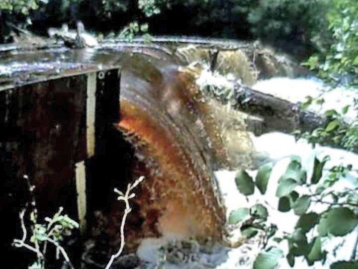
Just upstream of (and visible from) Bayfield Road bridge, this ledge has a sweet playable hole even at a fairly low flow (as shown in the photo). With higher flows, this may get a bit sticky/tricky!.
Hwy.2
For a shorter trip, access (take-out or put-in) is possible at Hwy.2.
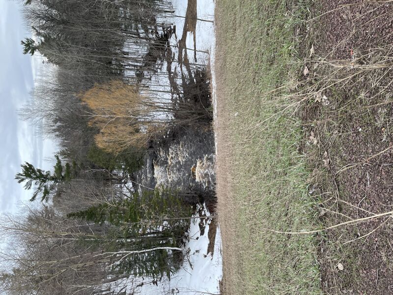
From reports, apparently there may be periodic concerns with wood (trees) blocking the tunnels passing under the highway, making portage necessary.
Dam
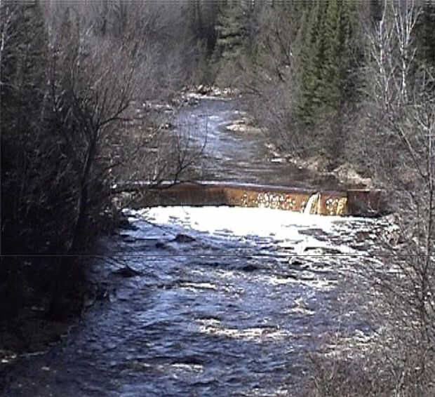
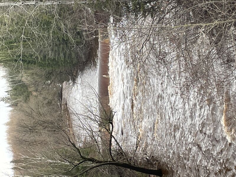
MnktoDave reports that there is a dam at this location which they found fairly easy to portage.
Nonetheless, we would highly recommend scouting (while running shuttle, before putting in to run this section of river) to be aware of conditions leading into this dam.
An added benefit is that there is apparently a stick-gauge at this location, so it would be handy to check that for water level before you put-on, especially since the 'reference gauge' (on the Bois Brule) may not always correlate well to flows here.
Take Out
Trip Reports
Log in to add a reportThis trip report is the synthesis of 18 runs on the Middle over the past 5 seasons- from 2020 to 2024. It has become a staple of my Duluth area creeking.
The river can be done in one of three lengths: the full 9 miles from Lackson Road to Sleepy Hollow Road. Or as the Upper 6 miles from Lackson Road to Moonshine Road. Or the Lower 3 miles from Moonshine Road to Sleepy Hollow Road.
Depending on the spring, the Lower Section can run for an additional two weeks after the Upper becomes unnavigable or painfully boney.
The Middle River has four primary hazrads: Spring Ice Shelves, US Hwy 2 Box Culvert, Snag Island and the Low Head Dam upstream of US Hwy 13.
Spring Ice Shelves: The class 2 rating is not entirely incorrect but, could be catastrophically misleading. The river has a different character and is radically more dangerous at spring flows just after the ice comes out. A solid background in whitewater creeking, dry suit and cautious attitude watching for wood are required if you don't want to get in trouble.
Climbing out of the boat onto ice shelves while in current, without the luxury of eddies can test your competence under high stakes. During spring high water, a creek boat is advisable to make climbing out of current easier. Once the weather warms and the water drops, beginner/intermediate boaters and all manner of craft can travel without incident.
The US Hwy 2 Box Culvert: over the last 5 seasons the left box, on the inside of the bend, has tended to collect wood more than the right. Be mindful that spring ice out is persistently cleaning out and depositing wood.
Ahead of the run it can make sense to pull off of US Hwy 2 (west bound side has a wider shoulder ahead of the gaurd rail) and take a look on the upstream side of the Box Culvert. The road embankment is at a 3:1 in-slope which obscures the view of wood on the upstream apron of the Box Culvert. Getting a sideview and looking across can make it easier to see what is really going on down there.
Determining wood at the Box Culvert can be critical at high flows since there are no eddies in the 200 feet upstream of the Box Culvert. When boating, be ready to think quick and make decisive moves once you come in view of US Hwy 2. This has treated me well so far but, it can be a bit spooky.
Snag Island: shows up about 7 minutes downstream of the golf course and can be found on the map and aerial photography 1/4 mile upstream of Moonshine Road. Portaging around the downed trees in the narrow channels can be done on either left or right shore but, I have found the right shore to be markedly easier hiking.
Be mindful that the portage around Snag Island is on privately held land but, as of the 2024 season, the family that lives there are very friendly and curious of whitewater boaters. And they take no offense at transient minor foot traffic.
The US Hwy 13 Lowhead Dam: this is a deadly retentive hydraulic any time the river is navigable. This steel plate structure was installed by the US Fish and Wildlife Service to stop Sea Lamprays from going up river. Thankfully it is well marked before you get to it by the view of the US Hwy 13 bridge. And thankfully there is a large pool ahead of the dam to portage on river right.
In early spring, if there is a big ice shelf on river right upstream of the Lowhead Dam, the river can become too dangerous to run. This is a well shaded valley and can hold it's snow and ice later into the spring.
Be aware that downsteam of US Hwy 13 (to the north) to the lower take out at Sleepy Hollow Road there is more residential housing and more No Tresspassing Signs with a less friendly sense of the locals. So far I have made a point to step lightly and there hasn't been any trouble.
This photo shows the aging gauge plate on the river-right flanks of the dam just upstream of Hwy.13. Levels around 1.2' should be good for this run.
Standing on the Hwy.13 bridge, MnktoDave shot video of this dam just upstream. The photo is a composite of two 'frame grabs' from that video, showing the river upstream and down from that dam.