Chetco
1) Carter Creek to Steel Bridge(Kalmiopsis Run)

| Difficulty | II-IV+(V) |
| Length | 20 mi |
| Avg Gradient | 40 fpm |
| Permit | There is no permit required, but you may want to check in with the Forest Service to get a wilderness permit. |
| Gauge | Chetco River Near Brookings, or |
| Flow Rate as of 49 minutes | 77 cfsbelow recommended |
| Reach Info Last Updated | April 18, 2025 |
The Siskiyou Mountains in Southwestern Oregon give rise to iconic wild rivers like the Wild and Scenic Illinois, Rogue, Chetco and North Fork Smith Rivers. The region is known for its stunningly clear rivers, salmon strongholds, unique and rich biodiversity, and outstanding opportunities for angling and backcountry whitewater adventures. [...]Read More
This is the section of the Chetco Wild and Scenic River that flows through the Kalmiopsis Wilderness Area. Access is challenging--involving a 4, 8, or 10-mile hike--but a few groups do this incredible run every year. The advent of packrafts is making this run more accessible to boaters, and there's even a creative but arduous way to do the run as a no-shuttle trip.
Mandatory permits are required to float the Chetco for all users year-round. Free self-issuing permits are available at a boat registration station along the North Bank Chetco River Road (Forest Service Road 1376). This is downstream of the take-out.
An access overview is given at the bottom of this page.
There are two typical ways people do this run:
1) Low water runs in summer. This style trip became popularized by an Oregon Public Broadcast report. A low or extremely low flows, the whitewater is less difficult (class III with a couple exceptions), but route finding is more challenging. This style of trip is typically done using packrafts or inflatable kayaks at flows well under 1,000 cfs at the USGS gage near Brookings and is considered more of a boat-asssited wilderness adventure than a classic boating trip. This typically involves walking many rapids or portions of rapids that are too low to boat. Some refer to this as boat-assisted hiking. The pools are long, so there's still a fair bit of unimpeded boating involved.
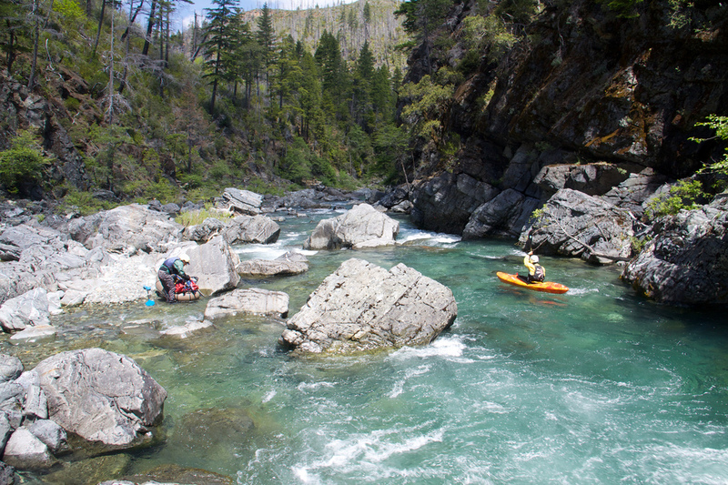
2) Whitewater boating runs in spring (or very ocassionally in fall) flows. With 1,500 cfs or more at the Brookings gage, the Chetco provides a typical whitewater boating experience. Much of the run can be boat-scouted with a couple exceptions. Portagi
...Boaters hiking in from Babyfoot Lake put in the Chetco at the confluence of Carter Creek, allowing them to float the Magic Canyon section just downstream.
Boaters coming in from Chetco Pass put in at the confluence of Slide Creek and the Chetco River. The river ar here offers a couple small spots for individual camp areas and camping in the middle of the trail just upstream of Slide Creek is also an option.
Though possible, few boaters choose to take out at Tollman Ranch due to the difficult and long drive to reach it (which has been made only more difficult after the Chetco Bar Fire). It is easier to continue to float the river to an easier access point downstream, such as the steel bridge or the SF Chetco confluence.
Apr 28, 2016
An alternate approach via Box Canyon Creek is an option for boaters wanting to increase the whitewater difficulty, while decreasing the access difficulty.
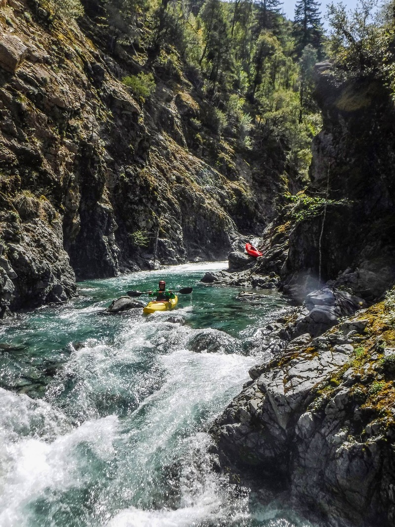
Photo was taken April 16, 2016 at about 2,500 cfs and dropping on the Chetco gauge.
Nov 22, 2011
This is one of the fun rapids around 5 miles below Slide Creek. There are several miles of Class IV and IV+ rapids in this section.
Nov 22, 2011
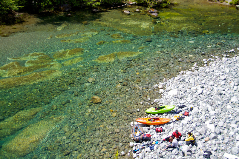
Looking at the river and kayaks from Taggarts Bar. Once you reach Taggarts Bar the gradient eases.