Big Creek (Pigeon R. trib.)
2. NPS Campground to Confluence with Big Pigeon(Lower Big Creek)
Jun 22, 2004
I don't care what they say the levels need to be. I was on it Thurs. 6-17. The gauge said the oconoluftee was running 700-725 that day. Caught a big thunderhead on the way in from Asheville, did a quick run on the Pigeon, and 2 hours later the Big was running BIG! They say it got up to 3 ft that day. A friend I talked into it lost her boat and paddle. Anyway, 2 days later (Sat, the 19th) I decided to scrape down to try and find the lost boat. The gauge said that the OC ran 400 cfs that day. I was surprised to find all the rapids between the campground footbridge and the Mt Sterling Rd bridge to be quite clean and still fun, but the closer I got to the powerhouse, the scrapier things got. Point is, I believe that this summer may have alot of late afternoon creek runs after thunderstorms that are so brief (and local) that they may not even show up on the gauges. If clouds are on thier way, head to big creek and hope for the best!
STRAINER ALERT - Not far below the Mt Sterling Rd bridge is a rapid where the river equally splits. The left chute fans out over most of the riverbed, getting shallow and rocky, while the right chute funnels to the right, getting deeper and ending in a small drop above a 5 ft slot between 2 large boulders. THERE IS A TREE STUCK BETWEEN THESE 2 BOULDERS!! It may not be a problem at higher water flows, but it was there the other day. And by the time you see it, you may not be able to catch an eddy outta there. Downstream, at the islands, the left chute strainer has cleared enough to run, as long as you stay left.
Mar 2, 2004
shortly after you go under the cataloochee road bridge (first car bridge you come to), you should be able to see the local store on river left. just past it, the creek is split by an island and rejoins a little further downstream into a stretch of flatwater. the creek is split by another island after the flatwater and both sides have a large creekwide strainer across them. the strainer on river right seems to be there for a long stay; one on river left is slowly giving away to the water.
took a look at it today at 738cfs - at this level you could duck and get under them but at levels you could actually run this comfortably, they're going to be a problem.
Oct 1, 2003
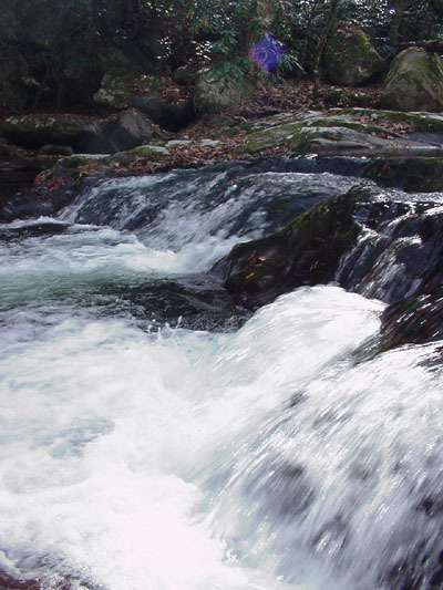
this is the first ledge you come to after the put-in at the National Park Service campground. at the time this picture was taken, the water level was very low but, at runnable levels, the hole at the bottom of this approximately 3ft drop could possibly get sticky. the slide on river-right is the best line to take if you're not interested in boofing it. the drop on river-left is nearly straight down and there are two large rocks sitting down under the water.
Apr 3, 2003
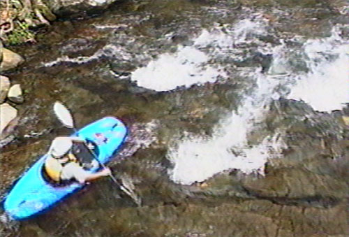
this is the second ledge you come to (right underneath the wooden bridge at the picnic area) after the put-in at the NPS campground. the hole in the center line has potential to be a playspot at this level, with a nice eddy on river right. if you choose to play here, be confident in your roll. there are some bumpy drops just downstream.
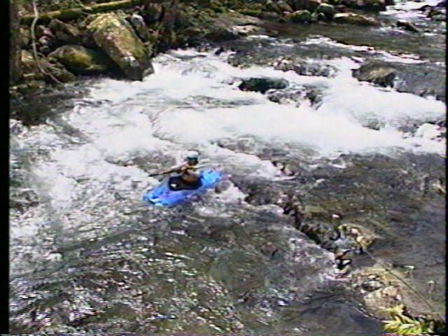
this is a videocapture of me running river left of second ledge. on far left at this level, the ledge is a little bit underwater.
Apr 3, 2003
videocap of me heading for the second ledge