Chattooga

Rock Gorge - Burrell's Ford to Lick Log Creek(AKA Section 1)

Reach banner

Projects

Chattooga Headwaters Access (NC)

Table of Contents American Whitewater Chattooga Project Summary Forest Service Process Paddlers’ Litigation Against the Forest Service Overflow Creek Upper Chattooga Timeline American Whitewater Chattooga Project Summary The Chattooga River, which starts in Western North Carolina and flows south to form the border between Georgia and South Carolina, was [...]Read More
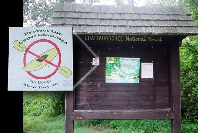

River Description

NEW RULES!

The new rules include:

  1. Allow paddling to occur between Green Creek and Lick Log Creek (about 15 of the 21 miles of the Upper Chattooga),
  2. Allow paddling to occur between December 1 and April 30, on days when flows have hit 350 cfs or higher.
  3. Permit must be obtained at locations shown below.  Burrell's Ford (GA side) is easiest for this reach.
  4. Leave paddling banned on the uppermost two miles, the lower four miles, and all tributaries all year.
  5. It would also ban paddling from May 1 through November 30 on the entire Upper Chattooga, and on all days when flows have not hit 350 cfs or above.
  6. Impose no direct limits on other similar visitors.

These severe restrictions are the only of their kind in the entire Unites States, and are intended to benefit anglers who pursue heavily stocked non-native trout. The artificial fishery created by the USFS-sanctioned stocking has significant impacts including hatchery pollution, backcountry helicopter disturbances, near elimination of native brook trout, user created angling trails, and the elimination of nature based paddling from the upper Chattooga River. Ironically, the USFS decision actually harms anglers across the Country by creating potential competition for wild rivers that are currently shared by all forms of backcountry recreationists, and by degrading the rights of anglers to fish from a boat.

During a press briefing, the acting Sumter Forest Supervisor, Monica Schwalbach, stated that the US Forest Service has determined that boating on the upper Chattooga -- even in unlimited numbers -- 'would have no impact on the resource.'

AW has been working for a decade to bring responsible, nationally consistent river management to the Chattooga, and this work continues today.

For more information about American Whitewater's efforts to remove this boating ban go to the Chattooga P

...

River Features

Burrell's Ford

Distance: 0 mi
Burrell's Ford

Big Bend Falls

Class: V+Distance: 2.73 mi
Waterfall / Large Drop
Big Bend Falls

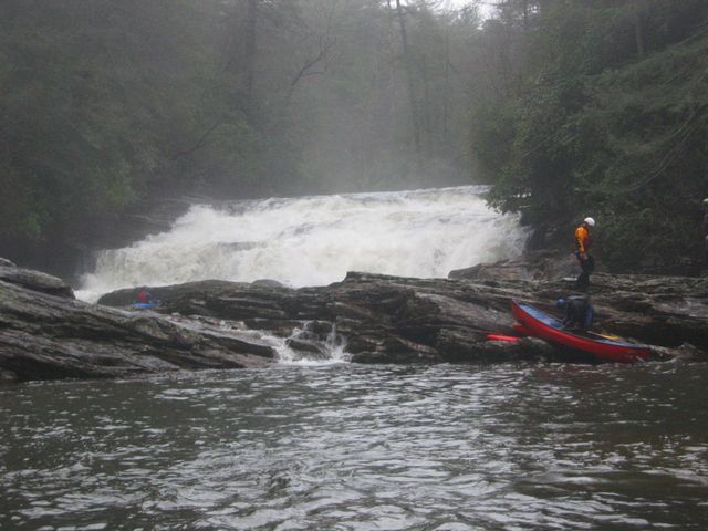
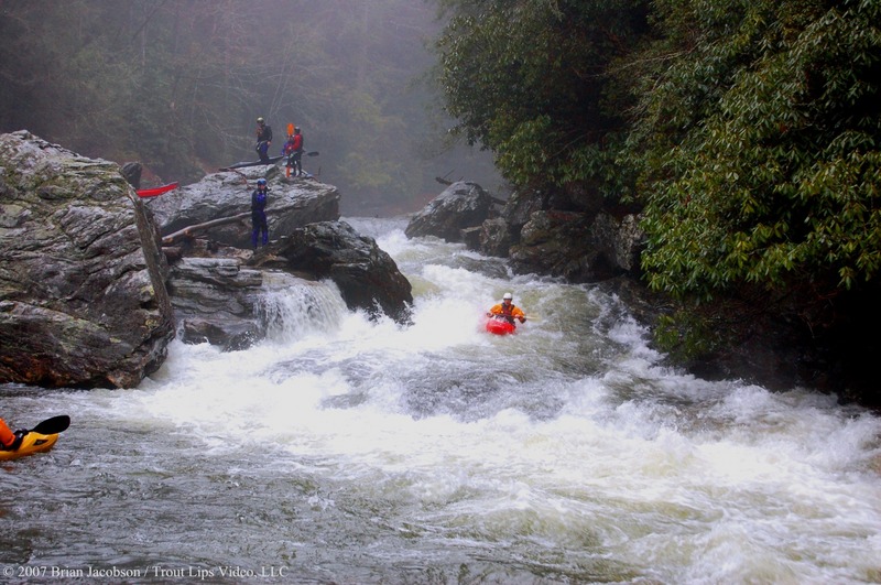
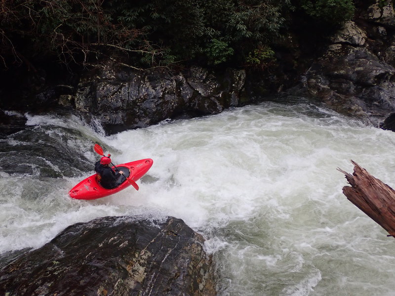
This waterfall is one of the largest drops on the river. Lines exist on the far right and left but the consequences of missing are large. In an emergency there is a trail head just upstream from the falls at the right bend in the river that goes up to the Big Bend road. Low Water

Rock-in the-Hole-in the-Wall

Class: IV+Distance: 4.45 mi
Hazard
Rock-in the-Hole-in the-Wall

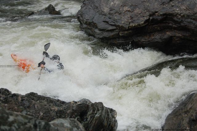
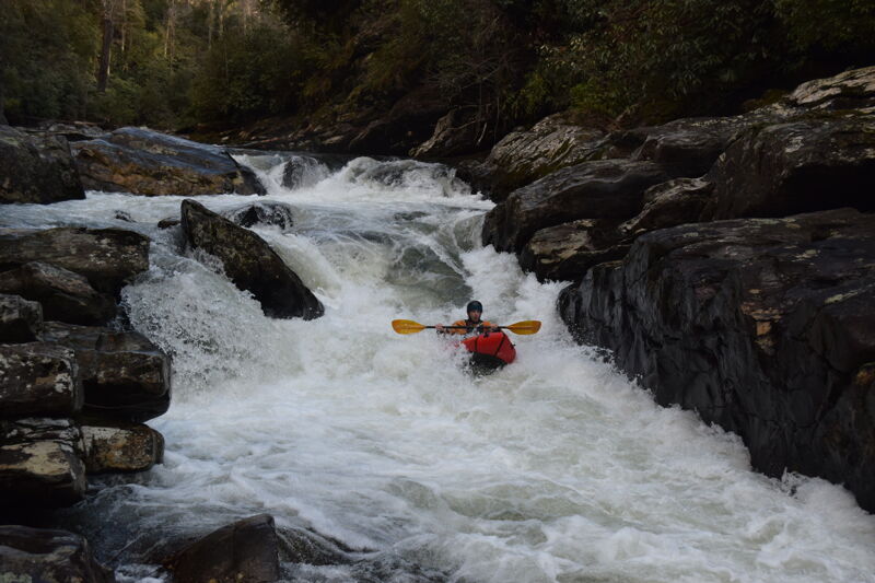
Significant drop signaled by a rocky slide upstream. A rock resides in the middle of the hole in the bottom of the drop. Run to either edge of the hole.

Maytag

Class: VDistance: 5.2 mi
Hazard
Maytag

Drop into a large hole that is backed up by a rock that intensifies hole quickly with higher water. Trees tend to hang up here. There is an alternate route down river right if needed. Low Water

Harvey Wallbanger

Class: IVDistance: 5.63 mi
Rapid
Harvey Wallbanger

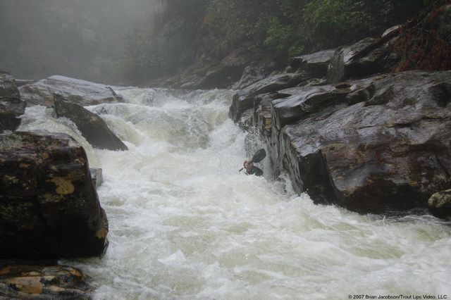
Converging water feeds into rock wall on left shore Low Water

Upper Big Hairy Bastard

Class: IVDistance: 5.81 mi
Rapid
Upper Big Hairy Bastard

Blind approach into slide.

Lower Big Hairy Bastard

Class: IVDistance: 5.9 mi
Rapid

Boulder garden rapid with hidden holes

Lick Log Creek Trail

Distance: 7.4 mi
Take Out
Lick Log Creek Trail

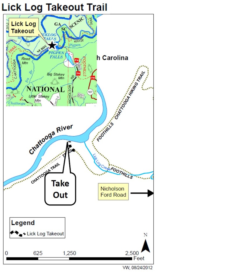
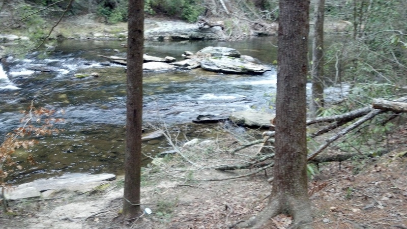
Designated Take Out, Emergency Access Point  From the river to the parking lot is about 3/4 mile all uphill

28 Bridge

Distance: 11.3 mi
Access Point
28 Bridge

This should be the take out except for an arbitrary decision by the Forest Service to protect a heavily stocked artificial trout park on the last two miles of this reach.  Boating is banned on this reach with no justification.


Great day running Section 1 in packrafts. This was my last section to complete after working on (mostly) opening the river to paddling. We had a lot of fun, had to portage a couple things. Nice level, with plenty of water.
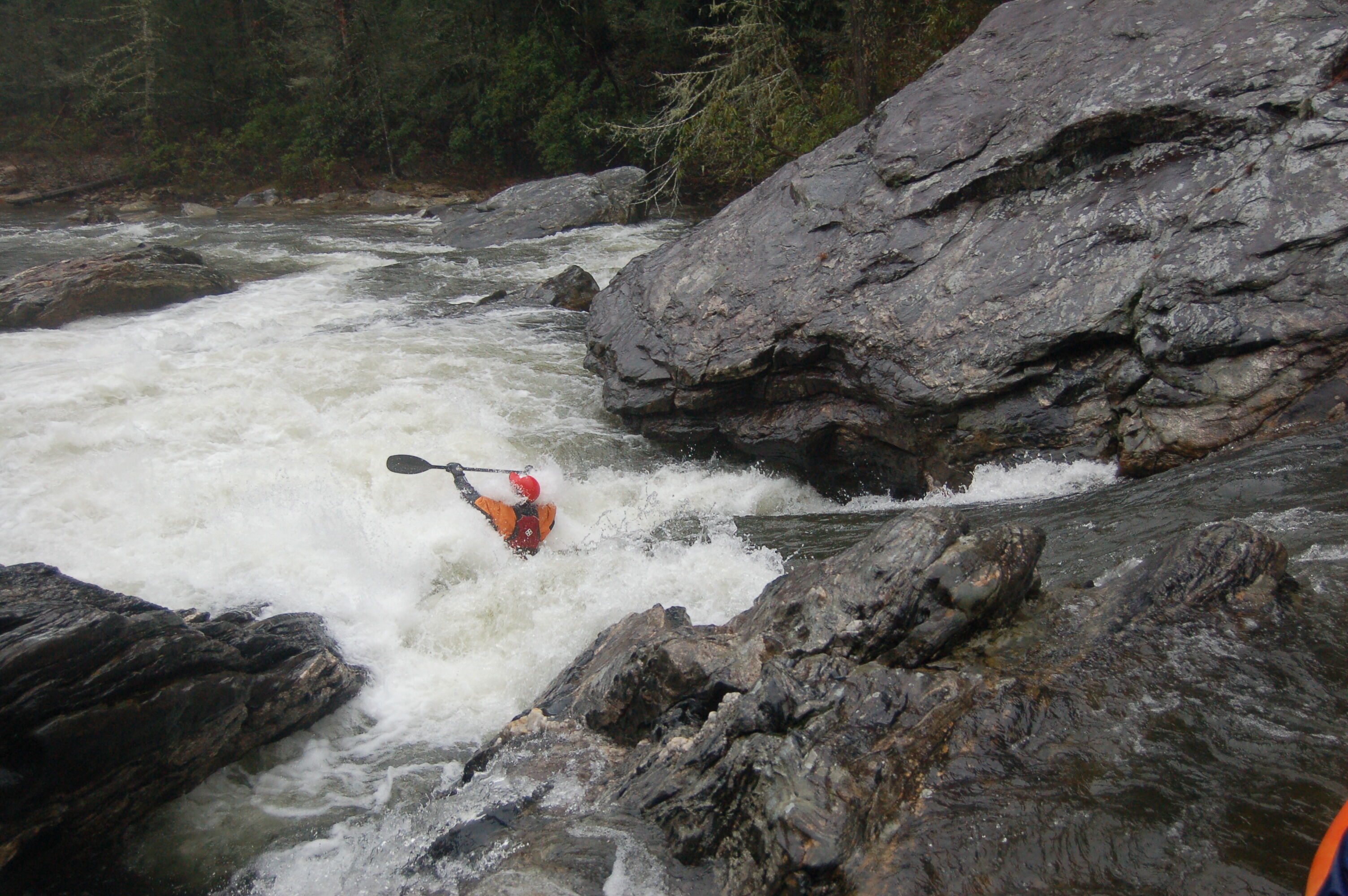
MJ
Matt Jackson

Dec 31, 2018


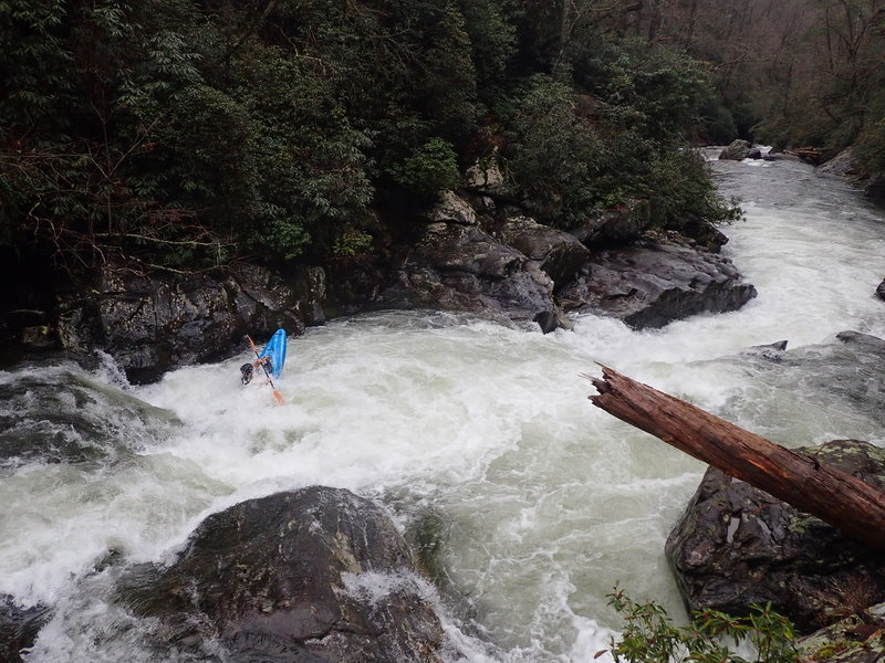
Looking down at Harvey Wallbanger and its approach at ~750cfs

MJ
Matt Jackson

Dec 31, 2018


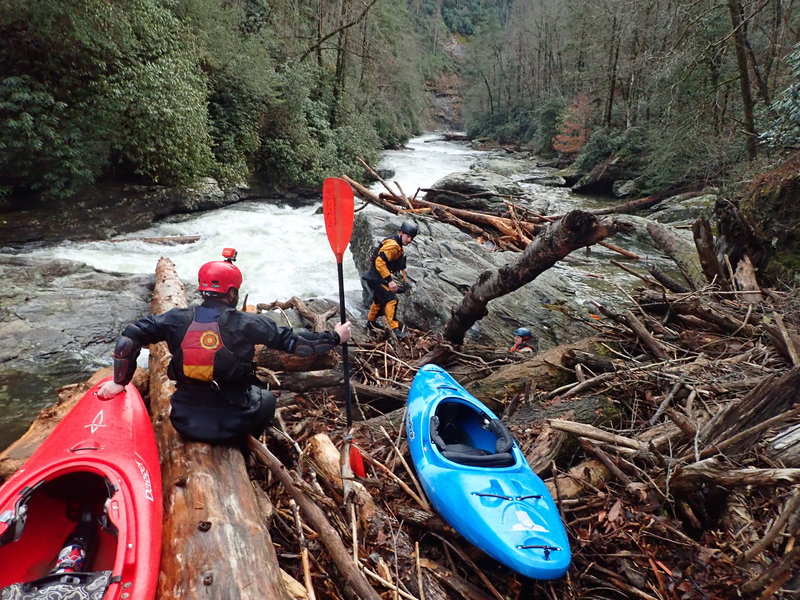
From a riverwide log blocking Upper Big Hairy Bastard

MJ
Matt Jackson

Dec 30, 2018


~750cfs

AH
Alex Harvey

Apr 1, 2017


Level was about 450 cfs. Small dead hemlock in right line of Big Bend Falls, a saw could make quick work of removing this tree. Right side sneak at Maytag is open, but scout it. Top drop of Upper Big Hairy Bastard full of wood, there was a sneak to the right. No fisherman encountered.

GT
Garrick Taylor

Apr 14, 2013


Section 1 starts out with a couple of miles of Class I/II and flatwater. Scenic but not exciting. Then a few good rapids before Big Bend Falls.

Big Bend Falls is a big class V looking drop. The middle lands on rocks. River left side has a rock shelf that extends out from the left. There looks like an impossibly thin line over on the left that would land you in a nasty hole due to that rock shelf kicking water back in. River right has what appears to be a fairly reasonable (for a class V) line. The problem there is it lands in a real boily eddy which has wood in the eddy and blocking most of its outflow. Decent portage trail on the right that ended by dropping 10-15' down to the river - ropes were helpful here.

Then a mile or more of Class II before it picks up into some Class III water leading up to what I think is called Rock in the Hole in the Wall. That is a nice rapid with some quality III+ lead in ledges before the river necks down into a 10' wide slot. The problem there was the slot had a log in the exact middle of the slot, where all the water goes. Easy portage on a rock outcropping.

More Class III follows, leading up to Maytag. Maytag had all sorts of wood everywhere. The main line had an overhead log with enough head clearance. Small log in the right of the main line that was mostly out of play. The drop itself looked to drop into fairly shallow water that then dumped into a very boily eddy. This eddy had one tree that was easily avoidable and another tree that went across the entire length of the eddy, most of it underwater but it was hard to tell how much. The 'sneak' described on AW was also clogged full of wood. The portage for this one was a real pain in the a$$. River left was a rock cliff. River right was a scramble up a very steep hillside to the Chattooga Trail. Ropes were again handy to pull the boats up to the trail.

After Maytag, the river continued on with some Class III rapids until we dropped into the Rock Gorge. There was some good quality Class III and IV stuff in there. Also very, very beautiful with high rock walls. In many spots, moss grew on the rocks, with water dripping through the moss. The gorge slowly opened back up after just under a mile, and the river slowed back into Class I/II before coming to the takeout just past Licklog falls.

Next was the 0.7 mile takeout up a steep trail similar to the Upper Green hike out. At least there were some pretty waterfalls on the small stream along the trail. Worth doing once to see the rock gorge and say you have done it but I am guessing I got my PLD on the same days as my PFD. If someone I trusted told me that all the rapids were clear and I could run Big Bend Falls, Rock in the Hole in the Wall, and Maytag and it was a nice day and the river was at a good level, I'd probably do it again. Barring that unlikely event, it's probably a PLD (personal last descent)

Harvey Wallbanger and Upper Hairy Bastard were both a lot of fun!

Brad Roberts
Brad Roberts

Jan 15, 2013


Section 0 has a significant class 5 on it. The rest is class 3 at ordinary flow.

Section 1 has a bunch of 4/5 stuff. Both must have run at yesterday's levels. They run with a little less water than Overflow.

Brian Jacobson
Brian Jacobson

Mar 16, 2012


Located about 200 yards below Lick Log Creek Falls. Round one bend and look on River left.

Brian Jacobson
Brian Jacobson

Nov 14, 2009


Sign at Burrells Ford bridge warning boaters the river is reserved for fishermen

RM
Robert Maxwell

Aug 12, 2006


I saw this sticker on the Hwy 28 bridge information sign on 8/12/06. If you don't think they are serious about keeping the illegal and unjust boating ban in the Chattooga Headwaters, think again.