Chattooga
Rock Gorge - Burrell's Ford to Lick Log Creek(AKA Section 1)
Jan 3, 2021
Great day running Section 1 in packrafts. This was my last section to complete after working on (mostly) opening the river to paddling. We had a lot of fun, had to portage a couple things. Nice level, with plenty of water.
Dec 31, 2018
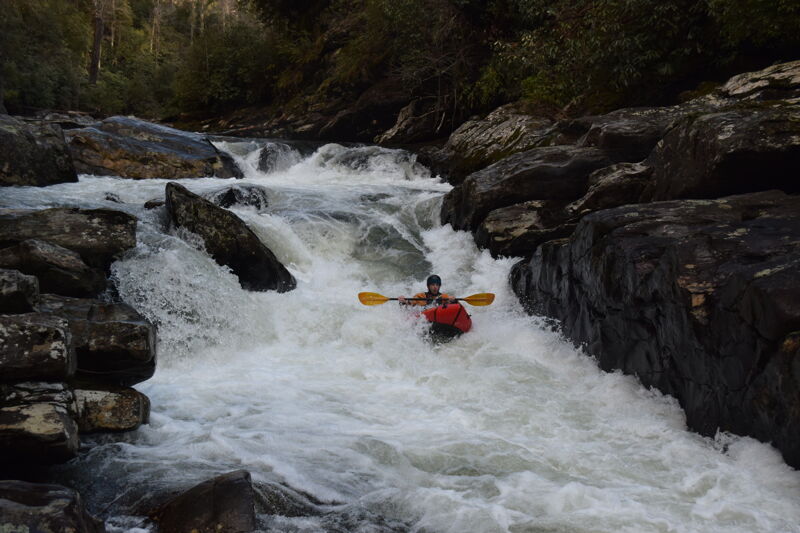
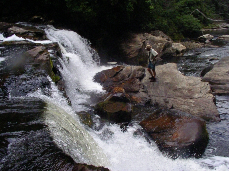
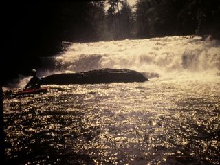
Looking down at Harvey Wallbanger and its approach at ~750cfs
Dec 31, 2018
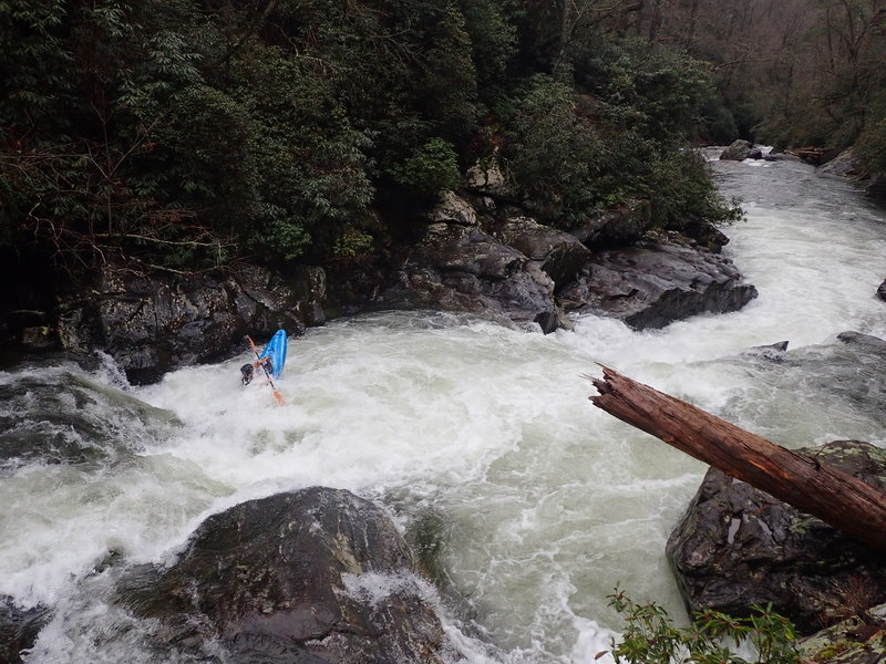
From a riverwide log blocking Upper Big Hairy Bastard
Dec 30, 2018
~750cfs
Apr 1, 2017
Level was about 450 cfs. Small dead hemlock in right line of Big Bend Falls, a saw could make quick work of removing this tree. Right side sneak at Maytag is open, but scout it. Top drop of Upper Big Hairy Bastard full of wood, there was a sneak to the right. No fisherman encountered.
Apr 14, 2013
Section 1 starts out with a couple of miles of Class I/II and flatwater. Scenic but not exciting. Then a few good rapids before Big Bend Falls.
Big Bend Falls is a big class V looking drop. The middle lands on rocks. River left side has a rock shelf that extends out from the left. There looks like an impossibly thin line over on the left that would land you in a nasty hole due to that rock shelf kicking water back in. River right has what appears to be a fairly reasonable (for a class V) line. The problem there is it lands in a real boily eddy which has wood in the eddy and blocking most of its outflow. Decent portage trail on the right that ended by dropping 10-15' down to the river - ropes were helpful here.
Then a mile or more of Class II before it picks up into some Class III water leading up to what I think is called Rock in the Hole in the Wall. That is a nice rapid with some quality III+ lead in ledges before the river necks down into a 10' wide slot. The problem there was the slot had a log in the exact middle of the slot, where all the water goes. Easy portage on a rock outcropping.
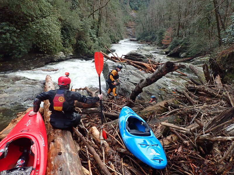
More Class III follows, leading up to Maytag. Maytag had all sorts of wood everywhere. The main line had an overhead log with enough head clearance. Small log in the right of the main line that was mostly out of play. The drop itself looked to drop into fairly shallow water that then dumped into a very boily eddy. This eddy had one tree that was easily avoidable and another tree that went across the entire length of the eddy, most of it underwater but it was hard to tell how much. The 'sneak' described on AW was also clogged full of wood. The portage for this one was a real pain in the a$$. River left was a rock cliff. River right was a scramble up a very steep hillside to the Chattooga Trail. Ropes were again handy to pull the boats up to the trail.
After Maytag, the river continued on with some Class III rapids until we dropped into the Rock Gorge. There was some good quality Class III and IV stuff in there. Also very, very beautiful with high rock walls. In many spots, moss grew on the rocks, with water dripping through the moss. The gorge slowly opened back up after just under a mile, and the river slowed back into Class I/II before coming to the takeout just past Licklog falls.
Next was the 0.7 mile takeout up a steep trail similar to the Upper Green hike out. At least there were some pretty waterfalls on the small stream along the trail. Worth doing once to see the rock gorge and say you have done it but I am guessing I got my PLD on the same days as my PFD. If someone I trusted told me that all the rapids were clear and I could run Big Bend Falls, Rock in the Hole in the Wall, and Maytag and it was a nice day and the river was at a good level, I'd probably do it again. Barring that unlikely event, it's probably a PLD (personal last descent)
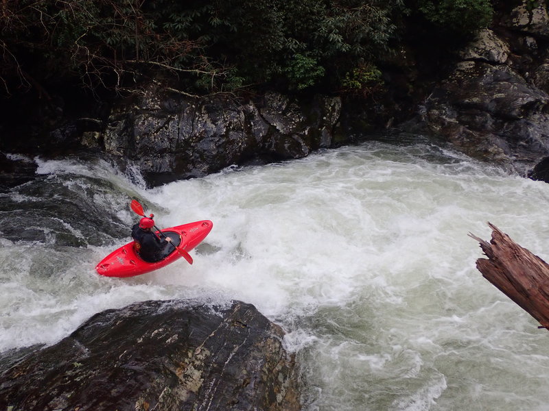
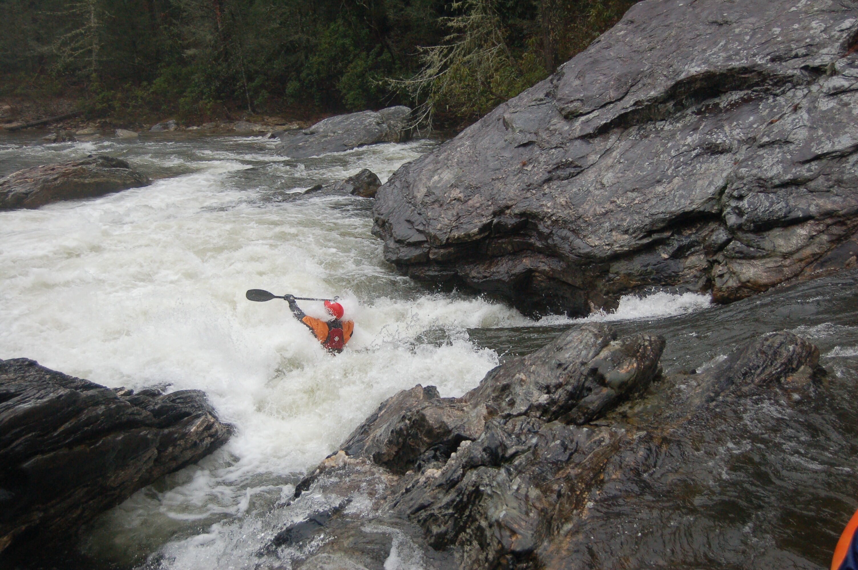
Harvey Wallbanger and Upper Hairy Bastard were both a lot of fun!
Jan 15, 2013
Section 0 has a significant class 5 on it. The rest is class 3 at ordinary flow.
Section 1 has a bunch of 4/5 stuff. Both must have run at yesterday's levels. They run with a little less water than Overflow.
Mar 16, 2012
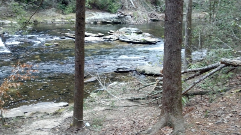
Located about 200 yards below Lick Log Creek Falls. Round one bend and look on River left.
Nov 14, 2009
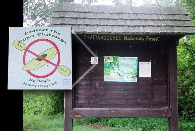
Sign at Burrells Ford bridge warning boaters the river is reserved for fishermen
Aug 12, 2006
I saw this sticker on the Hwy 28 bridge information sign on 8/12/06. If you don't think they are serious about keeping the illegal and unjust boating ban in the Chattooga Headwaters, think again.
Jul 18, 2005
We stopped by the Burrell's Ford bridge to check the level on July 8 when Overflow was 2.6 and Hwy 76 about 6 ft, just to have a look. A ranger, Dave Heddon, drove up warn us that boating above Hwy 28 was illegal. He said he drove around on high water days looking to bust boaters trying to poach a run. Fine for 1st offense would be $150, more after that. He wrote down our tag #'s as souvenirs. Word to the wise.
Jan 1, 1900
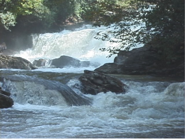
This is the biggest drop between Burrell's Ford and the Highway 28 Bridge. Although currently illegal to run this section, this drop is runnable at certain flows on the right side.
Jan 1, 1900
River narrows down.
Jan 1, 1900
Big Bend Falls Portage
Jan 1, 1900
Looking upstream at Rock in the Hole In the Wall. Need to ride a shoulder on the right around the hole to avoid the rock.
Park on beach and follow established fishing trail to rapid
Bottom of drop
Top of drop
Develops big hole at higher water due to backing rock
Higher water requires running the RR side to avoid the substantial hole
Jan 1, 1900
Entering Harvey Wallbanger 750cfs
Jan 1, 1900
I saw this sticker on the Hwy 28 bridge information sign on 8/12/06. If you don't think they are serious about keeping the illegal and unjust boating ban in the Chattooga Headwaters, think again. Support AW now!