Cedar Creek (Floyds Fork trib.)
Cedar Creek Rd near Johnson School Rd to Bells Mill Rd (12.2 miles)
| Difficulty | II |
| Length | 12.4 mi |
| Avg Gradient | 15 fpm |
| Gauge | Cedar Creek at Thixton Road Near Louisville, Ky |
| Flow Rate as of 26 minutes | 0.50 ftbelow recommended |
| Reach Info Last Updated | April 15, 2018 |
NOTE: Cedar Creek Road goes over Cedar Creek twice. To clear up any confusion I will either call the road Cedar Creek Road (near Zoneton Road)-the put in for the main WW stretch, or Cedar Creek Road (near Johnson School Road)-the put in for upper Cedar Creek.
ALSO NOTE: I noticed the gauge doesn't seam to update perfectly on AW, and so always check the level here: http://waterdata.usgs.gov/ky/nwis/uv/?site_no=03298250&PARAmeter_cd=00065,00060,00062 before heading out to the creek.
Main WW stretch:
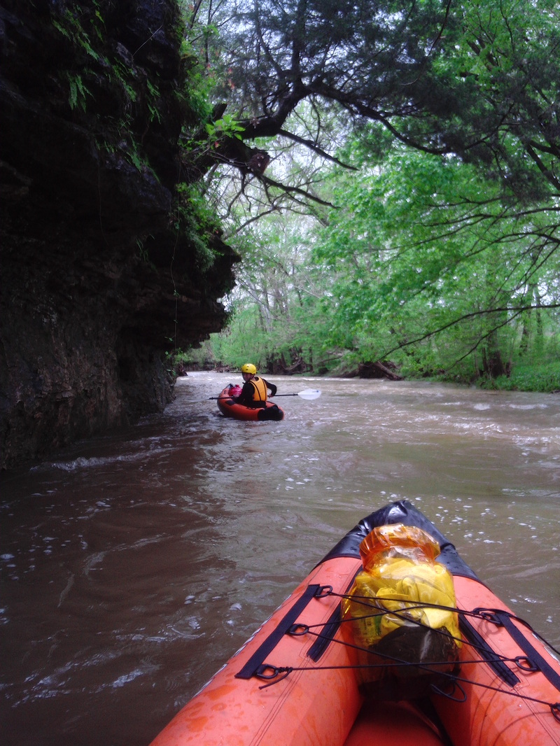
The heart of this creek lies between Cedar Creek Road (near Zoneton Road) and Zoneton Road and I will refer to this section as the 'main WW stretch'. In this 2 mile stretch there are 3 class II rapids, a few surf waves, and a few 1+ rapids. The parking at Cedar Creek Road (near Zoneton Road) and Zoneton Road is great, just pull off to the side of the road and park. I have run this stretch 7 times. It can be run as low as .78 feet/30 CFS, but it will be so low you'll have to get out in a few palces. I have found 1.3 feet to be a good minimum, 1.5 is great, and 1.7 is even better. Just recently (Feb 2018) I ran it at 2 feet and it was amazing. There were two surf waves before the entrance rapid, and all the 1+ rapids turned in to II's. Eddys were still available for all the scouting.
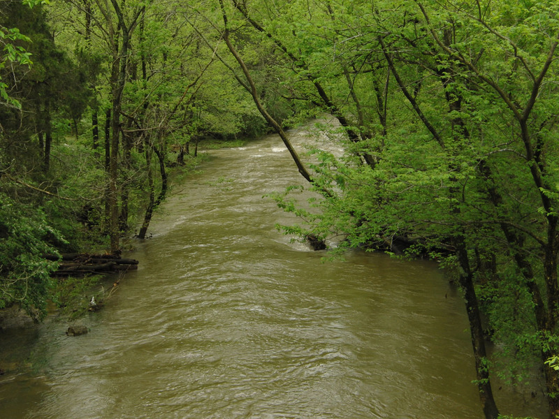
Scenic Section:
A great way to add some miles to the main WW stretch is to put in a Thixton Road. From Thixton Road to Cedar Creek Road (near Zoneton Road) there is some great scenery, and so I refer this section to as 'the scenic section'. There are rock walls for most of that stretch and there are very large boulders in the middle of the creek that you have to maneuver around. There are also lots of small waterfalls on this run, none of which are over 15 feet tall, but they still add to the scenery. At one spot right befo
...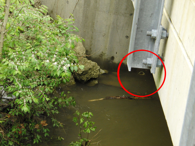
You can use this white pipe under the bridge as a gauge for upper Cedar Creek. It's at Cedar Creek Road (near Johnson School Road) on the upstream side of the bridge, river left. This photo was taken when the gauge said 2.1 feet and going down. If it was at 2.1 feet and going up then it would most likely have been higher here since the USGS gauge is about 4 miles downstream.
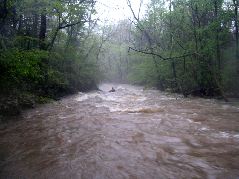
I call this the falls of Cedar Creek, but really it isn't much. At low water there is lots of rocks to maneuver around to get through here. It always looks cool from the bridge. This photo was taken at 2.1 feet. I would consider this a borderline class II.
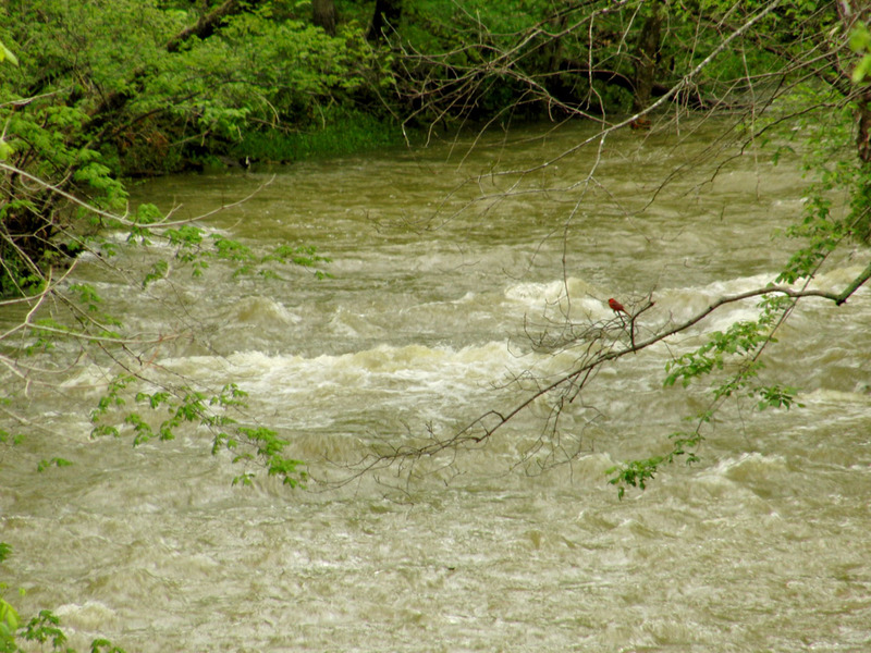
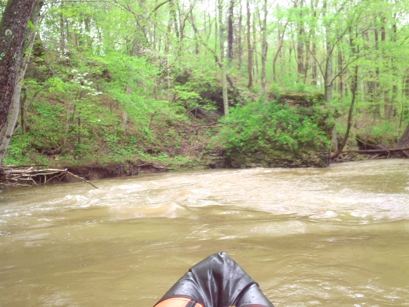
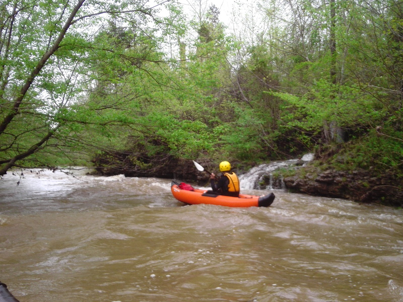
A 500 foot stretch of 3 or more rapids. The first is a wave at 2.1 feet or a small ledge at low levels. The second is a small but decent diagonal ledge. The third is a surf wave (shown in the picture) that might only appear at higher levels. Be careful because the log strainer is right after the third rapid. At high levels you might have to portage the second and third rapid to be safe from the strainer.
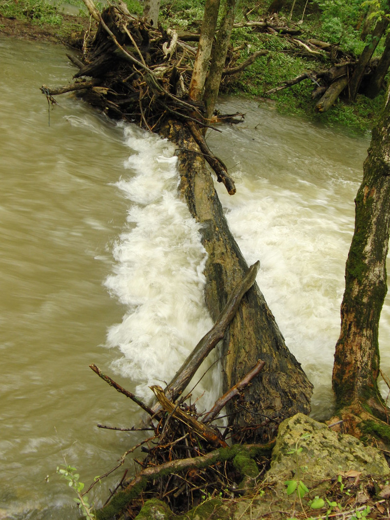
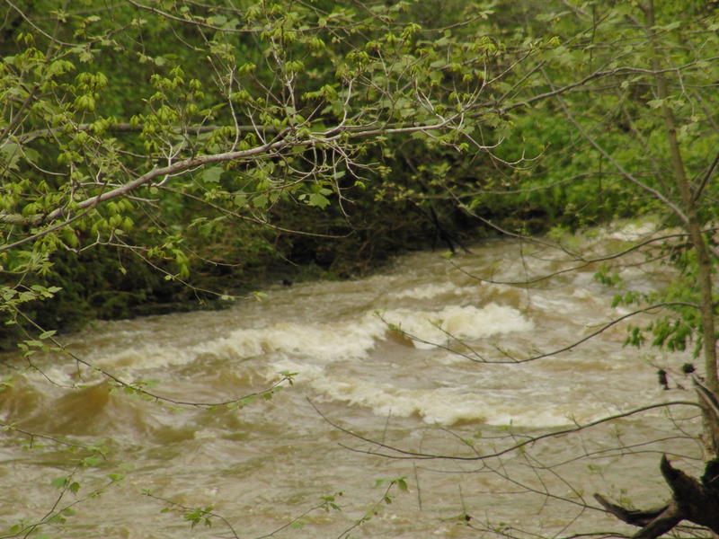
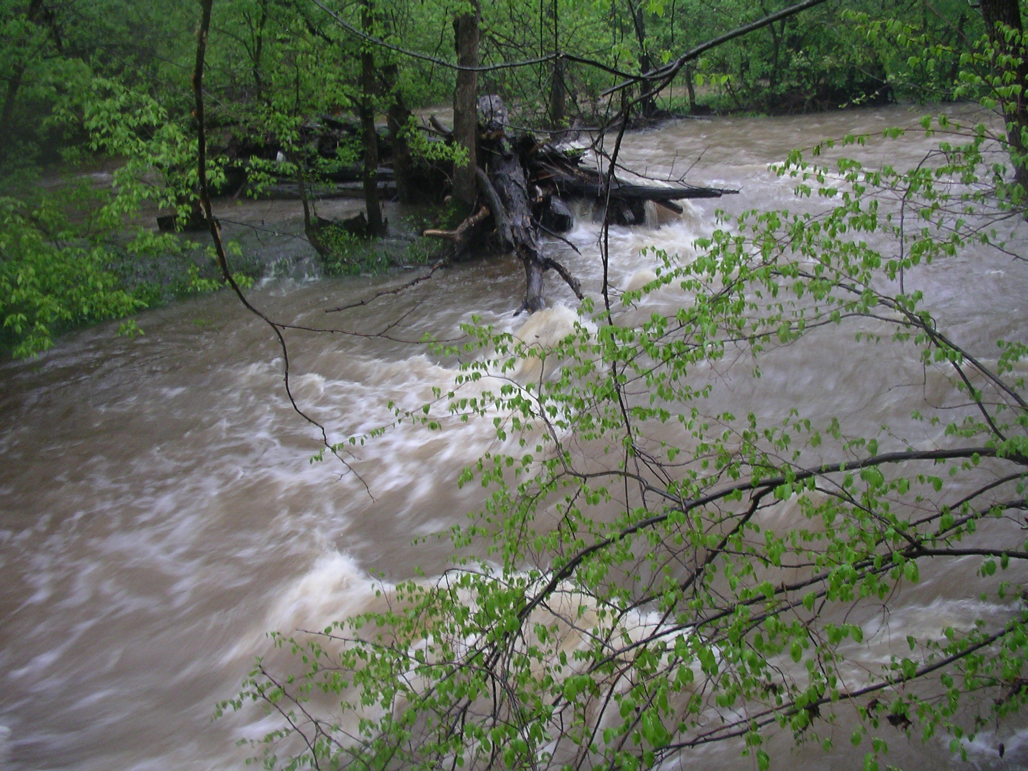
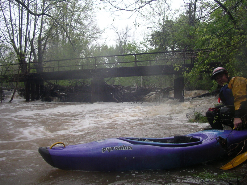
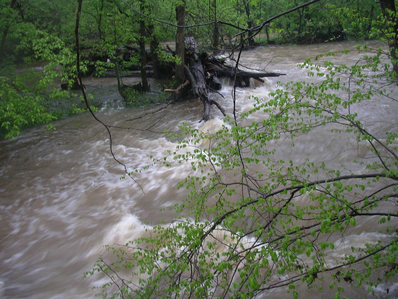
This is why running upper Cedar Creek at high water is bad for your health. Then again none of the drops are so steep and the banks are not so confined, that you wouldn't be able to pull over and scout stuff like this. This photo was taken when the gauge said 2.1 feet and going down. If it was at 2.1 feet and going up then it would most likely have been higher here since the gauge is about 3 miles downstream.

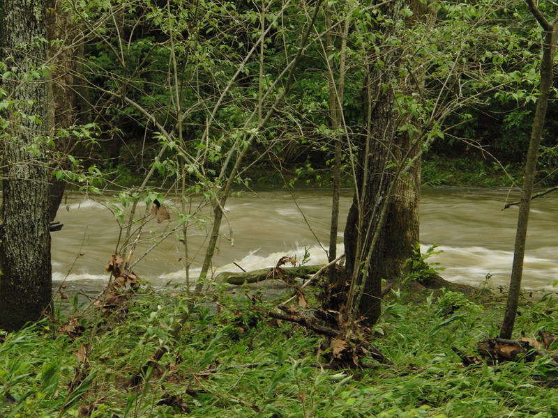
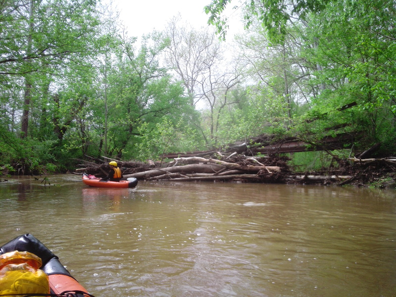
I went on a hike starting at Independence School Rd hiking downstream and saw at least 3 giant creekwide strainers. They were hard to hike through and so I definitely wouldn't want to boat through them. I remember back in the day having to portage constantly cause of strainers in this region. Only run this section at a scrapy level or I wouldn't at all.
Right after you do a long low gradient drop and miss the first giant boulder that is on river left, there is a second similar drop with a giant boulder at the base of it also on river left.
This rapid is always in and can be seen from the bridge on Cedar Creek Road (near Zoneton Road). This rapid is a lot like Elkhorn's S-turn rapid. After you go through a decent wave, there is an island where the main creek turns hard right. If you accidentally get washed in to the left side of the island it might be too shallow to get through but I made it through at 1.7 feet by going far left and hugging the rock wall. This photo was taken at 1.7 feet.
Right after Entrance Rapid you cruise past a couple houses and then the creek drops and makes a hard left turn. This is probably the easiest class I+ on the main WW section. It used to be the best rapid on the creek but after a house got built there, the WW wave at the bottom of it has seamed to disapear. One day some kids were catching Turtles in front of it and warned us that a crazy rapid was ahead, and we told them that we were well aware of it because we had just run the creek a couple of hours ago.
A small drop that makes a hard left turn at the end. There is a limestone feature that will grab a paddler if he doesn't paddle left hard enough. The rock feature doesn't appear to be undercut or pose any real threat. I would consider this a 1+
A metal bridge known for massive log jams but it's never cause a mandatory portage for me. As of 8-25-2017 it was log jam free.
This steel bridge has had massive log jams requiring mandatory portages. Portage river left or right. Left has a better place to put in thanks to the sidewalk like limestone bank. As of 8-25-2017 it was clear.
This is the best drop on the creek. At the beginning of the drop there is two back to back waves in river middle and then it finishes with a rooster tail at the bottom of the drop.
There seams to always be wood at the top of the drop on river right that requires some good paddling to miss, and then it washes in to a rock shelter. If you go too far left you might hit a shallow area. At 1.7 feet there is a surf wave on river left after the strainer. I have seen it at a low level and what forms the rapid is two ledges side by side so expect to get hit with some WW :)
There is a small surf wave after the cove rapid on river right. I am possitive it's in when the creek is at 1.5 to 1.7 feet. It has good eddy service if you get flushed out of it.
Apr 27, 2011
It isn't a mandatory portage, but it could be one day. Just go left to get around it.
Apr 27, 2011
This is why running upper Cedar Creek at high water is bad for your health. Then again none of the drops are so steep and the banks are not so confined, that you wouldn't be able to pull over and scout stuff like this. This photo was taken when the gauge said 2.1 feet and going down. If it was at 2.1 feet and going up then it would most likely have been higher here since the USGS gauge is about 3 miles downstream.
Apr 27, 2011
You can use this white pipe under the bridge as a gauge for upper Cedar Creek. It's at Cedar Creek Road (near Johnson School Road) on the upstream side of the bridge, river left. This photo was taken when the gauge said 2.1 feet and going down. If it was at 2.1 feet and going up then it would most likely have been higher here since the USGS gauge is about 4 miles downstream.