Stonelick Creek
2. Anstaett Rd to US 50 Bridge(Lower Stonelick)
| Difficulty | II |
| Length | 4.9 mi |
| Avg Gradient | 20 fpm |
| Gauge | East Fork Little Miami River at Perintown Oh |
| Flow Rate as of 56 minutes | 92 cfsbelow recommended |
| Reach Info Last Updated | March 24, 2012 |
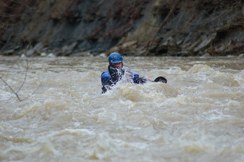
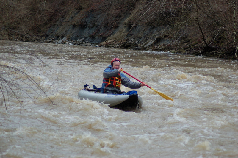
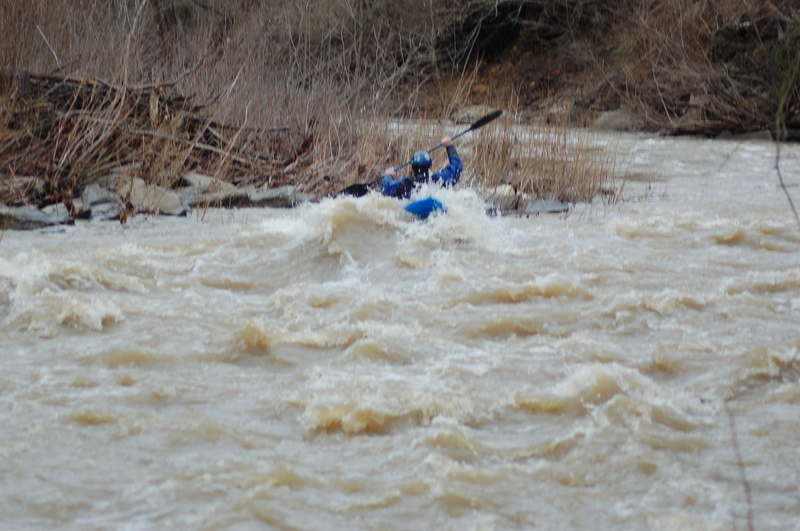
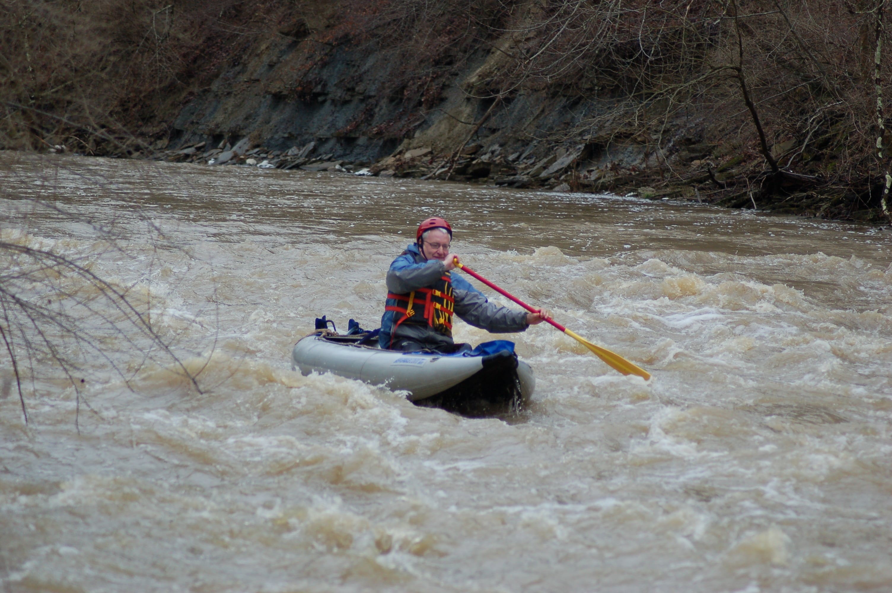
Lower Stonelick Creek is a great Class II run with all the features for beginner and intermediate paddlers to hone their skills. At lower water, it's probably less hazardous than O'Bannon but definitely more challenging than the East Fork of the Little Miami, Little Miami, Caesar's Creek, or Todd's Fork. At higher water (5+ feet on the OH 131 gauge), it has a Class III section.
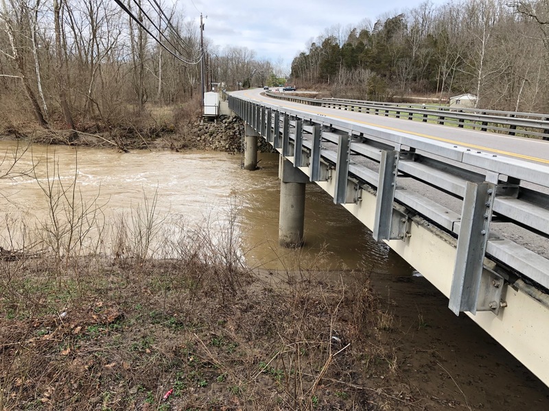
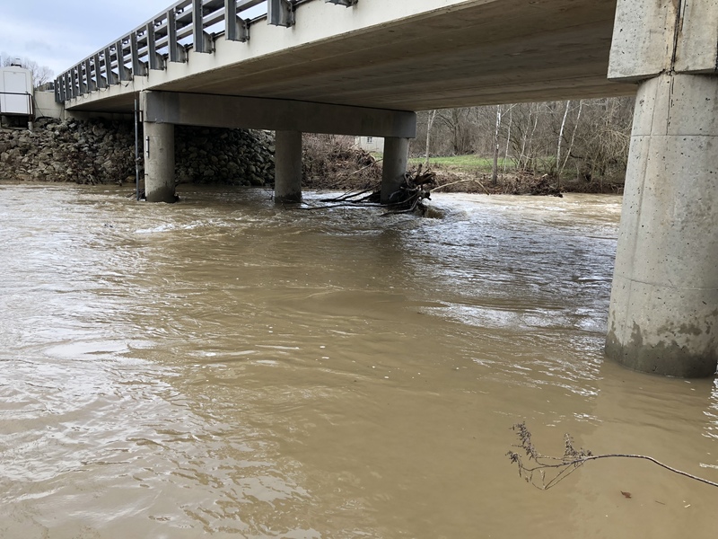
There are two put-ins for Lower Stonelick. The first is the listed put-in, probably room for 3-4 cars. If that is parked up, the other is just past the OH 132 bridge crossing Stonelick Creek (2 minutes back the way you came from the take-out). You'll see a gravel pull-off just behind some mailboxes. Don't block the mailboxes if you park there. Carry down on the downstream side of the bridge through the honeysuckle. While the take-out is on US 50, parking for the take-out is just down the road at the US 50 and OH 222 junction. Tons of parking at the take-out.
The best rapid of the Lower Stonelick is 'S-Turn' which runs directly into 'Speed Bump'. At higher water, it becomes one rapid. At the bottom of Speed Bump, a nice surf wave forms. It's also deep enough behind the wave that you can roll in the event of a flip. Be mindful of getting out of your boat here - the property owner on river right has been known to be unfriendly to paddlers! There's a great covered bridge that you paddle under right after you go through 'Dental Plan'. It's a great little rapid that can be easily avoided to the left. If you decide to go through, just maneuver through the little boulder garden. Another spot with some play is a hole/wave that forms by 'Sycamore Point' (the river bends to the right, with a Sycamore tree hanging out on river left partly in the water). Also fairly deep for rolling, however, be mindful of the sycamore tree downstream. Also a good place to practice squirts.
Take out at the US 50 bridge on river left downstream of the bridge. You can take out on the
...
OH-132 bridge is another access point. Walk down as close to the bridge as you can.
A small wave forms on river left just downstream of a house on river right.
Follow the wave train all the way down the left side of this rapids. At higher flows, some pretty nice waves form!
This rapids is immediately after S-Turn. Watch out for a large rock at the end of this rapid. (More of a concern at lower water.) The line is to start center and head to the right. There's a play wave at the end of the drop (on the right) with good eddy service on the right and in the center.
A tight line to run between rocks on river right, but it can be avoided by running to the left at lower water.
At higher water, a wave forms above this little section.
Take notice of sweet covered bridge!
You can take out at the church on river right. I wouldn't park there at 8 am on Sunday though (they have mass then).
A little hole/wave forms near the bottom of this drop with good eddy service on river right. Watch out for the sycamore tree just downstream!
At higher water, features wash out and the area is not as fun.
Jul 22, 2018
Just R2’d lower Stonelick. Absolutely not at 2000 CFS as the gauge is currently showing. Lots of rain past couple of days means the East Fork dam folks are letting water out (where the gauge is), but Stonelick drains out in less than 24 hours after big rains, so it’s not suddenly going to magically get good again. The gauge at East Fork lake has literally nothing to do with Stonelick. Flow today was probably on the order of 800 CFS or less. There was wood down in numerous spots, but at this level, it’s easy to see and prepare for. Had to carry twice. Otherwise, it was a fun lower-water run. If you see exposed rock bar at the Rt 50 bridge, it’s probably too low or will be soon.
Feb 26, 2018
Checked it again today at noon, approximately 24 hours after observing yesterday’s flow. At the US 50 bridge, Stonelick was down about 3’ below its level from yesterday. For additional correlation, O’Bannon was running at 135 CFS at about the same time today, down from around 1000 CFS 24 hours previously. At midday today, Stonelick would have been barely runnable. Now, a few hours later, it’s definitely too low. The flow info section above, when correlated with O’Bannon, will give you a reasonable guess at flow conditions.