Stonelick Creek
2. Anstaett Rd to US 50 Bridge(Lower Stonelick)
Jul 22, 2018
Just R2’d lower Stonelick. Absolutely not at 2000 CFS as the gauge is currently showing. Lots of rain past couple of days means the East Fork dam folks are letting water out (where the gauge is), but Stonelick drains out in less than 24 hours after big rains, so it’s not suddenly going to magically get good again. The gauge at East Fork lake has literally nothing to do with Stonelick. Flow today was probably on the order of 800 CFS or less. There was wood down in numerous spots, but at this level, it’s easy to see and prepare for. Had to carry twice. Otherwise, it was a fun lower-water run. If you see exposed rock bar at the Rt 50 bridge, it’s probably too low or will be soon.
Feb 26, 2018
Checked it again today at noon, approximately 24 hours after observing yesterday’s flow. At the US 50 bridge, Stonelick was down about 3’ below its level from yesterday. For additional correlation, O’Bannon was running at 135 CFS at about the same time today, down from around 1000 CFS 24 hours previously. At midday today, Stonelick would have been barely runnable. Now, a few hours later, it’s definitely too low. The flow info section above, when correlated with O’Bannon, will give you a reasonable guess at flow conditions.
Feb 25, 2018
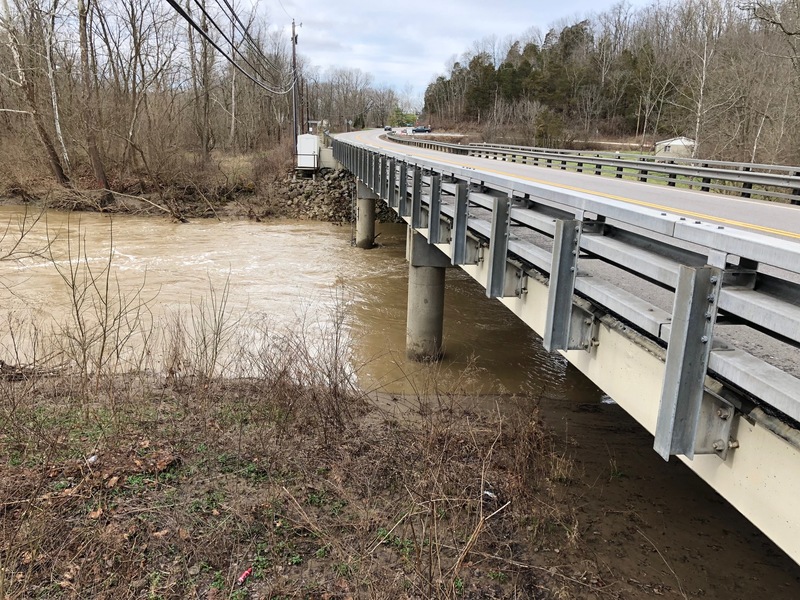
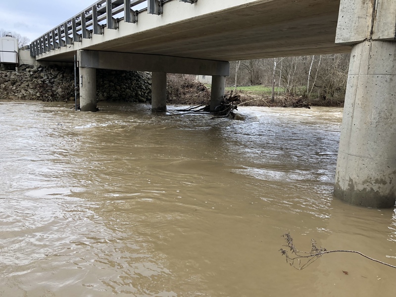
Photo of current flow on Stonelick at US 50. 11 AM 02/25/2018.
Feb 25, 2018
Photo of current flow on Stonelick at Rt. 50. 11 AM 02/25/2018.
Feb 25, 2018
Stonelick doesn't have a reliable gauge. I've been watching this creek for a year and I'm starting to get a feel for what the local rains do to it, which I think is not correlated with the published gauge on the East Fork at Perintown. Currently (11:45 AM) Perintown is showing 3440 CFS. I was just out to look at Stonelick on Rt. 50 and after last night's heavy rain the lower Stonelick is running pretty big. Is it 3440? No, probably not, but that's not surprising considering that the East Fork and Stonelick behave differently after storms. Stonelick right now looks more like 1500-2000 to me, but that's just a guess. Lacking a reliable gauge of any kind on Stonelick, I think O'Bannon may actually correlate a bit better with Stonelick than East Fork at Perintown. O'Bannon peaked early this morning at 00:45 AM at 10,300 CFS. Currently (11:45 AM) it's at 1080 CFS. Stonelick feels slightly bigger than O'Bannon and the storm response is similar. Anyway, I think it's time for a stage measurement to be installed or painted on one of the Rt. 50 bridge piling. Let's see if we can make that happen so we can start getting some more reliable data again. I'l post a picture of current flow under Rt. 50 in the photo section.
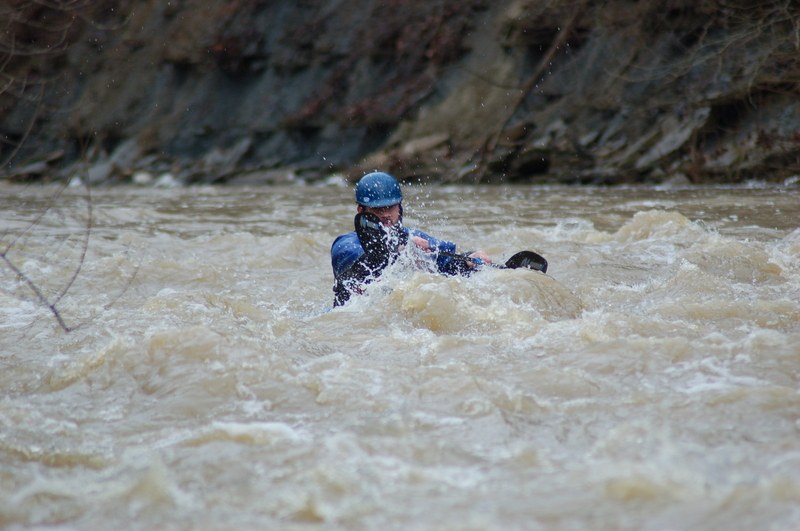
May 11, 2011
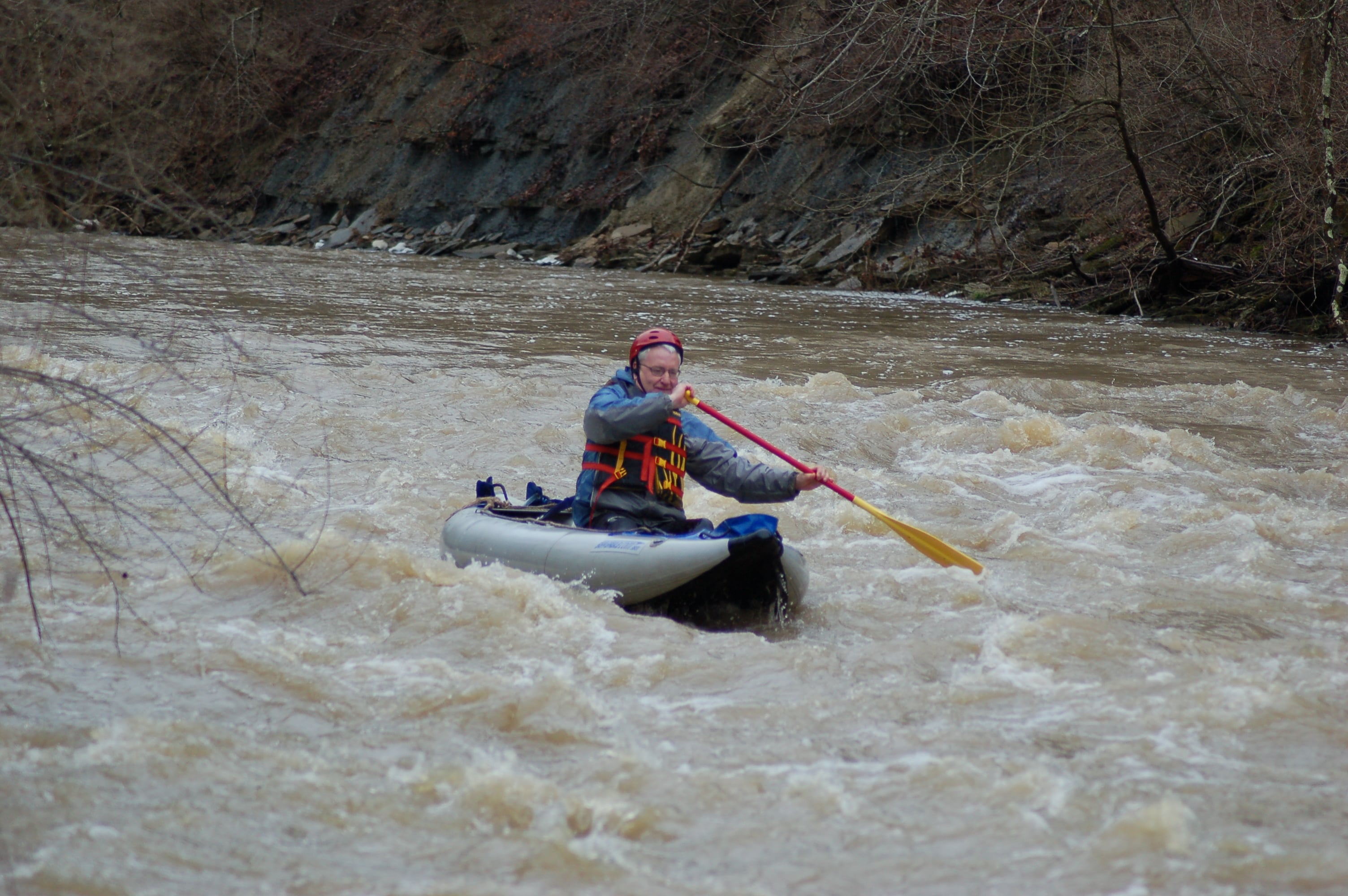
One of the many Class II rapids on Lower Stonelick.
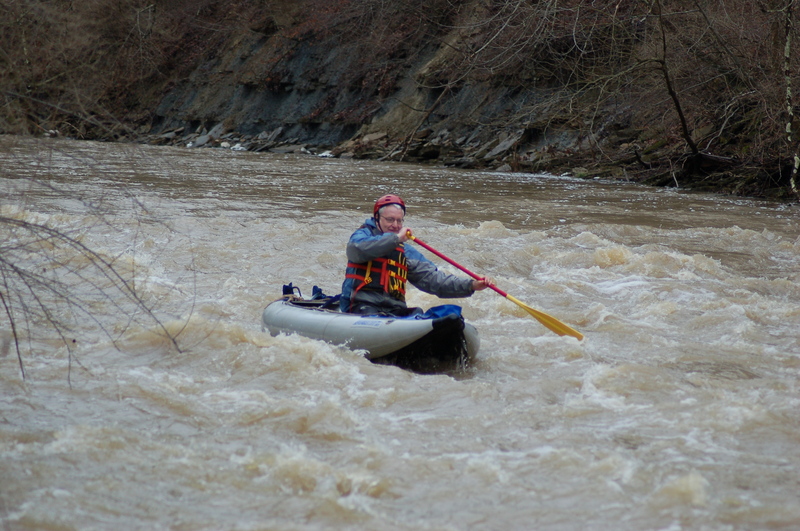
May 10, 2011
Running one of the opening rapids in the Class II section of Lower Stonelick. Gradient picks up about a mile into the run and some good drops are had.
Apr 5, 2010
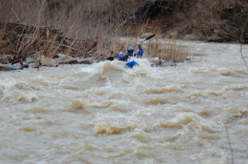
Big wave that can form at the end of S-Turn.