Cuyahoga
A1. Riverfront Park to Portage Trail Bridge
February 16, 2012
| Reporter | David Hill |
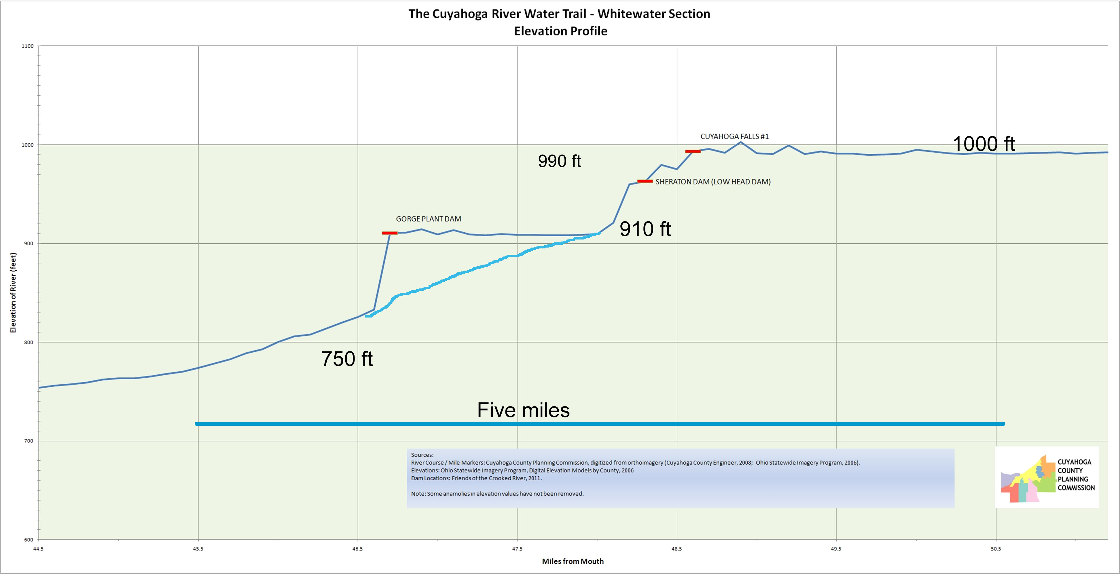
This figure presents river surface elevation data gathered during some of the River Trail projects. It presents a rough idea of how steep this section will become from Route 8, pass the 2 former dam sites, through the last drop below the Sheraton and to the start of the Ohio Edison Dam pool (~90 feet over 0.9 miles) and all within walking distances.