Clinton
W. Avon Road (at Livernois) to E. Avon Road (Yates Dam) (5 miles)
| Difficulty | I(II) |
| Length | 4.7 mi |
| Avg Gradient | 16 fpm |
| Gauge | Clinton River at Auburn Hills, Mi |
| Flow Rate as of 19 minutes | 33 cfsbelow recommended |
| Reach Info Last Updated | April 12, 2021 |
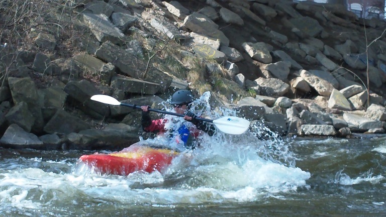
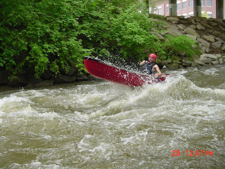
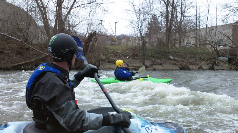
Mostly a swiftwater in-town float, but there are a couple good rips and (at some flows) a few surfable waves.
Be very aware of the dam at Yates, which should be portaged by most paddlers at most flows. This is a classic 'killer low-head dam', and has killed unwary paddlers who underestimated the recirculating backwash. Beware of strainers also.
Just south of the intersection with W.Avon Road, you'll find 'Eagle's Landing' (to the west off of S. Livernois Road).
Just boyond the confluence with Paint Creek, look for a fine little ledge/wave.
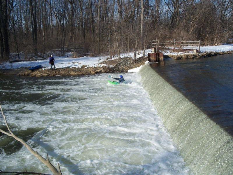
Plan on scouting and portaging at this dam. People have died due to being unaware of the real danger here! (It's not about the drop, it's about the recirculation at the base.)
That said, at some flows this dam may be safely run by suitably experienced paddlers, with proper precautions and careful assessment of the backwash. Have someone with a throw-rope (and the knowledge of how to use it) on shore.
Pay special attention to the boil-line below the dam as a canoe runs the dam in this video (at 1:48+). https://youtu.be/SoQA1ExjwYA
Be aware that a shorter boat (like a play kayak) will not 'bridge' the drop nearly so well, and is more likely to get caught in the reversal! Please do not be the next death in this classic killer 'low-head dam'.
Aug 20, 2013
Ran Avon / Livernois to Yates Cider Mill, 8-3-13, upper gage @ 1.5, Getting shallow but still fun, 2 short portages. Ran it again 8-10-13 and 8-17-13. Upper Gage @ 1.2 Water very low. Had to pay attention to not drag bottom. Got better after Paint Creek.
Ran Ryan Rd / S. of 22 mile to Heritage Park, 8-24-13. 'Lower' Gage around 7.5 ft. Low and slow.
Ran Heritage Park to Clinton River Park (Clinton River Rd. & West of Schoener) 8-25-13, Lower Gage at 7.5, Very calm stretch. Look out for wood. 4 portages to Dodge park. 7 portages from Dodge to Clinton River park. Almost all portages were difficult with the steep banks. Luckily there is a paved bike/hike trail on the left side of the river for much of this section. Bring bug spray!!!
Here are the USGS links for gages and discharge.
Upper (Auburn Hills to Yates)
http://waterdata.usgs.gov/mi/nwis/uv?site\_no=04161000&format=gif&period=31
Lower (past Yates)
http://waterdata.usgs.gov/mi/nwis/uv/?site\_no=04161820&agency\_cd=USGS
Jun 13, 2013
Oliver Dixon III, 47, of Sterling Heights had a planned excursion Thursday June 13, 2013
Authorities said they believe they have found the body of a Sterling Heights kayaker who had been missing since a planned excursion Thursday in the Clinton River.
The body was discovered after a citizen located a kayak about 5 p.m. today that fit the description of the one used by Oliver Dixon III, 47. The kayak was in a logjam between the River Bends Park canoe launch and Heritage Park in Utica, Shelby Township police said.
Authorities found and recovered a male body near the blue and white kayak. Identification is pending, but the body is believed to be that of Dixon, police said.
The body was found east of Auburn Road, north of M-59 and south of 21 Mile Road.
No foul play is suspected at this time, Sgt. Robert Trupiano said.
The kayak and body were found in an area being searched by numerous law enforcement agencies.
Investigators did not know exactly where Dixon planned to kayak. They suspected his trip was to originate at the River Bends Park boat launch on Ryan south of 22 Mile in Shelby Township and continue downriver to Heritage Park on Van Dyke south of Hall Road, Sgt. Scott Trumbo said Sunday.
“His car was parked at the boat launch and his bike was found at Heritage Park,” Trumbo said.
Investigators were called to Dixon’s abandoned car at 1:30 p.m. Saturday.
Trumbo said the picture issued by the police department was taken by Dixon of himself at Heritage Park and posted to Facebook at 3:30 p.m. Thursday. No one had heard from him since.
Two Shelby Township firefighters kayaked a stretch of the river Saturday but did not see any sign of Dixon or the kayak. The Macomb County Sheriff’s Office searched the area by boat and plane.
Anyone with information is asked to call the Shelby Township Police Department at 586-731-2121, ext. 3.