Deep
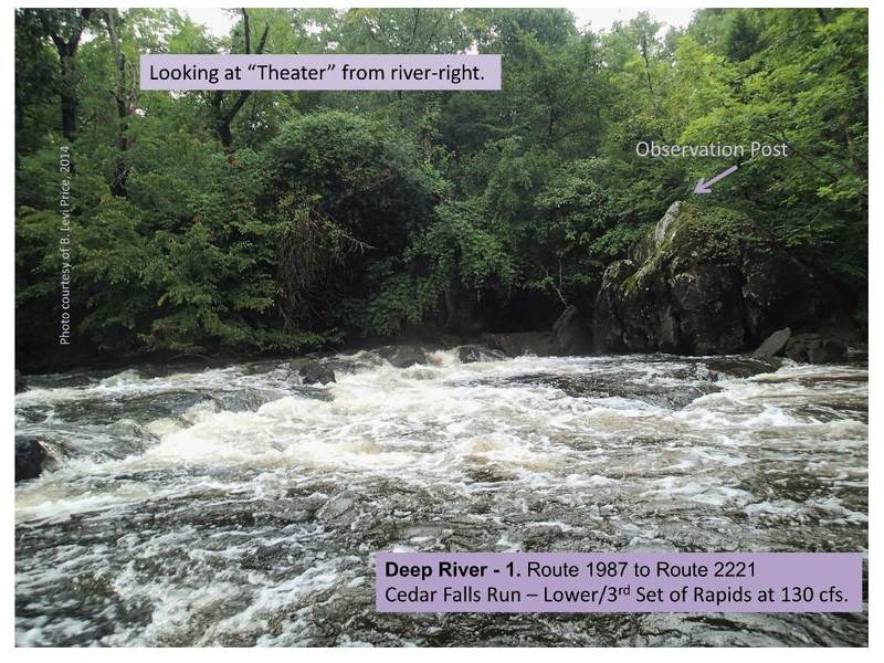
1. Route 1987 (Randleman) to Route 2221 (Cedar Falls)(Randleman to Cedar Falls)
Feb 13, 2023
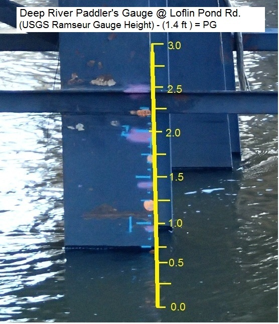
using the awa reading for the park and huck section level should be 1.8 min. and that starting to scrape. ideal level 2.5
May 23, 2016
went to the 'park and run' section at the end of this run to check it out. Level was 1.5 ft and falling, river was nearly unboatable it was so low.
May 5, 2016
Anything between 1.0 and 2.0 is usually a good level for Class II / III-
Jan 24, 2015
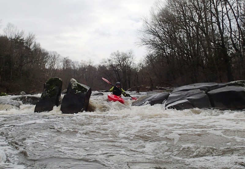
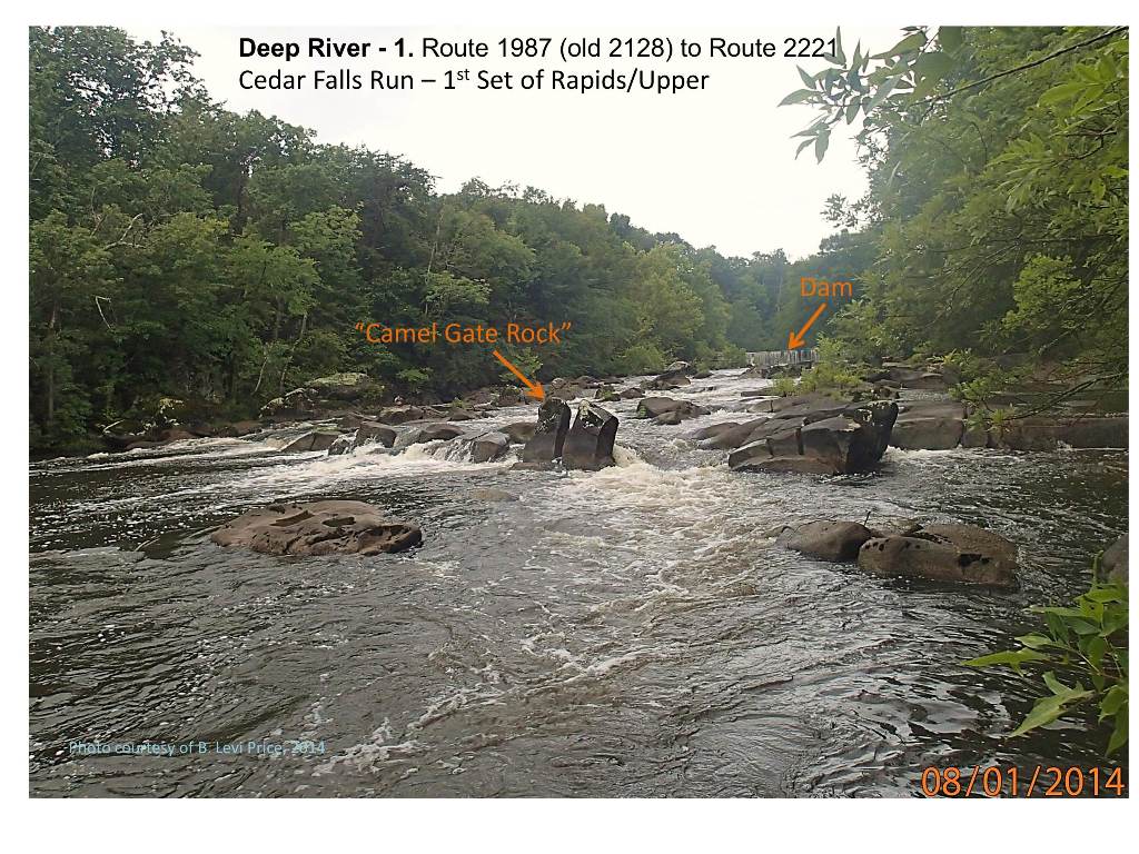
Alan on the River left line at Camel's Gate.
Oct 14, 2014
From the dam to the bridge at cedar falls the river jams at class III to IV at levels of 2.5' and up. Its only about a half mile section though, but well worth it if you live in the area.
Aug 22, 2014
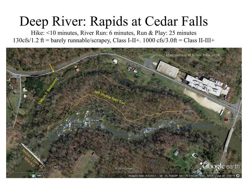
The rapids at Cedar Falls are a great option for a solo whitewater paddler or for a quick group trip after work. Map is for information purposes only, do your own research.
Aug 22, 2014
Probably the best rapid, but also the most variable with flow.
Aug 22, 2014
This is the biggest drop in the Cedar Falls subsection.
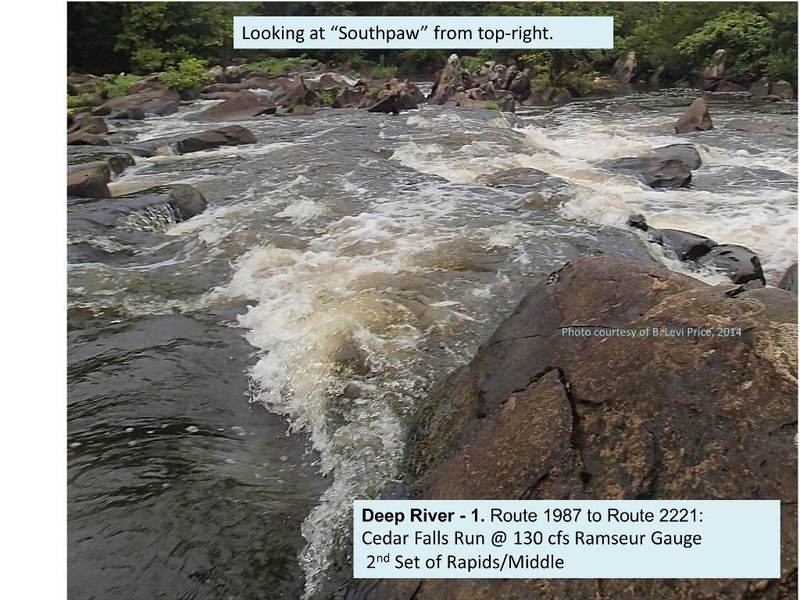
Aug 1, 2014
Calling this Camel Gate until some old-timer corrects me.
Jun 12, 2014
Would love to have someone who paddles this section add some pics and other information to AW about this run. If you would like to do that please contact me. Strive2@ymail.com
Jun 12, 2014
Be sure that the level at Ramseur is not falling, for Section 1 needs at least 300 cfs to have a clear path through the boulders and drops. Ramseur read 555 cfs and falling on the afternoon I ran it, but I surmise that there was less than 200 cfs when I arrived, making the clogged run from the dam a solid tech 4 with no clear passages on some drops. The last major drop I scouted and, fortunately, did not run blindly, as the only clear passage from above had a strainer waiting to decapitate from below.