French Broad
9. Barnard to Hot Springs (Section 9)
| Difficulty | III-IV |
| Length | 8.2 mi |
| Avg Gradient | 24 fpm |
| Gauge | French Broad River at Marshall, Nc |
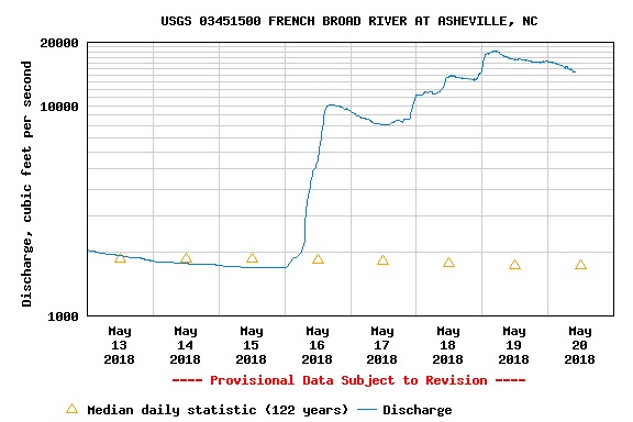
| Flow Rate as of 1 hour | 1350 cfsmedium runnable |
| Reach Info Last Updated | September 9, 2024 |
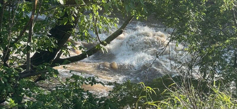
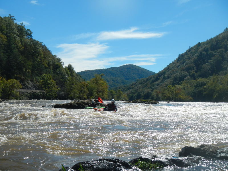
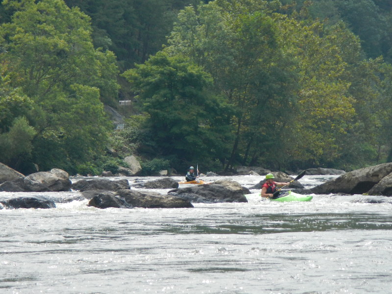
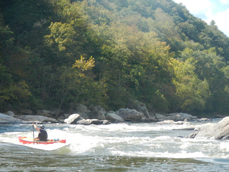
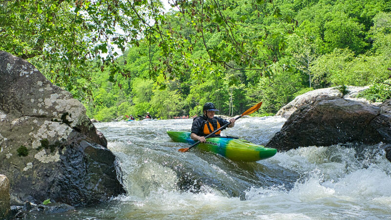
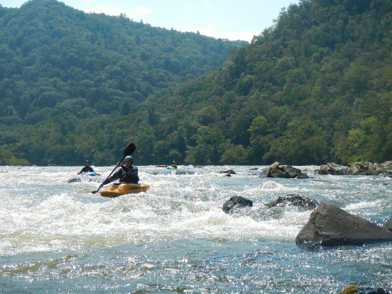
Section 9 of the French Broad (known widely as FB9) is one of the primary intermediate whitewater runs in WNC thanks to it being runnable pretty much all the time, its fun rapids, and close proximity to Asheville. Paddlers have the option of a ful run from Barnard to Hot Springs, or the shorter and more common run from Barnard to Stackhouse. From Barnard to Stackhouse the river has fairly evenly dispersed class 2 and 3 rapids with relatively little flatwater. If you paddle below Stackhouse, you paddle 4 miles of mostly flatwater for 2 good rapids: class 3 Kayak Ledge and Class 4 Frank Bell's. Paddlers that are short on water, daylight, or time typically opt for the shorter run.
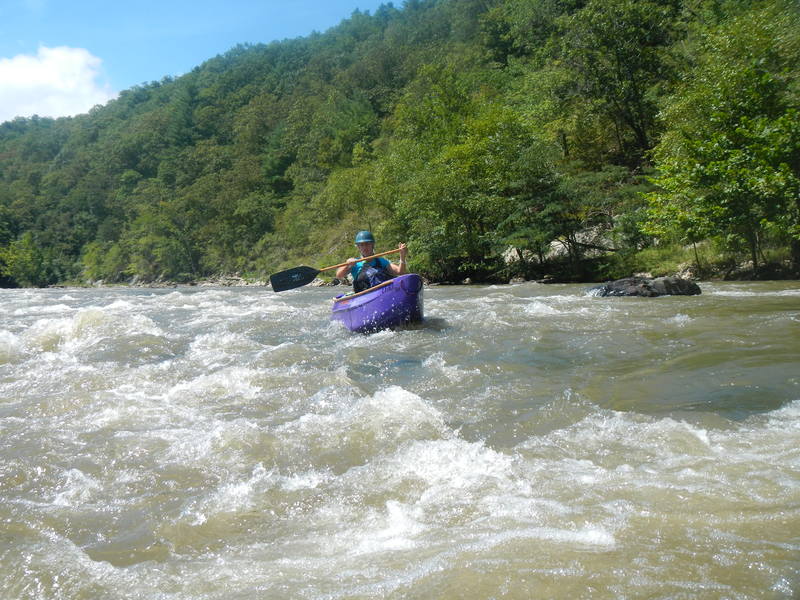
The river gradually builds in difficulty below the put in with some nice warm up rapids and surfs. Keep an eye out for S-Turn Rapid where there is reportedly a very easily avoided sieve lurking on river left, and for the fun powerful waves in Big Pillow. A big pool signals that its almost time to surf at Sandy Bottoms just downstream, and Ledges Rapid will keep you busy with its namesake small legdges spaced throughout a long rapid. You won't be able to miss the Stackhouse Take-Out on river right, which comes right before the river flattens out.
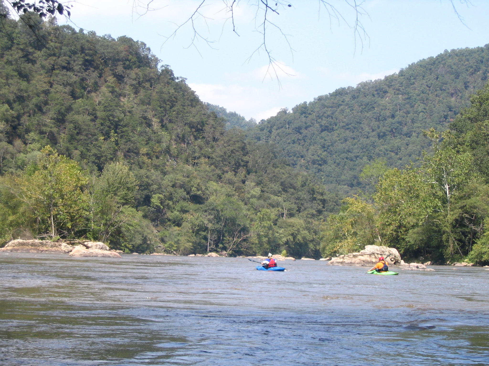
Past Stackhouse the river spreads out and slowly makes its way down the Windy Flats. There is a distinctive rock spire at the upper end of the island as a marker for Kayak Ledge. If some in your group are not ready for Kayak Ledge or Frank Bell's the left sides of both islands have much easier routes. At Kayak Ledge most of the flow goes to the left of the island. Below Kayak Ledge the river is divided into several channels by smallish islands. After the channels join, the river is in a wide pool above Frank Bell's (where most of the flow goes to the right of the island) You can scout Frank Bell's from near (on) the RR tracks but you won't get a great view.
700 cfs is a good minimum flow since you can run from Barnard to Stackhous
...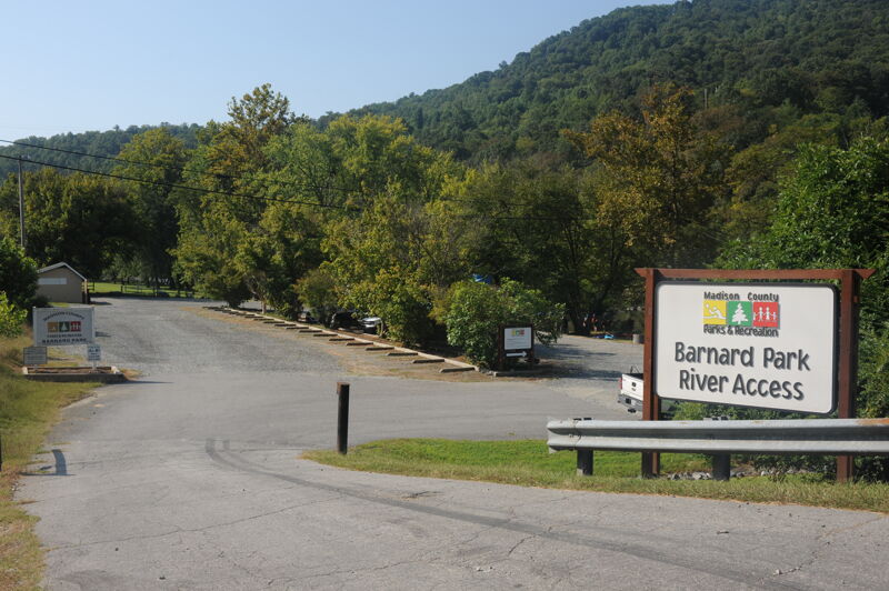
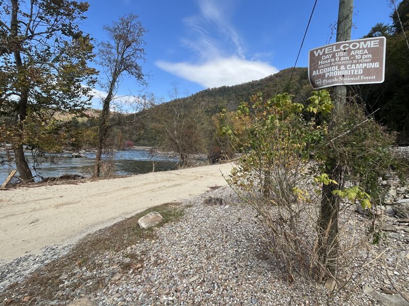
The put-in access is on river right immediately upstream of the Barnard Road Bridge. The access is administered by Madison County Parks and Recreation and is open for day use. The site has designated parking sites, ramps with convenient access to the water and a toilet.
AKA Beginer (Class II-): This rapid starts more or less at the put-in. It is an easy rapid and fairly long. There are a couple places to surf at most levels. If you have any trouble with this rapid, it's a really good idea to get out on river right and carry your boat back to the put-in.
Most people run down the left side and angle back right near the bottom. At flows above 1500 cfs there are lines on the right. If you have trouble here, see the warning on beginning rapid. It will be a slightly longer carry back to your vehicle.
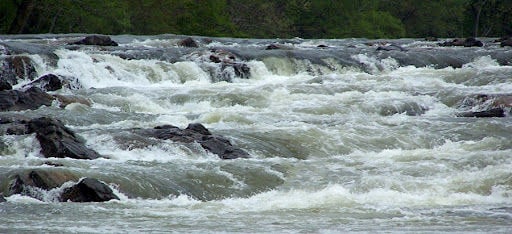
Maze is a long rapid. There are many rock ridges that if you are travelling from 6 o'clock to 12 o'clock will cross at a 1 to 7 o'clock alignment. There are many breaks in each of these rock ridges, so there are several ways through each. With well over a dozen ridges, there are over a thousand permutations and combinations of ways down. In general there is always an open and easily readible path on the right. There are several good technical lines.
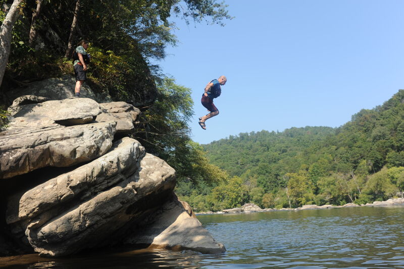
Not a rapid but a popular cliff to jump off of into a pool above Turtle Rock rapid. I have to give it a rating so class 1.
The Turtle Rock for which the rapid is named is about halfway down on river left (looks sort of like a snapping turtle). The most common line is 8-10 feet to the right of the Turtle's snout. There are a lot more lines in the center / right of the river.
Pillowcase Rapid is a small gap in between the rocks leading up to Big Pillow Rapid, it is run as an alternative choice to S-Turn rapid. There is one small hole at the bottom of pillowcase rapid which has two tounges on the left and right sides of the hole.
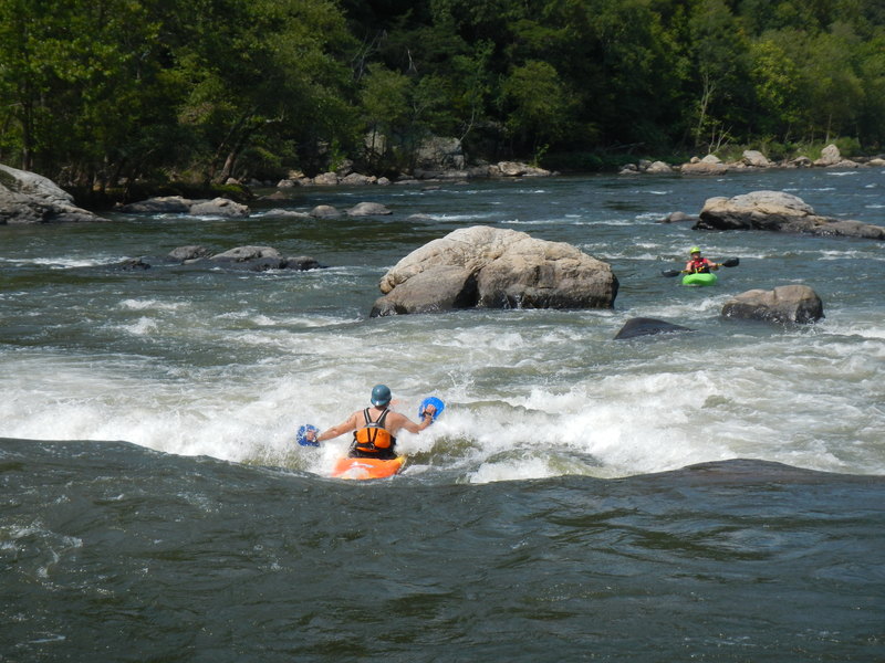
There are many lines through S Turn. The photo shows the most common and the one for which the rapid was named. This line straighens out at 3,000 cfs so no turn is required there. A couple of the most common alternate lines - Left with an eddy turn (in a location that begs you to eddy out on the left) with a peelout that takes you back to the center and another, catching an eddy in the center of the river just above the rock island with the tree growing on it and heading toward river right from that eddy.
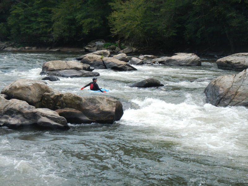
From the short pool below S Turn, you will see a horizon line with a lot of rocks on river right and a huge opening on river left. If you head toward the center of that opening, you will see a wave train that starts out modestly and gets progressively larger as it crashes into the Big Pillow rock. In this photo, taken at 1640 cfs, the 'pillow' rock is approximately in the center of the photo with a little of the top out of the water. At 2000 cfs you can't see the rock from upstream only the pillow and aerated water. There are many strategies for running this rapid. At levels up to 4500 cfs, the easiest line is to ride the initial ramp more or less down the center, then get on the right side of the wave train, angle right, and paddle right to the fairly large eddy on the right side. Boaters with more skill will want to catch the eddies on the left and right on the way down.
Not a very difficult rapid. The river is split by a boulder and most boaters will run to the obvious channel on the right. . There is a significant fold in the current; this make a great squirt spot for those into squirting. Capable of mystery moves if you have a squirt boat. It also create some downdraft, such that jumping in off a raft will get a swimmer a little down time and they come back to the surface a bit downstream. At one time it was a popular option on rafting trips and thus the name.
Most of the water in Sandy Bottom goes to the left of the large relatively flat center rock, creating a long wave train. You can crash through the wave train or ride either shoulder for a tamer run. At levels above 2000 cfs there are easy lines to the right of the center rock. It's a popular surfing spot and the rocks mid river are a good lunch spot.
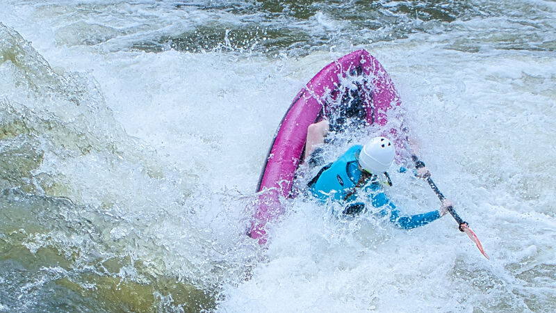
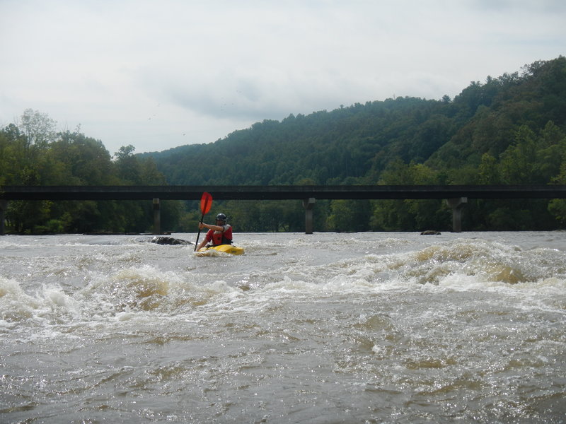
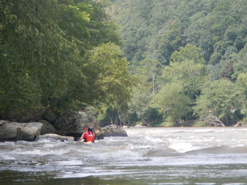
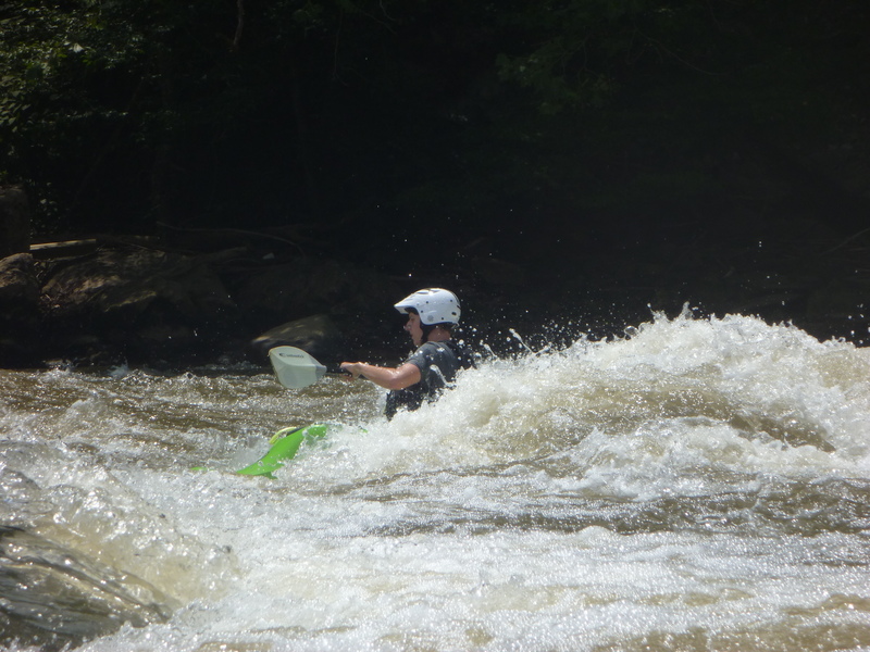
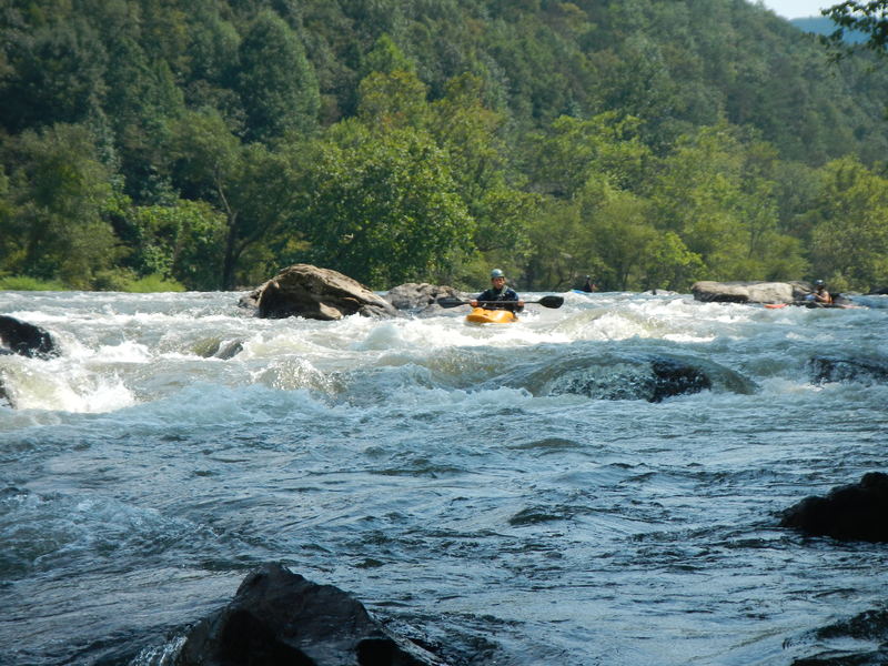
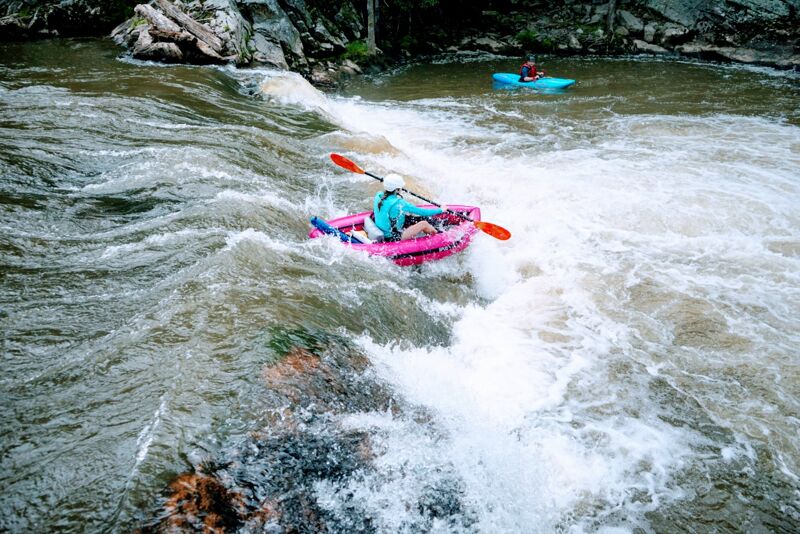
Shortly after the pool below Sandy Bottom, the Ledges start. This rapid is long and frequently split by rock islands. The right sides are almost always good (top one may be marginal at very low flows) and most of the ones in the center and left are good also. When you get to a point where there is a small sandy beach on the right with a large whale shaped rock on the downstream end of the beach the crux ledge is just below you. The normal line is following a wave train about 30 ft off the right bank over the drop. This leads you on a mostly glassy tongue between two holes. At levels above 2,000 cfs another easier line is open about 8-10 ft off the right bank (at levels above 4500 cfs it is nice to know that this alternate line is there. There is a more interesting more technical pair of lines on the left side of this same ledge. Large areas in the center of this ledge are pourover-ish and can be very testy above 3500 cfs. The photo shows a had paddler running the classic line, splitting the wave holes at 1850 cfs. At 4000 cfs these holes are best avoided. There are several good surfing / play spots in this rapid, including a couple just above the pool before Pinball.
Pit Stop is on the right side of the large island below the ledges. There are multiple lines on the right side of the island; the most common is shown in the photo. It is between the right bank and a boulder on the left. The gap is about 15 ft or so wide and you go right down the middle. This line becomes progressively more difficult with higher water levels and at 3,000 cfs it is no longer easier than Pinball. At around 5,000 cfs it gets harder than Pinball IMHO.
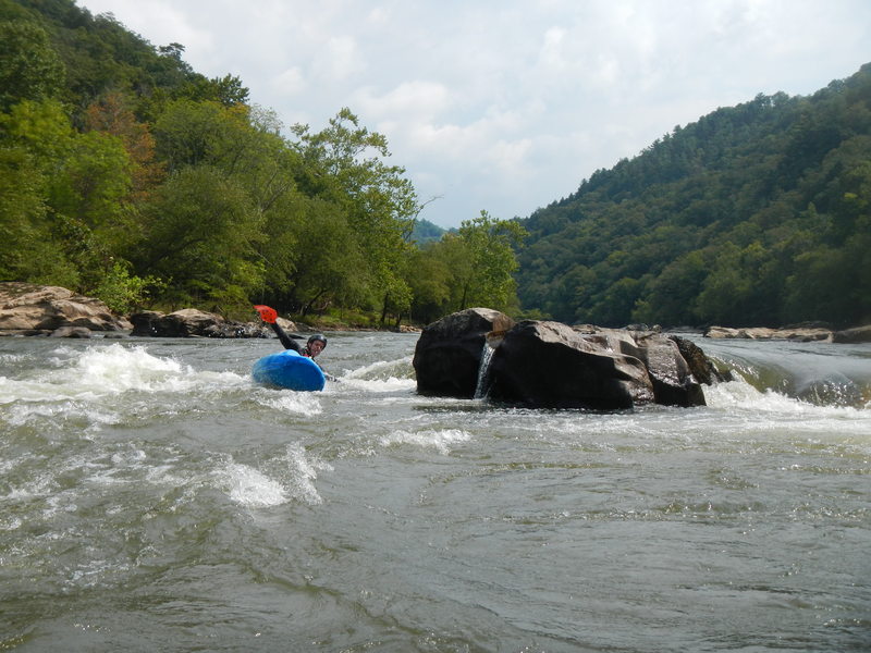
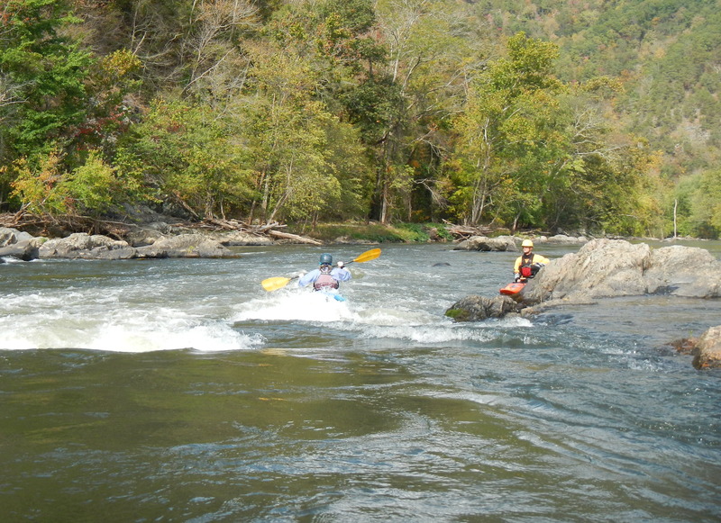
After the pool below ledges the river is split by a large beautiful island - a perfect camping spot. The rapid on the left is Pinball. Apparently named for the technique used by some rafts to get down this side. Most boaters will start about 15-20 ft off the left bank and follow the flow until they come to Decision Rock. Unless the river is very low, you won't actually see Decision rock but it forms and obvious sizeable pillow about 2/3 of the way down the rapid. At levels below 3,000 cfs, your decision should be to go to the right of the rock as the left side has sieves. Above 3,000 the left side is covered. The photo show a boater passing Decison rock at 1850 cfs. Skilled boater can catch several eddies on the way down Pinball. The last one on the right sets you up for a nice little chute between a couple boulders.
There is a flat and relatively shallow pool after Pinball / Pitstop. At the downstream end of the pool is an island on river left and the lower end of this island, Rebar rapid begins. It isn't truly rebar but there are many old steel spikes on the right 3/4 of the river from an old diversion dam. At levels below about 2500 cfs these spikes are visible. At 3000 you can still see a few. The best water for paddling is on river left where there are no spikes. The place with the most flow (and most obvious line) goes over a sloped 2 ft drop with a couple diagonal wave holes. You can easily punch them or can avoid them by angling left on the way down the drop.
There are lots of ways to run Stackhouse and if you've made it this far they should seem easy. The most straightforward (easy) is to start left center and after a drop, finish left. It's a tad more fun to start left and after the drop finish anywhere.
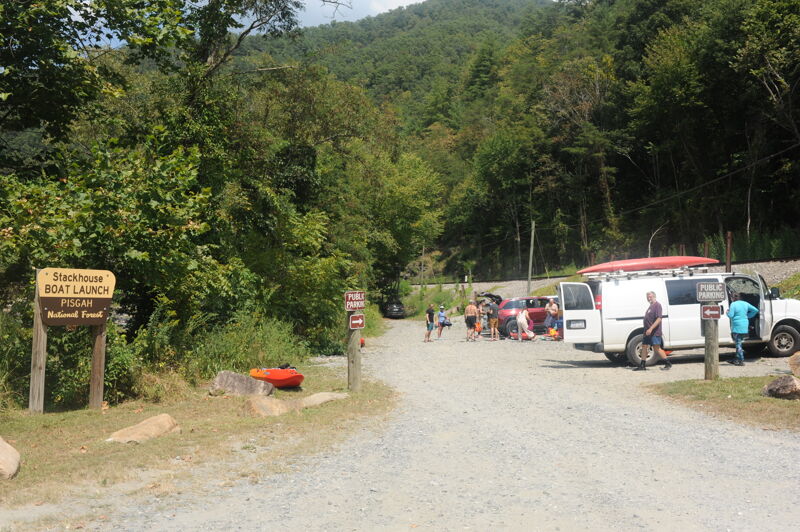
Intermediate access point on river right. This is a popular take-out option, particularly at low water. The site was privately owned before being acquired by the Forest Service. Outfitters have use of the upstream area. The public are directed to use the downstream porition of the site. It can get very busy and congested on weekends. The site has a toilet.
A ~5 foot ledge into a hole with a large eddy (far river right) and a large tounge formation (far river left). This rapid is the first rapid you will see if you go down the river right channel around Mountain Island. At ~7000 cfs Kayakers Ledge creates a terminal hole and commerical rafts will instead run the left channel around Mountain Island which has a smaller rapid called Needle.
Needle rapid is on the left channel which goes around Mountain Island and is an alternative to running Kayaker Ledge. Commercial rafts will run this rapid when the flow of the French Broad is high and Kayakers Ledge becomes a terminal hole. At high flows >7000cfs Needle will turn into a very large wave train.
Frank Bells is the second to last rapid on the French Broad (Section 9). It consists of a broken ledge at the enterance to the rapid and two large holes at the bottom of the rapid. There are many routes a raft can take depending on the water level, below ~1500 cfs there is a line rafts can take called horseshoe which is far river right from the middle of the rapid. Above ~1500 cfs the rocks in the middle of the rapid start to get covered by water allowing a raft to pass through. At lower flows on the French Broad a kayak can usually slide down the chutes created by the rocks at Frank Bells but horseshoe is also an awesome line to take in a kayak.
A small 3-4 foot tall ledge right before the takeout in Hot Springs, NC.