| Difficulty | I(II) |
| Length | 63.6 mi |
| Avg Gradient | n/a |
| Permit | No Permit necessary to float. |
| Gauge | One Hundred and Two River at Maryville, Mo |
| Flow Rate as of 1 hour | 6.39 ftrunnable |
| Reach Info Last Updated | November 7, 2014 |
River Description
The One Hundred and Two River is usually seen as a muddy mess. While excitement is minimal, the river provides excellent training, wildlife photography, and outdoors access.
Camping options at higher levels can be limited, but there are level sandbars and banks at lower.
'The One Hundred and Two River is a tributary of the Platte River of Missouri that is approximately 80 miles long, in Northwestern Missouri in the United States, with its source tributaries rising in southwestern Iowa. According to the Geographic Names Information System, it is also known as the Hundred and Two River. According to the National Atlas the river begins northwest of Hopkins, Missouri at the confluence of the East Fork One Hundred and Two River and the Middle Fork One Hundred and Two River. It is joined southwest of Hopkins by the West Fork One Hundred and Two River. All three of the forks originate in Iowa.' (http://en.wikipedia.org/wiki/One\_Hundred\_and\_Two\_River)
River Features
MO-Hwy 136 Access
Access PointDistance: 0 mi
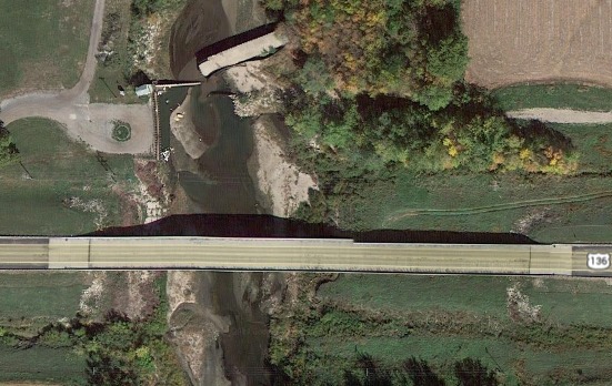
Hwy 136 Access - Popular putin for trips. Road Access located on East side.
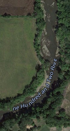
Bridgewater
Access PointClass: IDistance: 7.2 mi
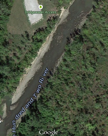
Riffles and small waves. Runnable at all levels. Becomes washed out above 10ft
Tail-End Charlie
PlayspotClass: IIDistance: 8.5 mi (approx.)
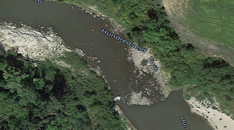
50 yard stretch of Class I with a small drop (1-2ft). Drop creates a surfable wave at 7-9ft.
Easy to see and, if need be, portage. Washes out above 15ft
Snake Side
HazardClass: IDistance: 50 mi (approx.)
150 yards of Class I fun. Difficulty increases with flow.
Watch out for the Grain Bin lodged in the middle of the river close to the end of the rapid
Saxton Access
Access PointDistance: 65.2 mi (approx.)
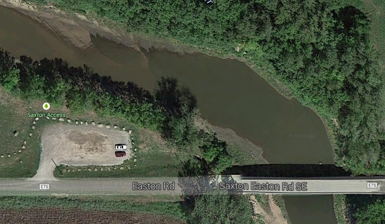
One of multiple takeout options for this river.
Trip Reports
Log in to add a reportBW
Brandon Woerth
Jul 9, 2016
We floated from Bridgewater Access (near Arkoe, MO) to the Barnard Bridge on June 18, 2016. The flow at the Maryville gauge was about 110 cfs. The put in and take out are steep but doable. I wouldn't recommend floating this section with less water. I walked our 16' SOAR Pro Pioneer through the rocky riffles at Bridgewater, over the exposed ledges at Tailend Charlie (also called Beattie's Falls?), and drug across some sandbars along the way. It was a surprisingly nice float with plenty of exposed sand bars, and took about five hours with easy paddling. Moffit's Bridge is roughly half way between Arkoe and Barnard, but doesn't offer a user friendly take out. There is a ton of tree debris piled up under Moffit's and the Barnard bridges, which isn't a problem at low water, but could become very hazardous in faster/higher water.
CM
Clifton McIntosh
Nov 7, 2014
Tail-End Charlie Rapid (40.233774, -94.834088)