Trip Reports
Log in to add a reportBW
Brandon Woerth
Jul 9, 2016
We floated from Bridgewater Access (near Arkoe, MO) to the Barnard Bridge on June 18, 2016. The flow at the Maryville gauge was about 110 cfs. The put in and take out are steep but doable. I wouldn't recommend floating this section with less water. I walked our 16' SOAR Pro Pioneer through the rocky riffles at Bridgewater, over the exposed ledges at Tailend Charlie (also called Beattie's Falls?), and drug across some sandbars along the way. It was a surprisingly nice float with plenty of exposed sand bars, and took about five hours with easy paddling. Moffit's Bridge is roughly half way between Arkoe and Barnard, but doesn't offer a user friendly take out. There is a ton of tree debris piled up under Moffit's and the Barnard bridges, which isn't a problem at low water, but could become very hazardous in faster/higher water.
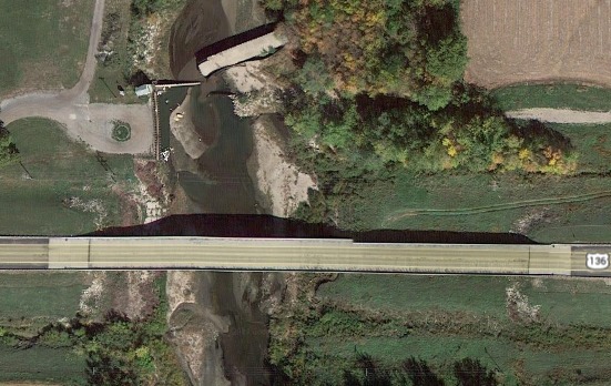
CM
Clifton McIntosh
Nov 7, 2014
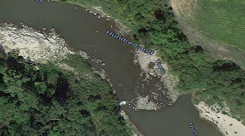
Tail-End Charlie Rapid (40.233774, -94.834088)
CM
Clifton McIntosh
Nov 7, 2014
Snake Side Rapid (39.864190, -94.763015)
CM
Clifton McIntosh
Nov 7, 2014
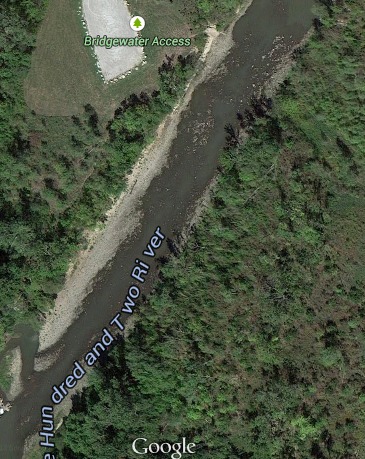
Missouri Conservation Bridgewater Access and Rapid (40.241925, -94.835716)
CM
Clifton McIntosh
Nov 7, 2014
Access Point
CM
Clifton McIntosh
Nov 7, 2014
Total: 65 miles
-Maryville dam to Bridgewater Access: 7.72mi
*Rapid Mile 7.72: 'Bridgewater' I(I+)
*Rapid Mile 8.5: 'Tail End Charlie' (II)
-352nd Street Bridge: 12.2mi
-Hwy M Bridge (Barnard): 16mi
-Hwy B Bridge: 20.72mi
-Hwy 48 Bridge: 25.72mi
-Hwy C Bridge: 29.59mi
-Hwy E Bridge: 41.75mi
-Hwy 337 Bridge: 43.31mi
-Rock Quarry Access: 47.53mi
*Rapid Mile 50: 'Snake Side' I+(II)
-Hwy 169 Bridge: 50.45mi
-Hwy ?? 57.57mi
-Hwy 6 Bridge: 59.14mi
-Hwy E3S Bridge: 61.93mi
-Platte River Confluence: 62.25mi
-Hwy 36 Bridge: 62.66mi
-Railroad Bridge 64.63
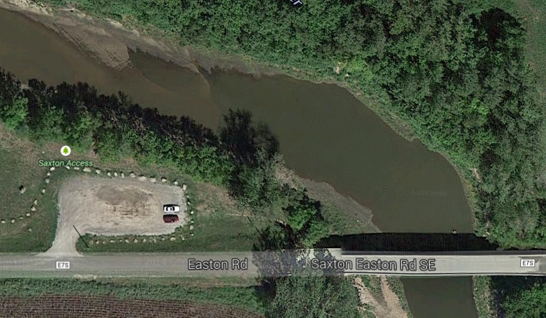
-Takeout: Saxton Access 65.13
CM
Clifton McIntosh
Nov 7, 2014
Access point SE of St. Joseph, Missouri. Steep bank to parking lot.