Haw
1. Route 1545 (Chicken Bridge) to US Route 15-501 (Bynum)(Upper Haw)
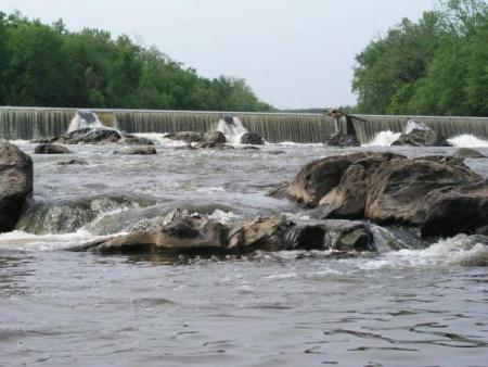
July 16, 2025
| Reporter | Sonia Dekker |
| Gauge Reading | 1200 cfs at HAW RIVER NEAR BYNUM, NC |
| Flow | Low Runnable |
Paddled post flooding event from TS Chantal. We did not use the public put-in for this trip, but note that it has suffered fairly significant damage with multiple (~7+) trees down on the usual path to the usual steep launch. As an alternate, take a right on the path that takes you under the bridge towards the swimming hole/rope swing. The path itself dows have a couple of trees down and got completely washed out before reaching the rope swing but the washout created a steep and less obstructed area to put in. There were no significant log jams or changes to the small rapids as a result of the floods. All strainers on July 13th were easily avoidable. ~1,200 cfs at bynum gauge when we started out and was perfectly runnable by beginners. I paddled a 9'6' Hala Atcha and was joined by a paddler in a Wavesport X and a couple on sit-on-top kayaks. This section is very beginner friendly, although some rocks may cause flips at the lower level. Total time on the water took approximately 3.5 hours, with a couple of short stops to play or chill.