Haw
1. Route 1545 (Chicken Bridge) to US Route 15-501 (Bynum)(Upper Haw)
| Difficulty | I-II |
| Length | 6.8 mi |
| Avg Gradient | n/a |
| Gauge | Haw River Near Bynum, Nc |
| Flow Rate as of 45 minutes | 120 cfsbelow recommended |
| Reach Info Last Updated | July 13, 2026 |
Put-in:
The put-in for this section is on Chicken Bridge Road on river left. The put-in is about 100 yards down a small trail. The put-in itself is very treacherous and requires near vertical portage.
Take-out:
The take-out is right above the Bynum dam on river left. Parking is available off of US 15-501. This is also the put-in for the Middle Haw.
Description:
The Upper Haw is a nice section of river through rural Chatham County. This section is ideal for beginners, novices, and intermediate paddlers. Most rapids are boat scoutable. From the put-in there are small rapids providing opportunities to test skills. This section of river has many unnamed rapids. The larger rapids include Sawtooth Ledge, Little Nantahala and Final Solution.
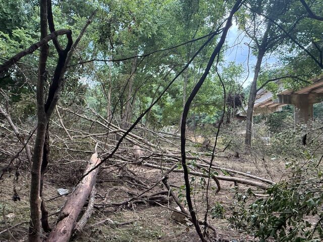
This is the old path to the put in launch, obstructed by no less than 7 trees down, thanks to Chantal July 2025. Now, I would turn right before this mess, to take the path under the bridge towards the swimming hole, which is not without obstacles, but a fairly decent alternative to the old launch. Note that there is not a very good cell signal here at all and the usual route that is taken to set shuttle at the dam (River road to Hamlets Chapel to Moore Mountain to 15-501) is detoured due to multiple road washouts, so plan to drive across the bridge and take Old Graham to Russel Chapel to 15-501 (all lefts) to get to the take out to set shuttle.
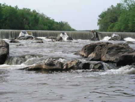
The first major rapid on this section of the Haw. There are rapids on either side of an island. On the left, there is a rocky Class I. On the right, there is a slighty more technical, but fun rapid named, Sawtooth Ledge (II). The rocks at the end of this rapid are sometimes hard to avoid. Photo shows what it looks like from the bottom of the rapid at ~1,200 cfs
The next rapid really does not have name. It is an ok playspot. It is a nice spot to step out of your boat and stretch.
This rapid is recognized by old bridge supports. Run this rapid towards the center, in the main flow. Fun rapid to surf.
This is the last rapid before the Bynum Dam slack water. According to guidebooks and CCC mailing lists, canoes love to broach on this rapid.
Take-out for the Upper Haw. Portage around the dam on river left. Running this dam, like all dams, is not recommended.
Jul 16, 2025
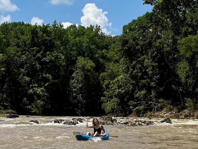
Paddled post flooding event from TS Chantal. We did not use the public put-in for this trip, but note that it has suffered fairly significant damage with multiple (~7+) trees down on the usual path to the usual steep launch. As an alternate, take a right on the path that takes you under the bridge towards the swimming hole/rope swing. The path itself dows have a couple of trees down and got completely washed out before reaching the rope swing but the washout created a steep and less obstructed area to put in. There were no significant log jams or changes to the small rapids as a result of the floods. All strainers on July 13th were easily avoidable. ~1,200 cfs at bynum gauge when we started out and was perfectly runnable by beginners. I paddled a 9'6' Hala Atcha and was joined by a paddler in a Wavesport X and a couple on sit-on-top kayaks. This section is very beginner friendly, although some rocks may cause flips at the lower level. Total time on the water took approximately 3.5 hours, with a couple of short stops to play or chill.
Oct 30, 2018
Upper HAW14,000 cfs 27OCT18 Hala Atcha 9'6
A lot of water moving very fast. Cruising at 5.5 mph without paddling. Some features were bigger, some were washed out. Hell of a fun time though.