Linville River
3. Linville Falls to Lake James (Linville Gorge)
| Difficulty | V |
| Length | 16.9 mi |
| Avg Gradient | 110 fpm |
| Gauge | Linville River Near Nebo, Nc |
| Flow Rate as of 46 minutes | 2.13 ftrunnable |
| Reach Info Last Updated | December 12, 2025 |
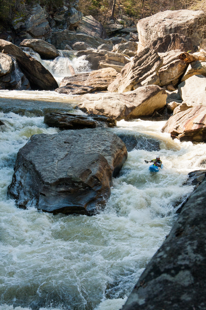
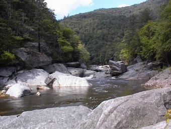
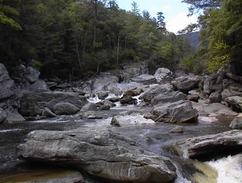
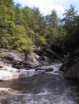
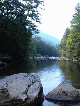
If there is one river in the southeast that truly has it all, it is the Linville River. Born atop the highlands of the Blue Ridge near Newland and Linville, North Carolina, the Linville River floats slowly and quietly for several miles. Just after passing under the Blue Ridge Parkway though, it breaks through the main crest of the Blue Ridge unlike neighboring rivers like the Watauga, Elk, and Nolichucky, which follow a much more reasonable path through the gentler northwestern end of the region. As a result of the river following this difficult path, there is only a relatively short horizontal distance the river has to drop the abrupt 2000 feet all the way down to the Piedmont lowlands below.
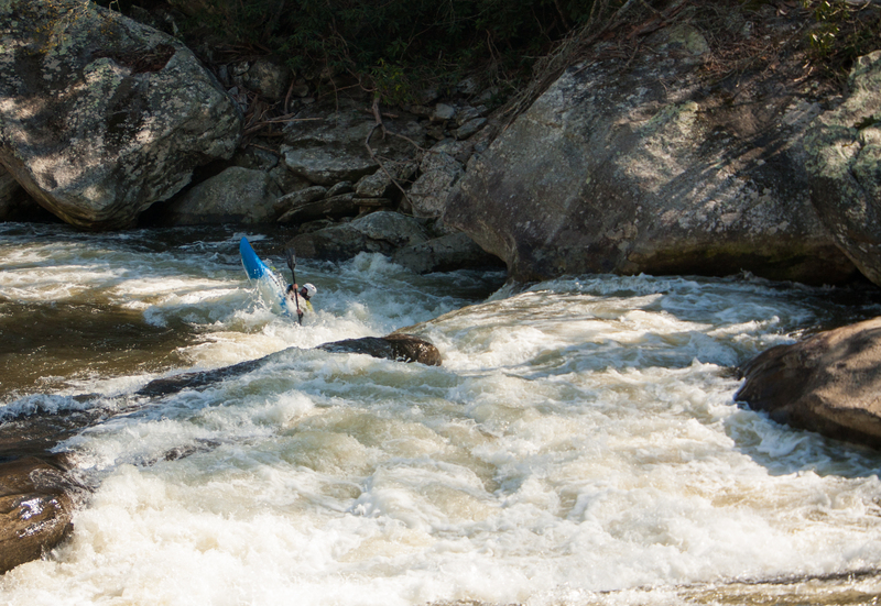
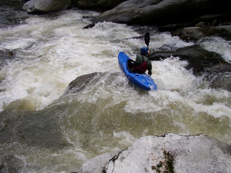
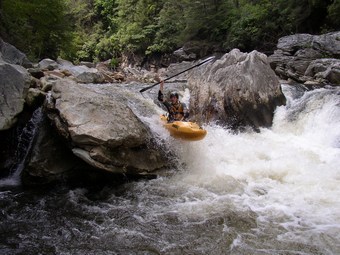
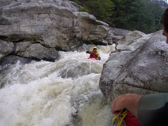
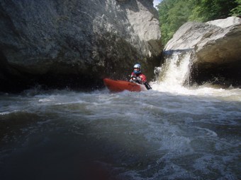
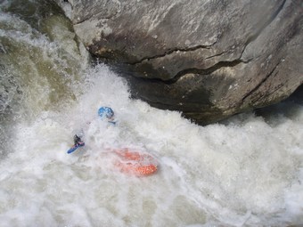
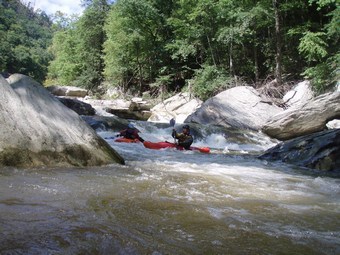
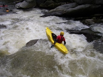
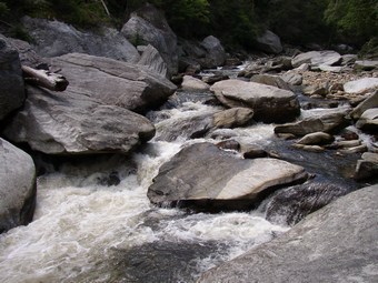
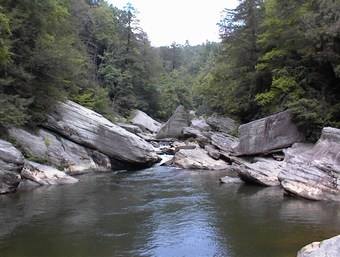
What allows the river to cut through this ridge instead of flowing off the backside like most streams is a geologic fault plane. This contact between materials that were thrust up and on top of each other millions of years ago made an excellent spot for the river to begin its work cutting through the billion year old core of the Blue Ridge. The river quickly was able to down cut through the weak region in contact with the fault plane and this process produced a giant gorge that runs right down the middle of Linville Mountain that is in some spots as much as 2300 vertical feet below the surrounding high points along the rim. The high gradient and complex geology of the gorge create intense and demanding rapids that are sustained for distances unparalleled in the eastern United States.
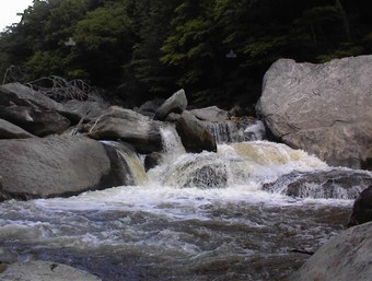
Due to the rugged terrain produced by this type of structure, much of the gorge was not logged completely, so there are still old growth areas left. The wilderness area designation also helps with maintaining the rugged feel of the gorge. The hiking trails alone are serious, with one mile in Linville equating out to more like 2 anywhere else in the southeast.
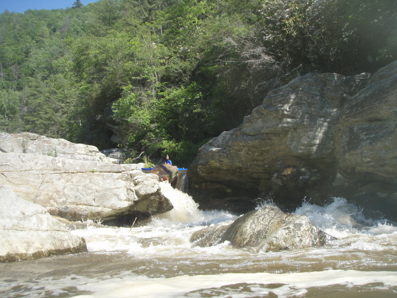
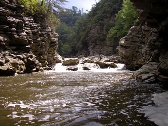
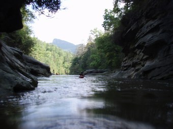
In turn, the Linville River is hands down the most epic, beautiful, and quality stretch of whitewater to be found east
...
It is possible but not recommended to put in below the falls. Be discrete and try not to cause too much erosion.
Another east rim access point, this trail travels 1.7 miles down from Mtn Park road, providing a nice putin above the better part of the paddle in, while avoiding the flatter upper 2.6 miles.
A classic putin option with a hell of a first drop.
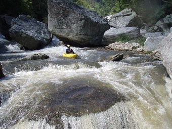
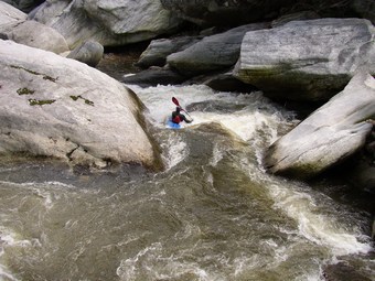
Stay right and keep her straight. No way around at all. A good rapid.
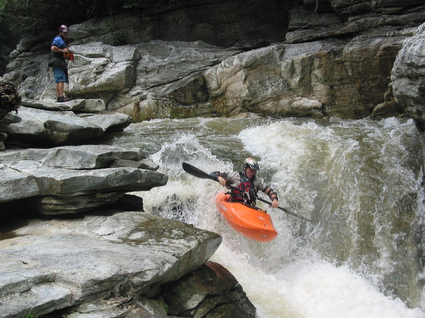
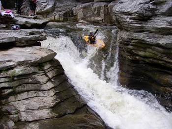
Just drive off the big shoulder on the right for a great boof. Smiles and railgrabs are a must.
The term 'don't mess up' was created for rapids like this one. Easy portage on the left.
Its been run a few times, but is just not pretty.
One of the best boofs on the run, your boys may tingle upon landing.
Scariest rapid on the run, yet annoyingly easy. Still, the line is fine and the consequences horrendous.
It starts kinda junky on the left, but finishes nicely in the center.
A classic, this rapid has 3 ledges, with the top being the crux.
Just a little scary, since the floods of 2004 opened up bad rocks on river right.
The floods of 2004 cleaned this one up a bit, lowering the pucker by filling in some voids.
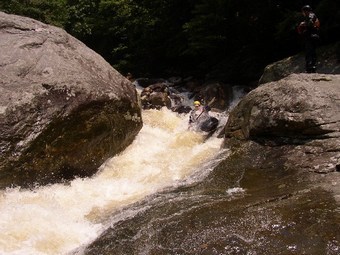
A fun rapid that suprises you. You will run some boogie below jailhouse that throws you into a blind ledge. The safe line is left of center, but a sweet boof is to be had far right, just don't get pocketed.
When the river is running solid, this can be run left or when high down one of the center slots. At low water it is an easy portage on the left.
This big double drop is always interesting. Boof right then clap down on another drop that deposits you into an interesting hole.
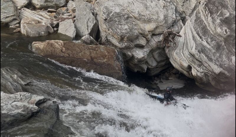
What used to be a portage for many is now a sweet sliding drop.
One of the best and least portagable rapids on the run. Down the left side is the way, fast and hard.
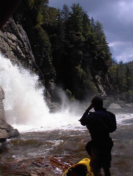
A great way to fall out of the Bob Ross gorge, I can't believe I don't have a picture. Its a low angle 15 foot slide with a hydro-esque hole at the bottom.
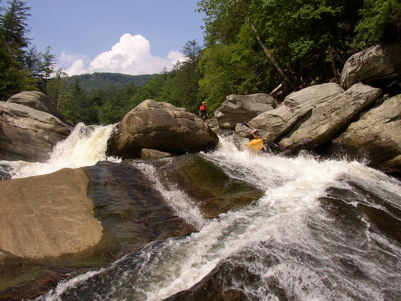
The longest and one of the best rapids on the run, this one is a little on the cardiovascular side of things.
Take out on river left right below Spence Ridge Rumble and at the new footbridge. The trail leads 1.7 miles and 800 feet up to the parking area.
Seldom run now, since the floods of '04 made it very dangerous. There is a sneak on the left. Though easier and safer, it is sketchy too.
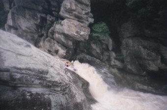
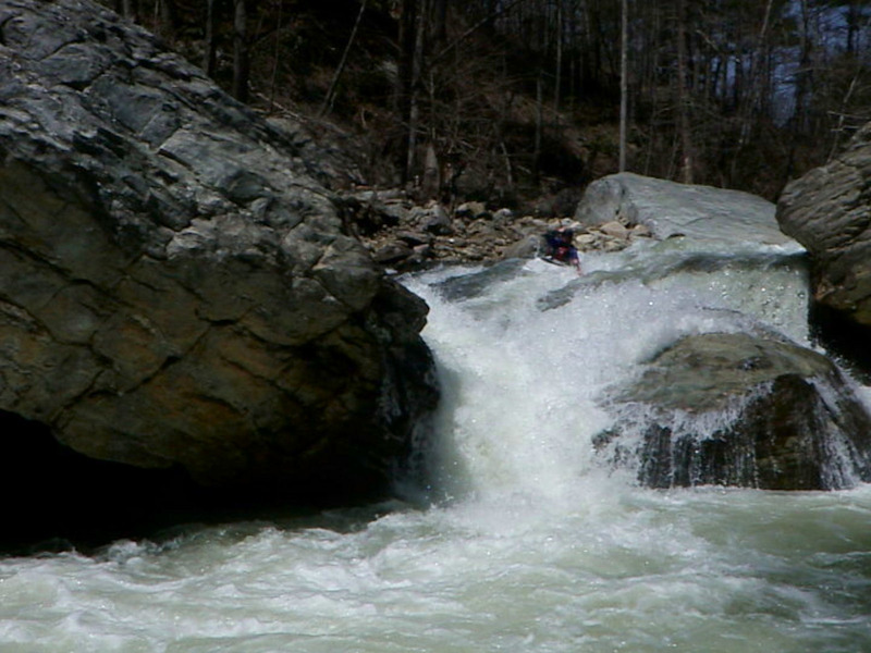
One of the best drops and the biggest one, this one is sweet and is in an other worldly setting.
Get out on the right after the scenic and long pool below Cathedral Gorge. Then hike the steepest mile of boat hiking in North Carolina.
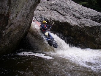
Just go far right and plop face first off this classic 10 foot spout into a deep pool.
Great rapid with an elongate boulder wall near the bottom on the right that shoots a wall of water back left and off a 6 foot drop. Watch for wood on this one.
1800 feet in 1.5 miles. That would be absolute misery with a boat. Hiking down would be horrible to. Paddle to the lake at this point.
Right when you see the Hwy 126 bridge a few hundred yards down, grab a big eddy on the right where the gauge is located.
May 18, 2025
Aug 4, 2023
depends who you ask… roughly speaking 2.0’-2.3’ is low (especially past Conley cove), 2.3’-2.6’ is medium fluff, stuff fills in (past Conley getting good), higher than 2.6’ & up is another gray area between good fluff and pushy, 2.8’-3.0’ is pretty stacked and the upper threshold for mere mortals. The Putin is about 6hrs ahead of this gauge at Lake James so today depending on the high country’s summer water table you’d get the gorge probably around 2.45’-2.7’.. perfect
Apr 5, 2017
This is Matt Kuckuk. I was in a group that ran the lower half of the gorge in April 1976, for what we believe was the first descent (exploratory) of that section. The group consisted of me (K1), Fred Young (C1), Mark Hall (C1), Harry House (C2), Bob Obst (C2), Dean Tomko (C1), and Mike Fentress (K1). As I remember we hiked in from the Wiseman Overlook trail and I remember seeing a formation called something like Raven's Rock or Raven's Head from the trail. We ran a lot of Cl 5 through huge boulder fields, no portages. One memorable drop that we scouted and ran, squeezed the water between a big midstream boulder and the right bank, making a sloping falls. Not sure how to line this run up with the descriptions of the sections here, just that we ran out the lower part of the gorge, probably the lower 1/3 to 1/2 after what we heard was an unsuccessful attempt to run the whole gorge by another party.
Jan 18, 2007
From Leland Davis:
Lat / Longitude from TopoZone.
Gradient, mile-by-mile, from Rte. 183 to Rte. 126: 144, 50, 80, 80, 90, 150, 170, 240, 180, 200, 180, 100, 80, 70, 30, 40, 30, and 10 feet in the last 0.55 miles.
That's right, boyzngurls: this baby's got 7 consecutive miles where the 100+ ft/mi gradient doesn't let up! In that stretch of the Linville Gorge, it drops 1220 feet, averaging 174 ft/mile! Ho-lee Fudd! You'd better have your dancin' shoes on!
The above mile-by-mile gradient assumes a putin at Rte. 183. A more realistic putin, as Leland describes below, is below the Falls; that takes 124 feet out of the first mile, leaving 20 feet in the first 0.35 miles. After that, the gradients are pretty much accurate.
Leland Davis' description of the run circa 2001, from his experience:
The putin is at the Falls, although we try to keep a fairly low profile there. The takeout is at the bridge just before the lake. Yes, it is as intense as the (gradient) numbers look. Levels should be 2.0 - 2.5 on the gauge just upstream of the takeout. I did it at 2.0
(Streamkeeper Note: This is the old level, this would be about 2.5 on the new gauge) and that seemed about perfect for me. The first 4 miles is class III with a couple bigger drops, the next 10 miles is class V+ in three gorges. The first reminded me of Vallecito in Colorado. The second gorge was reminiscent of California creeking through granite bedrock, and the third was pure gnarly Linville. After the third gorge there are a couple more miles of class V before the gnar lets up. There were only 1.5 rapids that didn't get run by someone in the group. I did 4 portages. Good fun down there--can't wait to get back!! We had a really strong group of 6 and it took us 7 hours (we did break for lunch). Trip and I are hoping to get it down to 4 hours once we know the lines a little better. Not a good place to get in trouble, though; it's a 2-mile, 2000-foot climb out in the few spots where there are trails instead of cliffs. Scenery is an A+.