Little (Eno trib)
Route 1461 (Johnson U.) to US Route 501
| Difficulty | I-IV |
| Length | 5.1 mi |
| Avg Gradient | n/a |
| Gauge | Little River at Sr1461 Near Orange Factory, Nc |
| Flow Rate as of 1 hour | -0.01 ftbelow recommended |
| Reach Info Last Updated | March 21, 2025 |
Says robert martin 2001-02-07 17:06:24
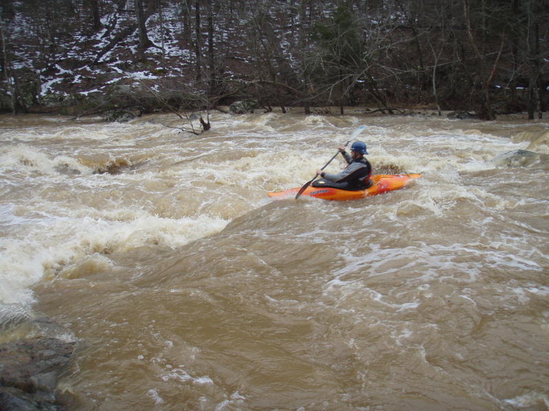
Here are some notes from Russ Condrey, a paddling legend. At 3.2' USGS it's like the Nantahala+, at 4.8' it's excellent, at 7.2' it's huge (Upper Gauley), at 10.4' it's scary.
Other notes from Russ: 2.0 is painfully low. 3.0' to 5.0' is a good level. 5.0' it gets pushy.
If you look on a map there are two possible put-ins above Johnson's Mill Road, one is on South Lowell rd. Before Hurricane Fran this was a good warm-up before the Micro-gorge below Johnson's Mill Rd. They have developed this area heavily, so you will be paddling through people's back yards. Due to the Eno River Society, areas of this unique river are being saved from developement and turned into a park. This river also harbors the Roanoke Bass, a spieces of fish that has become threatened in the last few years. They are locally know as 'red eyes'. They thrive in swift moving waters. What better fish could represent whitewater boaters.
robert martin 2000-10-16 12:48:27
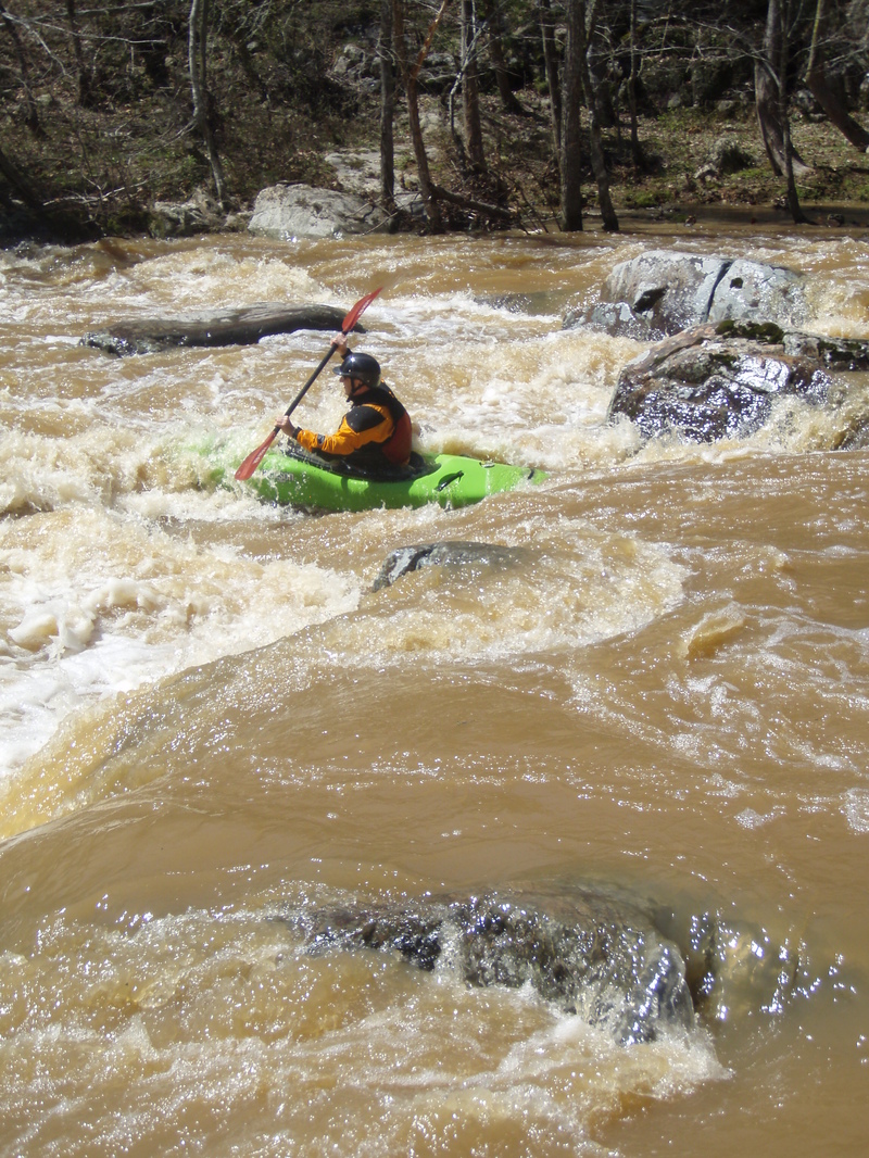
The most challenging 1/4 mile of whitewater on the Piedmont of North Carolina, no joke. It's like being on an Appalachian Creek! At high water it's class V!
Put in at Johnson's Mill Rd. and take out on Hwy 501. If you park at the takeout on the river right, upstream side of the bridge, DO NOT park in the grass, keep all 4 tires on the pavement. The land owner has complained about this.
Eddy left before the drop to scout. There is some manuevering leading up to the drop to reach the eddy. Peel out and run the drop curving left and watch for diagonal waves in the outflow. Some more manuevering needed just beyond the drop before things mellow out a bit.
Feb 1, 2025
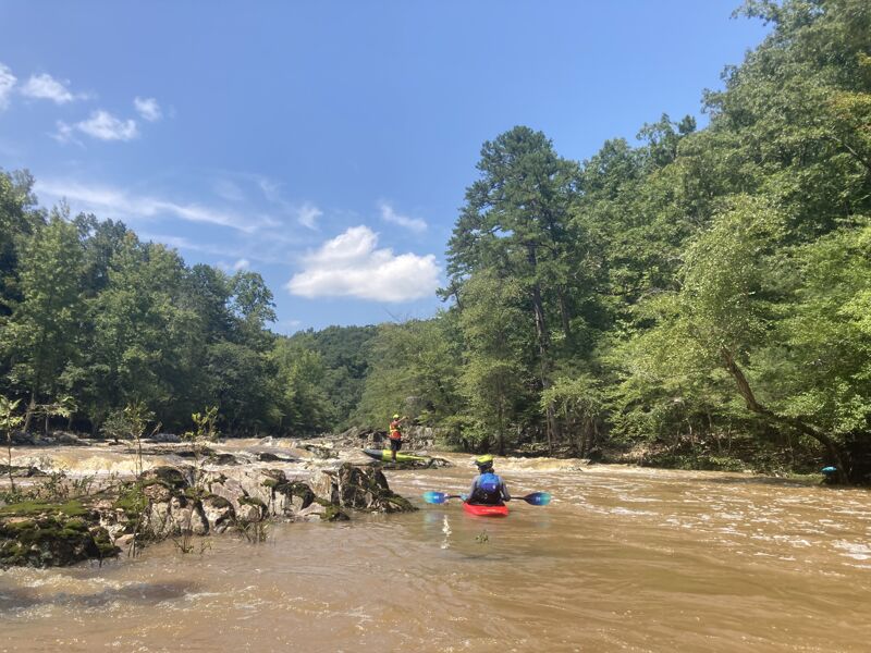
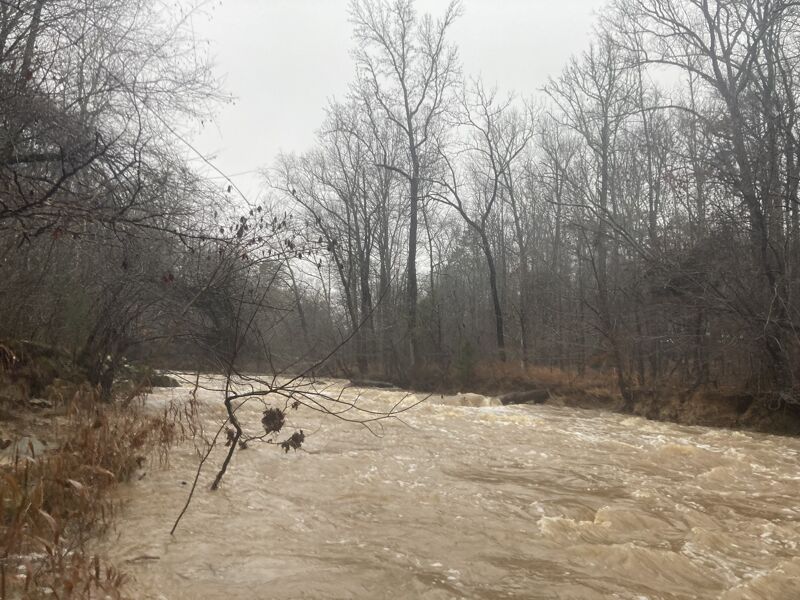
We paddled from the South Fork at Guess Rd to 501 with 2.5 ft on the gage putting on, jumping to 2.9 ft by the time we got off. There were a few places we scraped on the South Fork, but Russell Mill Ledge just before S Lowell Rd was runnable and no scraping once we reached the confluence with the North Fork. Some drops before the gorge had some surfable waves including a good wave about a mile and a half below the forks coming together. In the gorge, the rapids were a bit more difficult than my previous run at 3.4 ft due to having more rocks to dodge, but not as difficult as when I ran it before at 4.5 ft since current was mild. The first bigger drop at Swimming Hole rapid had some fun play on the bottom wave. Rapids leading to Fossil Rapid and the drop itself were a bit more technical, but not particularly difficult. For anyone wondering what would be too low, I would think about 2.5 ft would be a good minimum for the 'gorge' section and any lower would probably be too scrapey for fun, especially upstream of Johnson Mill Rd.
Aug 10, 2024
I had run this section before, but wanted to update that the level we ran this at is probably a good flow for a first timer not familiar with the run. It is not pushy, but not scrapey, allowing for proper boat scouting for wood and safe lines. I'd still recommend running this with someone familiar just so that you know where to scout. We started on the South Fork at Guess Rd and ran to 501 for take out. There are 3 spots where you'll want to scout, but we were able to do so from our boats. These were at the boof on the South Fork about a tenth of a mile above S Lowell Rd (36.149177, -78.949280), Swimming hole rapid (36.141226, -78.917474) and fossil rapid (36.139572, -78.916674). Level is just above scrapey and still fun. You can see the gradient for each of the drops. From the merging of the forks, there is a ton of flat water, but some really decent class II rapids scattered throughout with some surf opportunities and we didn't have problems eddy hopping down once we got to the gorge. We didn't have to portage anything, but keep an eye out for wood since there is always a chance that it'll be there.