Little (Eno trib)
Route 1461 (Johnson U.) to US Route 501
Feb 1, 2025
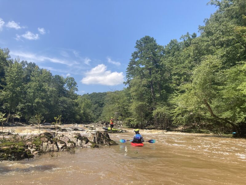
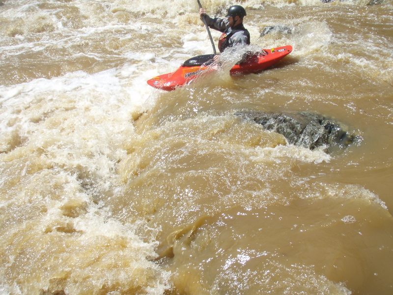
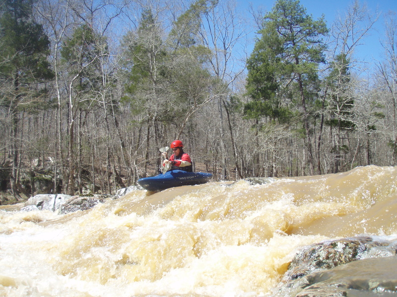
We paddled from the South Fork at Guess Rd to 501 with 2.5 ft on the gage putting on, jumping to 2.9 ft by the time we got off. There were a few places we scraped on the South Fork, but Russell Mill Ledge just before S Lowell Rd was runnable and no scraping once we reached the confluence with the North Fork. Some drops before the gorge had some surfable waves including a good wave about a mile and a half below the forks coming together. In the gorge, the rapids were a bit more difficult than my previous run at 3.4 ft due to having more rocks to dodge, but not as difficult as when I ran it before at 4.5 ft since current was mild. The first bigger drop at Swimming Hole rapid had some fun play on the bottom wave. Rapids leading to Fossil Rapid and the drop itself were a bit more technical, but not particularly difficult. For anyone wondering what would be too low, I would think about 2.5 ft would be a good minimum for the 'gorge' section and any lower would probably be too scrapey for fun, especially upstream of Johnson Mill Rd.
Aug 10, 2024
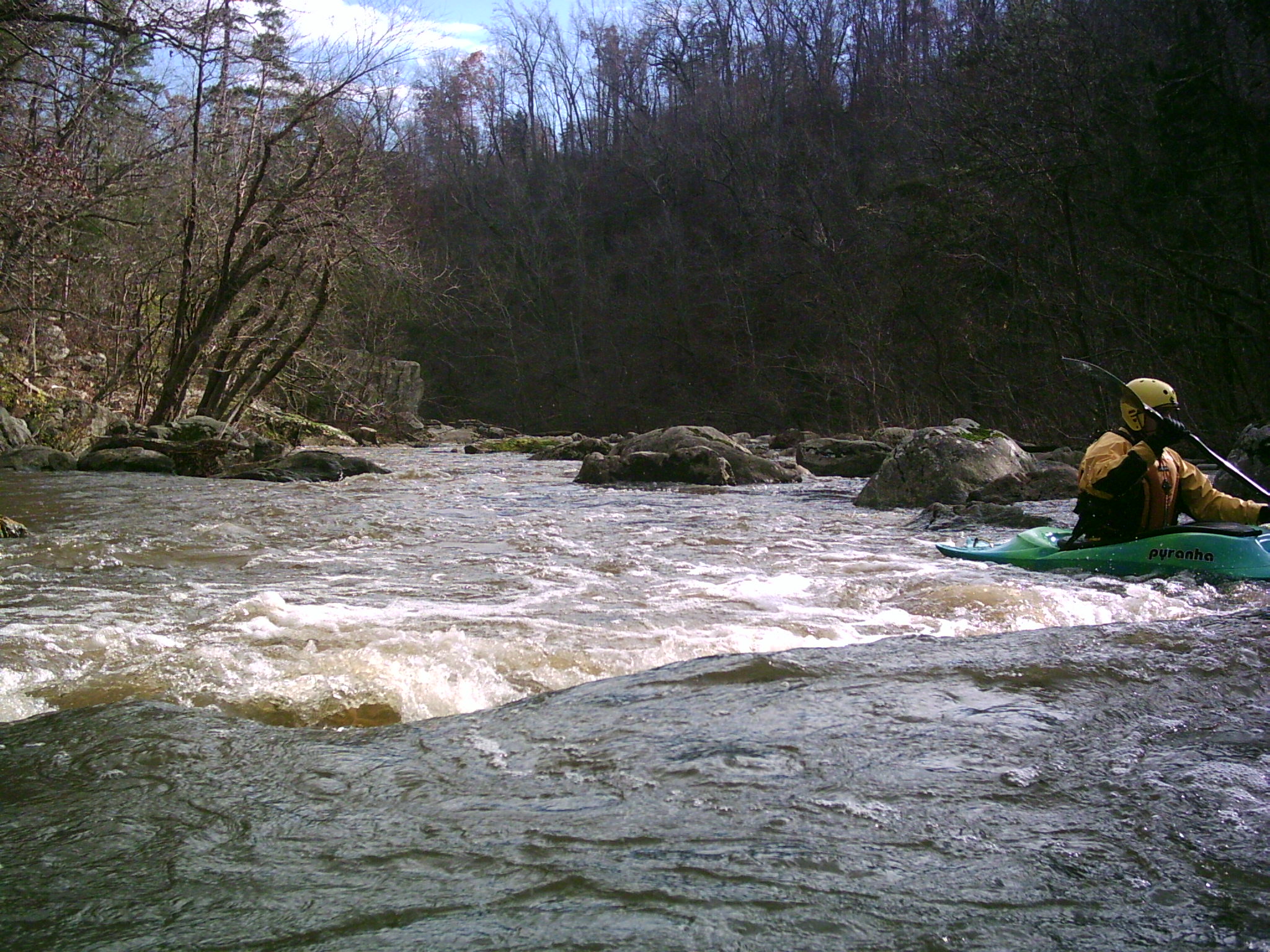
I had run this section before, but wanted to update that the level we ran this at is probably a good flow for a first timer not familiar with the run. It is not pushy, but not scrapey, allowing for proper boat scouting for wood and safe lines. I'd still recommend running this with someone familiar just so that you know where to scout. We started on the South Fork at Guess Rd and ran to 501 for take out. There are 3 spots where you'll want to scout, but we were able to do so from our boats. These were at the boof on the South Fork about a tenth of a mile above S Lowell Rd (36.149177, -78.949280), Swimming hole rapid (36.141226, -78.917474) and fossil rapid (36.139572, -78.916674). Level is just above scrapey and still fun. You can see the gradient for each of the drops. From the merging of the forks, there is a ton of flat water, but some really decent class II rapids scattered throughout with some surf opportunities and we didn't have problems eddy hopping down once we got to the gorge. We didn't have to portage anything, but keep an eye out for wood since there is always a chance that it'll be there.
Dec 28, 2023
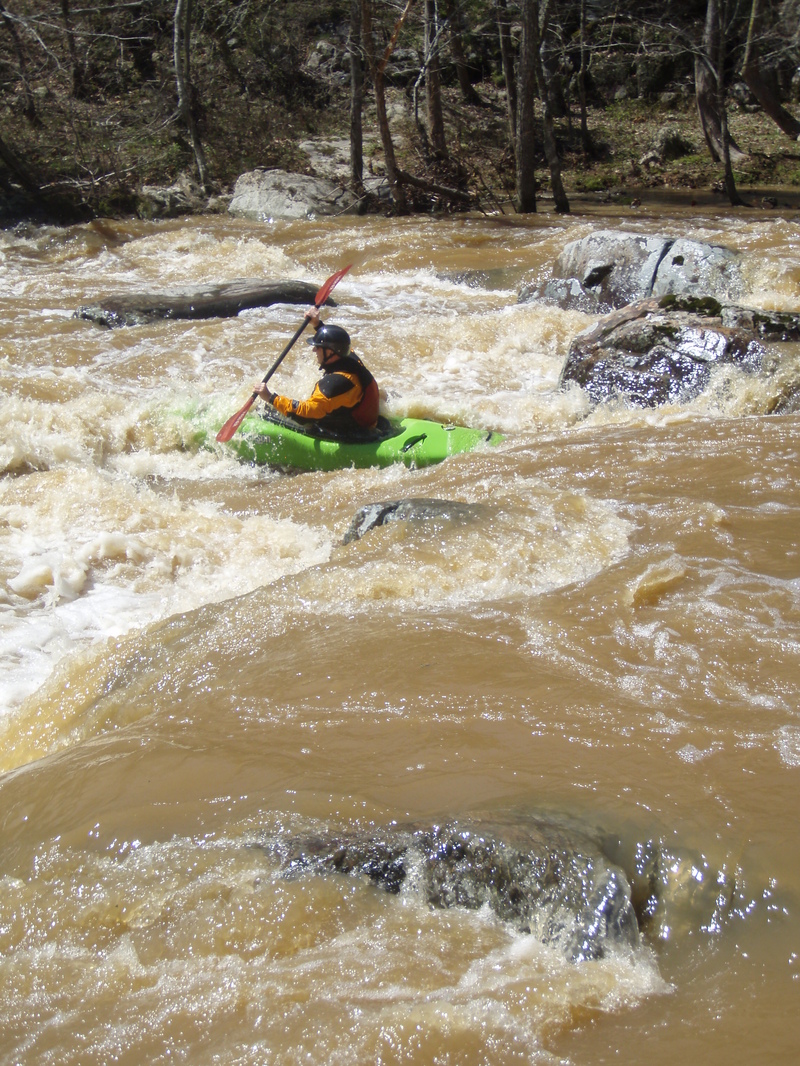
I explored from the South Fork off Guess Rd and then continued into the gorge. There's a neat 5-6 ft vertical drop about a mile below Guess Rd just before S Lowell Rd that used to be a dam. I don't think the level I ran was considered high necessarily, but for those curious, at 4.5 ft, this was definitely the biggest rapids I've run in the triangle, but still fun in the gorge section.
May 1, 2017
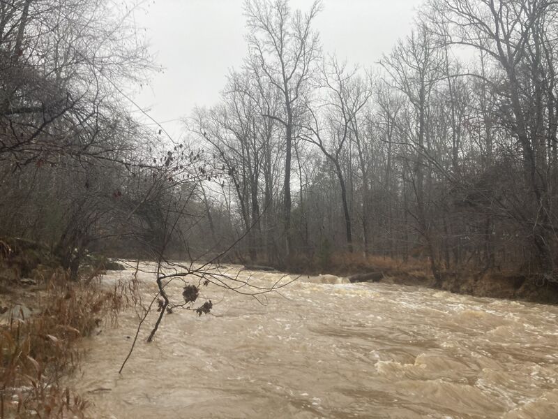
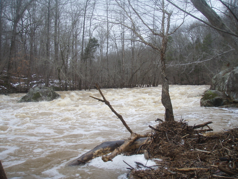
I was a little skeptical that anything in this area could be comparable to the Upper Gauley but we paddled this on 4/25/17 at 9.5ft, and this run at this high flood stage level is legit! The Upper Gauley comparison is accurate and definitely scary with how high the water gets up in the trees. By far the most fun you can have kayaking in Durham if you are up to it! But be aware that there are no eddies and a swim at this flow would be very bad!
May 3, 2011
Little at about 5 ft on nice COLD december day- greta flow!
May 3, 2011
Eric running Little at about 5ft in the snow- great flow and most scenic triangle run
Mar 24, 2011
It is possible to run the gorge and carry back to the put-in. There is a goat trail on river left, at the last rapid with the rock wall on the right, that leads you up along the ridge back to Johnson Mill Rd. I have done it once. It's about a twenty minute hike. Not particularly enjoyable but very doable.
Actually, the trail is on river right and you can access it after the bottom of the second big drop from the big eddy. It is a fairly straight forward hike back up the river with some houses on your left. If the river is running really high, the trail will be under water. It is not uncommon for local boaters to get in a bunch of laps without even going to the take-out!
Dec 10, 2010
First large rapid on Little at about 5 ft. Notice wood pile, it was helpful at catching our swimmer's boat that day. About 30 degrees, cold water- sounds like a good day to swim, eh?
Jul 20, 2010
This run is not 1.5 miles if you put in from South Lowell Road. There are two put-ins. One is Johnston Mills Rd and from that bridge to the takeout may be about 1.5 miles. However if you put in from South Lowell Rd, the trip is more like 5 or 6 miles. The best rapids were after Johnston Mills Rd, but the first stretch is worthwhile if the river is running above 3 feet.
Mar 29, 2009
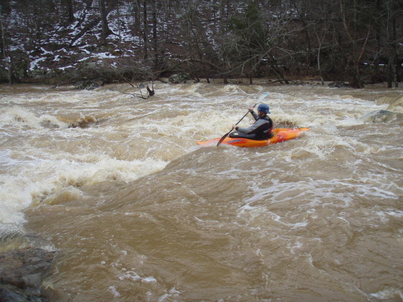
Little at about 4.5 ft on COLD december day
Mar 29, 2009
Brad on river left boof on Littel at about 4.5 ft.
Mar 17, 2007
There are several nasty strainers on this river. Be careful.
Sep 19, 2004
Here is the deal on the permits required to run the Little. (OK, they are't strictly required to run it, but they are required to use the lake for the takeout. I pity the fool who would try to take out without going over the lake).
The permits are $5 and are good for one year. You can get them from the boathouse by turning right onto Orange Factory Road from 501N then turning right into the boat house once you've crossed the lake.
Here is the official website http://www.ci.durham.nc.us/departments/parks/lakes.cfm
The best shuttle is to turn right out of the takeout area, turn right on Preston Andrews Rd., then right onto Johnston Mill Rd. Parking is not allowed at the bridge, so you'll have to move your vehicles up the road a ways once you've unloaded your boats.
Oct 28, 2002
One thing to keep in mind about this
run is that walking things can be
difficult. The trails beside the river,
where there are any, are sparse and
badly overgrown. Scouting, if you need
to, is pretty rough is places too.
Also, a lot of the rapids are some
weird kind of carved boulder jumbles,
so the lines are pretty technical.