Anthony Kill
Coons Crossing to the Hudson (Tenandeho Section)(Tenandeho)
| Difficulty | II |
| Length | 4.7 mi |
| Avg Gradient | n/a |
| Gauge | Glowegee Creek at West Milton Ny |
| Flow Rate as of 1 hour | 5 cfsbelow recommended |
| Reach Info Last Updated | March 22, 2018 |
This creek is officially named the Anthony Kill, but is known to many as Tenandeho Creek. It has a very short runnable season during the spring, during which it is a class II run with several named rapids. With heavy rain or snowmelt it can reach a surprisingly difficult class III, but it does not hold water long. It can be paddled in the early summer after a heavy rain but will usually be class I and very scratchy.
The put-in for the whitewater section is at Coons Crossing Rd in Mechanicville, NY. Public parking is available and it is an easy launch into the water. There is an alternative put-in at the DEC dock and boat launch on the west side of Round Lake along Highway 9. This adds about 3 to 3.5 miles of scenic flat water (and lots of tree falls to scramble over/around). Watch for the bald eagles nesting around the southern edge of the lake.
The take-out is at the public mooring area on the Hudson River in Mechanicville. This is on the river left side of the Tenandeho at the confluence with the Hudson. The total paddle is about 4.75 miles from Coons Crossing.
The opening mile of the run will bring you through a rock garden that is a nice warm up. The first named rapid is Roundhouse at mile 1.8 where a small island splits the creek. Do not go left. The main flow goes right, but there is a channel left of the island. Left is sometimes runnable but most often is choked with wood that can't be seen from above. From Roundhouse will be a mile of mostly flat water before you enter Mechanicville where things will pick up.
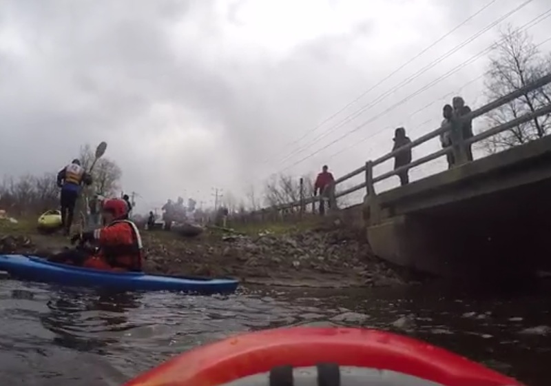
Mechanicville itself features concrete walls which amplify waves as well as a large number of blind 90 degree bends. There are also three named rapids. The first is The Apartments, a long section of class II water. The second is called Downtown, and features large wave trains and two hard turns. The last is the final drop into the Hudson River. Beware, if you swim in Mechanicville the concret
...
A developed boat ramp has been constructed on the west side of Round Lake where highway 9 comes close to the lake. There are lots of parking spots. Adds about 3 to 3.5 miles of scenic flat water (and lots of tree falls to scramble over/around). Watch for the bald eagles nesting along the southern edge of the lake.
There are a few parking spots in a gravel area next to the train tracks. If you can easily fit under the bridge, the flow is low. If you have to lean back to fit, the water is medium. If you don't fit under the bridge, the water is high.
After the put-in will be 1.5 miles of twisty flatwater, riffles, and rock dodging. There are often downed trees and strainers.
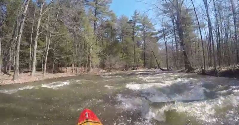
The opening of this run is fairly mild, but there is a small rock garden section which can be a nice warmup.
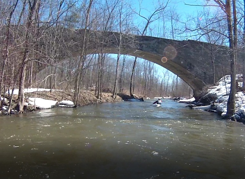
This old arched bridge signals the beginning of the Roundhouse Rapids section. The creek will begin to pick up as you come around a bend up ahead.
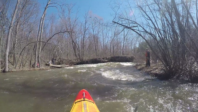
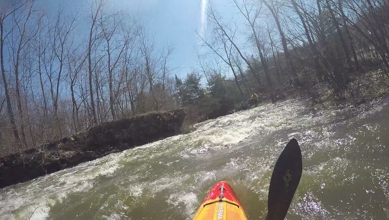
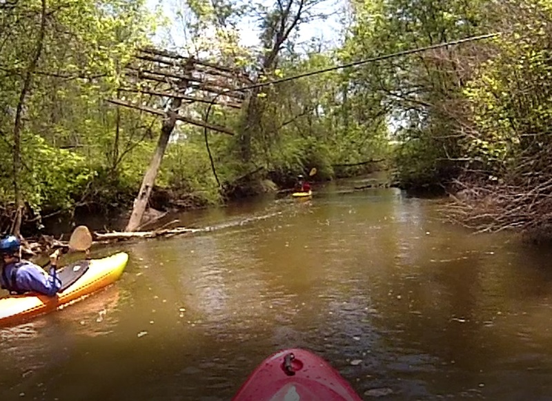
You will paddle through some choppy water around bend and under power lines. You will see a small island ahead that has two paths around it. The first you notice continues off at about 45 degrees to the left. The 2nd path, a 90 degree turn to river right, will come into view when you are almost on top of it. Go Right! At first you might not even see the right-hand channel, but that is where the main flow is. The left channel is sometimes runnable, but it is very shallow and usually choked with wood that you can't see from above. Unless you have scouted left and have high flows, Go Right.
This rapid can be tricky. The current will try to push you into the island in front of you and the main drop happens as you are executing a 90 degree turn to river right. Most people 'cut the corner' to avoid turning perpedicular to the creek flow. Immediately after taking your hard right, you must take a hard left over a smaller drop. You will then pass through some choppy class II water down to where the left channel joins back into the main creek flow. The rapid ends as you come within site of route 67.
After a mile of mostly flat water you will pass an old powerpole that is sinking into the creek. This is the halfway point between Roundhouse and The Apartments. The water will begin to pick up from here and become a steady class I-II as you enter Mechanicville.
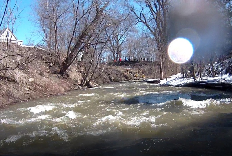
You will pass under Vial Ave Bridge (arched bridge with a chain link fence on top). This marks the start of a long section of class II water know as The Apartments. You'll come around a left-hand turn, under a pedestrian bridge, then around a right-hand bend after which the water becomes calmer.
This section changed significantly between 2015 and 2017 when Mechanicville's downtown area underwent reconstruction. Much of this stretch used to be inside a tunnel, but is now open to the sky and easily scoutable from Main Street.
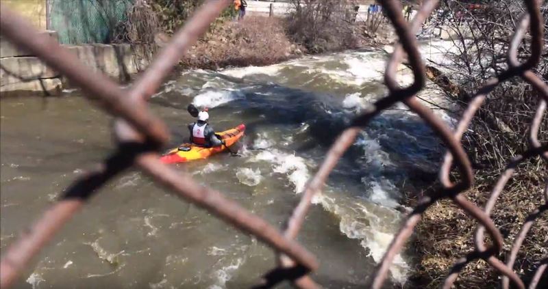
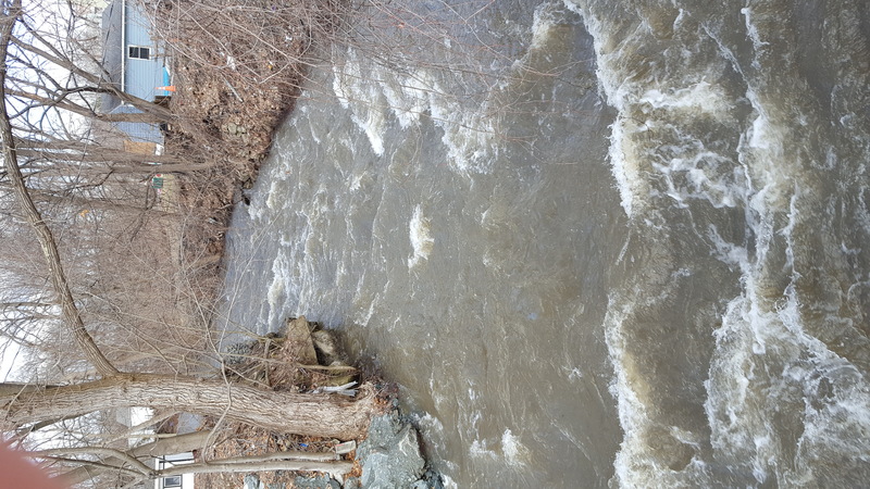
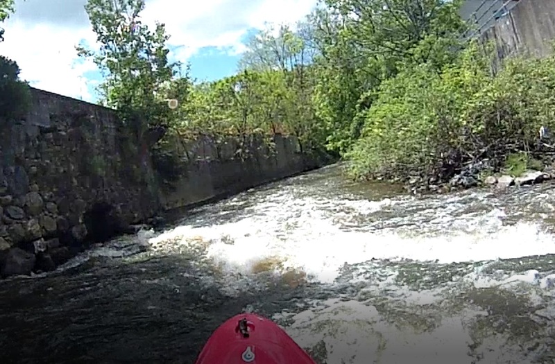
The Downtown rapids is a long run of class II+ water through the heart of Mechanicville. The difficulty varies widely depending on water level. The creek is surrounded by concrete walls which amplify waves and put them at odd angles. As a result, this section can be class I+ at low levels, up to class III and probably the biggest water of the course at higher flows.
You will come into a section of choppy water and wave trains at the start of Downtown. Because of the sheer walls and lack of boulders there are few, if any, places to stop.
A short way in you will see a large concrete wall directly ahead, and the creek will make a 90 degree turn to the right. After this turn will be a number of smaller bends, and one river-wide ledge that can form an impressive hole at most levels. The downtown section ends when you pass under the N. Main St bridge. A very large wave will form directly underneath this bridge when the water is high. If you go out of your boat here be prepared to swim all the way to the Hudson.
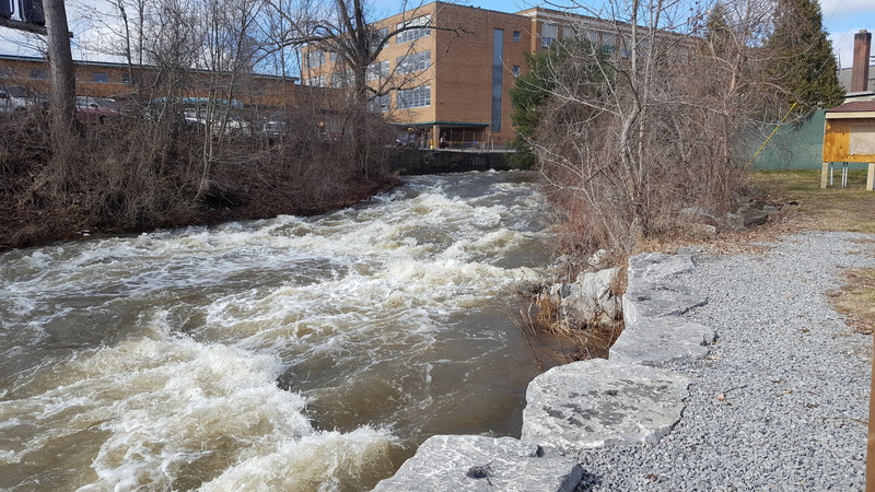
After passing the N. Main St. Bridge you'll come around a left bend and see the final rapid. It is a short series of ledges that might be called class II+ or even III at some flows.
At lower levels there is a line down the entire thing on the extreme river-right edge. You'll be practically against the right-hand shore until the last ledge where you'll want move center-right or center-left.
At higher levels the center or left paths can open up, but there will be several holes as well so pick your line carefully. The rapid can be easily scouted from the take-out.
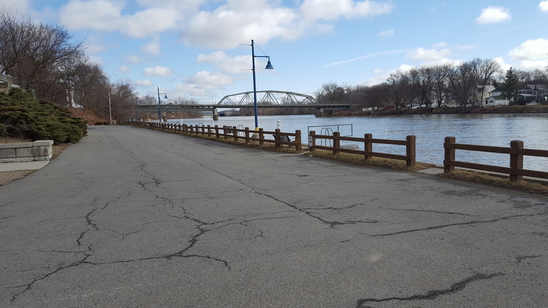
The public mooring area is on river left of the Tenandeho at its confluence with the Hudson. There is public parking.
Apr 11, 2017
Parking and access at the takeout on the Hudson River, river left of the final rapid. There is a gate across the road that leads into this area, but no one has ever seen it closed since there are occupied apartments down this road as well.
Apr 11, 2017
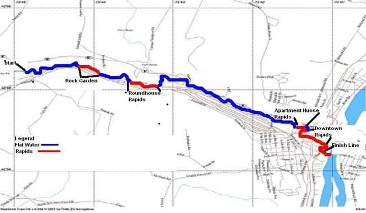
A map of the Tenandeho Section, put together by the organizers of the Annual Tenandeho Whitewater Derby
Apr 2, 2017
After taking the right bend at roundhouse you'll need to make an immediate left up ahead.