Anthony Kill
Coons Crossing to the Hudson (Tenandeho Section)(Tenandeho)
Apr 11, 2017
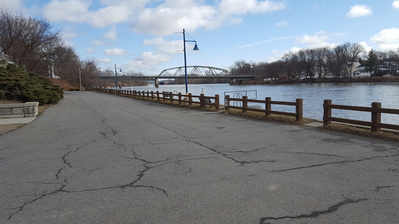
Parking and access at the takeout on the Hudson River, river left of the final rapid. There is a gate across the road that leads into this area, but no one has ever seen it closed since there are occupied apartments down this road as well.
Apr 11, 2017
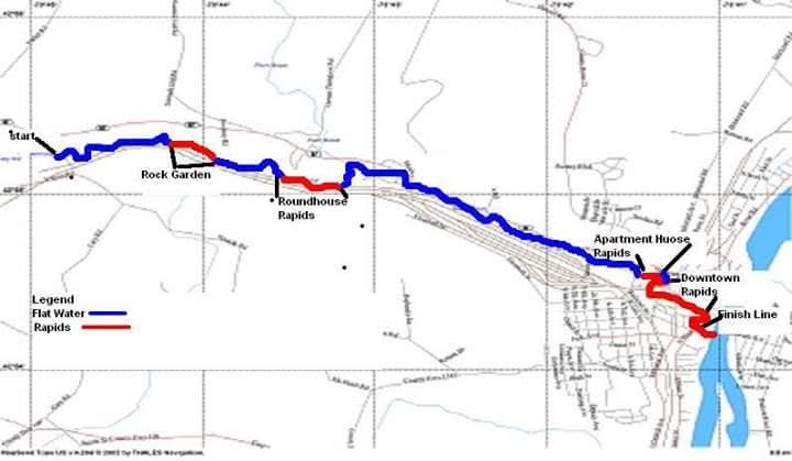
A map of the Tenandeho Section, put together by the organizers of the Annual Tenandeho Whitewater Derby
Apr 2, 2017
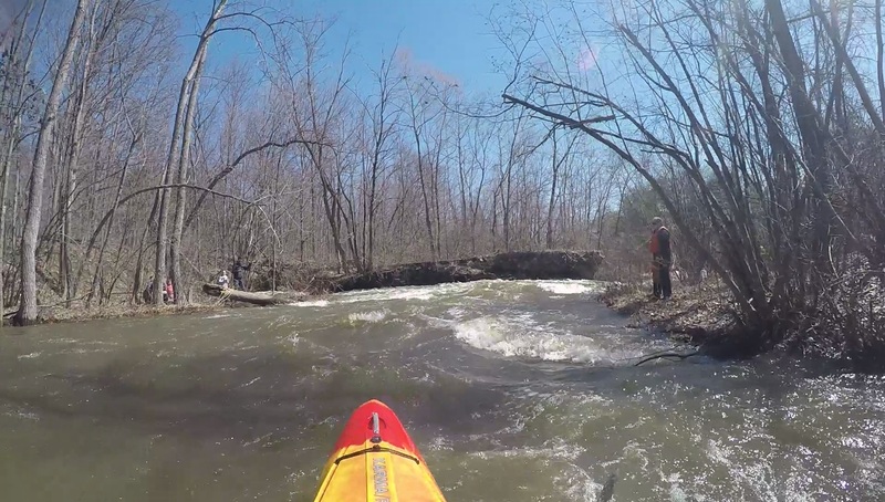
The approach to roundhouse. Always go right unless you've scouted the left channel.
Apr 2, 2017
A view of the last drop into the Hudson taken from below the rapid. Photo taken at high (but runnable) water.
Apr 2, 2017
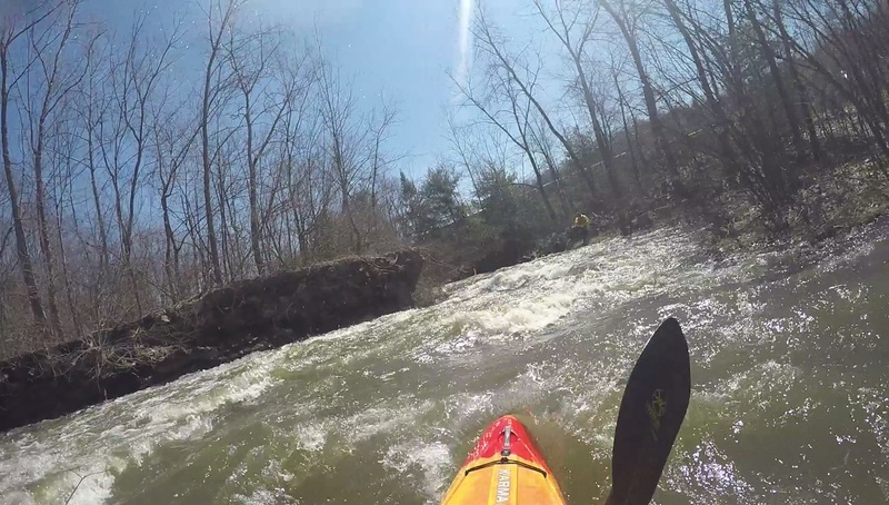
After taking the right bend at roundhouse you'll need to make an immediate left up ahead.
Apr 2, 2017
Photo taken above the rapid The drop into the Hudson River. Most consistent path is on the extreme river right edge. At high flows other lines will open up, center being the most common. If you take the river-right chute you will need to move center-right or center for the final ledge.
Apr 2, 2017
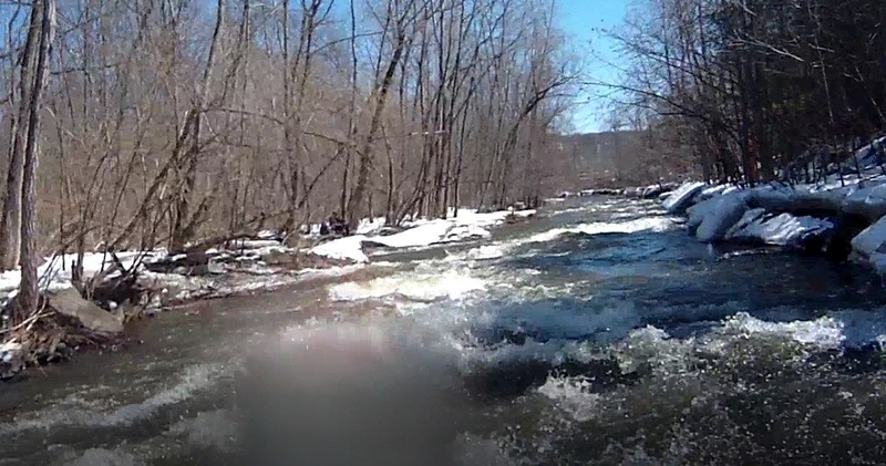
A small rock garden gives you a warmup right around mile .75 or mile 1.
Apr 2, 2017
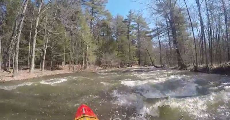
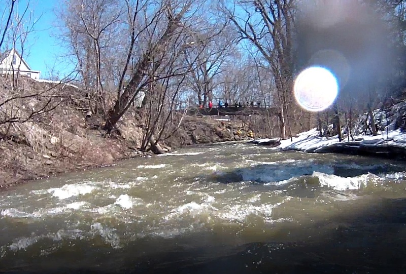
Photo looking upstream shows the start of the Downtown Rapids. Around the 90 degree turn beneath where this photo is taken, water will become very choppy. At high levels this section can create unexpectedly huge waves.
Mar 28, 2017
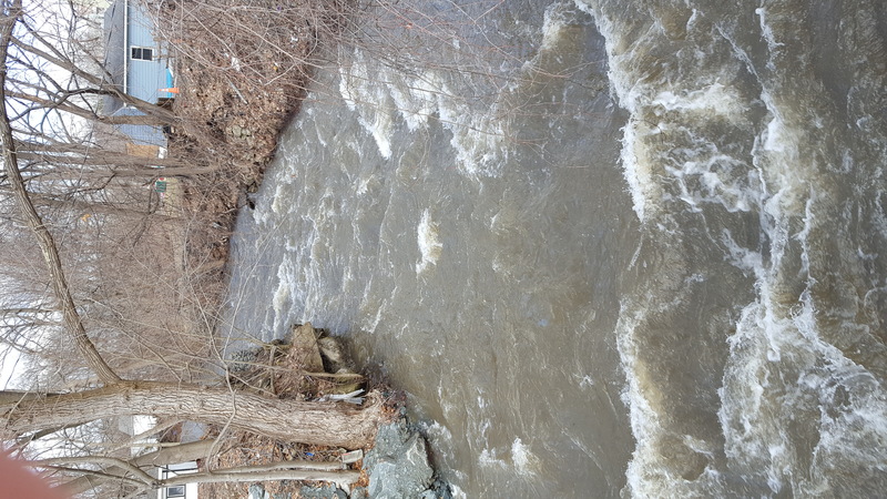
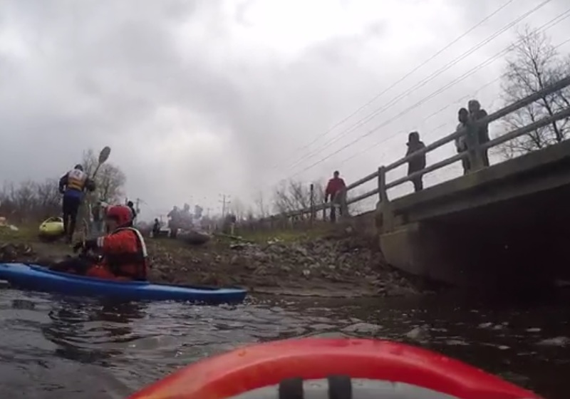
The putin at Coons Crossing Rd. The bridge works like a gauge. If you can paddle underneath without ducking much, run is probably class I If you need to duck a lot, water is probably class II. If you can't fit under the bridge, water is II+ or III.
Mar 28, 2017
The bend at Highway 67 marks 2 miles from the put-in.
Mar 29, 2015
Photo taken at fairly low water. After taking a hard right and hard left you have a stretch of choppy water before coming alongside the highway.
Mar 29, 2015
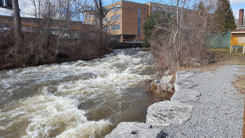
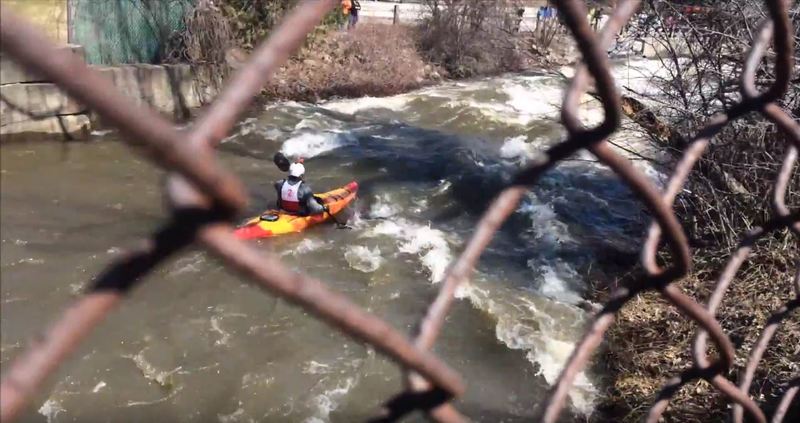
This bridge with chain link on top marks the start of The Apartments rapids, a fairly long section of class II water.
Mar 29, 2015
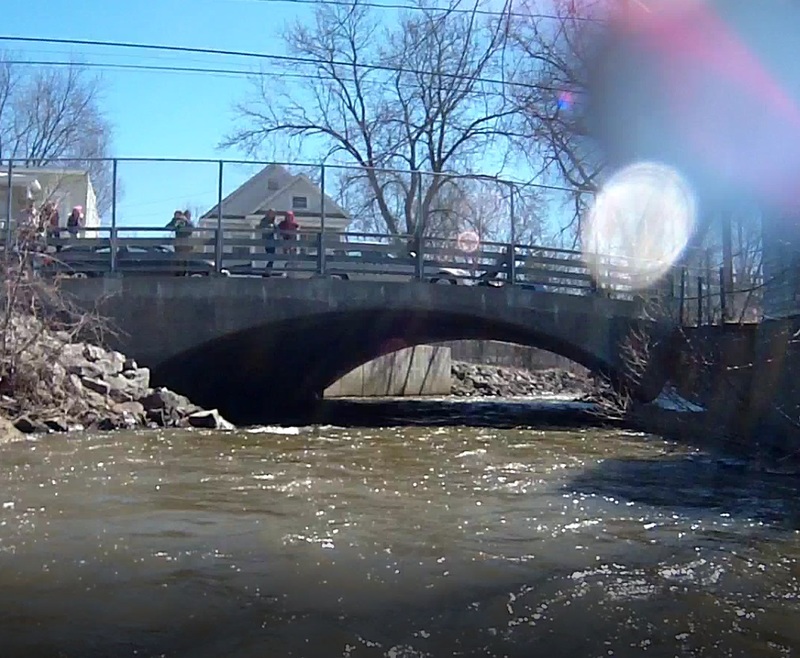
The main put-in for this section, picture taken at low water. The bridge here acts like a gauge. If you can easily paddle under it, the water is low. If you need to duck a moderate amount, water is medium. If you need to press yourself to the deck, or can't fit under the bridge at all, water is high.
Mar 29, 2015
Photo taken at fairly low water. This is midway through The Apartments rapids. You will pass under a pedestrian bridge then travel around a few bends in the creek before reaching calmer waters.
Mar 29, 2015
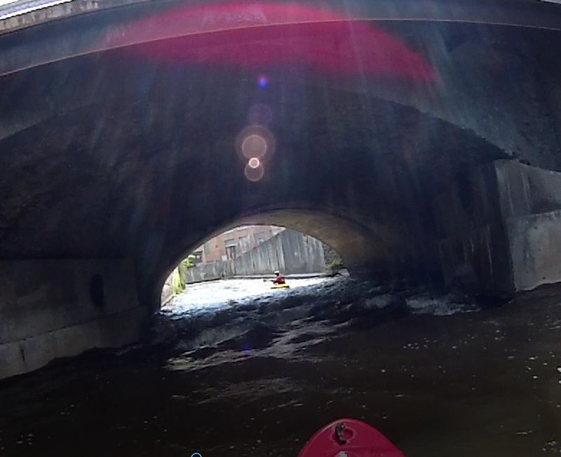
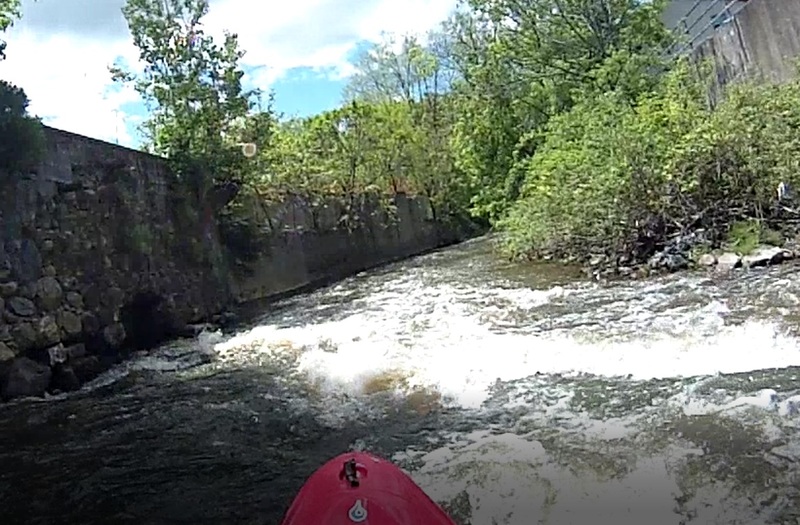
Photo taken at fairly low water. The Main St. Overpass marks the end of Downtown rapids and the beginning of the last drop into the Hudson River. At most water levels a large wave forms under this bridge. Note the concrete walls ahead. If you swim here you will likely swim all the way to the Hudson.
Mar 29, 2015
Photo taken at fairly low water. The drop into the Hudson starts around this bend. Line varies based on year and water level, but most of the time there is a chute on the extreme river right side. Watch out for strainers.
Mar 29, 2015
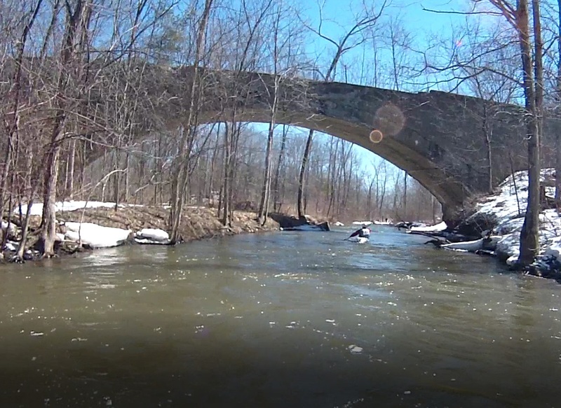
This bridge marks the start of the roundhouse rapids section. The water will pick up around a bend up ahead, then bring you into roundhouse proper.
Mar 29, 2015
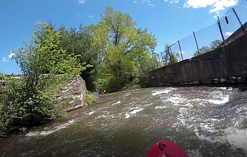
Photo taken at fairly low water. After coming around the first bend of Downtown you will hit a stretch of choppy water. The concrete walls will create waves at opposing angles when water is high. At low level (as in photo) there are few, if any, waves.
May 19, 2014
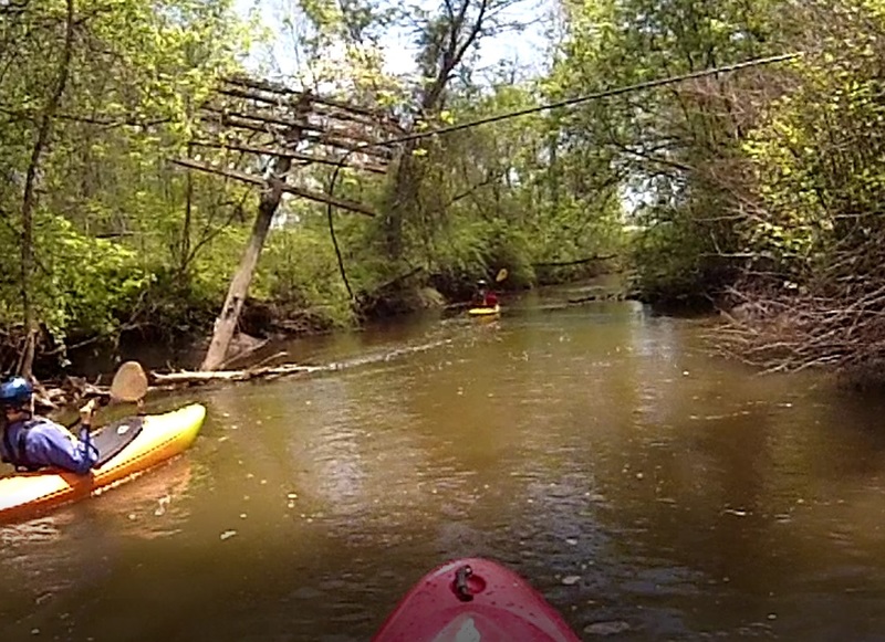
This sunken power pole marks mile 2.75 and the halfway point between Roundhouse and The Apartments. Water usually begins picking up from here.