Klamath
06. K’utárawáx·u / Grizzly Hill Access to K’účasčas / Fall Creek Access(K’íka·c’é·ki Canyon)
Nov 30, 2025
Sweep boaters looking to up their game will find this section to be a moderate step-up from other popular sweep boat runs in the region.
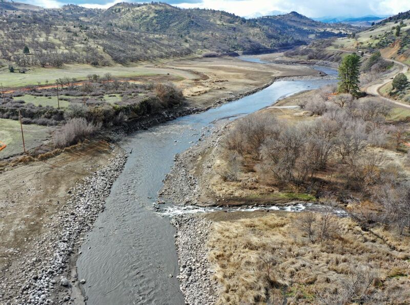
1040 CFS was ideal, but not without unnecessary drama at Forgotten Forest / Wild Horse / Bogus Bend.
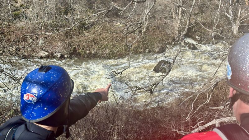
Beware medium hanging tree limbs that offer a unique challenge to sweep boat drivers at their elevated height of choice.
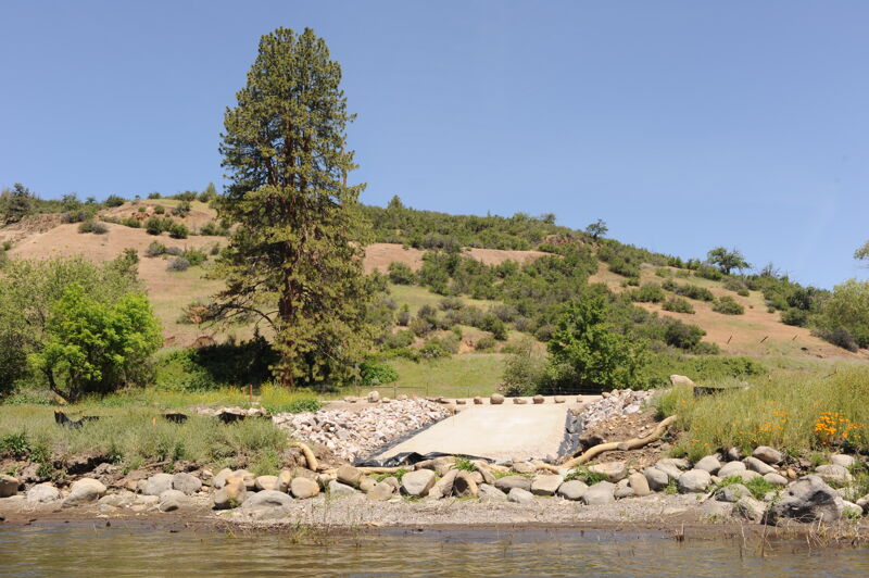
The newly developed access points at Grizzly Hill and Fall Creek are excellent for unloading and loading sweep boats.
Jul 10, 2025
We put in at Access 1 since the access at the entrance to the canyon was under construction. The six miles of class I/II had no real rapids but a steady current which helped us cover the distance in a little over 1.5 hours.
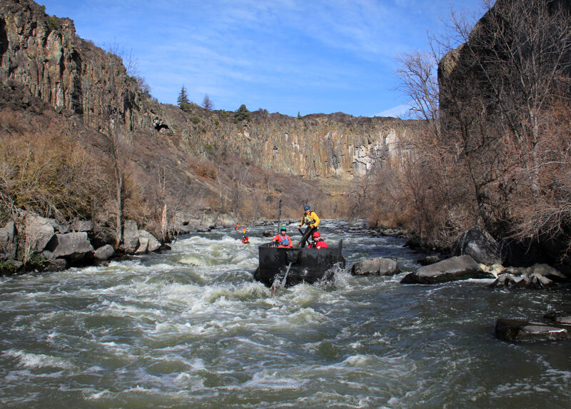
Once in K’íka·c’é·ki Canyon the river changed character instantly and the flow (1200cfs) suddenly seemed a medium flow with a bit of push to it. Overall the flow seems on the low end of medium. I think under 1000 it would be ok but start to get a little manky in some of the rapids.
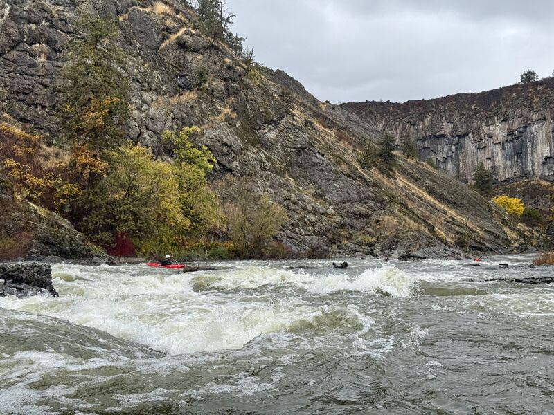
The rapids were mostly class III but often hard to see the end from the beginning, so hard to recognize when they were a little bit harder (class IV). Scouting was OK but some were a little challenging due to brush/canyon walls. Some rapids were solid IV and the final drop on K’íka·c’é·ki Falls borders on class V at these flows.
Overall it was some really good whitewater in a super cool canyon that we were all really happy to get on.
Jul 7, 2025
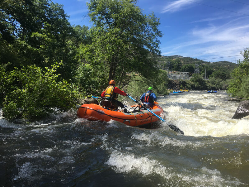
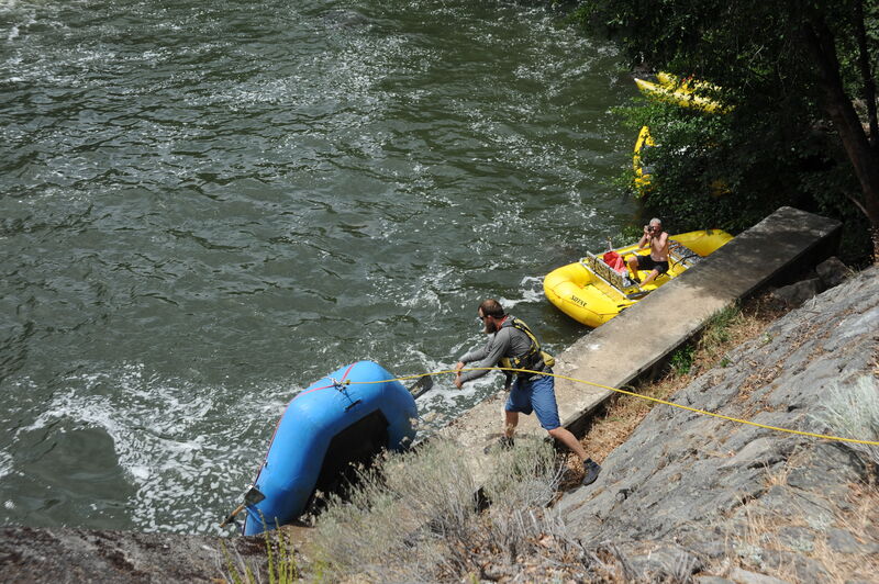
We ran Kikaceki Canyon on 7/2/2025 at 1100 cfs (Iron Gate Gage) and found ourselves in over our heads. We estimated a ~1 hour trip through the canyon and ended up being in there for about 5 hours, with scouting, raft pins, and eventual lining of rafts through 2 rapids. We've all played with class IV before, but were all a bit rusty, so the early mishaps and river conditions made us extra cautious and led us to choose lining rafts. 2 oar rafts with no paddle support.
The early dam site section was great. Really cool piece of history to witness as we floated through. Several fun smaller rapids were easy enough to navigate.
At a big right-hand bend, we reached Rapid 4 (I think), with the big ledge drop on the left. We tried to push the right line hard, but the laterals forced us left and the hole sucked us right in, dumping a passenger who was fortunately recovered quickly. The second raft tried to get even further right, but also got sucked into the hole. That raft got pinned on some rocksdownstream and took about an hour to recover. You need momentum here! A full load of paddlers might be able to punch the hole, but at this flow, it is very very sticky!
Rapid 5 was full of wood, including in the big chute at the bottom. Given our recent mishaps at #4, we decided to line our rafts through on the right. Another hour gone...
Rapid 6 was our minor redemption and was a fun time. Reminiscent of House Rock on the Grand Canyon, if only because it's a big yard-on-the-sticks-to-the-right kind of rapid.
And finally, Kikaceki Falls. At this point, it was late and we were pretty beat. All that notwithstanding, this rapid looked scary. From our perspective, there is a right line only at the top. Full of nearly exposed rocks, so plenty of chances to get spun around in there. The entrance leads right into three consecutive, almost channel-spanning holes, and more rocks downstream. In all likelihood, we probably could have ran this and been OK, but the margin of error was slim, and swimming through multiple big holes and rocks was not sounding great. So, we lined through again.
The canyon is beautiful, and part of me wants to go back, maybe with a bigger group, better rafts for the run, and better flows. I'm not sure what the sweet spot is, but for us, this flow is too low!
May 15, 2025
Apr 17, 2025
In kayaks, we ran from access one to iron gate on Wednesday Apr 17 2025 at significantly higher flows than we had seen it. This is solid class V at this flow and I would not recommend it. 1: there is an obvious large breaking hole at the top. past the horizon line is a very large ledgy hole that will flip a raft easily. sneak far left or push it and get right.
2: Joyous long wave train with two large breaking wave holes in the center. keep right and smile. look for a large eddy on the right to park and set up for 3,4 and 5 which must be run consecutivley.
3: chaotic breaking waves and extremely fast current. trees in the water along the banks. do not attempt to take the eddy at the bottom left as you will not be able to make the ferry to survive 4. the bottom of 3 has a strainer/ pourover on the left and a big breaker directly across. thread the needle and start moving right hard.
4: 3 of the largest holes and hydraulics are on the left side of this rapid. go right of flip your boat for sure.
5: cannot be scouted. trees and blackberries line the bank of this swift rapid. start right and get center for the right hand corner. large features on either side and lots of wood along the banks.
6. Immediatly after the basalt pallasaides is the last half mile. there are no eddys and the current is swift. enter far left inside the corner and get center. The river carved ou a 100' obelisk and there is a cave which the river forces water into a seam im dubbing the 'thing'. large boils and the thing feeds a massive breaking wave. massive. pass on the right and breathe through a fast section of green waves before the falls.
7: get far far left for the entrance to the falls. use the typewriter move on the obvious large lateral to catapult right of the 'turbine' hole at the powerhouse. this wave hole is an absolute monster and may be the most narrow secion of the canyon.
Jan 11, 2025
Ryan Allred, Kyle Allred and I kayaked the full 16 miles as described in previous reports through the former Copco and Iron Gate reservoir beds, and the beautiful K’íka·c’é·ki Canyon / Wards Canyon in between at 2100 CFS at the Iron Gate gauge. Prior descriptions were extremely helpful but wanted to add that at double the water of those descriptions I would say that everything was significantly more sporting. I would compare it to the classic Upper K run at somewhere closer to 2 guns than 1. In particular rapids 3 and 4 were definitely one rapid with several holes with raft flipping potential, primarily on the left. And the final rapid, K’íka·c’é·ki Falls, I would rate class 5 at this level. The hole at the bottom spanned most of the river and wasn't forgiving middle or right. Definitely punchable far left, but would require a strong right to left ferry above through some strong currents. We chose to portage given the air and water temperature and our off-the-couch status.
Nov 1, 2024
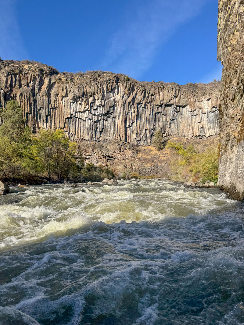
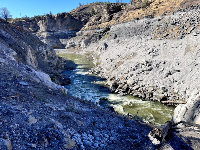
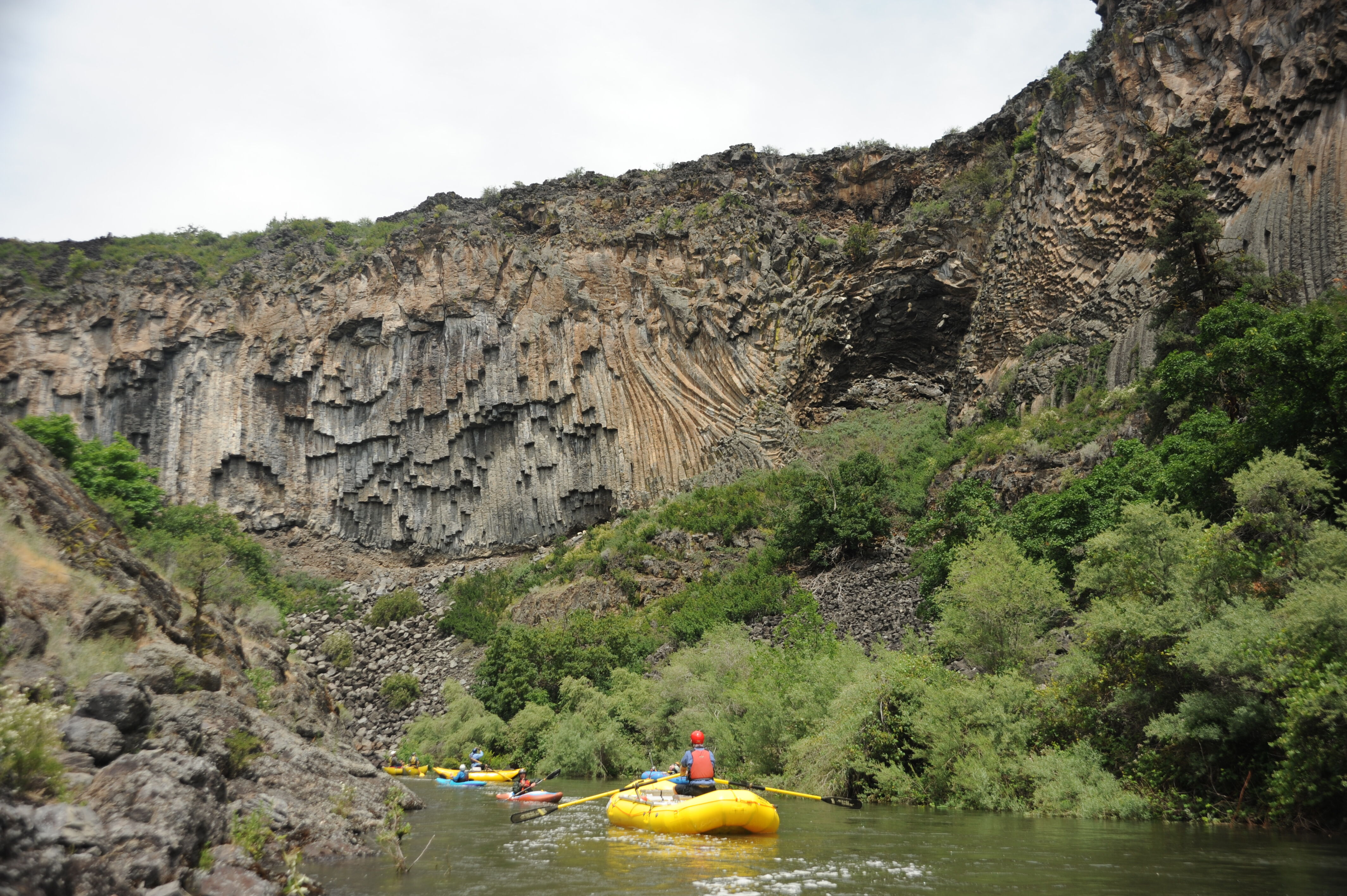
We paddled the 16 miles from Access 1 to Iron Gate, a trip that took 4 hours and 15 minutes. The float through the canyon from K’utárawáx·u to Kucascas, a distance of approximately 2.7 miles in the middle of the full run we did, was approximately 1 hour. We could have moved through this reach more quickly but took time to experience and enjoy the place. We witnessed spawning salmon, the remnants of the former Copco 1 and Copco 2 dam sites, and some of the most spectacular basalt walls of anywhere in the West.
At this flow we were able to boat scout all the rapids. The most challenging drop was the last rapid, K’íka·c’é·ki Falls, where the river drops over a ledge and through two holes before ending in a pool just upstream of the old powerhouse.
Oct 19, 2024
On October 19, 2024, our group of four kayakers completed a 41-mile journey down the Klamath River, paddling the entire reach formerly impacted by PacifiCorp’s hydroelectric project and recently restored by the removal of four dams and diversions. This scouting trip was part of preparations for the 2025 Paddle Tribal Waters mission, which will guide Indigenous youth on a source-to-sea journey down the undammed Klamath. Trip reports and photos are published for each whitewater run section we paddled that day, including the Keno Run, Big Bend Run, Hells Corner Run, Beswick Run, K’íka·c’é·ki Valley Run, and K’íka·c’é·ki Canyon Run.
Oct 14, 2024
We launched from access one, and found the 7 miles leading up to the mouth of Wards Canyon to be delightful and much more entertaining and prettier than expected. Also, due to its fairly swift current, the float punctuated by class two rapids only took about an hour and a 45 before reaching the dramatic climbing basalt walls that mark the entrance of the Canyon. We found it to be swift enough to make easy progress and most likely would carry boaters with relative ease even with a little upstream wind.
because there Is currently no take-out access at this transition point, boaters will currently need to run the Canyon and should be comfortable on class IV read and run.
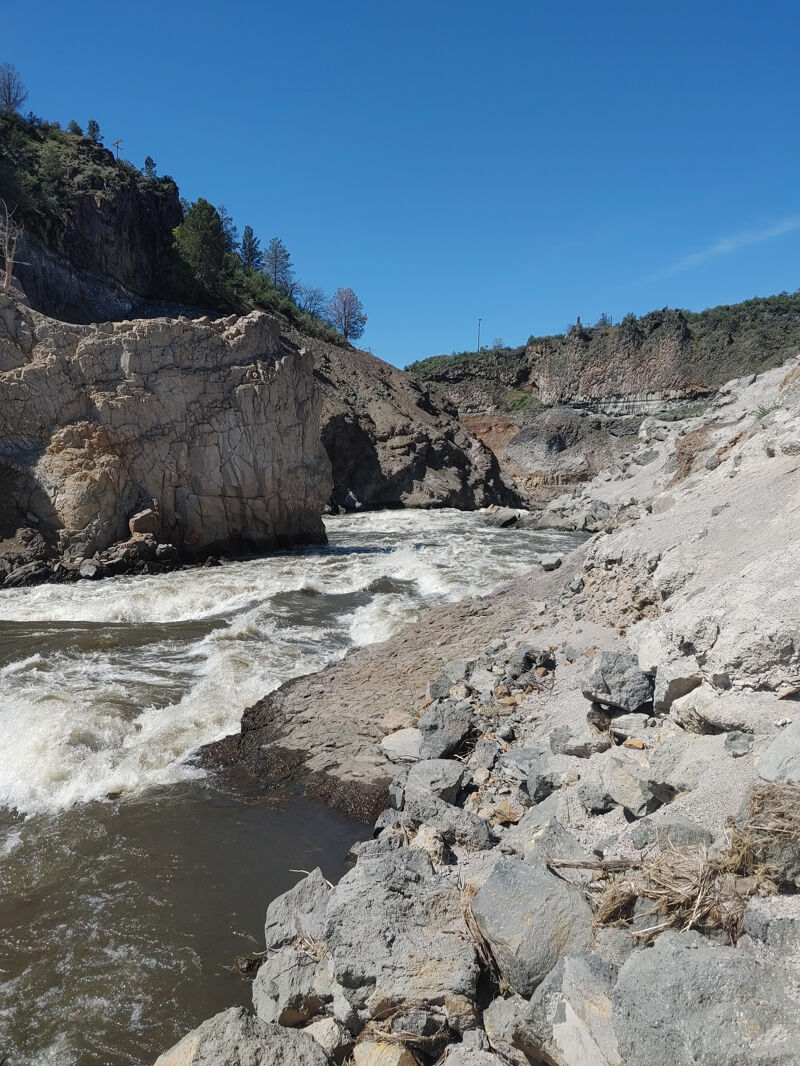
Wards Canyon's walls immediately begin to build, giving you a feeling of being small amidst the basalt grandure.
The entry rapid just above the dam site is a blind class III rapid and is best run down the gut of the first wave, staying center left. Be aware of a partially submerged Vehicle on river right.
once you enter the canyon, it's building class III to IV and pretty full on due to routing through a maze of root wads, grounded stumps, branches hanging over the banks, wood in the channel. Be vigilant and be aware that as the flows increase both rocks and wood will likely move around in the future. Being that this section had been behind a dam leaking under 20 CFS since 1910, it provided a perfect catalyst for tree growth in the river channel.
After a few long rapids with waves, holes and sporadic ledge holes sprinkled in, you arrive at the first stand out rapid with a very generous eddy on river left.
“Generator” marks the true start of the run as the rapids become pretty stacked below. This rapid is a clear left to right move above a few corner pocket, boat eater holes in a succession of waves on the inside of the left turn, culminating in a few smaller holes.
At this point, the run really takes on it’s gradually peaking difficulty, as you navigate boulder Gardens, sitting on top of bedrock lava flows. Several interesting 4 to 8 foot ledges begin to appear on the left or right of rapids and could prove to be some excellent side hustle lines for kayaks and small rafts.
The rapids get steeper, more constricted and reminisce the feeling of staring down horizon lines on the Hell’s Corner section of the upper Klamath. Wood remains a factor as branch nubbins are ever present in the main lines.
As you round the corner of the horseshoe bend, The canyon ends on a straightaway as the walls begin to recede marking the last 3/4 of a mile. But not before the whole run is punctuated by the final drop and climax of the run.
Don’t be fooled by the friendly pool at the bottom of Wards Falls. The river constricts through this final junky sieve pile, terminating in a river wide, steep boat stopper. Three of four kayaks saw the sky but managed to stay left, one raft swimmer just above the final move, a few stalled out rafts and one kayak gave us a nice rodeo show that ended in a less than friendly swim to river left.
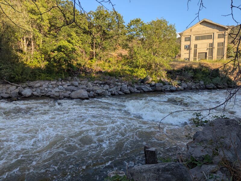
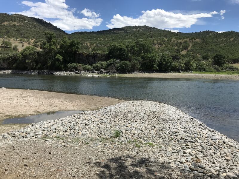
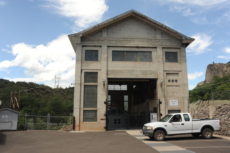
With power company buildings on both sides and a bridge just below, The takeout at fall Creek is another 3/4-1 mile downstream. This class II run out has some small surf that looks to be promising as flows increase.
Feb 8, 2024
Selected accesses and points of interest on the Wards Canyon run.
Jun 11, 2020
Photos from the June 11, 2020 whitewater boating flow study of Ward's Canyon conducted by Confluence Research as part of the Klamath dam removal project. The research question to be answered was: what will the whitewater in Wards Canyon be like at its projected annual low flow following the removal of the Klamath's four hydropower dams. Based on analysis and modeling of Klamath river flows, it is expected that the summertime low flow following dam removal will be 700-800 cfs through Wards Canyon in low water years..
With the cooperation of PacifiCorp in June 2020, flows of 700 cfs and 800 cfs were released from Copco 2 Dam into the Klamath River through Wards Canyon for the whitewater boating flow study. Study participants included American Whitewater staff, Confluence Research staff, and staff from three of the commercial outfitters that routinely operate on the Upper Klamath Hells Corner section. Craft types included hardshell kayaks, inflatable cataraft, and various sizes of self-bailing oar-rig whitewater rafts. Boaters ran the canyon at both the 700 and 800 cfs flows on the same day.
These photos are from the 800 cfs flow, and we paddled from the base of the Copco 2 Dam down to the Fall Creek access at the top of Iron Gate Reservoir. Flows were more than the minimum necessary for a quality whitewater experience for all craft types, indicating that this section of river will be boatable year-round (the 700 cfs flow was also determined to be more than minimum necessary for a quality whitewater experience).
The complete Whitewater Boating Study is available here and also covers post-dam removal whitewater on the Keno, Big Bend, and Hells Corner runs..
Jun 11, 2020
A flow study of Ward's Canyon by Confluence Research. This was the 800 cfs flow and we paddled from the base of the Copco 2 Dam down to the Fall Creek access on Iron Gate Reservoir.
Jun 11, 2020
A flow study of Ward's Canyon by Confluence Research. This was the 700 cfs flow and we paddled from the base of the Copco 2 Dam down to the Fall Creek access on Iron Gate Reservoir.
Jun 10, 2020
Site visit to Wards Canyon with the river reach dewatered. This assessment was conducted by Confluence Research and Consulting prior to the recreational flow study to investigate the character of the river bed prior to boating it.
Oct 2, 2019
On an afternoon in October we did a 2.5 hour hike out across the lava field to the rim of Wards Canyon where we spent some taking taking in the view of the canyon. It took about 20 minutes over uneven terrain to walk across the lava field but the rim provides a spectacular view up and down the canyon. The trip included Senator Jeff Golden, Upper Klamath Outfitters Association, American Whitewater, and National Park Service Rivers and Trails Conservation Assistance Program.
Oct 18, 2018
Site tour of Klamath River including Copco and Irongate Reservoir along with Ward's Canyon with Klamath River Renewal Corporation, agency partners, outfitters, and American Whitewater.
Nov 6, 2017
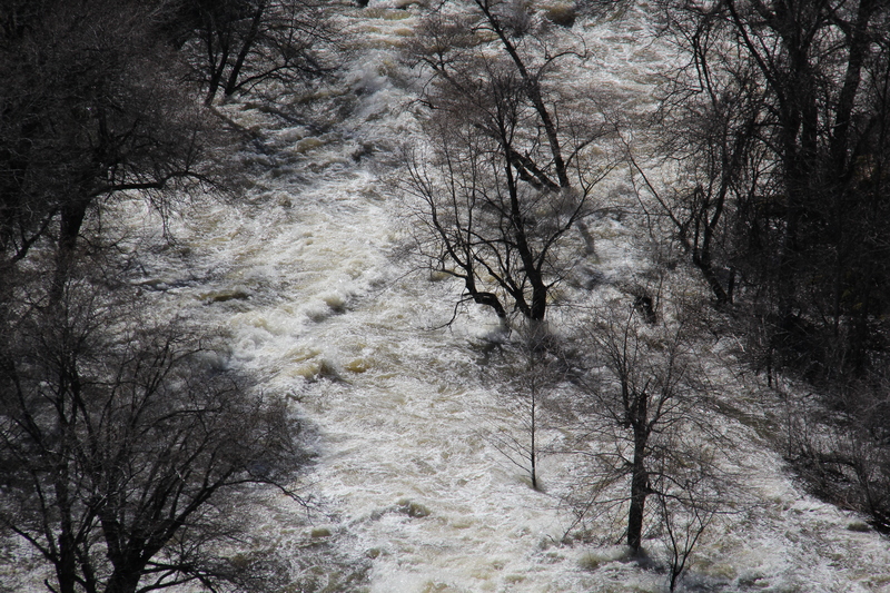
Mar 16, 2016
Copco 2 Dam spilling overflow into Wards Canyon and the Copco 2 bypass (Wards Canyon) reach of the Upper Klamath.
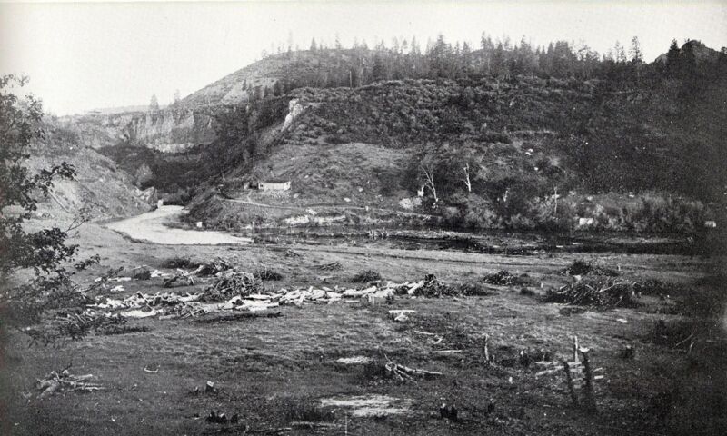
Jan 1, 1910
Historical photos from the Boyle Collection, Southern Oregon Historical Society.