Menomonee
B) MenWesTosa: Hartung Park to Hart Park (3.66 miles)
| Difficulty | I-II |
| Length | 3.5 mi |
| Avg Gradient | 10 fpm |
| Gauge | Menomonee River at Wauwatosa, Wi |
| Flow Rate as of 39 minutes | 14 cfsbelow recommended |
| Reach Info Last Updated | March 3, 2025 |
Quick Facts:
Location: Wauwatosa (Milwaukee County)
Put-in: 3456 Menomonee River Parkway, Wauwatosa, WI, Hartung Park
Take-out: 43.0487 -88.0072 (N.W.corner of Hart Park, near Tennis and Volleyball courts)
Shuttle Length: 3.8 miles/~10 minutes Recommended Shuttle Route
Character: Flatwater, swiftwater, and cobble/rock shoals in a semi-secluded-feeling parkway within mosly residential neighborhoods. Fairly wide-open channel with little maneuvering necessary (except to avoid grounding at lowest flows, or deadfall/snags at higher flows).
River banks: Generally gradual, with trees and shrubbery in urban river parkway.
Typical width: 50-75 ft.
General Overview
A fairly uniformly moderate-width stream provides relative seclusion even as it passes through residential and commercial areas of suburban-Milwaukee.
In the pattern of naming the other two sections of this river (MenFalls and MenTosa), I call this section 'MenWesTosa', standing for 'the Menomonee River in West Wauwatosa'.
(Yeah, it doesn't flow off the tongue quite like the other two sections, but so be it.)
Much of the run is flat but nicely flowing water, but there are numerous areas of rock/cobble shoals which the novi
...
We had previously listed this run as starting at Frontier Park in Butler since (years ago) it had been a fine run from there.
However, at present we strongly advise against putting in anywhere upstream our listed put-in at Hartung Park (just east of Mayfair Road)!
Why?
Numerous areas of massive deadfall and snags block passage of river between Frontier Park and the confluence with the Little Menomonee River (which comes in just upstream of Hampton Avenue).
If you attempt to paddle this stretch, your overall impression will be that you are spending nearly as much time and energy portaging as you are paddling.
Additionally, in Curie Park there are three golf course bridges which are problematic at nearly every boatable flow.
You will note that this put-in and a number of following 'Rapids' (locations/features) are listed with negative mileage values (their distance upstream from our recommended put-in at Hartung Park).
We detail these locations/features by way of emphasizing why you should not put in upstream of there, especially since there are a couple of websites (mostly for recreational paddlers rather than experienced whitewater boaters) which suggest put-ins upstream of our recommendation.
So, if you don't need further details or convincing, just scroll down past these first thirteen upstream 'features' until our listed put-in at Hartung Park (Mile 0).
A former USGS gauge at this location lists drainage as 60.64 Sq.Mi.
There are three huge culverts under the railroad. The center should generally be the best choice. Coming out the downstream end, there is an island with most of the flow going to the left. Aerial photos show a lot of downed trees in that channel, so proceed with caution, and be prepared if portaging is necessary. A very narrow right channel may be a better option (if it is not too wooded up, and if it has enough flow to paddle through) since it is a shorter channel.
For most people in the area, MPS stands for Milwaukee Public Schools. For would-be paddlers of this section of river, MPS stands for 'Massive Persistent Snag'! This thing is visible on all aerial views!
Just before this road bridge, Little Menomonee River enters from river-left, making a total of 82.1 square miles drainage area at Hampton Avenue.
There
are folks who put-in from someplace on it, however there is
much better parking at our listed put-in than anyplace one could access
the Little Menomonee, and you'd gain 2+ miles of flatwater meanders, a few more snags, only very minor riffles, and likely portages of one to three bridges in Currie Park.
A large island appears on aerial views. The right channel is likely to hold snags. The left channel is likely the preferred route (for any gluttons for punishment who ignore our info and try to paddle this portion of river).
Some folks may look at putting in from an area marked as 'Webster Park'. In a word: DON'T!
First, the actual river is well-off into the trees, with a large swampy floodplain between the river and the roadway (at least, from the northern end of Webster Park).
The next mile of river may still be prone to snags (though not likely near the mess which exists in the prior mile of river).
And again, as you pass under Capital Drive (a mile downstream), you will pass through the Curie Park Golf Course where you will encounter three crossings of the river for golf carts, each of which may be problematic (likely portage) at most boatable flows.
The northernmost point of the Menomonee River Parkway is at West Congress Street (midway between Capital Drive and Hampton Avenue).
There is very little parking evident along this stretch of road. Additionally, at least at the northernmost end of this area, the area between the river and the road is low swampy floodplain.
DON'T EVEN THINK ABOUT TRYING TO ACCESS FROM HERE!
(Just a waypoint, for anyone foolish enough to ignore the advice not to bother paddling this section.)
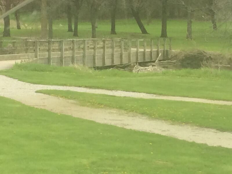
A hazard to navigation at quite a few different flows!
A hazard to navigation at quite a few different flows!
A hazard to navigation at quite a few different flows!
(Just a waypoint for anyone foolish enough to have ignored the advice not to paddle this part of the river.)
Park roadside along the Menomonee River Parkway just east (downstream) of Mayfair Road, near W.Keefe Avenue. The children's play area here means you need to mind your language and have some sort of cover up while changing.
It may be preferable to change (into and out of boating clothes) at your planned take-out, to be already dressed and ready to 'grab-and-go' when you arrive here. Leave a change of 'street clothes' in a take-out vehicle so you can change out of boating gear before returning upstream to retrieve the shuttle vehicles.
Unfortunately, our listed take-out is also a high-visibility area. If your group is sufficiently experienced (and the water levels are appropriate for your group) you can continue down the next section of this river, the take-out for which generally has less traffic, thus is much more relaxed for changing into or out of boating gear. (See the 'MenTosa' description for info on that.)
Another option is to shorten this run, taking at the Red Book parking lot which affords slightly more privacy. (See detail on that below.) However, while that site works well as a put-in, it may be a very difficult and awkward place for novice boaters to safely get out of the current to get ashore. (More about this follows in the description of the Red Book Lot.)
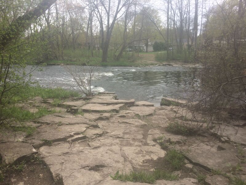
OK, to call this a 'ledge' is a bit misleading and generous. A minor rocky intrusion creates a sometimes-surfable/spinnable wave.
To river right (just through a break in the trees) you will see some fine houses along another portion of North Menomonee River Parkway.
Downstream and around the bend, lesser shoals creates splishy-splash action which continues a bit past Burleigh Street.
Just after passing Burleigh Street, another shoals is encountered. On river-left just upshore lies Mt.Mary University. On the right shore (mostly well hidden behind wooded shores) lies Bluemound Golf and Country Club.
Just downstream of the North avenue bridge, this significant side-stream (entering from river-right) has drainage of 19.6 sq.mi., adding to the 90.5 sq.mi. of the Menomonee above this point.
The North Avenue bridge and this confluence should serve as warning of the next bridge, which can be a hazard at higher flows.
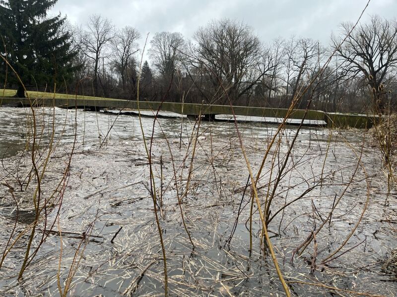
At flows under 1000 cfs or so, virtually any paddlecraft can easily get under. Up to something near 1700 cfs, you can 'limbo' under it in a whitewater kayak but canoeists may be in trouble. As flows exceed 1700 cfs, it will be necessary to portage.
There is a decent eddy river-right very near the bridge, but you must have confident boat-handling skills to get this eddy, get ashore, then re-enter the river. This may be uneasy for inexperienced boaters!
Somewhere around and above 2600 cfs, you may pass over the bridge with little or no problem.
Just downstream the river takes a bit of a jig-jog. The right bank has been undercut and collapsed into the river, along with trees from shore. At moderate-to-higher flows, intense maneuvering may be necessary to avoid mishap!
There are no fairways which cross the river (where golfers would hit a ball to a green on the other side). However, wildly errant shots (hooks and slices) may pose risk to passing boaters.
Just downstream of here you enter Hoyt Park (at river-right).
An oblique/diagonal Box Culvert (or 'Transect') crosses the river. At low-to-moderate flows, this creates some rather interesting currents and small surfable waves. Decent eddies will exist at such flows to allow exploring this area for entertainment.
Since the 'hydraulic jumps' (where cement box culverts had crossed the river) have been removed from the next stretch of this run, some folks may prefer to shorten their trip by getting out at (or someplace before) the suspension bridge in this park.
We have placed this marker at the former location of the first of the now removed jumps. (Some aerial views may still show the jump.)
If taking out here, park well-toward the pool to minimize the carry to your vehicle from the river.
Folks wanting to extend the next section (the MenTosa section) a bit, but not wanting to add the entire length of this (MenWesTosa) section, might use Hoyt Park as their put-in. To do this, park about midway between the park entrance and the pool, carry downslope along the border between grassy area and woods, and you will start off with the aforementioned diagonal box-culvert waves.
This rather scenic bridge is often the site of wedding photos during warm months of the year. (Photobomb, anyone?)
A former 'jump' site now has rubble erosion-control fill creating splish-splash rapids. At flows under 300 cfs expect to 'grunge out' through here. At moderate flows, a minor wave-train may exist.
The pool downstream has depth and strong currents which could allow bow-stalls/stern-squirts in freestyle kayaks and squirt boats, however water quality suffers at high flows making play less advised.
Flow heads into a gravel shoals with shrub willows. At low-to-moderate flows, paddle out of the main flow to avoid broaching here. At higher flows, these will be awash. More shoals lead around the bend downstream.
BTW, at river right (beyond the cement, grillwork, and berm) lies a large excavated retention pond. When Underwood Creek goes to flood levels with heavy rains, similar grated structures allow it to overflow into tunnels to that retention pond. If/when the pond fills to unusual levels, water will overflow into grates and out the structure that you see here.
Once more, old aerial views may show an apparent 'jump' at this location. It was removed, and the bed and banks of the river have been 'armored' with quarried rock. At some flows, this may create some interesting splishy-splash rapids (and, if you're lucky, maybe even minor play).
The river takes a quick right-then-left as it heads toward a railroad embankment. It encounters a bit of a shoals, and (at moderately high water) a minor wave-train may be found in this area. At low flows it will barely rate any classification, at higher flows it may merit a class II-. Just before the left-bend, tight to river-left, at some flows, water flowing over a boulder creates a funky little surfable hole. As with most things on this run, we're not talking about great freestyle play or anything, just a minor surf wave.
From the prior bends, to and beyond this pedestrian and bike trail bridge lies one of the longest and strongest rapids on this (MenWesTosa) section of river. Be very alert! The rapids rarely rate above a class I+, but strong current makes it difficult for novice boaters to avoid disaster if wood is present!
The area around the bridge is an optional take-out point, though novice boaters will find it more than a bit challenging to do so as there may not be good eddies.
The river-right bank is generally quite steep, with trees and shrubs, and is mostly lined with quarried rock. This makes it awkward to 'beach' any boat and exit safely to shore, and difficult to ascend to the parking lot.
The river-left bank (immediately upstream of the bridge) has some eddies and lesser currents, and there are places where the riverbank is less steep. However, at moderate-to-high flows, it may take very skilled maneuvering to break out of the currents and find the small sheltered areas which may allow exit. Exit before the pedestrian/bike bridge, then carry across the bridge to the Red Store Lot.
So ... why would anyone take out here (rather than the other listed take-out)?
(1) It offers plenty of parking (if Hart Park has an event which fills parking).
(2) This lot is slightly more secluded (than both our put-in and our listed take-out) for those needing to change into or out of boating clothes.
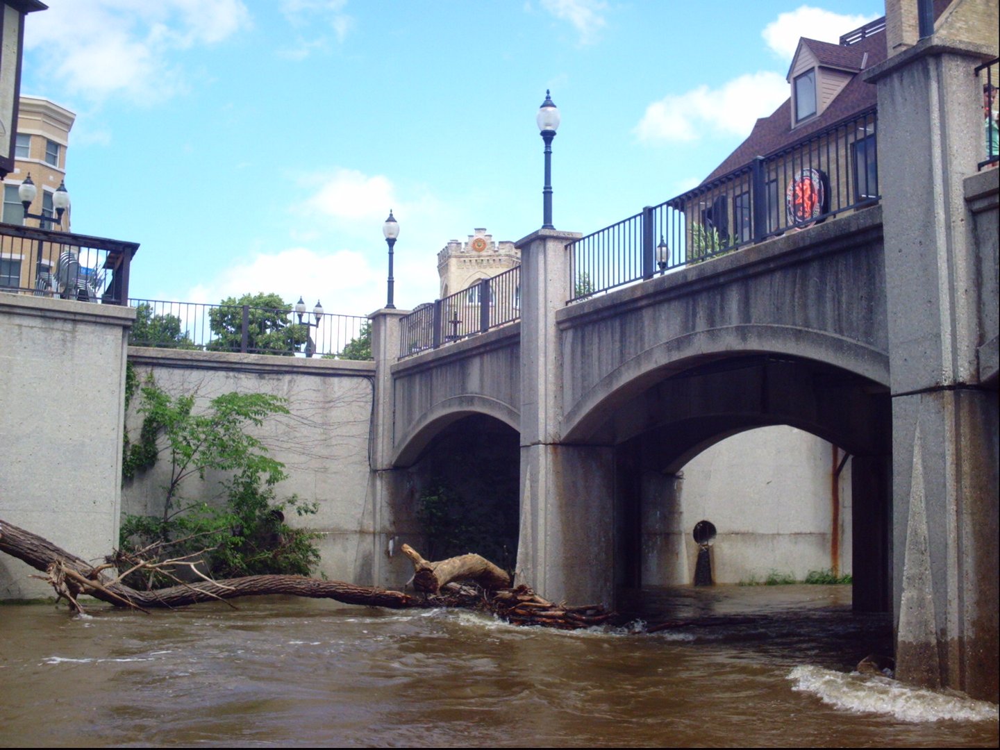
(3) Occasionally, large branches or whole trees block passage at the piers for the pedestrian mall bridge by the restaurants in downtown 'Tosa. ( Highly recommend scouting those bridge piers before putting on this run! You need to know if you can get through there safely!)
(4) If you put-on at flows above 3800 cfs (or flows rise above that while you are on the run), the railroad bridge just after the pedestrian mall bridge in downtown Tosa IS NOT PASSABLE! It will be mandatory to get out before being swept downstream of the high overhead Harmonee Avenue bridge.
Harmonee Avenue crosses high overhead on this bridge. Take this as your signal to look downstream to the next bridge. If you have not scouted it ahead of time, be prepared for possible emergency maneuvers!
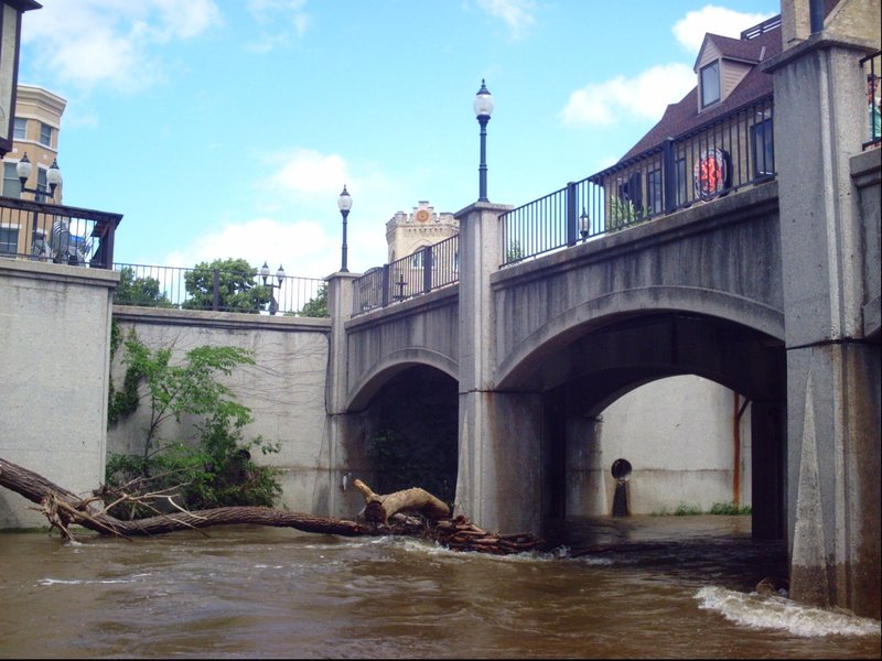
Harwood Avenue bridge is closed to vehicular traffic to be a pedestrian mall with tables and chairs.
Two sets of piers in the river tend to collect branches and whole trees, partially or totally blocking passage on river. (SEE PHOTO!)
SCOUT THIS LOCATION WHILE SETTING SHUTTLE to know whether the river is clear or obstructed, and assess whether you can safely get past.
IF THERE IS ANY WOOD, GIVE IT WIDE BERTH! (Branches can 'bounce' up and down in the current, going from submerged to snagging you or your boat!)
IF THIS IS TOTALLY BLOCKED, YOU MAY NEED TO TAKE-OUT BEFORE COMING THIS FAR!
There are stairs coming down to the water through the vertical wall at river-right, so there is a way to get out of the river. However, the steps are at the bridge, so if the whole river is blocked, you would be perilously close to the blockage before being able to get out! Again, best to know before putting on for your run!
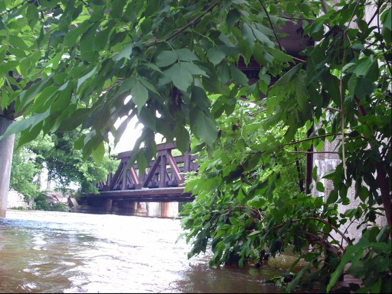
Almost immediately after the Harwood Avenue (pedestrian mall) bridge there is a railroad bridge. At normal and usual flows, this presents no hazard.
At flows above 3800 cfs this is an extreme hazard! There will be no clearance under this bridge!
Side-by-side with the railroad bridge there is a bridge for the Oak Leaf Trail (paved pedestrian and bicycle path).
Our standard take-out is river-left at a storm-sewer outflow. DO NOT MISS THIS TAKE-OUT! Currents in this area should generally be slack enough to allow getting out, but you are likely to see and hear 'Hart Park Rips' just ahead around the bend.
At flows under 300-400 cfs, novice paddlers will probably be fine if they continue downstream to do some part or all of the MenTosa section (at least, as long as they read and heed warnings about a couple of very specific hazards).
However, at levels of 600 to 1000 cfs and higher, the next section takes on quite entirely different character. Above 600 cfs, all boaters of the next section should have proper whitewater gear and experience! They should also have knowledge and skills in self rescue, and (ideally) should have taken a Swiftwater Rescue Training class.
Apr 11, 2025
Jun 22, 2011
Immediately after the pedestrian bridge in downtown Wauwatosa, the railroad bridge has somewhat low clearance. It will be fine at normal (low-to-moderate) flows, but could be impassable at high flows. ALWAYS SCOUT DOWNTOWN 'TOSA BEFORE PUTTING ON AT HIGH FLOWS!!!
Jun 22, 2011
The Pedestrian Mall/Bridge in downtown Wauwatosa can be a hazard. When the river is high it sweeps all sorts of logs and whole trees downstream. With some regularity these bridge piers accumulate some wood. AT MODERATE TO HIGH FLOWS ALWAYS CHECK THIS AREA BEFORE PUTTING ON UPSTREAM!!!