Oconee, Middle
3 - Tallassee Shoals to Ben Burton Park
| Difficulty | I-III |
| Length | 7.5 mi |
| Avg Gradient | 10 fpm |
| Gauge | Middle Oconee River Near Arcade, Ga |
| Flow Rate as of 32 minutes | 170 cfsbelow recommended |
| Reach Info Last Updated | September 23, 2021 |
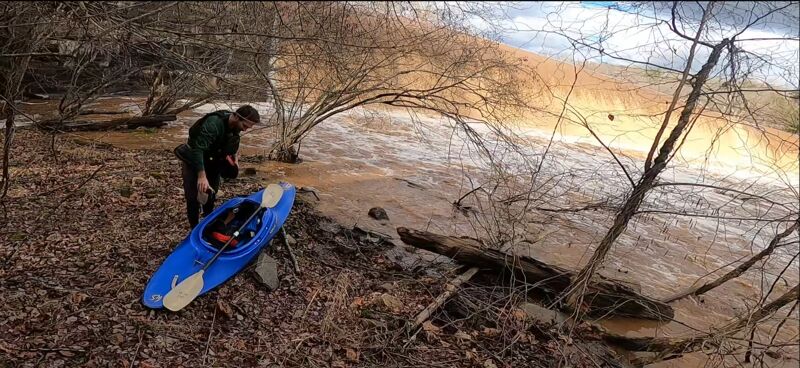
A 25 foot tall dam resides on this section 1/2 mile below the hwy 330 bridge. The dam is dangerous and the portage on river right traverses difficult terrain. Thus it is suggested to park at an access easement at the end of Big Bear Road (look for a 3-4 car parking area) and hike down to the river and then upstream a bit, putting in at the base of the dam (there is a link to Google Map directions on the Access tab). As of 2021 the dam operator is in the process of constructing a portage trail on river right.
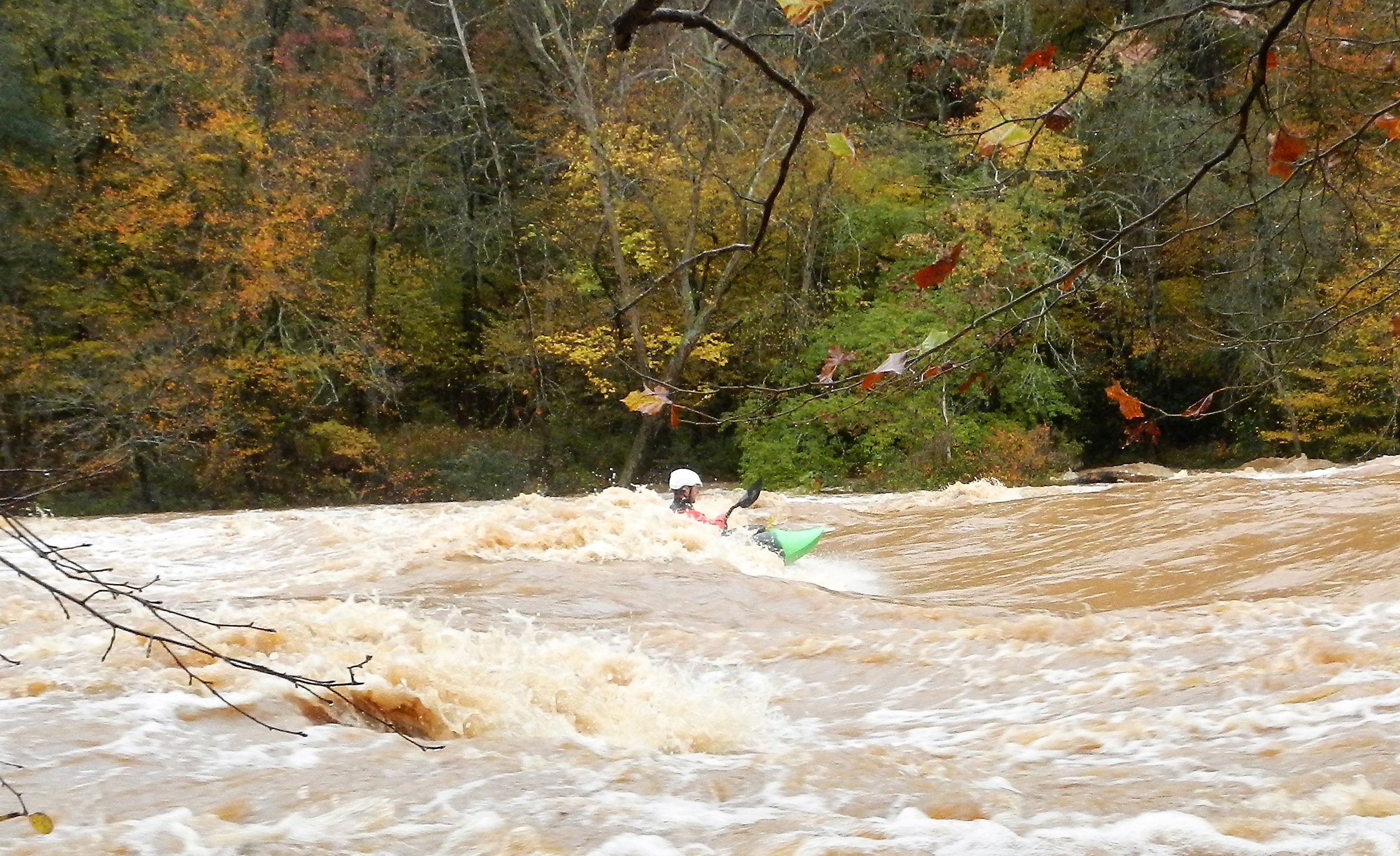
Tallassee Shoals rapid starts at the base of the dam, gently dropping 20 feet over 0.4 miles. Because water is diverted for hydropower, the shoals is a knuckle dragger until levels exceed 1100 cfs. Above 1300 cfs Tallassee Shoals is a mini-Ocoee, with multiple waves and holes that can be surfed. A river right trail allows doing laps on this section though do be conscientious of property owners. When flows exceed 2,400 cfs the shoals become class IV due to many large hydraulics.
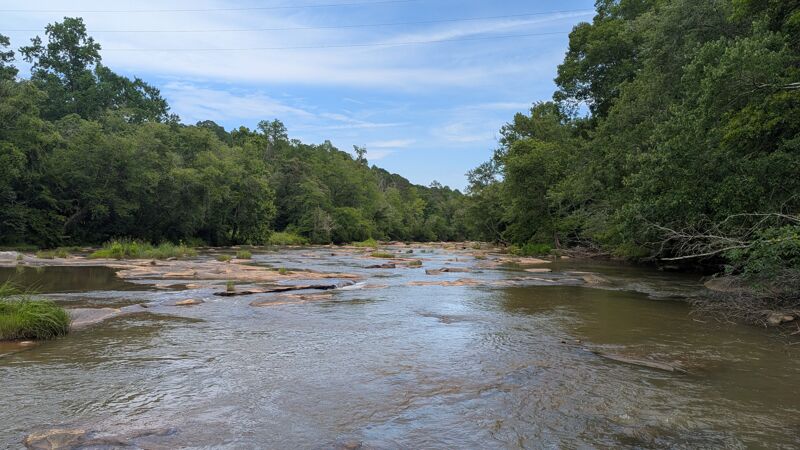
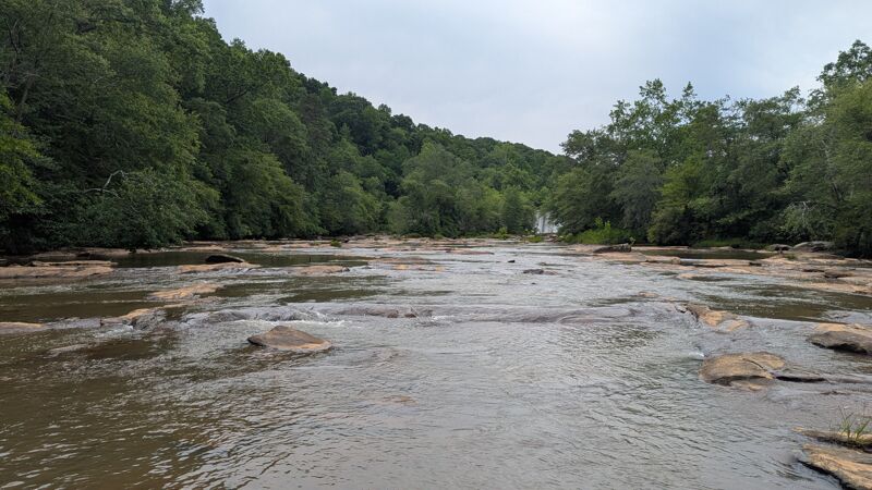
The next 6 miles is a relaxing class I float. Do keep an eye out for two pipes that cross the river. Depending on the level the pipes may be difficult to get over. The gradient picks up at the end, marking the beginning of Ben Burton Shoals, a fast class III. The remnants of a dam at Ben Burton make for hazards so helmet is suggested. There is a county-maintained access point on river left.
More about the flows at Tallassee Shoals:
Up to 850 cfs can be diverted for hydropower. The dam operator is required to maintain a year round minimum flow of 70 cfs through the shoals and 138 cfs in May, for aquatic habitat. At these low flows, much of the shoals is not runnable but they can be walked or waded. Starting at around 1100 cfs on the Arcade gauge enough water is spilling over the dam and down the shoals to make the shoals mostly runnable. Above 1300 cfs a variety of fun play holes and waves start to form. Some of the features are small but great for spins and
...
This put-in is below the dam and at the top of Tallassee Shoals.
This is an alternative put-in but requires a portage around the dam, which is not easy. Park along the highway or up at the fire station.
As you approach the dam, get right ASAP. As of 2025 the portage bridge over the dam has been damaged by falling trees, but is passable. Rroceed on a billy goat trail to a point where boats can be lowered to the river. This is a difficult portage.
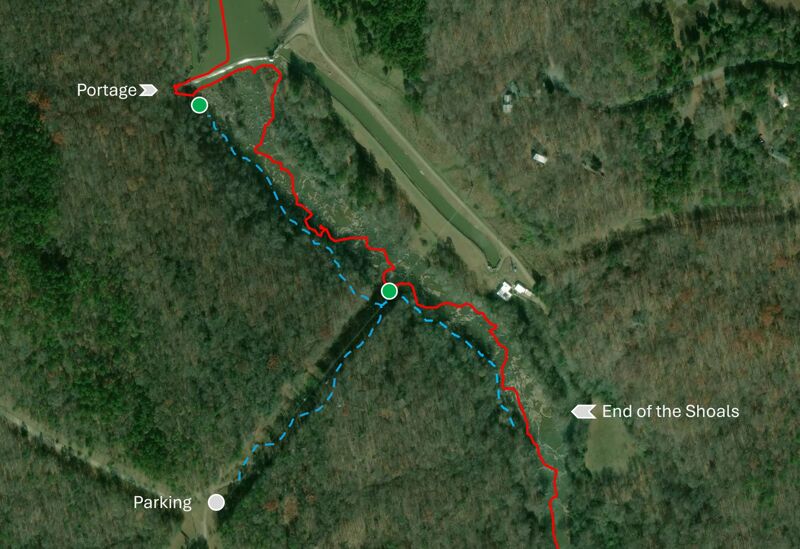
A half mile long shoals that starts below the dam. The orange line shows a low water route. Blue are trails to and along the Shoals.
There is space for 2-3 cars at this designated parking space, then a 0.4 mile hike to the river.
This put-in cuts out half of Tallassee Shoals and is a good option when the water is low.
Approach with caution as this may be a river wide blockage, depending on level and amount of trapped debris.
Approach with caution as this may be a river wide blockage, depending on level and amount of trapped debris.
The takeout is at the Ben Burton Park, a county-maintained access point on river left below the shoals.
Mar 1, 2026
We came out here on a Friday afternoon. We hiked up and put in right below the dam. It was chill class two until after the powerline easement. The main rapid was comparable to something found on the Ocoee. The shoals had good surfing and the hike up wasn't bad. We ran it a few times and then hiked back to the cars. We saw some of the people who live on the road and they were nice. They seemed to understand what we were up and didn't mind.