Buffalo Fork, North Fork
Hike In
| Difficulty | II-III |
| Length | 5.5 mi |
| Avg Gradient | n/a |
| Reach Info Last Updated | September 29, 2025 |
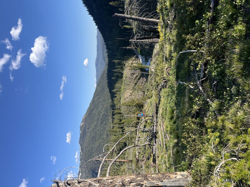
Hiking in on the North Fork Buffalo Fork Trail a few miles grants access to the scenic North Fork. Hike until the trail reaches the river at Soap Creek, and put on. Stay heads-up for wood as the river flows through meadows and then small boulder rapids and eventually reaching the South Fork.
From the bridge near the confluence you can either hike up for a significantly harder section of the South Fork, or just enjoy the swift paddle out on the Class III+ Buffalo Fork.
No river features have been added
Jun 28, 2025
This trip report is in response in the report by Shannon Golden on June 9 2025. Thanks for your report Shannon, I do think that it may be misunderstood by some. The stretch of river that was reported as unpaddleable is actually above the normal section. I have always portaged the section reported as blown down, because it is always full of wood. The normal put-in for day trips is at Soda Fork Meadows reached on the North Fork Buffalo Trail (FS 6047), below the section reported by Shannon. There is sometimes wood in that section, but more years than not, it is clear. The section reported by Shannon is always full of wood. I have not been on the NF yet this year, so don't know if the event she reported affected the stretch below Soda Fork Meadows, but paddlers shouldn't be detered from the normal run based on her report.
Jun 9, 2025
We hiked from Turpin Meadow Campground via the Clear Creek Trail (10 miles). Would recommend hiking in on North Buffalo Fork Trail instead, to have the possibility of checking the river. Put in around North Fork Meadows. Short bit of flat water and then the river starts moving and the canyon walls narrow. Unfortunately, about 1.5 miles in, we found the first strainer (43.9279872, -110.2028891). The walls are steep and there are few eddies. We managed to avoid the strainer and climb along river right to scout potential options to get back into the river. Traversing this area is difficult, due to steep banks and significant deadfall. We continued to see multiple strainers that prevented us from resuming the paddle, and returned to the trail to hike out. The amount of wood in this section of the river, and the difficulty of scouting and portaging on this terrain, makes it seem unlikely that this section can be safely run for quite some time.
Jun 4, 2022
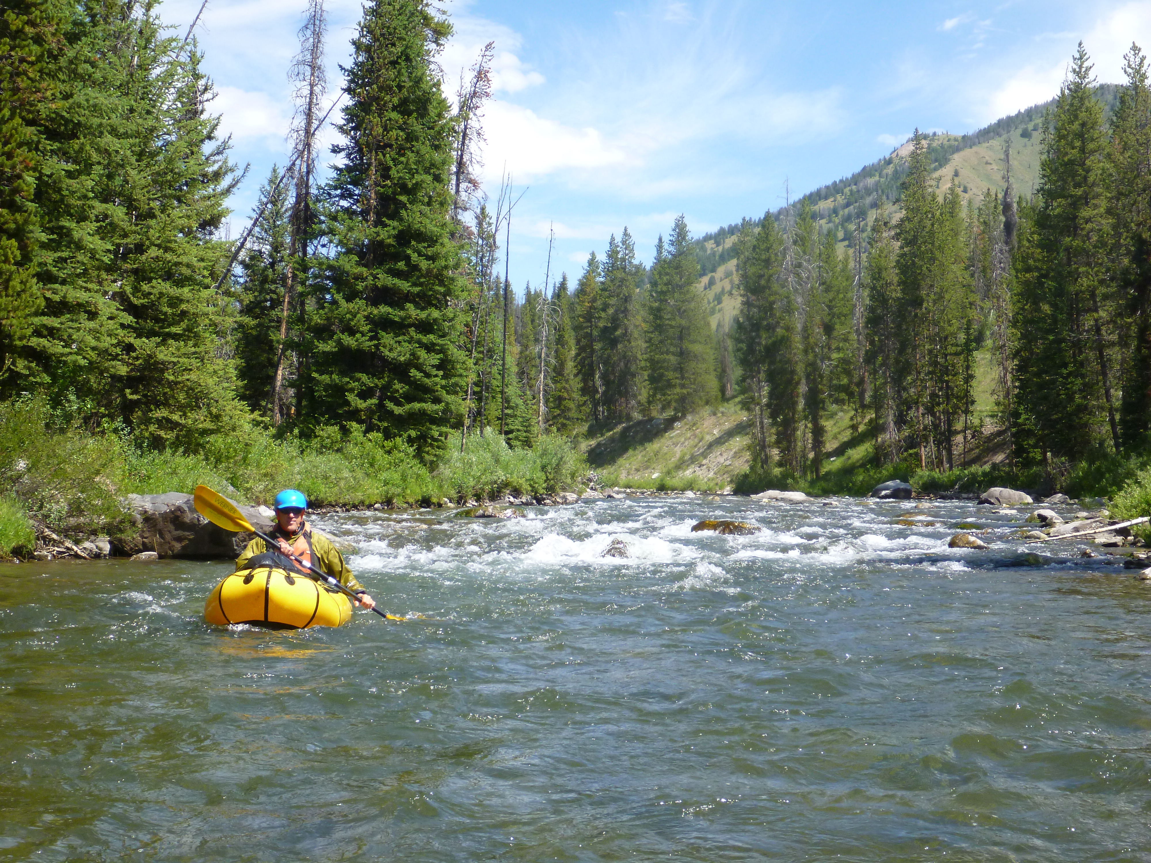
We hiked in and ran North Buffalo fork down to Turpin Meadows campground on 6/04/2022. This is horse packing country, so the trail was pretty wet, muddy and chewed up, which was a shame as it took away from what otherwise would have been a gorgeous and mellow hike. Was flowing at 1600 CFS on the gauge below the campground, so about 7 miles down from the north and south fork confluence.
Water was at a great level, lots of fun and busy class III on the upper north fork. There was a downed tree spanning the river about 3 miles into the run from 2021. At this flow we were just barely able to squirt over it, but probably should have portaged.
The lower section past the confluence has changed in the past few years. A land slide about 2-3 miles down has pinched the river into a nasty Class IV rapid with fresh jagged boulders. We were able to scout and eventually decided to portage on river left. This is where the landslide occurred so it was a real PITA. Lots of loose boulders, downed trees and wash outs.
Overall a great run, 5 miles of hiking for 10 miles of paddling. Exited on a nice sandy beach 200 yards from our campsite. Great view of the Tetons hiking in, followed some big old bear tracks on the trail, and got barked at by Elk at the put in when inflating our boats in THEIR meadow.