Salmon, North Fork
Right Hand Fork to Mule Bridge(Wilderness Run)
May 18, 2024
| Reporter | Scott Harding |
| Gauge Reading | 3850 cfs at SALMON R A SOMES BAR CA |
| Flow | Low Runnable |
After two earlier trips on this run, the first at 7,000 cfs in a kayak and the second at 10,000 cfs in a packraft, I was interested to return at lower flows to try figure out what the lower end range of decent flow is for this run. We found it.
After a week of Salmon River flows swinging on the snowmelt diurnal with peaks of 5,000+ cfs and lows around 4,000 cfs on the USGS Somes Bar gage, one cool night at elevation dropped flows significantly so that when we put on this run around 1 pm the gage was reading 3,850 cfs and dropping 35 cfs/hour. We paddled the run on the declining limb of the diurnal cycle between its high of 4,400 cfs from the previous day's snowmelt and a low of 3,600 cfs from the cool night before our trip. The USGS gage is nearly 50 miles downriver so its correlation is not super tight and there is a significant timing offset, but it's fairly good when the flow dynamics are simple as they were in this case (all snowmelt, no rain, and on a consistent pattern). This same flow at the Somes Bar gage when there is rain or elevated base flows in the mix would not provide enough water for this run...interpreting the gage is an art and science.
Actual flow at the put-in just below the confluence of the Right Hand Fork and North Fork was an estimated 400 cfs. The stage gage on the downstream river right side of the Sawyers Bar Road bridge just below Idlewild Campground was reading 3.0 feet at the end of our trip. This old-school stick gage is the best indicator of flow for this run. A flow of 3,850 cfs is a low flow, but it's certainly adequate and enough to be worth the effort of getting to the put-in. That said, this is near the lowest flow I'd choose for the run--but I tend to favor more water over less.
The hike in was easy with a couple dozen small diameter fallen tress across the trail, all of which were easily traversed. A few larger ones required only minimal effort to get over, under, or around (kayakers would've had to offload boats a time or two). The trail had not yet been maintained for the season. The two stream crossings were straightforward and could be crossed while keeping shoes on and dry: Yellow Dog Creek was low enough to rock hop across and Big Creek had a fallen tree across it that made for a dry crossing. At an easy pace, we reached the put-in at the Right Hand Fork in almost exactly three hours including short stops to look at the river, check out wood hazards, and take photos.
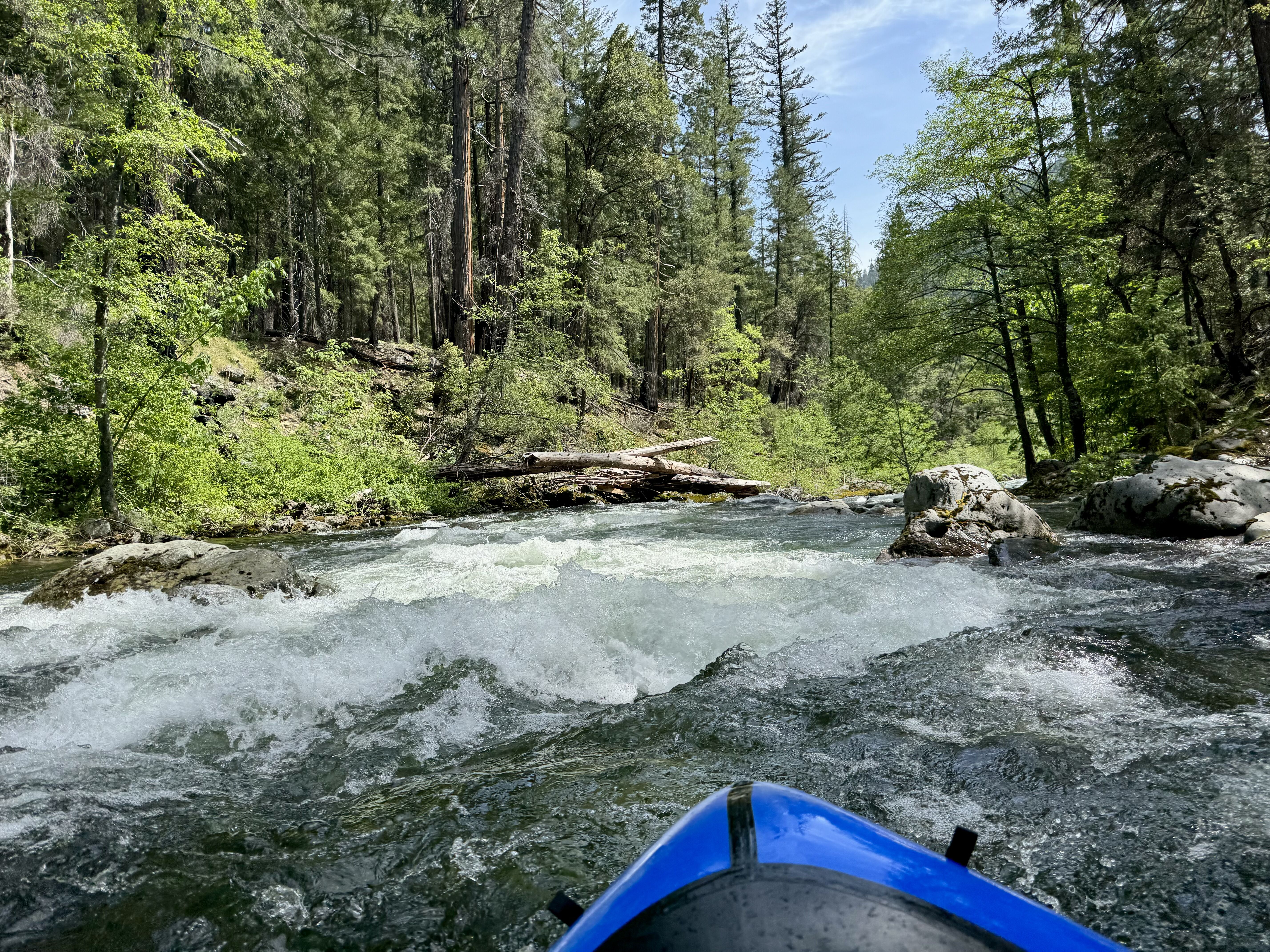
On the river, wood was the theme. Not far below the put-in we encountered our first wood hazard. In all, there were at least 15 wood hazards in play on the run. We were able to duck and dodge many but still ended up portaging about six times. One strainer looked as if it were purpose built for snaring packrafts. Much of the wood consisted of trees that fell directly from the banks into the river but some had also been transported from upstream. Always be alert for wood on this run! This is the most wood I've encountered on my three runs here.
Even with the wood, the run was great. The flow was low but not so much that we hit many rocks or that it detracted from the experience. At two wide spots we grounded out on boulder bars but that was it; even those we didn't have to get out of the boats to bump over. Much of the run is gorged in and there was ample water in these sections. No complaints doing at this flow, and it certainly could be run a bit lower, especially by packrafts. The extremely low flow threshold is likely closer to 3,000 cfs at the gage or 2.8 feet on the bridge stick gage (both guesstimates).
The water quality was spectacular with clear, emerald pools (in contrast, on this day the South Fork Salmon was turbid and brown). We saw a number of merganser pairs, some kingfishers, and wayward cow that obviously overwintered in the wilderness on the opposite side of the river from the trail. Skies were blue and we had full sun on the water most of the day, punctuated by slight overcast in the mid afternoon and encroaching shadows on the lower part of the run as the afternoon wore on.
As always, the hike and the river run were gorgeous and the epitome of a great day in the wilderness. Count on the hike taking about 3 hours and the run taking about 2-3 hours at this flow (quicker if there's less wood). We started hiking at 9 am, got to the put-in at noon, on the water at 1:30 pm after lunch and a leisurely transition, and to the take-out at 4:45 pm, all at a leisurely pace and with added time to deal with the wood and typical packraft routines on the water.