Contoocook, N. Branch
Route 9 & 123 to Hillsboro Fire Sta
| Difficulty | V |
| Length | 8 mi |
| Avg Gradient | 55 fpm |
| Gauge | Contoocook River Near Henniker, Nh |
| Flow Rate as of 1 hour | 4.63 ftbelow recommended |
| Reach Info Last Updated | May 1, 2018 |
Information from Greg and Sue Hanlon's Steep Creeks of New England, additions by Nate Warren
From Concord, NH, take I-89 North to Exit 5. Follow Rte. 9-202 to Hillsborough. Continue through Hillsborough, Lower Village to North Branch Village, where Rte. 9 crosses the North Branch. To the putin from North Branch Village follow Rte. 9 ~5 miles to a small pull-off just after a set of powerlines across Rte. 9, as you are driving up a hill. Park by a gated, overgrown farm road on the left. Carry past the gate, down the farm road, and through the overgrown path. Veer left at the first fork in the path, and look close for the path on the right after another 100 yards.
To takeout: follow Rte. 9 back toward North Branch Village (in Antrim). Take out at the junction of Rte. 31 (where 31 breaks off of 9 and heads south) and Rte. 9, below The Cleaver.
Click here for a GoogleMap of the run, including access points (and scouting points)
Warning: this run may contain thick ice in the early Spring; it tends to break up later than many other, steeper runs.
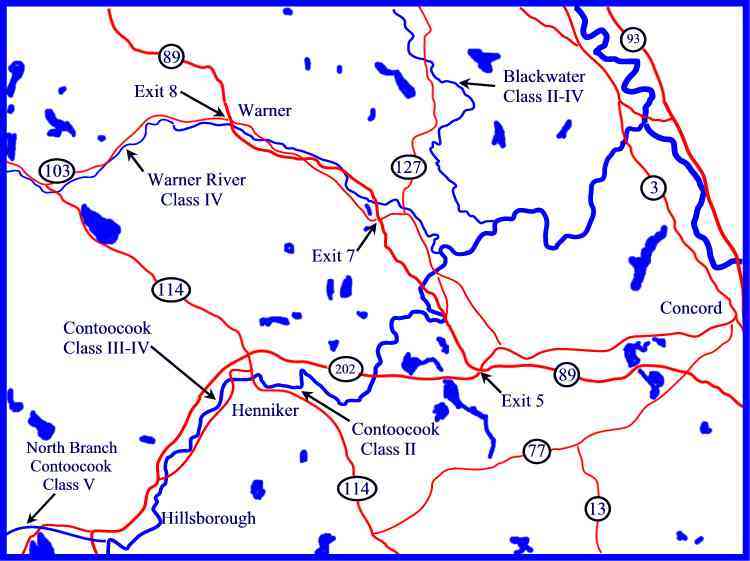
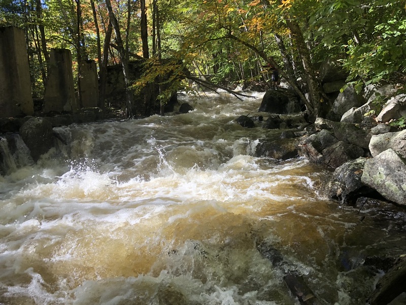
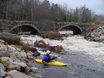
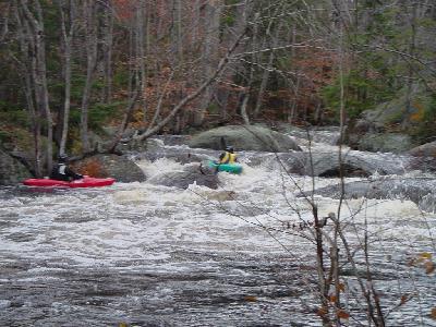
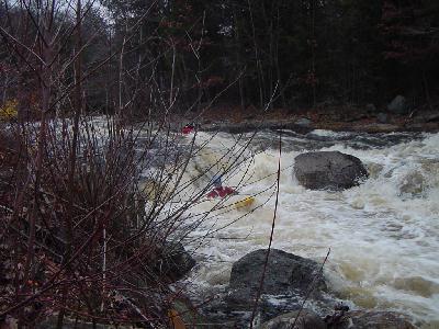
The NB Took is a class IV (2@V) creek in southern NH. It has a large, swampy drainage, which means it holds water far better than most other creeks in NH. The upper section has long zig-zagging class four rapids with big pools at the bottom. The largest rapid, Lost Lens, is class V- at good levels. Soon after Lost Lens is 'Stone Bridge,' a class III where the river passes under an old stone bridge, then under Route 9. Below here is a mile or so of class II-III, which is really fun if the level is not low,
...
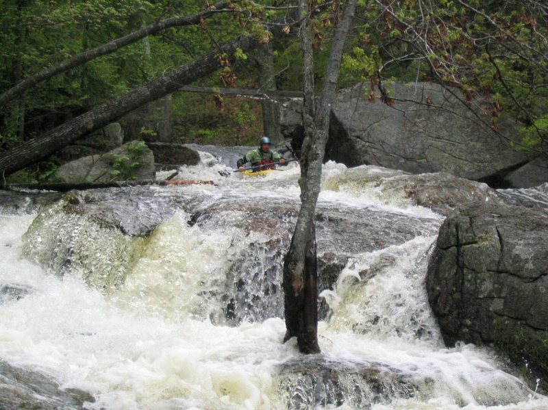
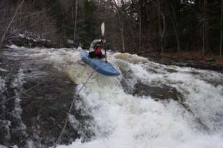
This rapid was named after a lost camera part carried by Scott Underhill in one of the first descents back in the 80's. This rapid deserves a good scouting. Take out on river right about two ledge drops below the small concrete bridge and scout. The rapid takes a hard right through a shallow rocky drop then takes a left dropping precipitously over three ledge drops. The final drop contains a tight slot that is often clogged with wood. The most common run is boofing a rocky pourover to the left of the slot.
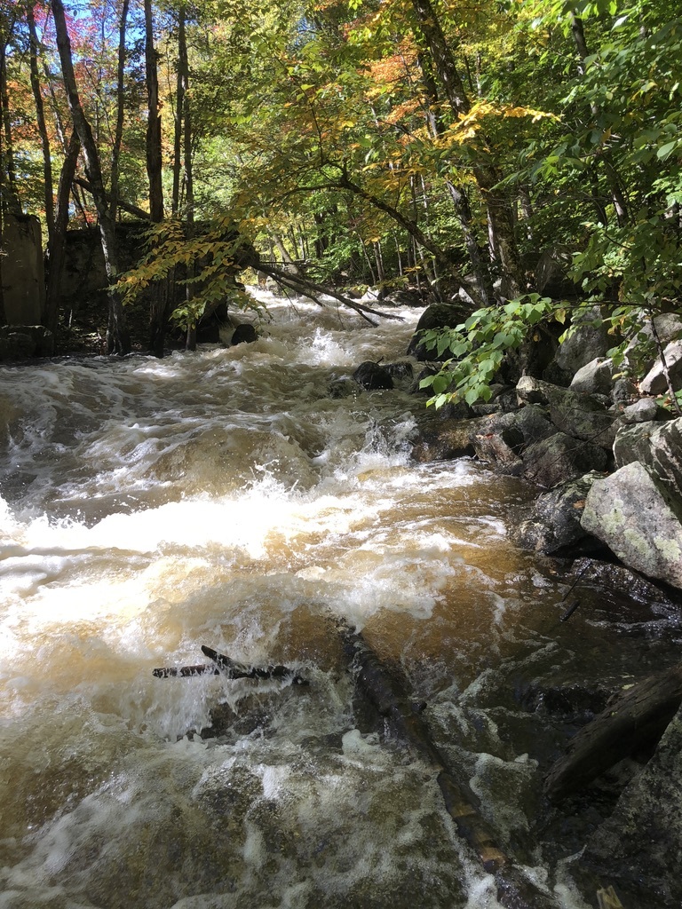
When the roadway reappears on river left look for the Stone Bridge downstream. The river right arch is easier, taking the river left arch descent takes you through three rather sticky holes one after another. Get ready to punch your way through or work your way out of them. Most boaters chose to take out here at the bridge then shuttle around the 1.2 mile flat swampy section to the next rapid.

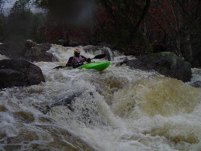
There are two options here. This is amoung the toughest rapid in southern NH. The North Branch splits just after a long flat section leading down from Stone Bridge rapid. The right channel is shorter in distance but drops more dramatically over this distance. Scout from river right. The left channel is longer and narrower but still packs a punch. The initial drop is about 5' from a deteriorating rock dam, the river then takes a sharp right and drops steeply over the 1000+ feet in lenght. Along the way there are many pinning spots in this narrow channel. Always scout this drop since a fallen tree could easily block the entire channel.
This is a rather long complicated rapid. There are many channels and routes to chose from. Be especially cautious of wood here since some channels are very narrow and blind. Most of the rapid can be viewed from Liberty Farm Road which follows on river left most of the way.
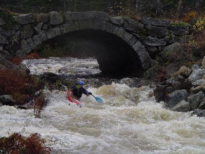
The Cleaver is the final drop on a rather long stretch of mostly class III and IV rapids. This one is difficult to scout from the river bank because of the steep bank and lack of eddies above. It is easily scouted from the takeout and route 9 which follows on river right. The best route to take over the Cleaver is about 8' from the river right bank. From here you will drop a few vertical feet. Do not run the center because the water piles up behind and under the enormous cleaver boulder. The run on river left is possible but is more difficult than the right side.
Nov 4, 2012
Both sides of Mill Race were clear of any significant wood as of 11/3/2012, after SuperStormSandy passed. There is a new rock road on river L, gated to prohibit vehicles, but creating an easy walk to the put-in up in the flatwater; easier scouting, too. In the Mill Race left channel, along the bank on river L side, there is a flagpole-sized trunk pointed upstream with only little showing - easily avoided but worth awareness.