Gale River
Franconia to Ammonoosuc
| Difficulty | II-IV |
| Length | 3.4 mi |
| Avg Gradient | 67 fpm |
| Gauge | Ammonoosuc River at Bethlehem Junction, Nh |
| Flow Rate as of 53 minutes | 1.48 ftbelow recommended |
| Reach Info Last Updated | May 1, 2018 |
The Gale is a beautiful northern NH river. The river starts out class II and picks up in intensity as a boater heads downstream. The first mile is class II, the second mile is class II-III, the last mile is the class IV gorge section. The last mile is the toughest as the river cuts a deep narrow gorge through an old basalt lava dike. The change in geology is responsible for the ledgy nature of the gorge section. The gorge contains several class IV ledge drops.
Put in elevation........850'Take out elevation......650'Total drop..............200'

1st mile................50'2nd mile................60'3rd mile................90'Average drop/mile.......67'Distance................3.0 milesRiver width average.....70'River geology...........Medium to large granite boulders, basalt schists ledge at the gorgeRiver water quality.....excellent, clarity good.Scenery.................excellent northern spruce/fir forest scenery, river is wild and isolated.Wildlife................Deer, hawks, moose, merganzers, coyotes.Interstate 93 to exit 38 (Franconia).
Left at the end of the ramp towards Franconia.
Right on NH 116 north at the stop sign.
1.3 miles take a left on Streeter Pond Road.
2/3rds of a mile take a left over the truss bridge on Crane Hill Road (dirt).
2/3rds of a mile past the open field into the woods park where the river comes close to the road.
Head back to Streeter Pond Road.
Take a left after the bridge.
Approximately 3 miles take a left on Sherman road.
Approximately 1/2 mile park on the rail trail just before the bridge over the Ammonoosuc River. The Gale enters the Ammo about 1/8 of a mile downstream from this point. Carry up along the rail trail.
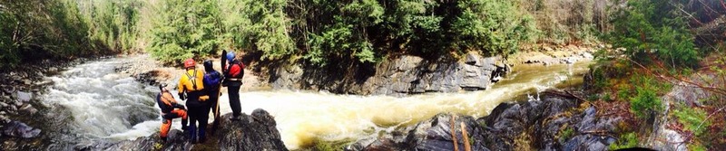
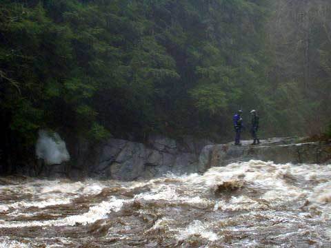
Comments From Jeff Swett:
Lead by Butch Mixon, the group included myself, Mike Rock, Eric Mixo
...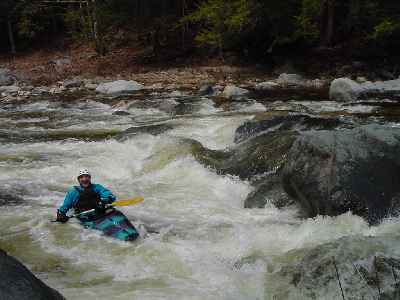
This is the first major horizon line you will approach. The river breaks up into three channels, the far right channel is the easiest and only requires a couple quick eddy turns. The far left channel drops 2' onto a rock which is usually pillowed enough for a straight run through. The middle channel with most of the flow drops 3' into a ramped rock. This rock creates a laminar rooster tail, then drops down into a sticky hole.
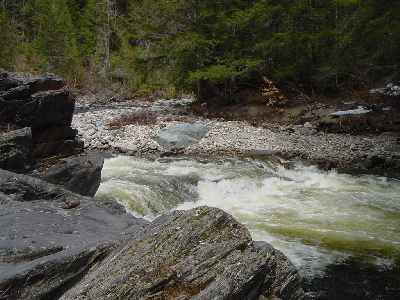
The river takes a sharp left turn and drops into the gorge. The rapid starts out in a steep slide heading into the left wall of the gorge. Start at river center and move left to avoid a large hole river right to center. After the hole catch the micro eddy just as the river takes a hard right. There is a nice pool to recover after this drop.
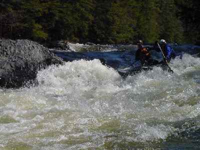
There are several ledge drops through the middle gorge the most difficult comes shortly after the Upper gorge drop. There is a 3' to 4' vertical drop on river right that creates a nasty hydraulic at its base. Run far right and paddle hard through the hole. After this drop there a several more ledge drops mostly in the 2' to 3' range. All these can be boat scouted.
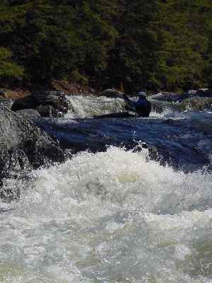
Lava rapid is created where the river cuts through a basalt lava dike. There is a 2' to 3' entrance drop into a small eddy. From here you can scout the drop. Running down the middle or left will lead you directly into a fairly large hole. The right side of the drop is gaurded by a piece of ledge that creates a large roostertail. The best route is starting from the middle of the channel and run towards the right just skirting the roster tail ledge.
Jul 13, 2023
Kayaked today with Vincent Dude.
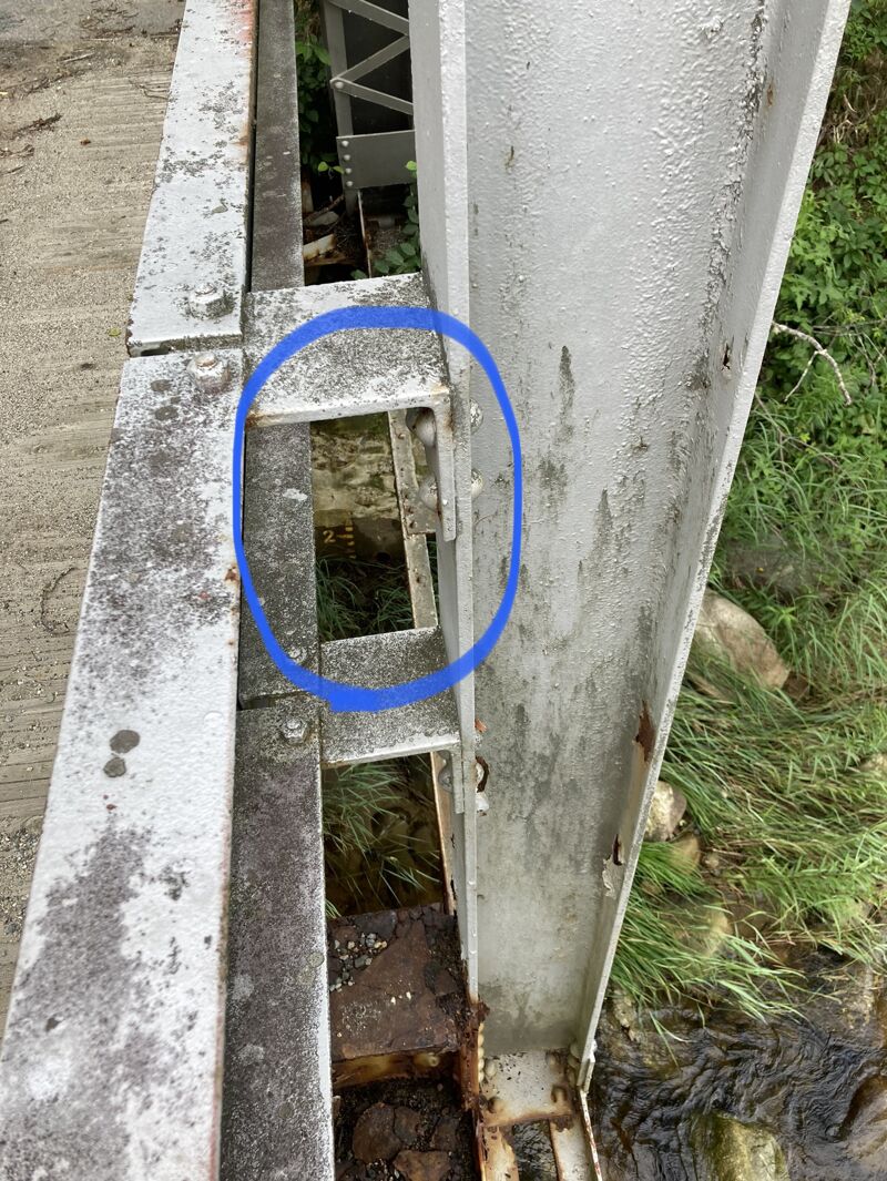
Low, but not too low at 3.15 ft. We scraped at times when we chose the shallower channel but it was plenty fluid. The recommended low of 3.10 seems like a reasonable low to stick to. The painted gauge is on river left of the bridge on Crane Hill Road (as you are nearly at the put in). It is fading and isn't useful at low flows like today. Pics of that added.
Not pushy, mostly cruisy II with the occasional III quick section until the gorge. 3 class IV drops in a row, each scouted and ran successfully - followed by Lava to finish things off, which wasn't too bad at this level. I tried to get fancy with my route and had to roll up after getting flipped.
To take out we parked where the rail trail crosses Streeter Pond Road next to the Ammo bridge crossing, and walked up the trail from the river. To avoid poison ivy, take out just before the railtrail bridge on river right as the Gale is flowing into the Ammo. Following up along the concrete abutment to the trail I managed to avoid stepping in any. It was all over the place everywhere else.
Beautiful and fun - totally worth it to me at this level! A wee bit more water would be nice, but at much higher flows those IV drops would get too spicy for me I think.
Jul 13, 2021
Ran it Memorial Day 2013 when the Ammo @ Bethlehem Jct (USGS gauge) read 1000 cfs (falling) and the painted gauge read 1.1. We posted our pictures from the day here: https://www.vtpaddlers.net/?id=20 and Brock's trip report here: https://www.vtpaddlers.net/legacy/bowstern/pdf/Bow\_and\_Stern\_2013\_12\_05.pdf