Gale River
Franconia to Ammonoosuc
Jul 13, 2023
Kayaked today with Vincent Dude.
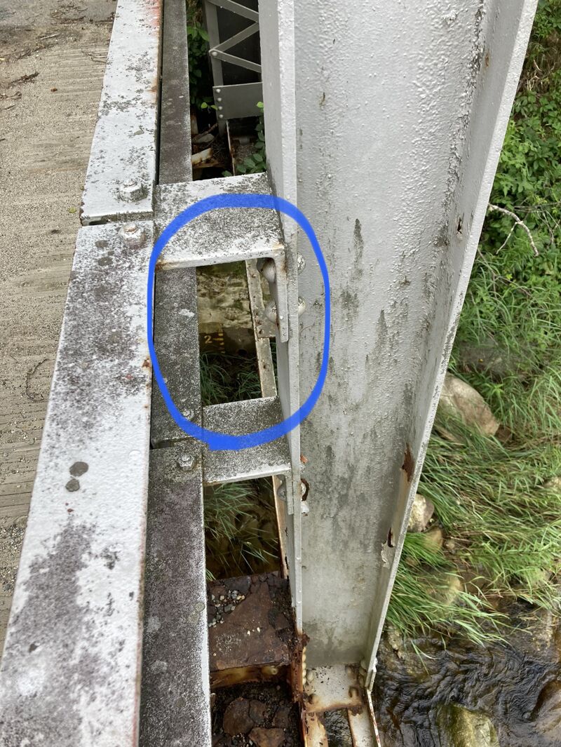
Low, but not too low at 3.15 ft. We scraped at times when we chose the shallower channel but it was plenty fluid. The recommended low of 3.10 seems like a reasonable low to stick to. The painted gauge is on river left of the bridge on Crane Hill Road (as you are nearly at the put in). It is fading and isn't useful at low flows like today. Pics of that added.
Not pushy, mostly cruisy II with the occasional III quick section until the gorge. 3 class IV drops in a row, each scouted and ran successfully - followed by Lava to finish things off, which wasn't too bad at this level. I tried to get fancy with my route and had to roll up after getting flipped.
To take out we parked where the rail trail crosses Streeter Pond Road next to the Ammo bridge crossing, and walked up the trail from the river. To avoid poison ivy, take out just before the railtrail bridge on river right as the Gale is flowing into the Ammo. Following up along the concrete abutment to the trail I managed to avoid stepping in any. It was all over the place everywhere else.
Beautiful and fun - totally worth it to me at this level! A wee bit more water would be nice, but at much higher flows those IV drops would get too spicy for me I think.
Jul 13, 2021
Ran it Memorial Day 2013 when the Ammo @ Bethlehem Jct (USGS gauge) read 1000 cfs (falling) and the painted gauge read 1.1. We posted our pictures from the day here: https://www.vtpaddlers.net/?id=20 and Brock's trip report here: https://www.vtpaddlers.net/legacy/bowstern/pdf/Bow\_and\_Stern\_2013\_12\_05.pdf
Apr 22, 2019
Ran it above 7ft according to the gauge on this page on Sunday morning. Great fluid run, we all portaged the first hole at the entrance to the gorge but it looked runnable. Scout the next two drops from here- the sneak river right was good. Everything was scoutable and portageable.
May 3, 2014
Level .85'ish on the bridge gauge.
Apr 24, 2005
At this level the guage is under water.
In very high water this large hole, spanning much of the river, guards the entrance to the gorge. First ferry across the river above the hole, then sneak by on river left while the current tries to take you into the river left rock wall. Or do what I did, and carry your boat around the gorge when the guage is completely under water.
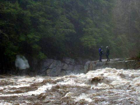
Entrance to the gorge when the guage is completely under water.
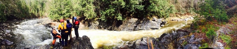
Two paddlers scout the entrance to the gorge in very high water. The river careens of the rock ledge on river right, then takes a sharp right turn when it hits the rock wall on river left. A nasty hydraulic spans much of the river as it makes the turn here.