Lacamas Creek
Round Lake to Highway 14
| Difficulty | V |
| Length | 1.6 mi |
| Avg Gradient | n/a |
| Reach Info Last Updated | October 15, 2025 |
Lacamas Creek is a short, infrequently run whitewater creek in Camas, WA, offering a quick but engaging descent when flows are right. The run features a clean, medium-sized waterfall followed by a long, fast slide that requires solid boat control. It's set in a forested canyon and best suited for experienced paddlers looking for a short, technical challenge.
There is no dedicated gauge for Lacamas Creek, so paddlers rely on local conditions to judge flow. The creek is rain-fed and responds quickly to storms. A key indicator is the status of the upstream reservoir—when it's full and there's ongoing rainfall, excess water spills into the creek, creating reliably runnable conditions on high-water days. Checking nearby rainfall totals and doing a visual scout at the take-out can also help determine whether the creek is in.
Put in Parking lot: Lacamas Park (45°36'13.4'N 122°24'24.9'W)
Take out Parking lot: Lacamas Creek Trailhead (45°35'20.9'N 122°23'29.9'W)
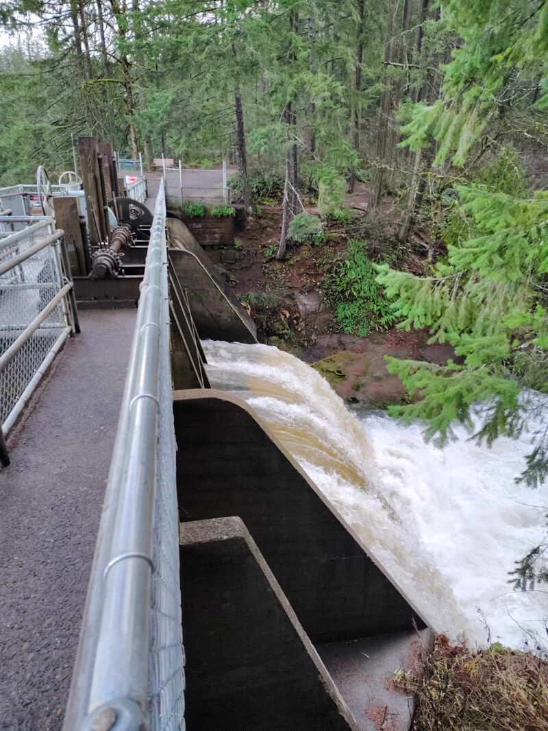
Put in at Lacamas Park on Round Lake and paddle or shoulder your boat 1/3 of to the south end of the lake where the creek starts below the dam. Portage the dam on the right, walk across the top of the dam, then put in river left
The run begins below the dam. At anything but high flows, this rapid looks horrible and is a portage. You need a significant amount of rain to run this, per the picture
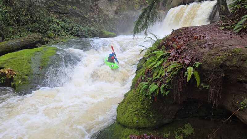
Scout left and assess the options among the three lines. Note: this waterfall will come up very quickly after you get past the dam rapid, so be prepared to eddy out quickly on the left. The left line looks the deepest and is generally suggested. The center line looks glorious, but the landing is a touch shallow
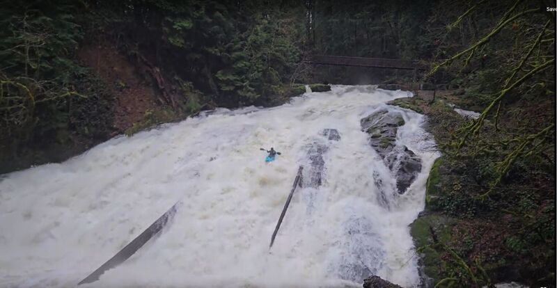
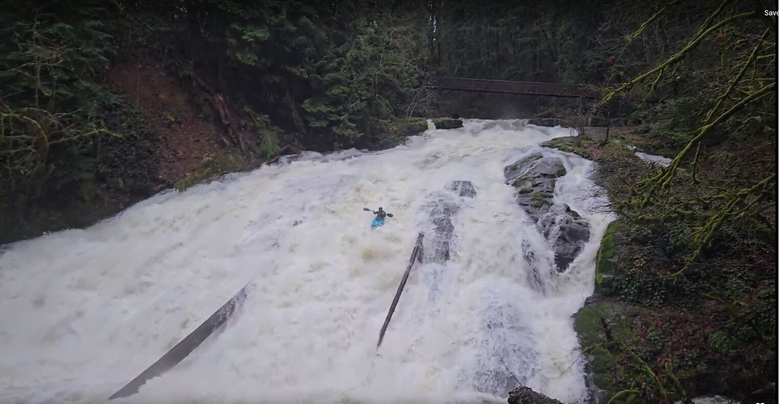
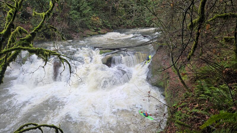
Eddy out before the foot bridge to scout this big slide or portage on river left. I'm not sure how big it is, but from start to finish, you're going down this slide for about 15 seconds. This is likely the largest slide within at least an hour or two drive from Portland
The take-out is at the Lacamas Creek Trailhead on the upstream river right side of the Highway 14 Bridge. While you will park at Lacamas Creek Trailhead, you will want to scout where to takeout from the parking lot. The closer you get to the parking lot, the steeper the bank gets. The ideal place to takeout is roughly one or two tenths of a mile from the parking lot. You will likely have some wood portages between Little Norway and the takeout, but they are in class 0-1 water, so it's easy to portage them
Dec 18, 2024
There isn't a gauge, but we ran this when EFL was at about 3k cfs and I think flows were about ideal. With that said, it looks like you can still scrape down this a good week after it's last rained. Anyway, I (Timothy Kunin) went with Kallie Kurtz and Andy Lozovoy. This run is very underappreciated, especially since big slides in PNW are rare and this is so close to Portland. Thanks to Kallie Kurtz for the majority of these photos