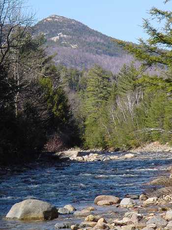
Mad River
1. Highway 49 Bridge (Waterville Valley) to Campton

| Difficulty | III-IV |
| Length | 7.6 mi |
| Avg Gradient | 85 fpm |
| Gauge | Baker River Near Rumney, Nh |
| Flow Rate as of 1 hour | 36 cfsbelow recommended |
| Reach Info Last Updated | May 2, 2024 |
The Mad has a relatively short season due to its small and steep watershed. When it is running this is one of the longest stretches of continuous class III-IV whitewater in the state. Be cautious of rain or warm days in the spring when you are at the put-in. The river can rise up from low to too high by the time you reach the gage 6 miles down river. On one occasion in May of 1994, a group put on in a light rain. The rain along with snowmelt from higher elevations of the watershed raised the river to a ragging torrent about 4 miles into the trip. Many boats, and paddles were flushed downstream as their occupants were rescued and found their way out. Most of this group took off at this point.
Put in elevation........1417Take out elevation......751Total drop..............666Average drop/mile.......85Distance................7.8 miles1st mile drop...........462nd mile drop...........1183rd mile drop...........464th mile drop...........955th mile drop...........1186th mile drop...........1227th mile drop...........957.8 mile drop...........26River width average.....25River geology...........small to medium granite bouldersRiver water quality.....Good, clear except for quick runoff periods. Small sewage treatment plant at put in.Scenery.................Good to excellent mountain and forest scenery. Route 49 occasionally visible along the river.Wildlife................Occasional deer, moose, hawksFood:
On route 49, Mad River Tavern: Good food moderate price. Pizza and subs available at the Lower Village store on route 175. Take a right after the lights.
Lodging:
Expensive hotels and condos available in Waterville Valley. Scandinavian Inn located at exit 28. Several Bed and Breakfast establishments. Less expensive motel located at exit 27.
Campgrounds:
Campton campground, located on route 49 about 2 miles f
...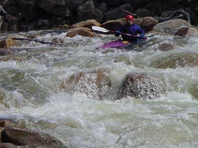
Class II and III rapids will be continuous until NH route 49 becomes visible for a short distance on your left. Once the river turns away from the roadway a sharp drop will be visible in the distance. Take out river left and scout the best line. Normally you would start from river left then move your way into the eddies behind a couple large boulders midstream. From this point you can peel out towards river right through a couple big holes at the bottom. In low water this drop can be full of pinning rocks. Even in high water large rocks can throw you off your line.
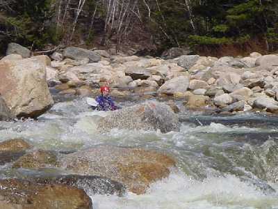
Once again this drop is out of site from NH 49. As you approach Welch Mtn on your right class III water leads up to a short pool. Look for a sudden drop in the river up ahead, a rock slide will be visible just to the right of the drop. Pull out on river left and scout. There are two possible routes, going to the right of the large boulder midstream will drop you vertically 3'to 4' into a fairly large hole. Going to the left of the boulder forces you to make a sharp right turn into a wierd hole. Where the river takes a sharp right the water piles up against a rock creating a pillow. Use the pillow to drop you into and through the wierd hole/whirlpool below. At low water there is not much of a pillow and the wierd hole is just a series of smaller holes.
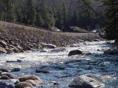
Once you pass the Upper Mad river road bridge the river calms down from continous class III to class II+. 1/4 mile from the bridge Smarts Brook enters on the left, NH route 49 will be visible straight ahead with a distinct drop before the road. Use a zig zag manuever starting from river right, move left, then river right once more around immense boulders. The turbulance in this section can be considerable in medium and high water.
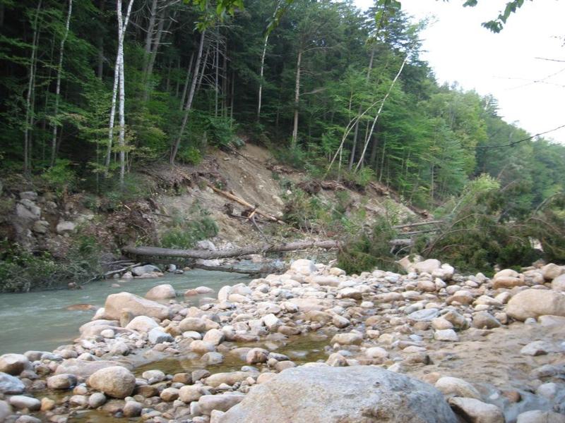
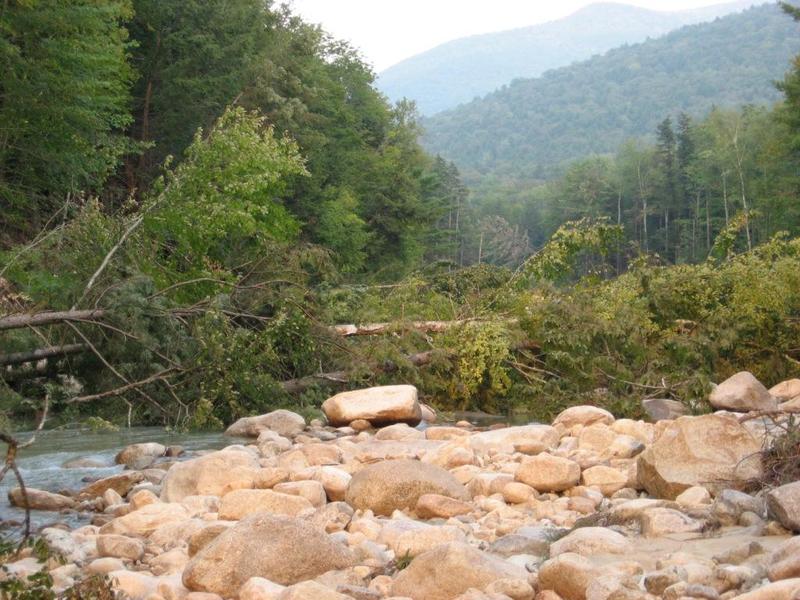
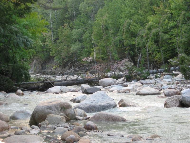
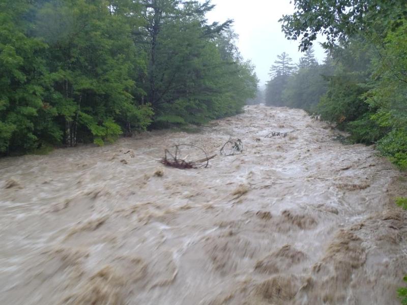
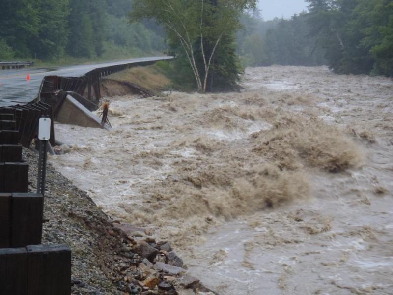
Sep 5, 2011
Hurricane Irene damage