Trip Reports
Log in to add a reportBW
Brad Walker
Aug 12, 2018
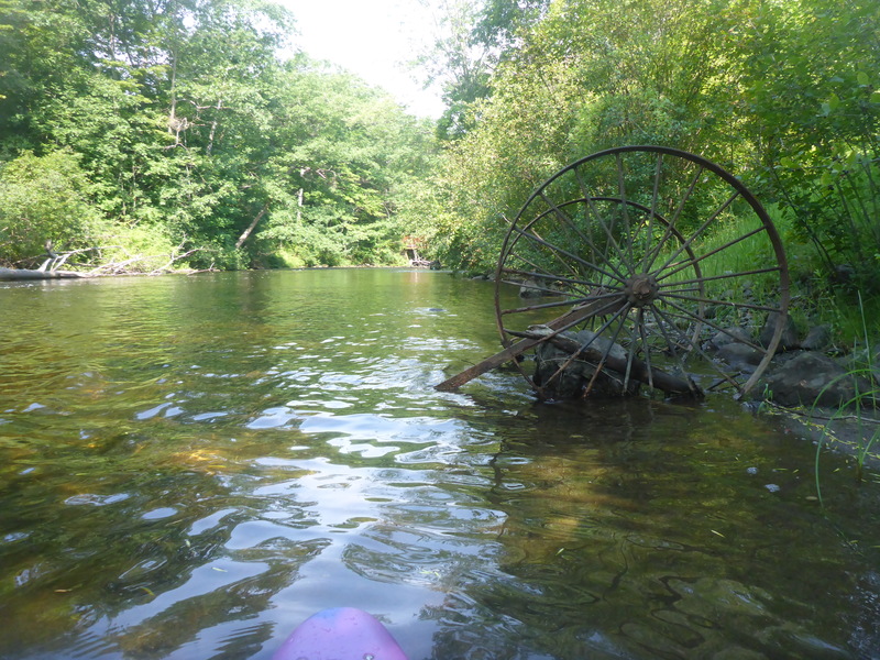
Decent amount of old metal objects throughout the run. Not bad, visible. Some bars and things that are not as obvious. Pretty standard stuff for NE Mill Country rivers.
BW
Brad Walker
Aug 12, 2018
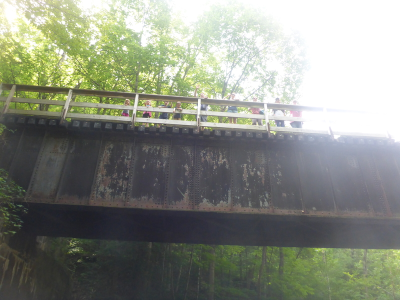
Your non-paddlers can enjoy themselves on Lake Mascoma proper, or hit the criss-crossing Rail Trail and still feel like you're participating in family events as you go!
BW
Brad Walker
Aug 12, 2018
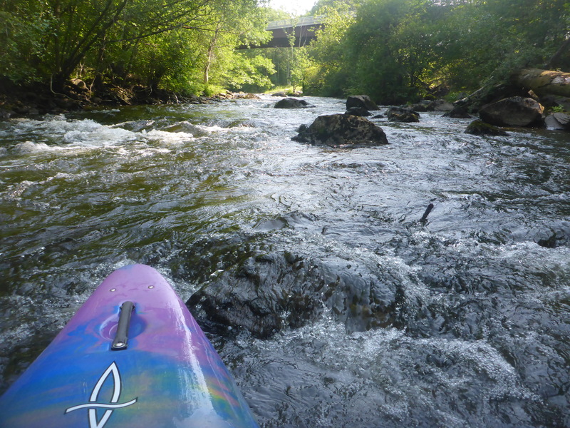
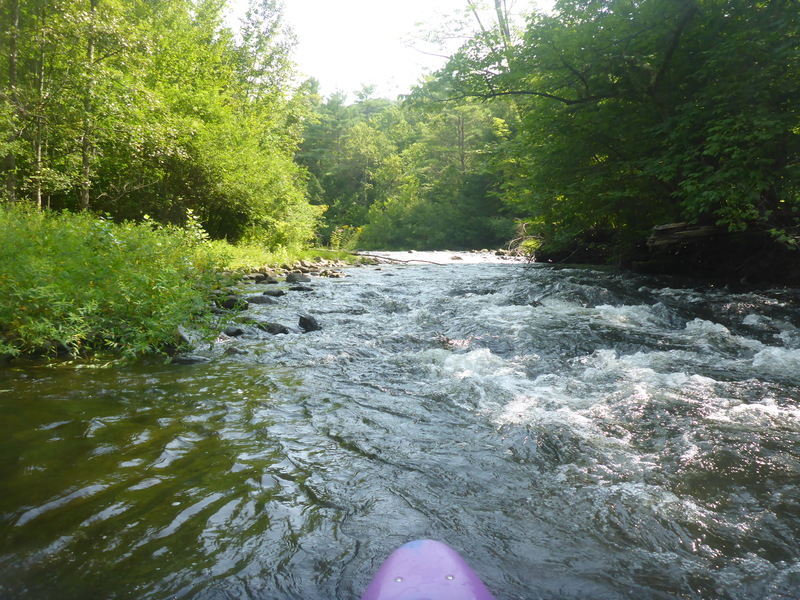
Higher flow could make for some play features in a handful of sections like this one.
BW
Brad Walker
Aug 12, 2018
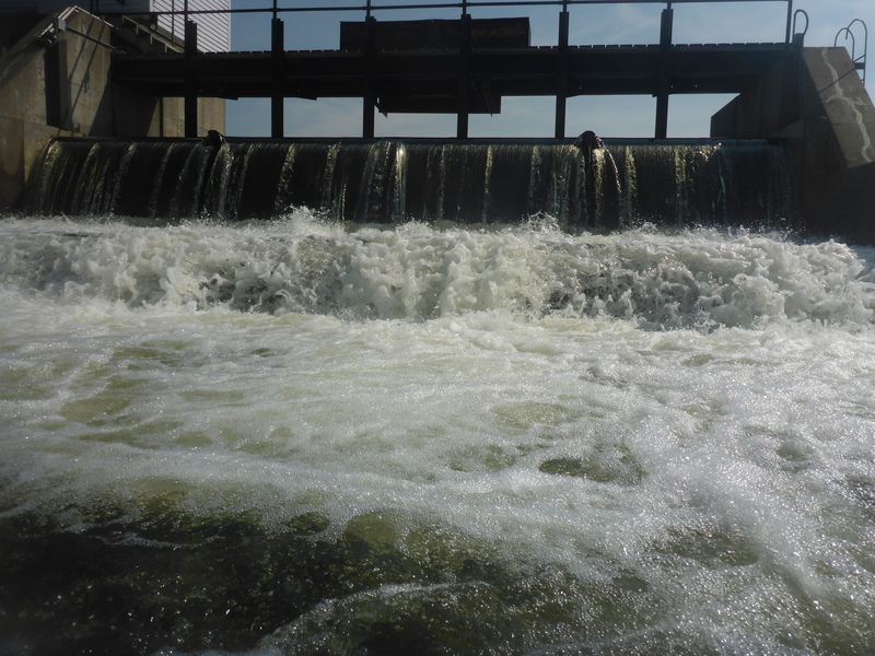
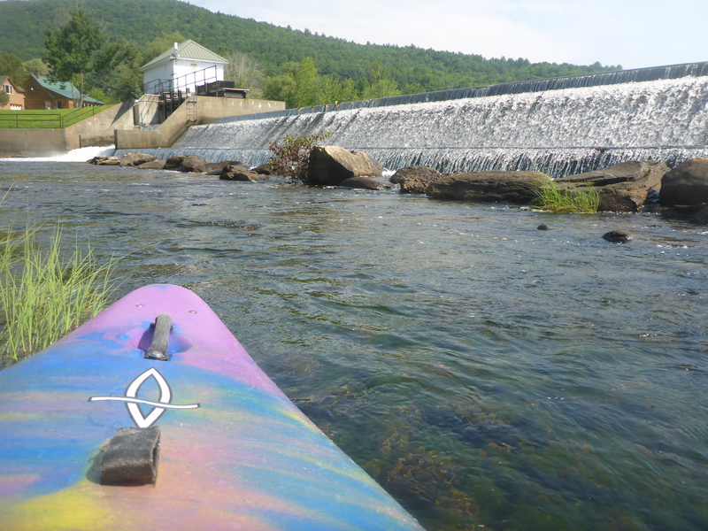
Paddled 8/7/2018 not sure level, the 2 gauges I saw were toppled in the water. See photo of dam to see what the overflow looked like. At this point the area had gotten several inches of rain, but things had already peaked a good 24 hours before I got the chance to get on.
Only did 1/2 the listed run - from the lake down to where Rte 4 and the Rail Trail intersect just a bit past the I89 overpass.
BONY run, minimal features to surf at. You can see plenty of potential when there is good flow... as it was, it was merely a nice break from flatwater lake paddling while shadowing family walking the Rail Trail. If you are camping in the area with non-paddlers, this is great - they can do the trail and with loads of bridge crossings, you can chat with each other as you go.
The section I did was free of wood. No portages needed (I started at Mascoma Lake Campground beach and did portage the dam onto river left). Though bony, all passable. Nice deeply wooded run giving a good sense of seclusion. Rubber at high levels beware, decent amount of metal objects scattered throughout the run, not bad, but aside from the cart wheels and the giant safe, I did notice some rebar-like rusty posts and such here and there.
I'll upload photos looking up at some areas that very likely become fun rapids at higher levels. I stopped where I did due to my family on the trail petering out. It was shallow enough I wasn't terribly sad to get off the run and besides, being alone, I didn't want to accidentally encounter the Cl V drop that I couldn't remember exactly where it was supposed to be :)
BW
Brad Walker
Aug 12, 2018
This is the release section of the dam. Not much coming out that way.
BW
Brad Walker
Aug 12, 2018
At low flow gotta go Right by the island. At higher flows, it looks like there are a few channels to choose from with potential for some fun play.
BW
Brad Walker
Aug 12, 2018
Overflow section of dam only had 1-2' - see my river Comment 8/12/2018 from 8/7/2018 run for details.
AB
Allan Berggren
Mar 17, 2016
Jimmy and I paddled yesterday. Strainers are everywhere, but all passable. However, the long left channel that starts just above the beaver pond is hopelessly blocked. Takeout, now upstream of the water works on left, has a rather steep climb-out. One must hike across a river bridge on the rail trail to exit. Alden Bird, in Let it Rain, says there is no permission to park alongside the rail trail below the old mill, but his description of a portage river left of the dam is invalid, for the takeout is now fenced off by the water works. If you positioned a cart, you could walk, carry or drag 1/2 mile back to the covered bridge parking area., I have run the dam off a jump platform far right, just left of a barrier rock below, but a friend's paddling hobby ended when he got carried along the boil line until he was spit out at the far left end.
BS
Ben Selleck
Sep 7, 2014
The route 4 bridge is under construction and there is a cable across the river at this location just under the water at 300. There are a couple full width strainers after the left turn just after rte 4.
JC
Jeffrey Clayman
May 9, 2008
Ran river 5/5/08. Clear and open all the way to covered bridge. No obstructions.