Pemigewasset, East Branch
Franconia Falls to Woodstock.

| Difficulty | IV |
| Length | 9 mi |
| Avg Gradient | 81 fpm |
| Gauge | East Branch Pemigewasset River at Lincoln, Nh |
| Flow Rate as of 24 minutes | 78 cfsbelow recommended |
| Reach Info Last Updated | April 23, 2026 |
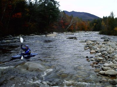
The East Branch of the Pemigewasset is a natural flow river best run in late April and May with the snowmelt from the high peaks of the White Mountains.
The river gets its start in the mountainous federally designated wilderness area upstream from the put-in. As a result the water is clean, clear, and usually cold when the river is running. Don't be fooled if the water looks too low; local river lore states that if it looks like there's enough water then it's probably too much!!!
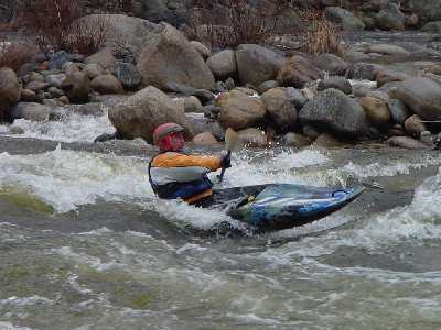
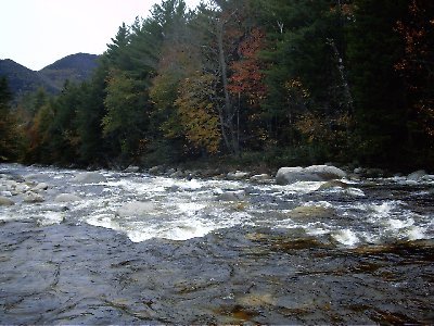
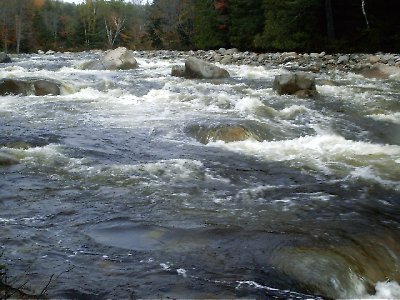
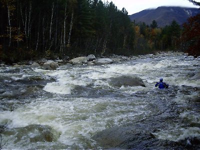
This river is a classic New England run. Continuous whitewater, a few more difficult rapids, and lots of technical moves required. Many boaters consider this river one of the best regularly run rivers in New England.
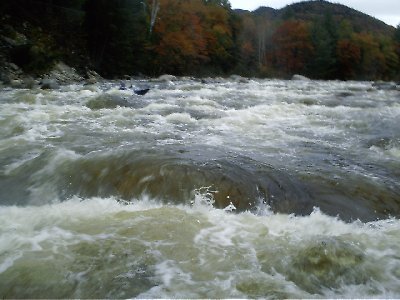
With the exception of a few bigger rapids on either side of Loon Mountain, the entire run is similar in character. (Although some purists claim that the upper section, reachable only by walking upstream is the best.) The river is relatively wide (85') for a New England river. It is strewn with car (and larger) sized boulders. These boulders create extreme turbulence during high water. The rapids are continuous and at high water all blend all together for a long class IV-V run. Any swim at high levels may result in the loss of one's boat as it is quickly swept many miles downstream. Be aware because of the nature of this river, boulders (even large ones) move and shift every spring changing the river character.
The Upper East Branch of the Pemigewasset run starts below Franconia Falls at the confluence of Franconia Brook and the North Fork of the Pemigewasset. To reach it you must walk/carry/drag your boat up the Wilderness Trail three miles along the river. The upper section is a bit more technical and unforgiving then the lower sections. Additionally the riverbed is more wide open, requiring a bit more water to paddle.
If a long walk just to paddle a beautiful river doesn't appeal to you, then start your run (as most do) on the middle section o
...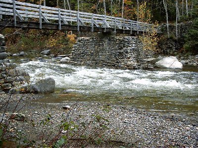
The put-in for the Upper East Branch is a long three mile walk/carry/drag up an old railroad bed. Put on where a bridge crosses Franconia Brook.
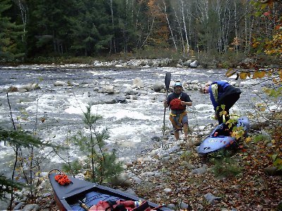
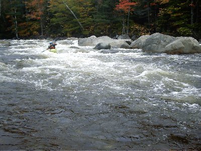
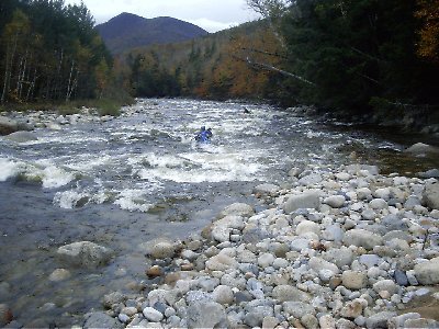
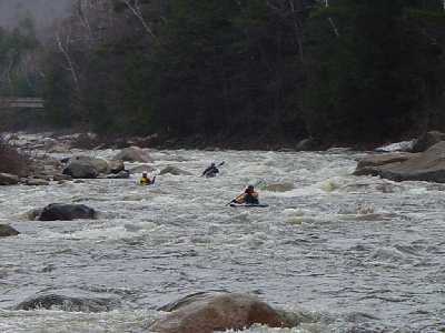
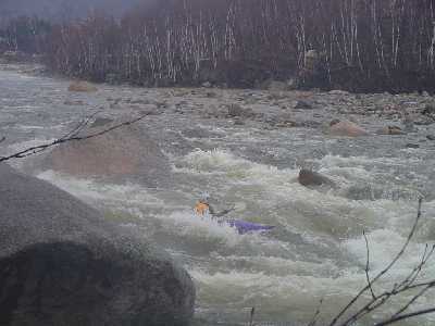
An old logging/maintenance road follows the river on the other (south) side. Put in here at the confluence of Franconia Brook and the North Fork of the Pemigewasset (the opposite bank from the boaters in this picture) where a gravel bar allows easy access thru the woods.
The Upper East Branch is a big wider and more open then the middle or lower sections requiring more water.
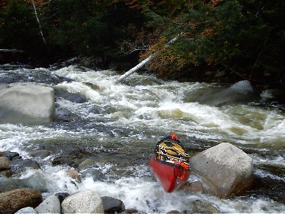
The first major drop is a wide, technical medium length rapid. There are multiple routes thru the rapid. It can be easily boat scouted.
The river narrows a bit at the second major drop.
The third major drop is a longish technical rapid requiring good river reading skills and quick reactions.
The fourth major drop is a series of big holes and rocks. The easiest route is far right thru the biggest section. This drop can be easily seen and scouted from the railroad trail on the way in.
The fifth major drop is a very long rapid full or waves, holes, and rocks. Open boaters in particular may have trouble here as they quickly fill up and find no easy place to stop and empty.
The sixth major drop is a longish technical rapid.
At the seventh major drop the river again narrows a big resulting in bigger waves and holes.
At the eighth major drop the river splits; the majority of the current flows left thru a steep narrow channel (currently blocked by a strainer). A small amount of current goes right. A manditory portage is currently required here.
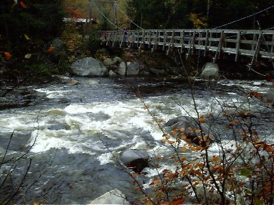
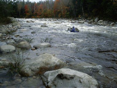
The put-in at Lincoln Woods parking area is the most common access point. Put on under the suspension bridge.
Once you pass Hancock campground on your right you will notice a large granite ledge on river left just before and after the confluence of Hancock branch. The river drops over two boulder strewn slides (above and below confluence) with lots of grabby holes.

Shortly after Hancock, the channel narrows again on the left. There are several large holes at the bottom.
The third difficult drop near the beginning of the Lincoln Woods section. Again watch for large holes where the channel narrows.
Another boulder strewn stairstep rapid. This rapid is just downstream from a large Mack truck sized boulder next to the first home you come up to on river right.
After passing a series of condos on your left, the river splits around an island, at low levels the left channel is too scratchy to be much fun. The right channel is narrow (25 feet) but steep. Many holes force the paddler to dart around the narrow channel. Just before the river joins up with its other half you will notice the remains of a dam on river right. There are also two large culvets in the river bed that must be avoided. Be aware fo another culvert downstream in the middle of the channel, as of September 2001, the openning of this culvert was facing downstream but high water could once again turn this culvert into a more dangerous position.
Just before reaching Loon Mountain Ski Area, and shortly after the end of Culvert Rapid in a longish, pushy, technical rapid. The river is wide open here and there are multiple channels and routes. The huge number of large boulders and holes require constant maneuvering. This is the longest difficult stretch on the river. Go left at the bottom and take out to scout Loon Mountain Rapid.
Update: Post-Hurricane Irene this is a different rapid. The upper section is easier; at the bottom the left is more technical and pushy. [Prior description: At the bridge to Loon Mountain ski area, the river drops over the most difficult rapid on the Pemi. This rapid has changed over the past several years, a flood in 1994 undermined the bridge abutments. The bridge abutments were repaired and the riverbed was filled with blasted rock just downstream of the abutments. This changed the rapid considerably leaving no good channel to run until the river scoured out a couple of channels over the past few years. The far left channel is easiest; it starts just past the bridge and is mostly a clean stair step drop onto the head of a rock island that splits the river. At this point you can maneuver to river right and complete the drop through a myriad of sharp pinning boulders that require lots of maneuvering or you can stay in the river left channel at higher water levels for an easier run. The right channel at the top of the rapid is more difficult because of the precise lines required to run it successfully. The usual route threads a pushy course along the left side of the channel bouncing thru some big waves. At higher water you can also thread your way down a narrow chute towards the right side of the channel. Scout this rapid carefully before you run.]
The river drops over the rubble left over from a dilapidated dam. There only seem to be boulders and some concrete in this drop but be aware that there could be rebar or spikes. Holes and pinning rocks are the greatest hazard here. Post-Hurricane Irene Update: This rapid is now more technical and difficult, especially at the bottom.
The channel narrows again along the right. Watch for holes and pinning rocks.
Look for this rapid near where the Loon Ski area snowmaking intake is.
Another nice class IV after a short class II stretch.
Once you view the USGS gauging building on your right, take out on river left on a gravel beach and scout the next drop. The rapid funnels through a cut in the log cribbing of an old delapitated dam then slides over a smooth ledge with two river wide hydraulics. At low water the upper hydraulic is worse, while at high water the lower one is. These hydraulics can hold boats and boaters for sometime and most people choose to walk around this rapid. There is a sneak route on the far left and another just to the left of the holes. The far left requires a paddler to scrape over ledge halfway down if the water is medium or lower. The usual route would be to run the tightrope just left of the holes and right of the shallow ledge. You can easily get off line here and end up in one of the holes.
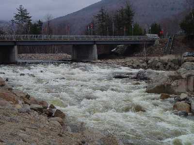
After Mill dam the river widens and can be a little scratchy at low levels. Most of the water in the river then channels to the left and is only about 25' wide at this point. Rapids pick up to the South Mountain bridge crossing. After the bridge the river drops over a constricted boulder pile that requires precise manuevering. At the base of the drop a nice series of surfing waves form with a convinient eddy on river left at medium levels.
Good view of this rapid from the I-93 bridges. At medium or high levels the waves can get quite big here due to the large gradient.
Apr 16, 2026
This was a fun level, requiring some scouting in places where the drops are steep enough to prevent a good boat scout. The culvert has washed up into the right bank below the island just above Upper Loon Rapids. Upper Loon had the most technical and sustained rapid finishing with several drops, some into stout holes, just upstream of the bridge. Took a barely-in sneak line past the old dams at 'Old Hole' behind Gordi's steakhouse and didn't have to carry. Very fun run to teach and practice good scouting!
Apr 28, 2024
Great run today with 6 paddlers new to the EBP, 6 miles from Lincoln Woods trailhead to the Fire Station in Woodstock. Total run with a few stops took 5 hours. Perfect intro level to learn the demands of this river character as it is not too pushy. The flip side is that there are half a dozen locations where the river widens and water gets thin requiring a few shoves over rocky shoals. 600 cfs would likely be more fluid over the entire range and still a good intro for new paddlers to Class 3/4 rivers. 800 cfs definitely ramps up to more forceful conditions that require faster reaction times. At 400 cfs, LOON RAPID was easy to scout and discuss on river right. We set safety and all who chose to paddle through had no trouble on the typical route of bobbling into the upper pool on river left, then darting across the current diagonally toward river right, aiming for the largest boulder, which creates a smooth line just past the hole on river left-center in the last drop. This river never lets up! The rapids are consistent with steep gradients and many holes and boulders to navigate, with many rapids ending in an unavoidable flushing hole. Only one significant STRAINER at this location tag, a half-mile before Mill Rapid. 44.050704, -71.651645 It is easily seen and does not cover the whole river with a 10-ft bypass on far river right.