Saco River
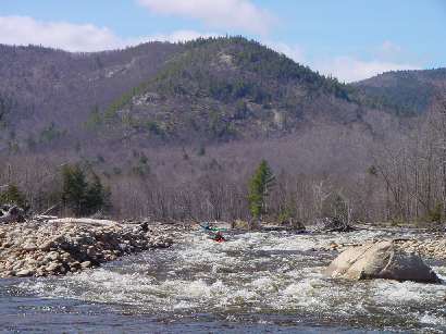
1.) Crawford Notch to Bartlett (along Hwy 302)
9/30/11 Post T.S. Irene Condition at .9 ft on bridge painted gage-
Paddled from Davis Path to River St. and noted the following: (1) Large tree nearly all the way across river about 100 yds. downstream of Davis Path put-in, just able to get by on river left. (2) There is a tree along river left blocking the small eddy right at the top of the gorge entrance. It is not blocking the river but don't plan on stopping there to scout. The larger eddy at the beach before the left turn well above the gorge is clear. (3) There are branches/roots extending half way across river from river left at the last drop in lower section of gorge. Also looks like there may be a log just below the surface at this drop. Runable on right, but hazard if on left or capsized/swimming. The narrow upper section was clear but I believe should always be scouted before running. (4) Many sections of the river have minor changes with rock bars that have built up due to significant bank erosion in some areas. (5) Tweedle Dum-Tweedle Dee is best run just right of center now, as medium size boulders have been deposited along river right near end of the rapid. (6) The rapid in the right hand turn after the last railroad bridge has been filled in on the right and scooped out around the large rocks on the left, which now are more in the center. Should be interesting at higher levels. (7) The class 2 section below this last big rapid has changed significantly in that a couple old channels have been closed by rock bars and new ones dredged out. Not any harder, just different. A lot of trees along banks, but none blocking river. (8) We were pleasantly surprised to find so few strainers. It appears that the flood level was so high that the trees were pushed parallel to the river and most are high on the river bank.
Mike Cummings
Glen, NH
On August 28th, 2011 Hurricane Irene struck New England. The resulting floods caused extensive damage throughout the region, the worst in over 100 years. More than half the rivers in Vermont and northern New Hampshire recorded their highest flow levels ever. Many roads, guardrails, power lines, bridges, trees and other debris now litter several rivers throughout the region. River beds have been scoured and changed course, many new strainers make navigation problematic at best and downright dangerous at worse. Please realize that the river description you see here may not match current situation after the floods. Use common sense and when in doubt scout especially on blind drops. Also, if you run this river in the next year or so please comment on its navigability, even if there are no problems this will be very helpful. Please report any new strainers or changes to the rapids that will impact future boating.
Thank you,
There is a large strainer stuck in the top drop of the gorge and it is unrunnable, very dangerous at a 2 foot level because the tree is just at the surface and difficult to see.
The strainer as of 4/17/08 is no longer there.
No articles