Smith
1) Route 104 to Cass Mill Road
April 21, 2013
| Reporter | David Su |
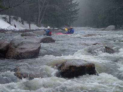
2013 April: Smith is clear of wood from intersection of old Smith River Rd & Murray Hill Rd (43.54076, -71.82057) to the power line easement after Cass Mill Rd (43.56112, -71.78730), including both routes around the island - Ray's Rapid - approaching Cass Mill Rd and Class II, except for Ray's Rapid (III), @3.82' on the Bristol gauge.
UNNAMED FALLS: We cannot find previous discussions of an unnamed waterfall and rapids farther downstream, 'Pre-file Falls'(?) [IV-V] running from the bridge at the intersection of Smith River Rd and Borough Rd (43.56112, -71.78730), to a take-out on Smith River Rd (43.569134, -71.738051) opposite a wide, distinctively cleared yard on the south (right) bank of the Smith. These drops significantly precede Profile Falls farther downriver. Both Profile and Prefile Falls clear of wood 4/19/2013 and runnable @3.82' on the Bristol gauge.