Smith
1) Route 104 to Cass Mill Road

Dec 13, 2014
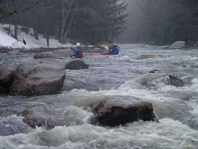
Paddled the Smith today at 5.0ft.
Confirmed the tree that was previously in Rays is gone. No other wood of note as far as the powerlines.
Apr 21, 2013
2013 April: Smith is clear of wood from intersection of old Smith River Rd & Murray Hill Rd (43.54076, -71.82057) to the power line easement after Cass Mill Rd (43.56112, -71.78730), including both routes around the island - Ray's Rapid - approaching Cass Mill Rd and Class II, except for Ray's Rapid (III), @3.82' on the Bristol gauge.
UNNAMED FALLS: We cannot find previous discussions of an unnamed waterfall and rapids farther downstream, 'Pre-file Falls'(?) [IV-V] running from the bridge at the intersection of Smith River Rd and Borough Rd (43.56112, -71.78730), to a take-out on Smith River Rd (43.569134, -71.738051) opposite a wide, distinctively cleared yard on the south (right) bank of the Smith. These drops significantly precede Profile Falls farther downriver. Both Profile and Prefile Falls clear of wood 4/19/2013 and runnable @3.82' on the Bristol gauge.
Sep 11, 2011
The Smith river was paddled (post Irene) on September 10th and found to be clear of debris and without any noticable change in river features with one exeption. There is a river wide strainer on the left channel of the Cass Mill rd to Berry road section. A short portage on the left is necessary or take the narrow bypass channel (also on the left) if it looks clear.
Apr 5, 2009
Profile falls downstream of the takeout looks unrunnable. cllass 5 lead in to a class 6 drop.
Dec 6, 2008
wondering if anyones run it all the way to pemi
Apr 2, 2003
Put in on the Smith just after sunset and before it started snowing again.