Souhegan
1) Greenville to NH Rt. 101 Bridge
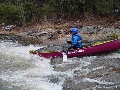
| Difficulty | II-III |
| Length | 5.6 mi |
| Avg Gradient | 59 fpm |
| Gauge | Souhegan River (site Wlr-1) Near Milford, Nh |
| Flow Rate as of 25 minutes | 14 cfsbelow recommended |
| Reach Info Last Updated | April 2, 2023 |
The Souhegan is a popular spring run. The river is small only about 30' on average. The first mile is steeper (class II-III) once you pass the bridge the river mellows out to a class II. This bridge crossing is the access for the easier section below. The entire river is wooded and scenic with only an occasional view of the road. The Souhegan is narrow and has many blind corners, because of this look out for trees and strainers especially early in the season before local boating clubs clear them out.
Put in elevation........690'Take out elevation......435'Total drop..............255'Average drop/mile.......59'Distance................4.3 milesRiver width average.....30'1st mile drop...........85'2nd mile drop...........65'3rd mile drop...........45'4th mile drop...........45'4.3 mile drop...........15' (50'average)River geology...........schists, small boulders, some ledgeRiver water quality.....good, clarity; good to neutral.Scenery.................excellent, route 31 occasionally visiable.Wildlife................Occasional deer, merganzers, beaver, hawks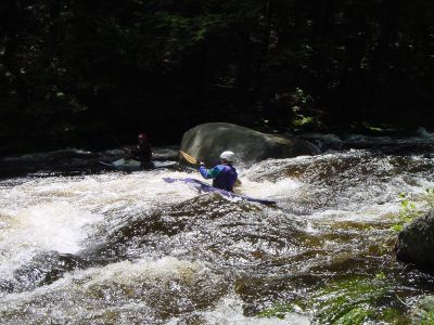
A short ledge drop. It can be identified by powerlines high over head just above. At the rapid lege and boulders protrude from right and left banks. The drop can have a good size hole on the right side at higher levels. Towards the left side there is a large boulder blocking the outrun.
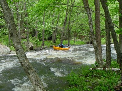
Probably the second most difficult rapid. Not far below Powerline the river widens then constricts into the rapid. Far river left at the wide section there is a boulder jumble with a few interesting chutes in between. The river then narrows down and splits around an island in high water, although the left channel is not too obvious. The main channel is narrow with two boulder / pourovers that upset many paddlers. The first is right of center forcing the paddler to go left, the next is left of center forcing the paddler to move right once more. Be carefull if you swim here since the Ledges section is only a little ways downstream.
The most difficult rapid on this section of river. You can recognize it from a play wave just upstream where the river narrows to 15' and creates a mini wave train. If you look downstream from this position you will notice a couple of large boulders midstream. One of the boulders has a hole bored in about half way up. The normal route is just to the left of the boulder skirting a large hole on river left. The river then continues over a trashy ledge with multiple crosscurrents. After this there are two riverwide 1' ledges about 20' apart. The last ledge is a great play spot.
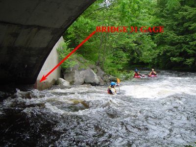
Once rt 31 comes into view on your right the river accelerates down a nice gradual chute with some nice waves. It then takes a sharp right and passes under rt 31. Just upstream from the bridge are two holes the one closest to the bridge abutement is great for 360's and other manuevers even at low water levels. Just below the bridge there is a weird hole with a sharp upstream apex. This one is not good for surfing but will not hold you. This is also the access for the easier lower class II section.
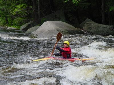
Once the river diverts away from the road on your left for the second time, the river takes a sharp right. In the distance a rock is visible at the end of the river. The river runs into this rock then takes a sharp left. The easiest way to run this in high water is to start from river right then cut to your left just before the rock. In low water you can eddy out on river right just above the rock then easily ferry across the river into the pool below.
The river splits into two channels just above a home (the only one on the river) on river right. The left channel is usually too clogged with strainers from beaver activity. The right channel is only about 18' wide at this point. Just below the house the river drops over a slopping ledge into a hole. Catch the small eddy on the right for access to this playhole.
The river splits into two channels once again. Take the right channel by taking a sharp right. Look out for strainers here the river is only about 20' wide at this point it is also covered over by a thick hemlock canopy which makes it dark at anytime of day.
May 16, 2026
Ran from bridge to near the electric company (the long very new looking driveway with the old Jeep parked on a boulder out front). 543 cfs, pretty shallow but not to scratchy, still fun.
Jun 14, 2013
6-14-2013 boated at about 1050 cfs;
several strainers...nearly river wide... but easily avoided.
Fun in the upper reaches.
Any less water and it would lose much of the fun factor.
Jun 26, 2008
JoeyT
2.7 via this site was scratchy from old power house down to the bridge on 31