Swift
3. Lower Falls to Darby Field sign(Lower Swift)
| Difficulty | IV(V) |
| Length | 5.2 mi |
| Avg Gradient | 84 fpm |
| Reach Info Last Updated | May 2, 2018 |
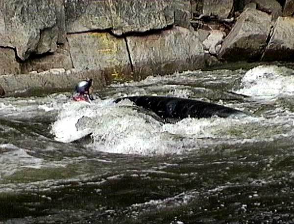
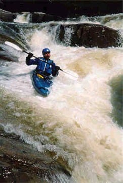
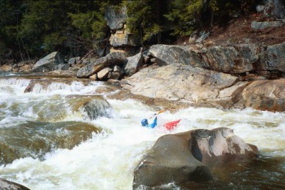
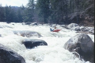
The lower Swift is the most sought after spring river in NH for intermediate to advanced boaters. The Swift drains the southeastern slopes of the White Mountains. The river is narrow only averaging 50 feet in most locations. You can put-in below the class V Lower falls in a relatively calm pool below. The first rapid after this is class IV then it calms down to class I-II water up to the Gorge (1.8 miles). From here on down the Swift once again calms down to class II until Staircase. After Staircase the river gradually gets steeper and more continous as you make your way downstream. It eventually builds up to a mostly continuous class III-IV with a few more difficult class IV's. This whole section looks and feels a lot like the Upper Yough in Maryland with blind obstructed drops through holes and pinning rocks. Most drops can be boat scouted but a couple should be looked at and carried if you feel uncomfortable, notably Lower Falls, Cabin Gorge, and Staircase. The Kancamagus highway parallels this entire section making for easy exit and entry points along the way. See also the Middle and Upper Swift.
Put in elevation.......885'Take out elevation.....508'Total drop.............377'Average drop/mile......70'......Including Lower fallsDistance...............5.35 miles1st mile drop..........92'......Includes Upper falls and Blackberry2nd mile drop..........23'......Includes Upper Cabin Gorge3rd mile drop..........49'......Includes Lower Cabin Gorge and Staircase4th mile drop..........75'......Includes Screaming Left Turn5th mile drop..........101'.....Includes Race Course and House Rock5.35 mile drop.........37'River width average....50'River geology..........large granite boulders, some ledges at fallsRiver water quality....Excellent, crystal clearScenery......Just pass the picnic tables from the parking lot for the put in, scout Lower falls and decide wheter to run it or put in below. The entrance rapid starts out well above the falls, carry up as far as you like for a warm up. Lower falls is a series of 6' to 8' ledges that run parallel to the river from the center with the ledges dropping off from left to right. You must scout this drop. It is necessary to run a route through a series of blind drops. A far left route leads the paddler over a more gradual slide. But the approach requires you to punch two large stickey holes. The slide itself contains numerous holes and boulders along its path. The other route (the usual one) requires a precise drop over the 8' ledge between a boulder and some shallow water. Take a sharp left after this drop paddle hard to launch over the next ledge over a stickey hole at the bottom of the drop. Below lies a fairly large calm pool for an esier put in for the lower section.
Blackberry rapid probably would not be as difficult if it were located further downstream but it is located shortly after the put in. The rapid is long (1/3 mile)and does not let up until you approach the Albany covered bridge. The main difficulty here is a miriad of pinning rocks. There are some holes and a few play spots along the way.
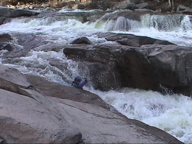
At levels above 2' this should be considered a class V. About a mile below the covered bridge you will come up to some cabins on river left. Take out below the last cabin and scout the drop below. The entrance rapid requires a boof move off a rock on river right at low water levels. After two ledge drops catch an eddy on river left then make a move downriver to eddy out behind a rock in the center of the river. From this point make your way to river right then then take the slot move through the center of the river. This rapid is fairly long (about 60 yards) and drops about 20 to 25 feet in that distance.
At high water this one should also be considered a class V. There is a sneak route on the far left. The main route requires a boater to remain upright and on course through two large channel wide holes that contain some boulders that could change your course or cause you to bounce back into the hole. There is a fairly clean line that would allow a boater to paddle straight and hard to punch the holes and avoid the rocks but you must scout this line since it is not obvious from above. There is another route on river right that is a little easier but more technical. A boater must manuever around boulder consticting drops. The run is very short only about 80 feet but it drops about 15 to 20 feet in this distance.
Mar 20, 2025
Unfortunately, many gauge links and flow information have been lost since the latest AW code update.
Upper Swift
https://www.americanwhitewater.org/content/Gauge2/detail/id/45492/
Lower Swift
https://www.americanwhitewater.org/content/Gauge2/detail/id/45943/
All NH Gauges
https://www.americanwhitewater.org/content/Gauge2/view/state/NH/
Jul 20, 2023
The falls are quite runnable at this flow. The lip on the first drop is a bit scratchy, so the boof is a bit tricky, but the hole at the bottom is not sticky at all, so all good even with a bit of a flop. After that kept to the right of the middle chanel and breezed right through the secondary drops. Pretty fun ride. High summer of 2023 keeps giving...