Swift
3. Lower Falls to Darby Field sign(Lower Swift)
Mar 20, 2025
Unfortunately, many gauge links and flow information have been lost since the latest AW code update.
Upper Swift
https://www.americanwhitewater.org/content/Gauge2/detail/id/45492/
Lower Swift
https://www.americanwhitewater.org/content/Gauge2/detail/id/45943/
All NH Gauges
https://www.americanwhitewater.org/content/Gauge2/view/state/NH/
Jul 20, 2023
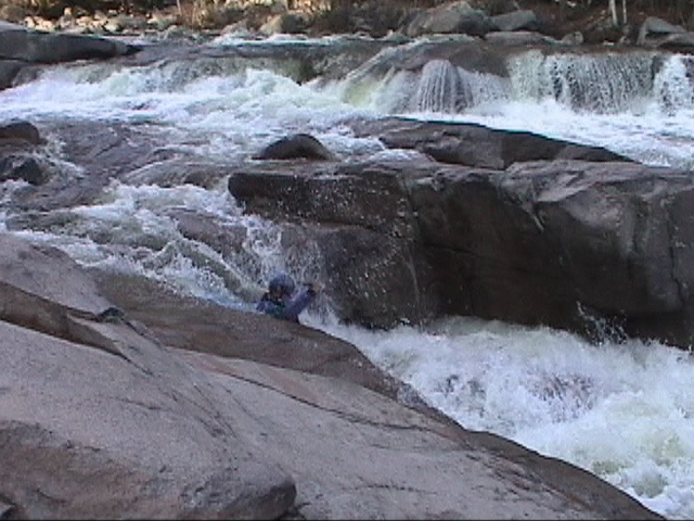
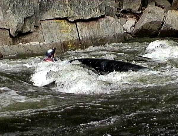
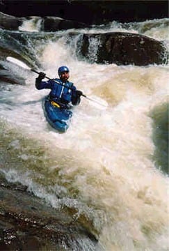
The falls are quite runnable at this flow. The lip on the first drop is a bit scratchy, so the boof is a bit tricky, but the hole at the bottom is not sticky at all, so all good even with a bit of a flop. After that kept to the right of the middle chanel and breezed right through the secondary drops. Pretty fun ride. High summer of 2023 keeps giving...
Oct 17, 2011
Several parties have run from the cabin gorge, just downstream of Hobbs Brook confluence to the Darby Field sign. Although there are some differences, most are subtle and are minor changes to lines.
Upstream of the cabin gorge, there used to be a log with a small US flag on it. The log is gone but it is a good historical reference to the following: The river did a large S-turn into the eddy just above cabin gorge. After Irene, at a little over a foot on the paddler gauge- there is a new slightly bumpy line down the right side of this, at higher level it goes pretty smoothly. Gorge is the same. Curious to hear what people think about things, I think one of the really big rocks moved a bit to the left, the big one just upstream of the gauge in the middle that the typical line went around either side. It felt tighter on river left along the wall...
We ran the typical line down the center and left of center in the staircase. The bottom has shifted a little but the line still goes. Center seems like it has a slightly wider tongue at the very bottom.
The steep reach, just above house rock which is just upstream from some wide ledge holes, and a takeout/swimming hole ledge is a little different. There has always been a hole on river right, then a dark colored rock in the middle. There is a new rock now to the left as well. So two tongues - between the hole and the dark rock or the two rocks.
The debris on the sides is amazing, how high and how much. Where Hobbs brook comes in, there is a little pull off where we put in, there are huge piles.
No wood of consequence, but if we get another round of high water, and the debris piles start breaking up, it could get ugly.
From Darby Field down - about a mile or so downstream - past the class II rapid, the river widened and filled in with cobblestones, it gets braided and shallow in spots, loads of wood, but it is passable. It will continue to evolve with higher flows, including some movement in the downed trees and wood piles along the sides.
Oct 17, 2011
Curious to hear what people think - the boaters gauge - which thankfully has been freshly painted... seems like it has changed. Currently a foot 'feels' like a foot and a half. We suspect that the level - at least in terms of the boater gauge appears lower than it really is within a few inches and so far - at the lower end of the boatable levels (1-2')
May 3, 2010
USGS Gage 01064485 reads 5.35' higher than painted gage in Cabin Gorge 50 yds upstream.
Jan 1, 1900
Got elbow pads?
Jan 1, 1900
When reading the gauge on the swift be sure to get up close for a good look.