Rio Chama
03. Los Ojos to El Vado Lake
| Difficulty | I-III |
| Length | 16 mi |
| Avg Gradient | n/a |
| Gauge | Rio Chama Near La Puente, Nm |
| Flow Rate as of 31 minutes | 22 cfsbelow recommended |
| Reach Info Last Updated | July 15, 2017 |
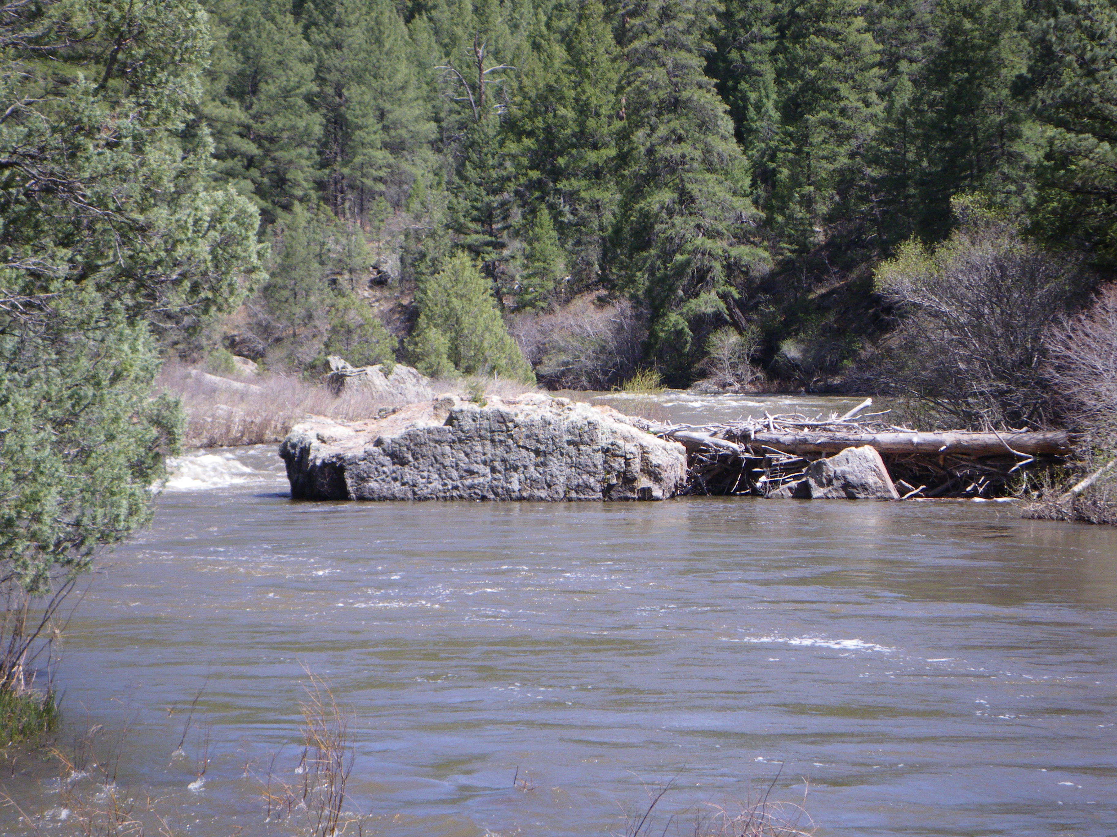
This is a great run. The river goes through a nice canyon and there are no roads or river access for much of it. There are many huge boulders in the river channel and some great play along the way. There is a tricky putin in the town of La Puente but I recommend putting in at the NM 95 bridge as there is better parking and less chance of trouble in a very tiny town..... The takeout is at a boat launch on the north end of El Vado Reservoir and comes after a long flatwater paddle out. I would recommend taking out at a fishing access point (under the footbridge) and following a steep but relatively short path up the canyon wall. This take out is just upstream of the Heron Reservoir Dam. You really don't miss much from the alternate takeout to the 'official' one, except some boring flatwater.
The shuttle route is rather strange. You start on one side of the river and make a U-turn over it and come down on the other side to reach the takeout. For information, see New Mexico Whitewater, by NM State Parks, & Rivers of the SW, by Fletcher Anderson. For more beta, check out Boating Waters, by NM State Parks.
Jun 5, 2024
Putin is under the bridge. Fun boogie water for miles, beautiful stretch.
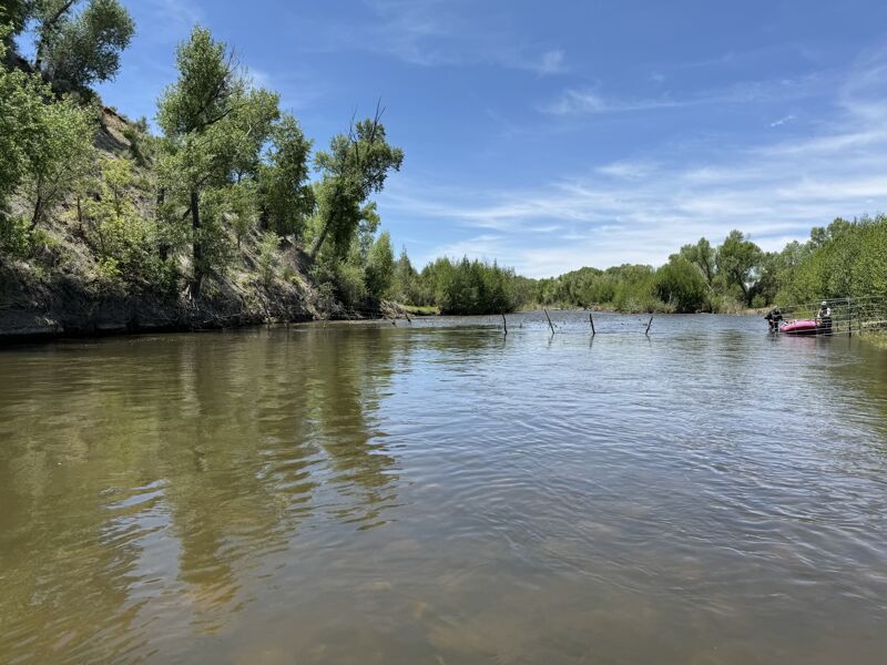
there is barbed wire across the river at mile 2.5 you can stop and scout and go under on the left, you can lift it quite high with a paddle or stick. There are a few T posts in the center another half mile down easily passable!
Mar 23, 2019
This link is the USGS gauge that you paddle past at that river-wide low-profile, concrete dam. This is your source for knowing the flow of this Upper Chama Canyon: https://waterdata.usgs.gov/nm/nwis/uv/?site\_no=08284100&PARAmeter\_cd=00065,00060
May 22, 2013
Ran it on 5/4 at about 750cfs. Saw three elk just before the canyon starts. Ran all the way down to El Vado.
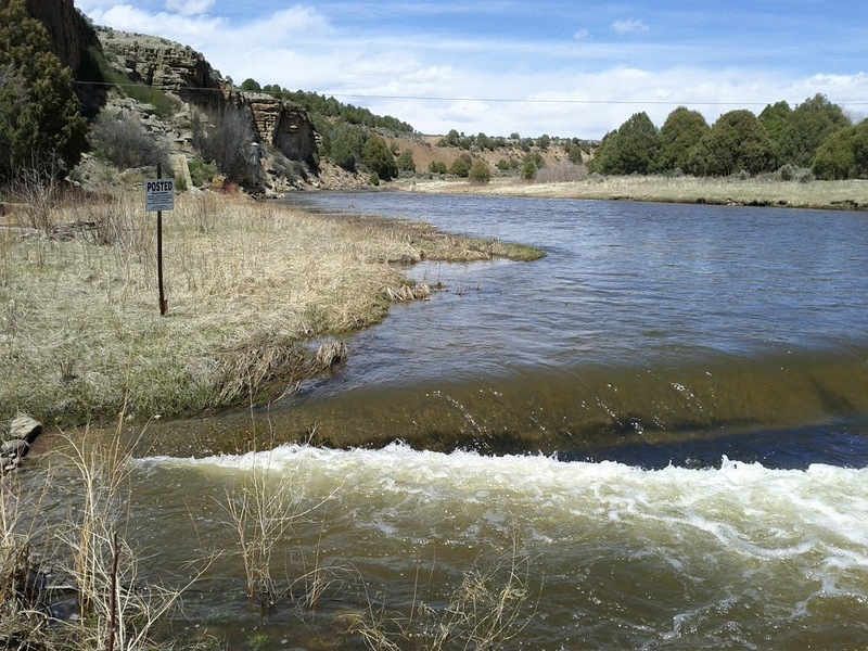
There is a low head dam at the USGS La Puente guage, but it has a dip on the right hand side that lets more water through. I've run it from 450 -2000 cfs and never had a problem on the right where the dip is. I think it actually makes a nice front surf spot (it's too shallow to do much of anything, and I don't recommend flipping)
First time I haven't had to paddle across the lake. The 'No Wake' buoy was in a wave train caused by the river. If the gate is open you can take out near the boat ramp or a little past it. Otherwise it's probably better to hike out at the fishing bridge, but good luck negotiating the stair landings with a canoe. When I ran it a long time ago with my 14' boat it wouldn't fit.
I talked to the folks at the USGS about the private property sign by the gauging station. They said that a fair number of the gauges are on private property. They sent me this link to a blm map showing what land belongs to the public and what's private
May 16, 2011
Did this run on May 14 2011, overall this great run. It was fence and wood free from the put in to the fisherman's bridge takeout. Level was around 1600cfs. Took about 2.5 hours for us to run straight through without stopping to scout or eat. Lots of nature to see and the scenery is quite different than the Monastery to Big Eddy section of the Rio Chama. Found this section to be a bit easier than Monastery to Big Eddy.
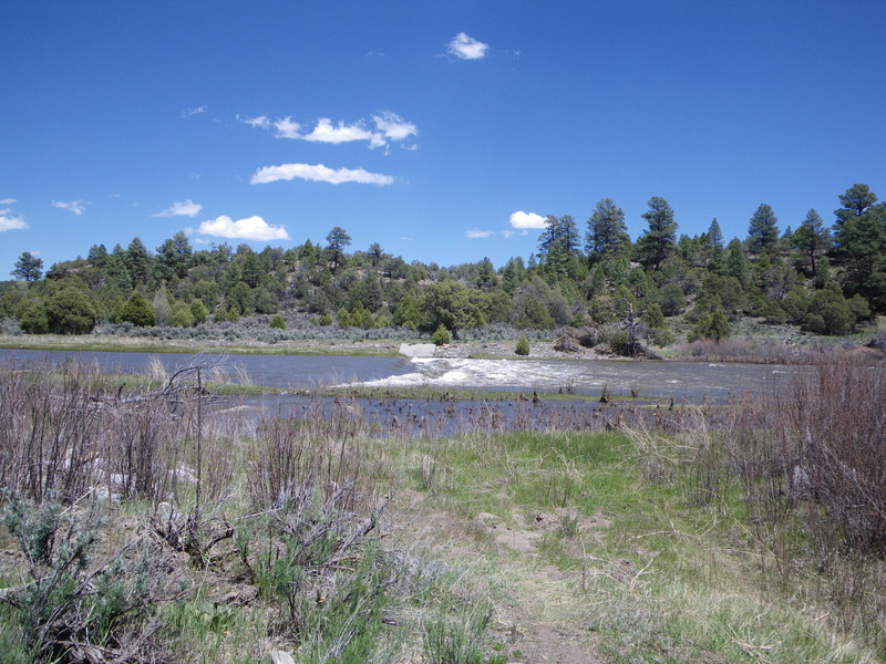
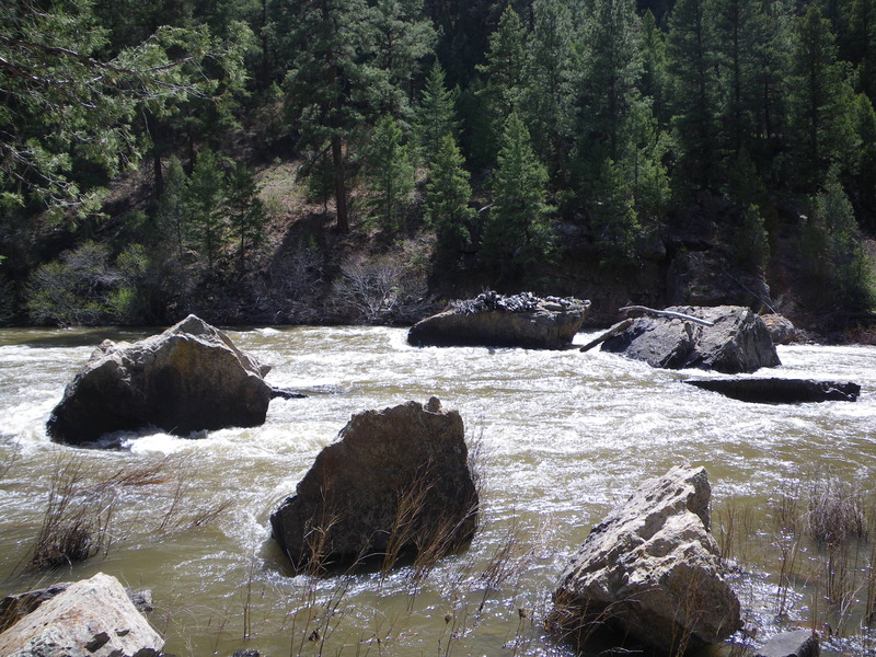
First few miles, before the gravel pit, there several shallow spots that are easily avoidable. Only other notable hazard is a very short low head dam, you will hear it before you see it. Possible to skirt it on either side due it's it's very short and stubby nature. Big Mamma Chama was a long rock garden, maybe solid III at 1600cfs. A few more thousand CFS would make it a stout rapid. Otherwise the rest of the rapids were mellow class II / III wave trains.
I would recommend that everyone do this run at least once as it is all natural flow and only runs a few weeks out of the season. I personally would not want to run it any lower than 1400cfs because I do not like to paddle flat water. Although I am sure it is possible to run it lower than 1400cfs.
Shuttle is straight forward if you take out at the fisherman's bridge, recommended unless you like long flat water paddling.
Visual Guage Height Beta:
The waterline at the put in was almost at the point where the steel bridge support meets the concrete on the east most pylon. The center Bridge support had a small pillow on it. Should be around 1600cfs or so.