Grass
1. Lampsons Falls to Downerville
| Difficulty | IV+ |
| Length | 4.1 mi |
| Avg Gradient | 30 fpm |
| Gauge | West Branch Oswegatchie River Near Harrisville Ny |
| Flow Rate as of 42 minutes | 99 cfsbelow recommended |
| Reach Info Last Updated | April 5, 2016 |
Directions:
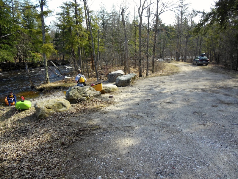
Put In: Heading north out of Degrasse on Clare Rd. for 4-5 miles to the yellow/brown sign on the left for the trail to Lampson's Falls. It's probably about a half-mile easy walk to the water from there.
Take Out: On Route 24 just north of the town of Russell boaters will see a NY state sign for Downerville, a no-longer existent town at the confluence of the N. branch of the Grasse with the Main branch. Coming from Russell, turn right (SE) onto dirt/gravel Donnerville road, after old cemetary on left, take next right. Follow along beaver pond then downhill to confluence. About a mile and a half from main road to take-out.
Description:
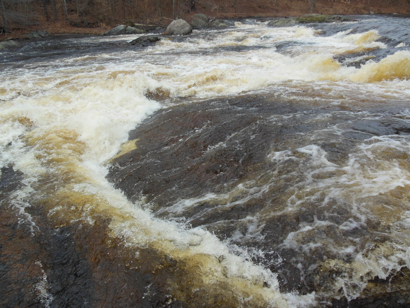
The trail comes out right at Lampson's Falls, which is Fowlersville-sized but has a bunch of flakes sticking up that don't look friendly at all; judge for yourself, I had no issues continuing down the trail to the bottom. From the pool below you have some flatwater to warm up on before dropping into a nice pool-drop rhythm. Most of the drops are worth scouting just to see the assortment of possible lines that most offer up. At low water this seemed like a nice creeking progression from Taylorville on the Beaver, with a few drops which were definite steps up. Nothing is mandatory and everything was pretty easy to scout/portage. The last mile stretch the river starts to widen and become more small rapids. When you come to the Confluence of the North Branch on river right, there will be a small path through the woods which will take you back to the parking lot. This section can be connected and run all the way down to Russell.
Canton - Cranberry Lake Area Reaches
...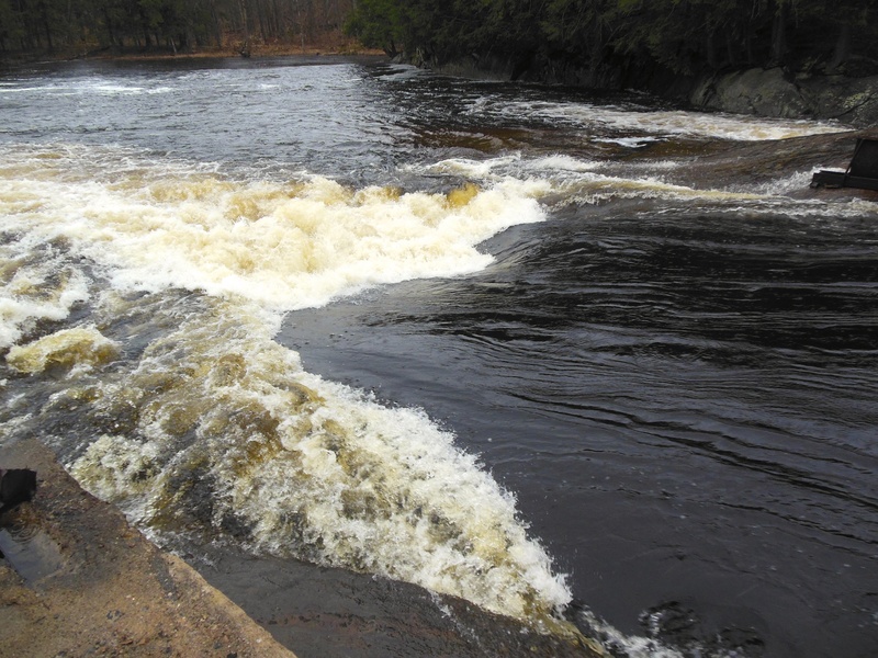
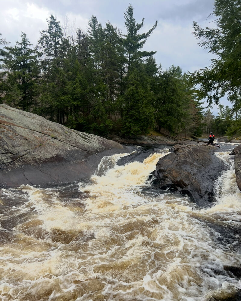
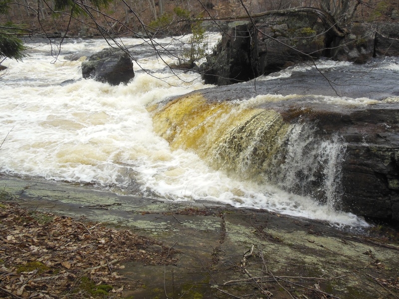
This is the first Rapid of the section, after a moderate flatwater paddle from Lampson Falls. The gradient drop is easily seen from above as well as remants of an old bridge. Scouting is best from river left, it is also possible to boat scout.
After the old bridge pool, This will be the next horizon line and is one of the largest sections on this section. It changes greatly which varing water levels from a flaky slide with large curling waves to large waves and holes. To scout, take on on river left of the island. Portage is a neccessary for most paddlers with the easiest along river left, along the game trail in the woods.
This is immediately below Thanks, at low levels this can be one of the best rapid but as the flow increases the holes become stickier and stickier. Scout along the same path as with Thanks, portaging too can follow this path
This is the next drop after No Thanks pool, this rapid also varies greatly as does the flows. At low levels this is a small hole but at high flows it become sticky with large boils and water pushing into the wall. Scouting can be either left or along the rock pennisula. A sneak line is available along the far right at high levels.

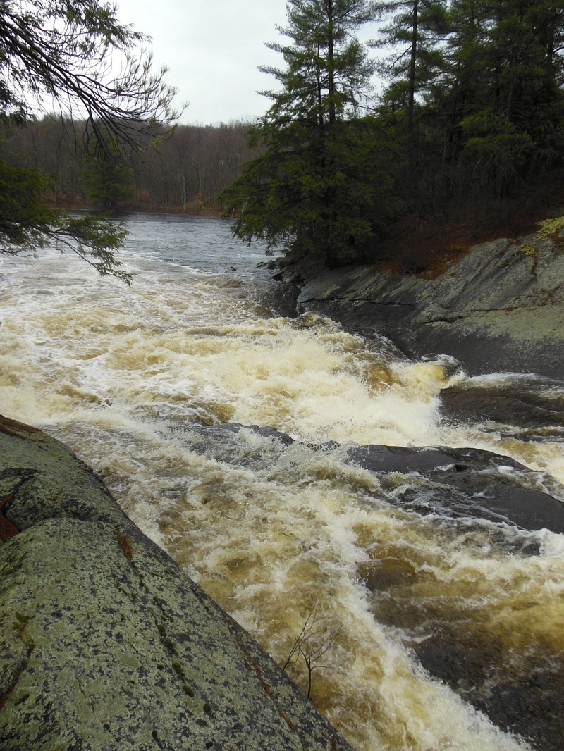
After some flatwater the river starts dropping gradient again. This is a large S-Turn in the river. This can scouted river right from the large rock abutment or boat scouting.

The river splits with a majority going left over a small waterfall, while right is a tight shoot with a hole at the bottom. This right section is runnable at all levels. Scouting can be left for the falls, and either on the island or right for the shoot.
At low water this rapid is a bunch on low angle slides, with multiple routes. At high water, it becomes a small slide into a hole, similar to the upper part of Sinclair Falls (Twin Falls section). Scouting can be down river left as well as a path to portage.
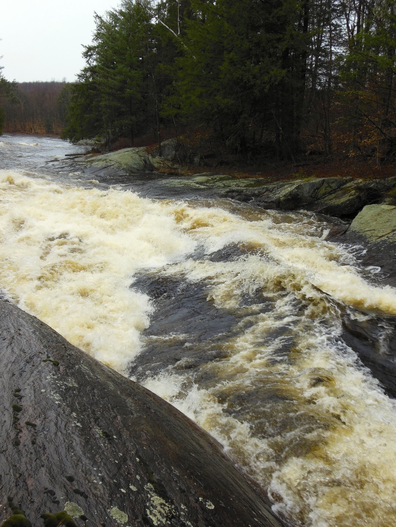
After the slots the river splits again around an island with the majority of the water flowing right, the right side has a small water fall with different paths, at low level this is the easier drop. The left has a small 45 foot shoot. At low water this shoot is either dry or unrunnable. Scouting is best on the island if running the rapid or left with portaging the easiest along the left side.
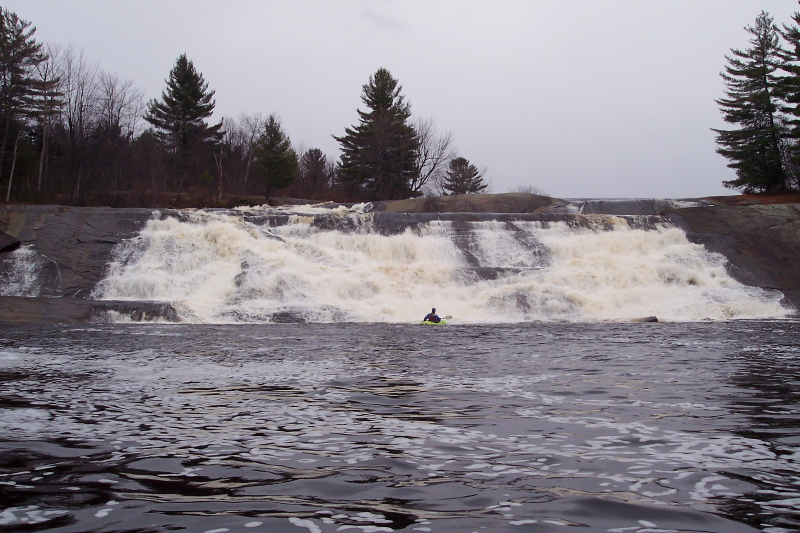
This is the final large drop. The river again splits with a large amount of water flowing right. The right side becomes difficult to run at high water, for this side scout right. The left channel has nice 7 foot waterfall, scouting for this is best left, as well as portaging. The rock on the river next to the falls (seen in picture) is a sive, this can be seen especially at low water.
May 6, 2026
Important. as of may 5 2026 there is a terrible strainer on Lampson falls on right line and more wood blocking entrance to main line down the main falls. Our group ripped down from Lampson falls at 650cfsa. at this level Lampsons falls was quite low with no main line other than middle we dput in below the falls. we played at an unamed play spot before the 1/3 mile flat water paddle before old bridge. just after Lampsons falls. At around 650cfs Thanks was quite the large hole, I couldent imagine it any bigger. next was no thanks, there is also a line that goes right around the island that is not mentioned, this could be a horrible line, at higher waters there is a potential for a go arond at both the left sides of the thanks rapids. Both Should be properly scouted before ran. At this level mikes hole was a breeze. then snot rocket we went right line. the next 2 rapids we snuck through with no issues at this level. we walked north country boof. the sive at the boof main line was looking worse than ever. After northcountry boof the waster was really low and unfun till the take out in Degrasse. jut a note about the portages, there are large dec signs marking the portage trails, the actual trails have not been kept up and practically dont exist.
May 9, 2013
This is the downerville take out, it is a little upstream on the North Branch, however, there is a Path through the woods to walk upstream from the Confluence.