Mettawee
Truthville to Upper Turnpike(North Granville)
| Difficulty | I-V |
| Length | 9.7 mi |
| Avg Gradient | n/a |
| Gauge | Mettawee River Near Middle Granville Ny |
| Flow Rate as of 40 minutes | 3.36 ftbelow recommended |
| Reach Info Last Updated | April 8, 2016 |
Safety Warning: There is a dangerous sieve in the second drop. On April 11, 2004, a paddler got stuck in the sieve and drowned. It is not obvious if one scouts from the river-right side. Read the description in Boater Talk for more details. Photos of the sieve at low water are posted to the AW site. Scroll down to see them.
Kinda a smaller, creekier Bottom Moose. Big drops, with big recovery pools. Locals typically run a 2-3 mile section of Class III-V water. Put-in is upstream of Middleton Road Bridge (river right) and take-out is river left downstream of N. Granville near Upper Tpk Road. Call Sacandaga Outfitters for local experts.
I got a call from the Forest Ranger who covers that area this morning asking for help getting this out to paddlers. The owners of the property on river left at the second drop, where Linda Weiss's accident was last year, are having trespass problems with 'kayakers'. After talking to the Ranger, I seriously doubt that paddlers are the problem (the spot is also popular with fishermen), and asked him to relay that back to the landowners.
Here's the deal, keep in mind that I'm getting this all second hand. Apparently, a few weeks ago, some friends of Linda's asked permission to go down to the river by the drop. The landowners were ok with that, under the impression that they would only be there a little while. They were there longer than the landowner's thought they would be and hung some flags (the flags were there when I paddled it last week). The landowners were still pretty much OK with that. Since then, they have put up new posted signs along the road and the access trail. Some of the signs have been torn down, people have parked in their driveway and by thier front lawn (the road is really narrow right there), and when they a
...Nov 22, 2021
11/20/2021 - ~4.7' on the gauge - https://www.youtube.com/watch?v=5ZXmx5aEhW0 - First rapid in video is the first major drop, second rapid is the second major drop (with dangerous sieve on river left - See description/low water pics for more info). Third rapid in video is 'triple drop'. Last rapid in video is the final drop (beware of cave behind the curtain on river right) Everyone in party decided to run river left lines to avoid a potentially nasty hole/cave on right.
-Jordan
Nov 8, 2010
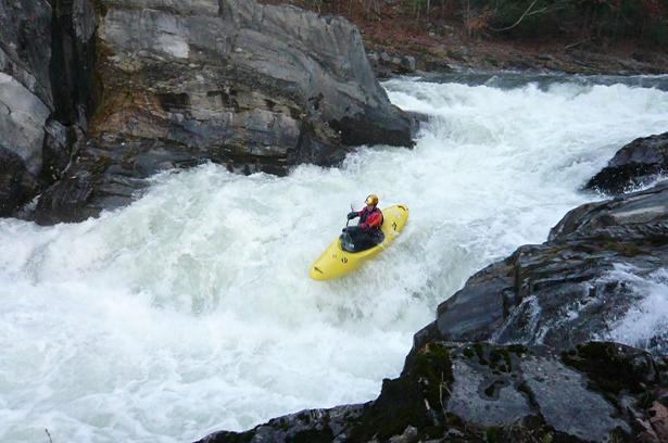
Ford Smith in Triple Drop on the Mettawee, 11/6/2010
Aug 30, 2009
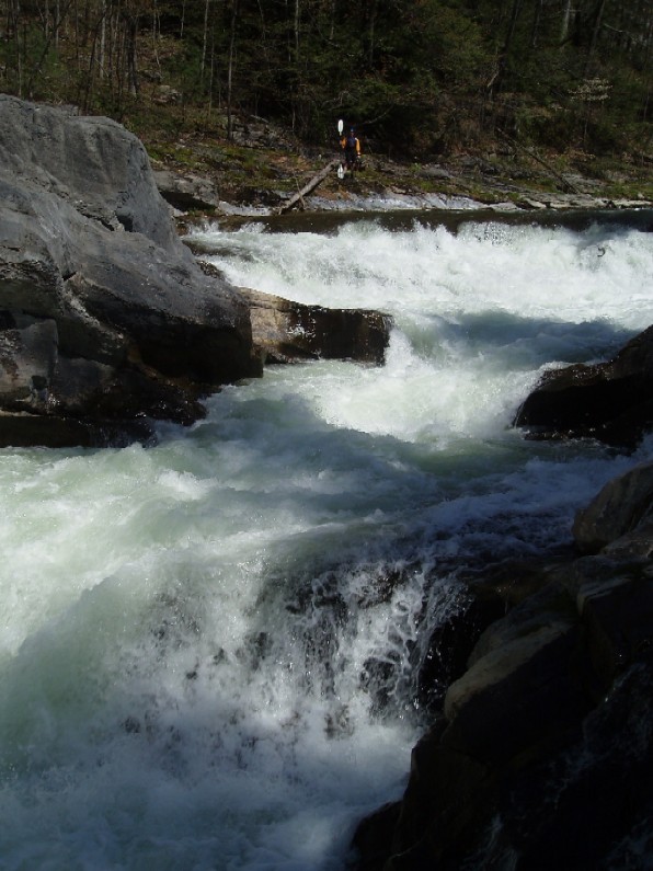
Mettawee River's 'FIrst Drop' @ 4.1'
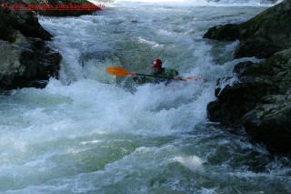
May 10, 2003
More of my photos can be found on my NEW kayakingphotos.com page and my American Whitewater page.
More of my photos can be found on my NEW kayakingphotos.com page and my American Whitewater page.
More of my photos can be found on my NEW kayakingphotos.com page and my American Whitewater page.
More of my photos can be found on my NEW kayakingphotos.com page and my American Whitewater page.
More of my photos can be found on my NEW kayakingphotos.com page and my American Whitewater page.
More of my photos can be found on my NEW kayakingphotos.com page and my American Whitewater page.
More of my photos can be found on my NEW kayakingphotos.com page and my American Whitewater page.
More of my photos can be found on my NEW kayakingphotos.com page and my American Whitewater page.
More of my photos can be found on my NEW kayakingphotos.com page and my American Whitewater page.
More of my photos can be found on my NEW kayakingphotos.com page and my American Whitewater page.
More of my photos can be found on my American Whitewater page and my Geocities page.
Check out the full-sized version of this photo by clicking here.