Neversink
1. Rock Hill to Oakland Valley
| Difficulty | II-IV |
| Length | 11.4 mi |
| Avg Gradient | n/a |
| Gauge | Neversink River at Bridgeville Ny |
| Flow Rate as of 1 hour | 149 cfsbelow recommended |
| Reach Info Last Updated | October 20, 2020 |
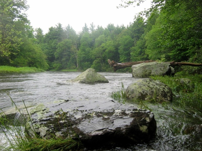
This 11.3 mile section of the Neversink is mostly class 1 to 2, but has about 1.5 miles of exciting class 3 to 4 rapids about halfway through. There is a mostly unobtrusive quarry operation along the right for the first 1.5 miles, but the gorge is very remote and isolated from there until the first houses appear on river right about 1/2 mile before the takeout in Oakland Valley
Lat/longitude coords are very close, from TopoZone and Google Maps. Thanks to Adam, from the Northeast Paddlers' Message Board for most of this information:
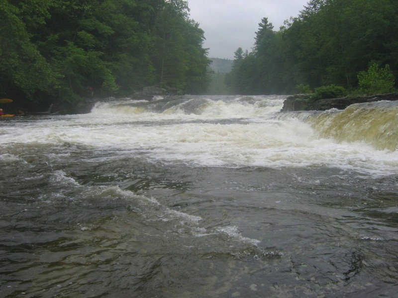
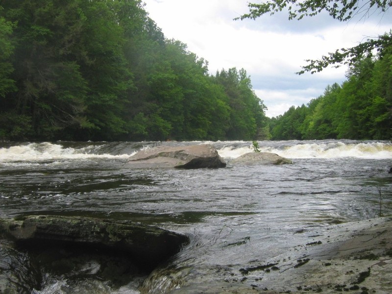
There are two major drops on the Neversink. Denton Falls is a slide run straight down the middle with no holes at the bottom. High Falls is small vertical drop of 5 feet, easily run far river right, or by taking the boof left of the rocky island. After High Falls is about 4 miles of flat to class 2 rapids. In between Denton and High Falls is the Gorge section, which is class 3-4 depending on levels. Over 7.5, I would say it is a 4. Lots of holes, waves and sticky spots. At bottom of the gorge, there are some waves to surf at 6 - 7 feet, above that they become pretty sticky. The river is not a great play river, with only a handful of waves on the 6-8 miles. However, it is beautiful and absolutely desolate. Have seen bald eagles every time I've been down. (Note- at 750 don't recall much play, but at 1200 there was a fair amount. Nothing amazing, but enough waves, pour overs and squirt spots to keep the easier section interesting. Still, bring your longest boat).
The put-in is just outside the gates to Holiday Mtn. Ski area off of Bridgeville Rd (public fishing access). The usual take-out is at the Oakland Valley bridge on county route 49. Alternate take outs further downstream include a small pullout about 1.5 miles south on route 49 or at the D&H Canal museum, just off of route 209 in Huguenot NY.
Here's a Google map showing the river, along with the main rapids, put in and takeout locations, and the shutt
...
Though usually listed as class 4 this is an easy slide down a wide tongue in the right center, at least at moderate levels. By the time the horizon line disappears you'll be committed, so you'll probably want to scout from the either side, with a river left scout giving a better view but requiring a more committed ferry to get back to the main drop.
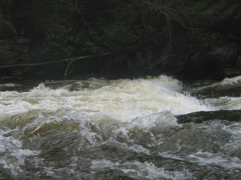
At anything above the most modest levels, from Denton Falls to High Falls you'll find about 1.5 miles of big water action with only brief pauses. There are eddies but it's long enough and the banks are overgrown so that you need class 3 + read and run skills.
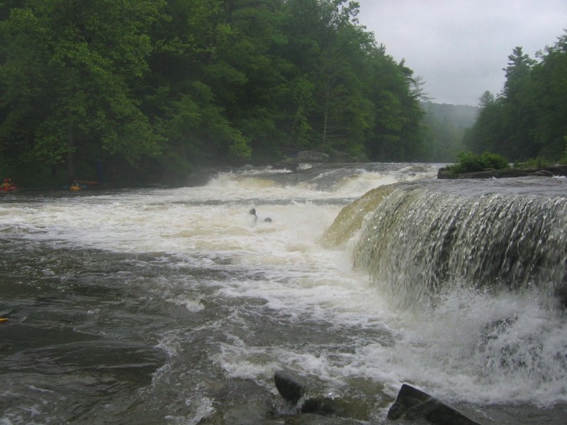
The last hurrah before things calm down for the rest of the trip, High Falls is a drop of about 5 feet. The conservative choice is to run left of a small rocky island (which may disappear at high water) for a boof into a hole that doesn't seem to be sticky at moderate levels. The other choice is to run the very far right, avoiding the rocks that you want to be very close to, while still missing the hole a couple of feet further out. Scouting and setting safety are easily done from the right side.
Nov 7, 2018
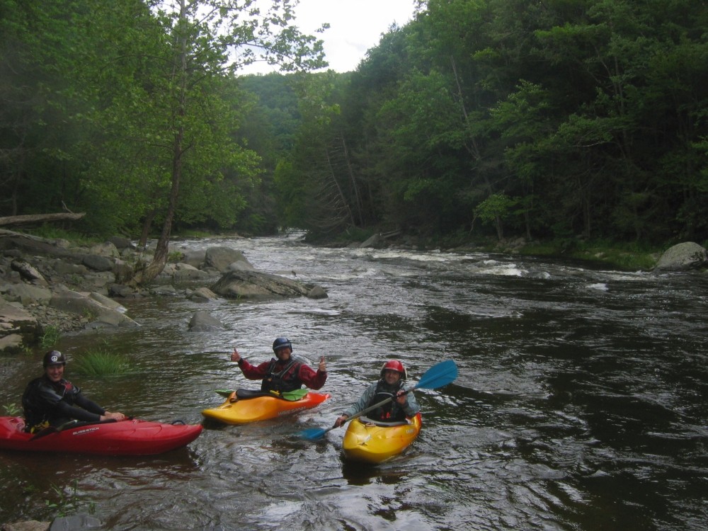
Clean, high water run today @ 2000cfs, big and pushy, some holes disappeared others way bigger, Left side of high falls was good to go and denton had a tongue right of center... the rapids in-between were big! No problems parking....
Apr 22, 2011
Aside from parking issues at the bridge, I'd guess that it's not convenient to stick to the legal right of way while taking out. I also don't think we're likely to be hassled as long as we park well. About 1.5 miles further downstream there's a pullout that's big enough for 3 cars or so. There's a nice rapid just after the bridge, but it's mostly very easy from there to the pullout. I'd suggest taking a look at Denton Falls. I don't think it's likely to collect wood, but by the time you can see the bottom of the tongue your options are limited.
Jun 23, 2009
Jordan runs a far river right line.