Neversink
1. Rock Hill to Oakland Valley
Nov 7, 2018
Clean, high water run today @ 2000cfs, big and pushy, some holes disappeared others way bigger, Left side of high falls was good to go and denton had a tongue right of center... the rapids in-between were big! No problems parking....
Apr 22, 2011
Aside from parking issues at the bridge, I'd guess that it's not convenient to stick to the legal right of way while taking out. I also don't think we're likely to be hassled as long as we park well. About 1.5 miles further downstream there's a pullout that's big enough for 3 cars or so. There's a nice rapid just after the bridge, but it's mostly very easy from there to the pullout. I'd suggest taking a look at Denton Falls. I don't think it's likely to collect wood, but by the time you can see the bottom of the tongue your options are limited.
Jun 23, 2009
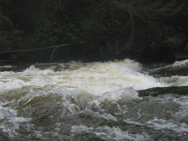
Jordan runs a far river right line.
Jun 23, 2009
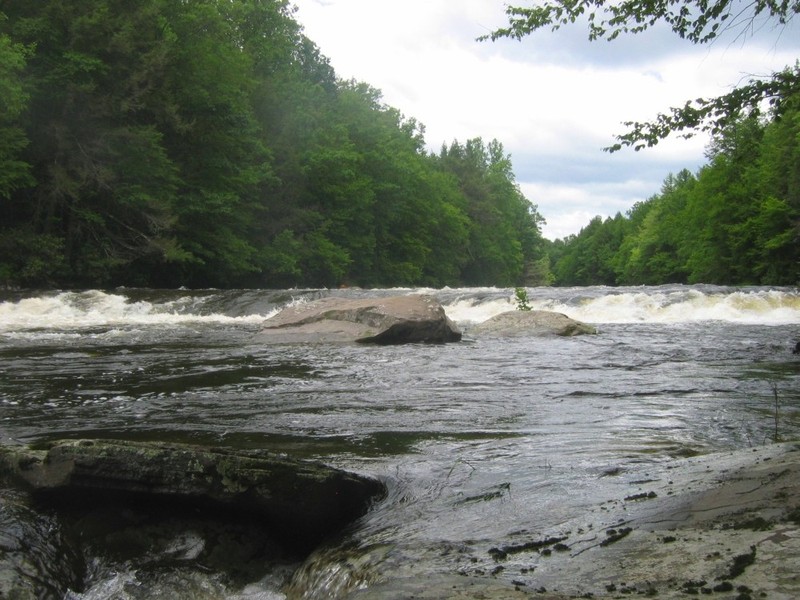
One of many good spots between Denton Falls and High Falls.
Jun 23, 2009
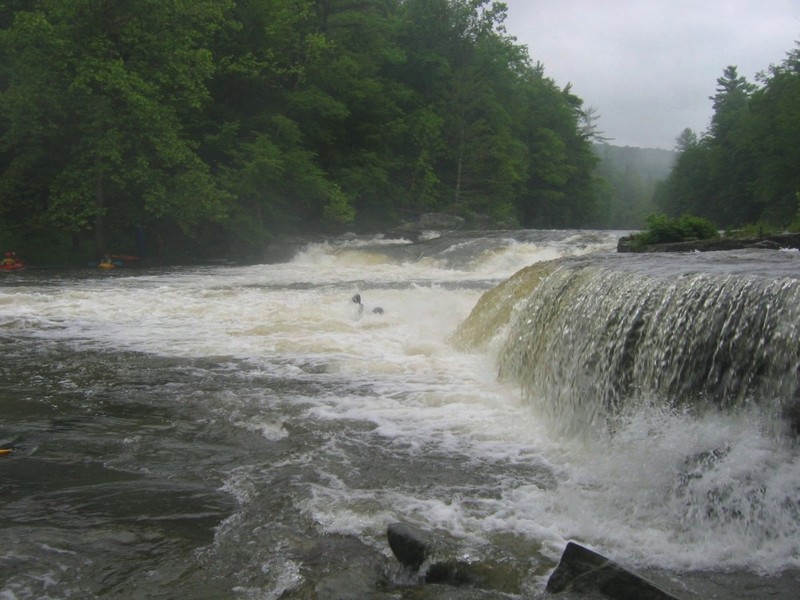
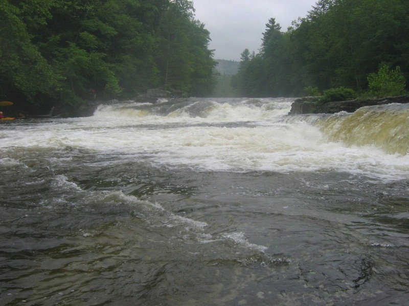
A drop of about 8', with a big, wide tongue.
Jun 23, 2009
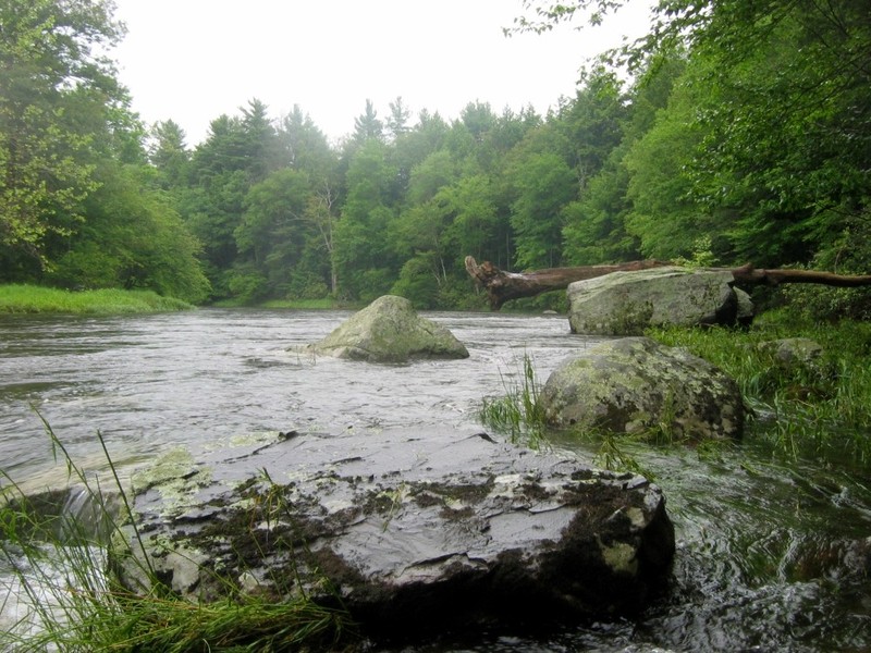
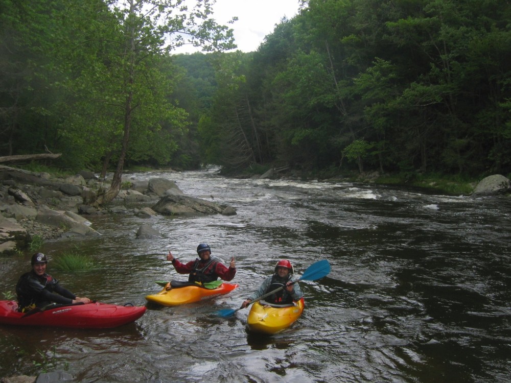
In between Denton Falls and High Falls. Typical scenery, but calmer water than a lot of this 1 mile stretch.
Jun 20, 2009
Typical scenery a mile or so below the Bridgeville put in. It's easy class 1 to 2- for the first couple of miles.
Jun 20, 2009
It looked like it could be sticky, but nobody found a sticky spot
Jun 20, 2009
River left is a boof of 3 to 4 feet. Far river right has a narrow tongue up against the rocks, and a hole taking up much of the center right. You may not want to be in the hole.
Aug 15, 2007
During an a scout at unboatable level
Jun 29, 2007
Took a hike at low water level when there wasnt really enough water to paddle most of it. Went to high falls and stood a the base of the falls, river left, where water was droping off just to the right of me while facing upstream. I was able to see over so at least on river left it's about 5.5 ft. I always hear people going down the right side, middle looked like it would be serious and the hardest. I never heard someone going down river left but it looked like it would be easy. My concern would be enough water to land in. It was a beutiful area and at times walking along the river I would have to back track as the bank would rise until I couldnt go forward due to no more room to walk and
it was way to steep to climb up. Getting out of this river without a kayak might prove to be difficult, particuliarly if you are injured. I would suggest bringing a USGS map and compass. There is a trail probably no more than a few yards to a 1/2 mile, depending where you are, that runs along the river, at least on river left. In places you may find it hard to get to.